Jefferson County, Florida
Jefferson County is a county located in the Big Bend region in the northern part of the U.S. state of Florida. As of the 2010 census, the population was 14,761.[1] Its county seat is Monticello.[2]
Jefferson County | |
|---|---|
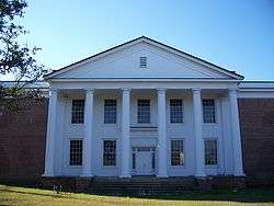
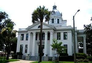 Jefferson County Courthouse in Monticello | |
 Seal | |
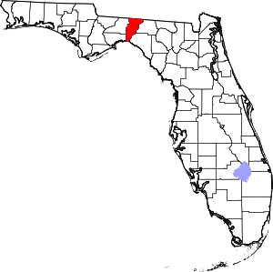 Location within the U.S. state of Florida | |
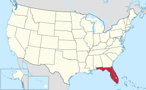 Florida's location within the U.S. | |
| Coordinates: 30°25′N 83°54′W | |
| Country | |
| State | |
| Founded | January 20, 1827 |
| Named for | Thomas Jefferson |
| Seat | Monticello |
| Largest city | Monticello |
| Area | |
| • Total | 637 sq mi (1,650 km2) |
| • Land | 598 sq mi (1,550 km2) |
| • Water | 38 sq mi (100 km2) 6.0%% |
| Population | |
| • Estimate (2019) | 14,246 |
| • Density | 23.6/sq mi (9.1/km2) |
| Time zone | UTC−5 (Eastern) |
| • Summer (DST) | UTC−4 (EDT) |
| Congressional districts | 2nd, 5th |
| Website | www |
Jefferson County is part of the Tallahassee, FL Metropolitan Statistical Area.
History
Jefferson County was created in 1827. It was named for Thomas Jefferson, third president of the United States, who had died the year before the county's establishment.[3]
Forts of Jefferson County
- Fort Roger Jones (1839), Aucilla (Ocilla Ferry), north of US 90.[4]
- Fort Noel (1839–1842), south of Lamont on the Aucilla River, six miles (10 km) northwest of Fort Pleasant in Taylor County. Also known as Fort Number Three (M).
- Camp Carter (1838), near Waukeenah.
- Fort Welaunee (1838), a settlers' fort on the Welaunee Plantation near Wacissa. Fort Gamble (1839–1843) was later established here.
- Fort Aucilla (1843), two miles (3 km) south-east of Fort Gamble, southwest of Lamont, between the Aucilla and Wacissa Rivers. Also spelled Ocilla.
- Fort Wacissa (1838), a settlers' fort located south of Wacissa on the Wacissa River, west of Cabbage Grove.
Geography
According to the U.S. Census Bureau, the county has a total area of 637 square miles (1,650 km2), of which 598 square miles (1,550 km2) is land and 38 square miles (98 km2) (6.0%) is water.[5]
Jefferson County is the only county in Florida which borders both the state of Georgia and the Gulf of Mexico.
Adjacent counties
- Thomas County, Georgia - north
- Brooks County, Georgia - northeast
- Madison County - east
- Taylor County - southeast
- Wakulla County - southwest
- Leon County - west
National protected area
Water Bodies
Demographics
| Historical population | |||
|---|---|---|---|
| Census | Pop. | %± | |
| 1830 | 3,312 | — | |
| 1840 | 5,713 | 72.5% | |
| 1850 | 7,718 | 35.1% | |
| 1860 | 9,876 | 28.0% | |
| 1870 | 13,398 | 35.7% | |
| 1880 | 16,065 | 19.9% | |
| 1890 | 15,757 | −1.9% | |
| 1900 | 16,195 | 2.8% | |
| 1910 | 17,210 | 6.3% | |
| 1920 | 14,502 | −15.7% | |
| 1930 | 13,408 | −7.5% | |
| 1940 | 12,032 | −10.3% | |
| 1950 | 10,413 | −13.5% | |
| 1960 | 9,543 | −8.4% | |
| 1970 | 8,778 | −8.0% | |
| 1980 | 10,703 | 21.9% | |
| 1990 | 11,296 | 5.5% | |
| 2000 | 12,902 | 14.2% | |
| 2010 | 14,761 | 14.4% | |
| Est. 2019 | 14,246 | [6] | −3.5% |
| U.S. Decennial Census[7] 1790-1960[8] 1900-1990[9] 1990-2000[10] 2010-2019[1] | |||
As of the census[11] of 2010, there were 14,761 people, 5,646 households, and 3,798 families residing in the county. The population density was 25 people per square mile (8/km²). There were 5,251 housing units at an average density of 9 per square mile (3/km²). The racial makeup of the county was 60.4% White, 36.2% Black or African American, 0.30% Native American, 0.40% Asian, 0.0% Pacific Islander, 1.50% from other races, and 1.30% from two or more races. 3.70% of the population were Hispanic or Latino of any race.
There were 5,646 households out of which 26.9% had individuals under the age of 18 living with them, 47.30% were married couples living together, 15.10% had a female householder with no husband present, and 32.70% were non-families. 28.1% of all households were made up of individuals and 10.6% had someone living alone who was 65 years of age or older. The average household size was 2.38 and the average family size was 2.89.
In the county, the population was spread out with 18.6% under the age of 18, 8.20% from 18 to 24, 25.0% from 25 to 44, 32.30% from 45 to 64, and 16.5% who were 65 years of age or older. The median age was 44.1 years. For every 100 females, there were 109.6 males. For every 100 females age 18 and over, there were 110.00 males age 18 and over.
The following income information is from the 2000 census. The median income for a household in the county was $32,998, and the median income for a family was $40,407. Males had a median income of $26,271 versus $25,748 for females. The per capita income for the county was $17,006. About 13.30% of families and 17.10% of the population were below the poverty line, including 21.70% of those under age 18 and 17.00% of those age 65 or over.
Government and politics
Jefferson County is one of only a handful of counties in the Florida Panhandle that usually favors the Democratic Party. In 2016 it flipped and Donald Trump won the county. In 2018, it voted for both the Republican candidates in the governor's race (Ron DeSantis) and the Senate race (Rick Scott).[12]
| Year | Republican | Democratic | Other |
|---|---|---|---|
| 2016 | 51.11% 3,930 | 46.05% 3,541 | 2.84% 218 |
| 2012 | 48.70% 3,808 | 50.45% 3,945 | 0.86% 67 |
| 2008 | 47.59% 3,797 | 51.24% 4,088 | 1.17% 93 |
| 2004 | 44.10% 3,298 | 55.30% 4,135 | 0.60% 45 |
| 2000 | 43.91% 2,478 | 53.89% 3,041 | 2.20% 124 |
| 1996 | 38.49% 1,851 | 52.90% 2,544 | 8.61% 414 |
| 1992 | 32.19% 1,506 | 48.55% 2,271 | 19.26% 901 |
| 1988 | 52.89% 2,326 | 46.73% 2,055 | 0.39% 17 |
| 1984 | 52.16% 2,244 | 47.81% 2,057 | 0.02% 1 |
| 1980 | 39.19% 1,623 | 57.16% 2,367 | 3.65% 151 |
| 1976 | 36.30% 1,361 | 61.62% 2,310 | 2.08% 78 |
| 1972 | 66.04% 2,108 | 32.86% 1,049 | 1.10% 35 |
| 1968 | 14.84% 459 | 34.48% 1,066 | 50.68% 1,567 |
| 1964 | 52.82% 1,684 | 47.18% 1,504 | |
| 1960 | 34.70% 600 | 65.30% 1,129 | |
| 1956 | 31.02% 540 | 68.98% 1,201 | |
| 1952 | 36.22% 665 | 63.78% 1,171 | |
| 1948 | 11.56% 153 | 52.91% 700 | 35.53% 470 |
| 1944 | 14.93% 188 | 85.07% 1,071 | |
| 1940 | 13.21% 215 | 86.79% 1,412 | |
| 1936 | 9.27% 127 | 90.73% 1,243 | |
| 1932 | 5.40% 81 | 94.60% 1,418 | |
| 1928 | 20.22% 235 | 79.09% 919 | 0.69% 8 |
| 1924 | 9.69% 66 | 83.11% 566 | 7.19% 49 |
| 1920 | 22.85% 239 | 72.08% 754 | 5.07% 53 |
| 1916 | 13.70% 104 | 85.11% 646 | 1.19% 9 |
| 1912 | 8.45% 47 | 82.55% 459 | 8.99% 50 |
| 1908 | 18.81% 149 | 71.34% 565 | 9.85% 78 |
| 1904 | 20.20% 123 | 77.34% 471 | 2.46% 15 |
Education
On April 23, 2009, the Florida Department of Education took over financial oversight of the district to rescue it from a declared financial emergency due to budget deficits.[14][15] In June 2011, the district exited financial emergency one year sooner than expected due to efforts from District faculty and staff; subsequently, it operated for two years with a fund balance well over the mandated 3%.
Career Academies have been introduced on the campus of Jefferson County Middle High School offering students options in career areas connected to the local economy.
The Jefferson County Tigers won the state championship in football in 2011.
Library
Jefferson County's library is the R.J. Bailar Public Library, which works with the Wilderness Coast Public Libraries.
Transportation
Railroads
The sole existing railroad line is a CSX line once owned by the Seaboard Air Line Railroad that was used by Amtrak's Sunset Limited until 2005, when the service was truncated to New Orleans by Hurricane Katrina. No Amtrak trains stopped anywhere in Jefferson County.
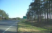
Major highways


Communities

Town
References
- "State & County QuickFacts". United States Census Bureau. Retrieved February 14, 2014.
- "Find a County". National Association of Counties. Archived from the original on 2011-05-31. Retrieved 2011-06-07.
- Publications of the Florida Historical Society. Florida Historical Society. 1908. p. 32.
- "IRC Library:Fort Roger Jones". Archived from the original on 2013-03-16. Retrieved 2008-08-01.
- "US Gazetteer files: 2010, 2000, and 1990". United States Census Bureau. 2011-02-12. Retrieved 2011-04-23.
- "Population and Housing Unit Estimates". Retrieved May 21, 2020.
- "U.S. Decennial Census". United States Census Bureau. Retrieved June 14, 2014.
- "Historical Census Browser". University of Virginia Library. Retrieved June 14, 2014.
- "Population of Counties by Decennial Census: 1900 to 1990". United States Census Bureau. Retrieved June 14, 2014.
- "Census 2000 PHC-T-4. Ranking Tables for Counties: 1990 and 2000" (PDF). United States Census Bureau. Retrieved June 14, 2014.
- "U.S. Census website". United States Census Bureau. Retrieved 2011-05-14.
- Journal, Pensacola News. "Florida and Jefferson County Election Results: General". Pensacola News Journal. Retrieved 2019-06-19.
- Leip, David. "Dave Leip's Atlas of U.S. Presidential Elections". uselectionatlas.org. Retrieved 2018-06-15.
- "State to take over Jefferson County School District's weak finances". Tallahassee Democrat.
- "Parents and teachers react to Jefferson County Schools' dire finances". Tallahassee Democrat.
External links
| Wikimedia Commons has media related to Jefferson County, Florida. |
Government links
Constitutional Offices
Jefferson County Schools
- Public School System
- Private School System
Judicial Branch
Special Districts
Places adjacent to Jefferson County, Florida | ||||||||||
|---|---|---|---|---|---|---|---|---|---|---|
| ||||||||||
Municipalities and communities of Jefferson County, Florida, United States | ||
|---|---|---|
| City | | |
| CDPs | ||
| Unincorporated communities | ||
| Ghost towns |
| |
| Plantations | ||
| Footnote |
| |
Region of Florida | ||
| Topics |  Map of North Florida | |
| Counties | ||
| Major cities | ||
| Cities and towns 100k+ | ||
| Cities and towns 25k–100k | ||
| Cities and towns 10k–25k | ||
| Metro areas |
| |
| Regions | ||
| Authority control |
|
|---|