Calhoun County, Florida
Calhoun County is a county located in the U.S. state of Florida. As of the 2010 census, the population was 14,625,[2] making it the fifth-least populous county in Florida. Its county seat is Blountstown.[3]
Calhoun County | |
|---|---|
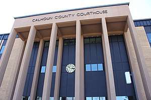 Calhoun County Courthouse in Blountstown | |
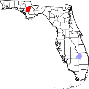 Location within the U.S. state of Florida | |
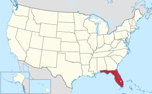 Florida's location within the U.S. | |
| Coordinates: 30°25′N 85°12′W | |
| Country | |
| State | |
| Founded | January 26, 1838 |
| Named for | John C. Calhoun |
| Seat | Blountstown |
| Largest city | Blountstown |
| Area | |
| • Total | 574 sq mi (1,490 km2) |
| • Land | 567 sq mi (1,470 km2) |
| • Water | 7.0 sq mi (18 km2) 1.22 %% |
| Population | |
| • Estimate (2019) | 14,105[1] |
| • Density | 25.5/sq mi (9.8/km2) |
| Time zone | UTC−6 (Central) |
| • Summer (DST) | UTC−5 (CDT) |
| Congressional district | 2nd |
| Website | calhouncountygov |
History
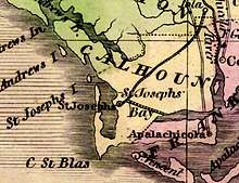
Calhoun County was created in 1838. It was named for John C. Calhoun, member of the United States Senate from South Carolina and the seventh U.S. vice president, serving under John Quincy Adams and Andrew Jackson.[4] The County originally was located between St. Joseph Bay and the Apalachicola River, with the county seat at St. Joseph (which was abandoned by 1844). The county was later expanded to the north with territory from Jackson and Washington counties. In 1913 part of Calhoun County was transferred to the new Bay County. In 1925 the southern part of Calhoun County was separated as the new Gulf County, which included the territory that had formed the original Calhoun County.[5]
In 1930 a federal employee shot the County Sheriff over a dispute of unknown origin.[6]
Geography
According to the U.S. Census Bureau, the county has a total area of 574 square miles (1,490 km2), of which 567 square miles (1,470 km2) is land and 7.0 square miles (18 km2) (1.2%) is water.[7] The county is bounded on the east by the Apalachicola River and is bisected by the Chipola River, site of Look and Tremble.
Adjacent counties
- Jackson County, Florida - north
- Gadsden County, Florida - northeast (EST)
- Liberty County, Florida - east (EST)
- Gulf County, Florida - south (southern part of the county is in the EST)
- Bay County, Florida - west
Demographics
| Historical population | |||
|---|---|---|---|
| Census | Pop. | %± | |
| 1840 | 1,142 | — | |
| 1850 | 1,377 | 20.6% | |
| 1860 | 1,446 | 5.0% | |
| 1870 | 998 | −31.0% | |
| 1880 | 1,580 | 58.3% | |
| 1890 | 1,681 | 6.4% | |
| 1900 | 5,132 | 205.3% | |
| 1910 | 7,465 | 45.5% | |
| 1920 | 8,775 | 17.5% | |
| 1930 | 7,298 | −16.8% | |
| 1940 | 8,218 | 12.6% | |
| 1950 | 7,922 | −3.6% | |
| 1960 | 7,422 | −6.3% | |
| 1970 | 7,624 | 2.7% | |
| 1980 | 9,294 | 21.9% | |
| 1990 | 11,011 | 18.5% | |
| 2000 | 13,017 | 18.2% | |
| 2010 | 14,625 | 12.4% | |
| Est. 2019 | 14,105 | [8] | −3.6% |
| U.S. Decennial Census[9] 1790-1960[10] 1900-1990[11] 1990-2000[12] 2010-2015[2] | |||
As of the census[13] of 2000, there were 13,017 people, 4,468 households, and 3,132 families residing in the county. The population density was 23 people per square mile (9/km²). There were 5,250 housing units at an average density of 9 per square mile (4/km²). The racial makeup of the county was 79.87% White, 15.79% Black or African American, 1.26% Native American, 0.53% Asian, 0.05% Pacific Islander, 1.04% from other races, and 1.45% from two or more races. 3.78% of the population were Hispanic or Latino of any race.
There were 4,468 households out of which 32.50% had children under the age of 18 living with them, 52.30% were married couples living together, 13.50% had a female householder with no husband present, and 29.90% were non-families. 26.50% of all households were made up of individuals and 12.40% had someone living alone who was 65 years of age or older. The average household size was 2.53 and the average family size was 3.02.
In the county, the population was spread out with 23.20% under the age of 18, 9.00% from 18 to 24, 31.50% from 25 to 44, 22.30% from 45 to 64, and 14.00% who were 65 years of age or older. The median age was 36 years. For every 100 females there were 117.20 males. For every 100 females age 18 and over, there were 120.80 males.
The median income for a household in the county was $26,575, and the median income for a family was $32,848. Males had a median income of $26,681 versus $21,176 for females. The per capita income for the county was $12,379. About 14.80% of families and 20.00% of the population were below the poverty line, including 23.60% of those under age 18 and 20.40% of those age 65 or over.
Transportation
Major Roads

Calhoun County is not served by any Interstate or U.S. Highways; the nearest access to the Interstate Highway System is Interstate 10 in Sneads in neighboring Jackson County and to the U.S. Highway System is U.S. Route 231 in northeastern Bay County.


Airport
Politics
Voter registration
According to the Secretary of State's office, Democrats maintain a massive majority among registered voters in Calhoun County.
| Calhoun County Voter Registration & Party Enrollment as of August 31, 2017[14] | |||||
|---|---|---|---|---|---|
| Political Party | Total Voters | Percentage | |||
| Democratic | 5,296 | 61.66% | |||
| Republican | 2,343 | 27.28% | |||
| Independent | 929 | 10.81% | |||
| Third Parties | 21 | 0.24% | |||
| Total | 8,589 | 100% | |||
Statewide elections
Like most of the Florida Panhandle, Calhoun County votes heavily Republican in presidential and congressional races yet still occasionally supports conservative Democrats in local and state contests.
| Year | Republican | Democratic | Third parties |
|---|---|---|---|
| 2016 | 75.96% 4,655 | 20.25% 1,241 | 3.79% 232 |
| 2012 | 70.61% 4,366 | 26.91% 1,664 | 2.47% 153 |
| 2008 | 69.36% 4,345 | 29.07% 1,821 | 1.56% 98 |
| 2004 | 63.42% 3,782 | 35.49% 2,116 | 1.09% 65 |
| 2000 | 55.52% 2,873 | 41.66% 2,156 | 2.82% 146 |
| 1996 | 41.29% 1,717 | 43.15% 1,794 | 15.56% 647 |
| 1992 | 37.58% 1,721 | 36.36% 1,665 | 26.05% 1,193 |
| 1988 | 64.01% 2,422 | 35.12% 1,329 | 0.87% 33 |
| 1984 | 65.48% 2,493 | 34.46% 1,312 | 0.05% 2 |
| 1980 | 38.72% 1,504 | 59.22% 2,300 | 2.06% 80 |
| 1976 | 31.26% 1,153 | 67.42% 2,487 | 1.33% 49 |
| 1972 | 81.68% 2,069 | 18.20% 461 | 0.12% 3 |
| 1968 | 11.38% 356 | 12.72% 398 | 75.90% 2,375 |
| 1964 | 64.66% 1,793 | 35.34% 980 | |
| 1960 | 28.46% 634 | 71.54% 1,594 | |
| 1956 | 24.57% 554 | 75.43% 1,701 | |
| 1952 | 24.41% 590 | 75.59% 1,827 | |
| 1948 | 7.13% 128 | 78.26% 1,404 | 14.60% 262 |
| 1944 | 12.10% 207 | 87.90% 1,504 | |
| 1940 | 9.03% 171 | 90.97% 1,722 | |
| 1936 | 14.79% 181 | 85.21% 1,043 | |
| 1932 | 8.84% 129 | 91.16% 1,331 | |
| 1928 | 35.02% 409 | 62.24% 727 | 2.74% 32 |
| 1924 | 10.79% 56 | 78.23% 406 | 10.98% 57 |
| 1920 | 9.02% 99 | 78.42% 861 | 12.57% 138 |
| 1916 | 24.85% 209 | 64.09% 539 | 11.06% 93 |
| 1912 | 10.15% 67 | 50.30% 332 | 39.55% 261 |
| 1908 | 49.56% 339 | 35.23% 241 | 15.20% 104 |
| 1904 | 40.30% 160 | 40.81% 162 | 18.89% 75 |
| Year | Republican | Democratic | Third parties |
|---|---|---|---|
| 2014 | 63.91% 2,676 | 28.71% 1,202 | 7.38% 309 |
| 2010 | 51.23% 2,201 | 43.18% 1,855 | 5.59% 240 |
| 2006 | 50.79% 1,737 | 45.70% 1,563 | 3.51% 120 |
| 2002 | 45.10% 1,917 | 53.49% 2,274 | 1.41% 60 |
| 1998 | 60.13% 1,796 | 39.87% 1,191 | |
| 1994 | 49.50% 1,775 | 50.50% 1,811 |
Education
Primary and secondary schools
Calhoun County School District operates public schools. Its two senior high schools are Blountstown High School and Altha Public School.
Library
Along with the 6 branches within the Calhoun County Public Library System, Calhoun County is also a part of the Panhandle Public Library Cooperative System. PPLCS also includes Holmes and Jackson counties. Branches are located in the following communities and offer public computers with internet access, free wi-fi, programming for all ages, downloadable e-books and e-audiobooks, and numerous online databases and resources.
- Blountstown Public Library
- Altha Public Library
- Hugh Creek Public Library
- Kinard Public Library
- Mossy Pond Public Library
- Shelton Public Library
Communities
Town
Unincorporated communities
References
- https://www.census.gov/quickfacts/fact/table/calhouncountyflorida/PST045216
- "State & County QuickFacts". United States Census Bureau. Retrieved February 12, 2014.
- "Find a County". National Association of Counties. Archived from the original on 2011-05-31. Retrieved 2011-06-07.
- Publications of the Florida Historical Society. Florida Historical Society. 1908. p. 30.
- Long, John H., ed. (2007). "Florida: Consolidated Chronology of State and County Boundaries". The Newberry Library. Retrieved October 16, 2018.
- https://news.google.com/newspapers?id=M85PAAAAIBAJ&sjid=u1QDAAAAIBAJ&dq=mcclelland%20coroner&pg=5398%2C5991871
- "US Gazetteer files: 2010, 2000, and 1990". United States Census Bureau. 2011-02-12. Retrieved 2011-04-23.
- "Population and Housing Unit Estimates". Retrieved December 12, 2019.
- "U.S. Decennial Census". United States Census Bureau. Retrieved June 13, 2014.
- "Historical Census Browser". University of Virginia Library. Retrieved June 13, 2014.
- "Population of Counties by Decennial Census: 1900 to 1990". United States Census Bureau. Retrieved June 13, 2014.
- "Census 2000 PHC-T-4. Ranking Tables for Counties: 1990 and 2000" (PDF). United States Census Bureau. Retrieved June 13, 2014.
- "U.S. Census website". United States Census Bureau. Retrieved 2011-05-14.
- "Archived copy". Archived from the original on 2016-10-24. Retrieved 2016-10-24.CS1 maint: archived copy as title (link)
- Leip, David. "Dave Leip's Atlas of U.S. Presidential Elections". uselectionatlas.org. Retrieved 2018-06-13.
External links
| Wikimedia Commons has media related to Calhoun County, Florida. |
Government links/Constitutional offices
Special districts
Judicial branch
- Calhoun County Clerk of Courts
- Circuit and County Court for the 14th Judicial Circuit of Florida serving Bay, Calhoun, Gulf, Holmes, Jackson and Washington counties
Tourism links
Places adjacent to Calhoun County, Florida | ||||||||||
|---|---|---|---|---|---|---|---|---|---|---|
| ||||||||||
Municipalities and communities of Calhoun County, Florida, United States | ||
|---|---|---|
| City | | |
| Town | ||
| Unincorporated communities | ||
Region of Florida | ||
| Topics |  Map of North Florida | |
| Counties | ||
| Major cities | ||
| Cities and towns 100k+ | ||
| Cities and towns 25k–100k | ||
| Cities and towns 10k–25k | ||
| Metro areas |
| |
| Regions | ||
| Authority control |
|
|---|