Pucallpa
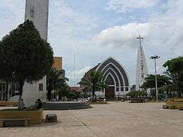
Pucallpa (Quechua: puka allpa, lit. 'red dirt') is a city in eastern Peru located on the banks of the Ucayali River, a major tributary of the Amazon River. It is the capital of the Ucayali region, the Coronel Portillo Province and the Calleria District.
Pucallpa May Ushin Pukallpa | |
|---|---|
      | |
Flag  Coat of arms | |
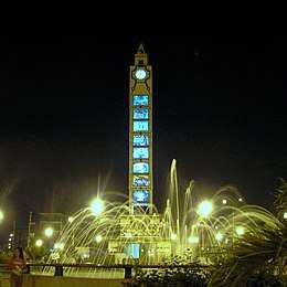
| Nickname(s): La tierra colorada (The Crimson Land) | |
 Pucallpa Location in Peru | |
| Coordinates: 8°23′S 74°31′W | |
| Country | Peru |
| Region | Ucayali |
| Province | Coronel Portillo |
| Settled | 1840s |
| Government | |
| • Mayor | Segundo Pérez Collazos (2019–2022) |
| Elevation | 154 m (505 ft) |
| Population (2017) | |
| • Total | 326,040 |
| • Estimate (2015)[1] | 211,651 |
| Time zone | UTC-5 (PET) |
| • Summer (DST) | UTC-5 (PET) |
| Website | mpcp |
This city is categorized as the only metropolis in Ucayali, being the largest populated center of the region. According to the Instituto Nacional de Estadística e Informática, it is the tenth most populated city in Peru and in 2013 housed a population of 211,611 inhabitants.
Although originally located in the district of Callería, in the 1980s it formed a conurbation with the towns of Puerto Callao (district of Yarinacocha) and San Fernando (district of Manantay, created in 2000).
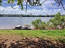
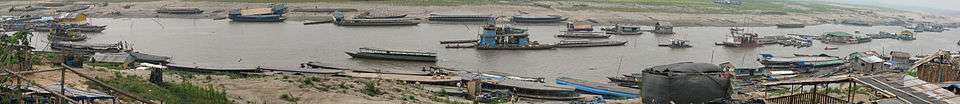
Most of the transport to Pucallpa is done through the Ucayali River, located in the central east of Peru and which contains the second most important river port in the Amazon (behind Iquitos). The Federico Basadrees highway is the main center of land transportation and connects the northwest of the city with the Captain Rolden International Airport (Aeropuerto Internacional Capitán FAP David Abensur Rengifo), where flights are made to Brazil.
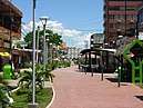
The economy of Pucallpa is based on trade, the timber industry and tourism. Among the main attractions of the city include ecological tourism, such as the Parque Natural, or cultural tourism, in the case of shamanism. Its main economic activities are fishing, agriculture, livestock and timber extraction. In addition, a small oil refinery near the Pachitea River and a gas refinery in the Curimaná District supply fuel to the city and the center of the country.
The first human inhabitants of the region were the Pano, who inhabited the entire length of the Ucayali River and its tributaries 3 millennia before being colonized.
History and transportation
Pucallpa was founded in the 1840s by Franciscan missionaries who settled several families of the Shipibo-Conibo ethnic group.[2] For several decades it remained a small settlement as it was isolated from the rest of the country by the Amazon Rainforest and the Andes mountain range. From the 1880s through the 1920s a railway project to connect Pucallpa with the rest of the country via the Ferrocarril Central Andino was started and dropped several times until it was finally abandoned. Pucallpa's isolation finally ended in 1945 with the completion of a highway to Lima through Tingo Maria. The highway allowed the commercialization of regional products to the rest of the country, thus improving the economic outlook of the region and its capital, Pucallpa. However, the heavy rainfalls of the Amazon Rainforest remain a problem as they erode the highway and can even undermine it by causing flash floods. Pucallpa is served by air through the Captain Rolden International Airport and by river through its port Pucallpillo near the center of the city. During the high water season, the floating ports of La Hoyada and Puerto Italia are used for riverine communications. Pucallpa is connected by road to Lima via the cities Huánuco and Cerro de Pasco. The San Lorenzo Megaport Project proposes to connect Lima with the Atlantic via a rail connection to Pucallpa and the Amazon.[3]
Climate
Pucallpa has a tropical monsoon climate (Köppen climate classification: Am).
| Climate data for Pucallpa | |||||||||||||
|---|---|---|---|---|---|---|---|---|---|---|---|---|---|
| Month | Jan | Feb | Mar | Apr | May | Jun | Jul | Aug | Sep | Oct | Nov | Dec | Year |
| Record high °C (°F) | 42.0 (107.6) |
40.8 (105.4) |
37.8 (100.0) |
37.2 (99.0) |
34.2 (93.6) |
36.2 (97.2) |
36.5 (97.7) |
40.5 (104.9) |
37.2 (99.0) |
36.5 (97.7) |
36.2 (97.2) |
37.8 (100.0) |
42.0 (107.6) |
| Average high °C (°F) | 31.3 (88.3) |
30.7 (87.3) |
30.7 (87.3) |
30.9 (87.6) |
30.4 (86.7) |
30.3 (86.5) |
30.4 (86.7) |
31.8 (89.2) |
32.3 (90.1) |
31.7 (89.1) |
31.5 (88.7) |
31.6 (88.9) |
31.1 (88.0) |
| Daily mean °C (°F) | 26.7 (80.1) |
26.4 (79.5) |
26.2 (79.2) |
26.2 (79.2) |
26.2 (79.2) |
25.6 (78.1) |
25.4 (77.7) |
26.0 (78.8) |
26.7 (80.1) |
26.8 (80.2) |
26.6 (79.9) |
26.9 (80.4) |
26.3 (79.3) |
| Average low °C (°F) | 22.4 (72.3) |
22.3 (72.1) |
22.3 (72.1) |
22.1 (71.8) |
21.5 (70.7) |
20.5 (68.9) |
19.8 (67.6) |
20.4 (68.7) |
21.1 (70.0) |
21.8 (71.2) |
22.2 (72.0) |
22.4 (72.3) |
21.6 (70.9) |
| Record low °C (°F) | 18.5 (65.3) |
17.6 (63.7) |
13.8 (56.8) |
12.8 (55.0) |
15.0 (59.0) |
12.2 (54.0) |
11.1 (52.0) |
11.6 (52.9) |
14.0 (57.2) |
15.0 (59.0) |
17.8 (64.0) |
17.8 (64.0) |
11.1 (52.0) |
| Average precipitation mm (inches) | 147 (5.8) |
165 (6.5) |
191 (7.5) |
163 (6.4) |
104 (4.1) |
66 (2.6) |
51 (2.0) |
56 (2.2) |
91 (3.6) |
168 (6.6) |
185 (7.3) |
180 (7.1) |
1,565 (61.6) |
| Average precipitation days (≥ 1.0 mm) | 14 | 11 | 12 | 12 | 9 | 6 | 5 | 6 | 7 | 11 | 10 | 11 | 114 |
| Average relative humidity (%) | 87 | 88 | 88 | 88 | 87 | 88 | 86 | 84 | 85 | 86 | 87 | 86 | 86 |
| Source: Deutscher Wetterdienst[4] | |||||||||||||
See also
- Tapiche Ohara's Reserve
- TANS Peru Flight 204 crash, 23 August 2005.
- LANSA Flight 508 crash, 24 December 1971.
- Yarinaqucha
References
- Perú: Población estimada al 30 de junio y tasa de crecimiento de las ciudades capitales, por departamento, 2011 y 2015. Perú: Estimaciones y proyecciones de población total por sexo de las principales ciudades, 2012–2015 (Report). Instituto Nacional de Estadística e Informática. March 2012. Retrieved 3 June 2015.
- (in Spanish) Alberto Tauro del Pino, Enciclopedia Ilustrada del Perú, vol. XIII, p. 2129.
- "Executive Summary". San Lorenzo Megaport Project. Retrieved 28 June 2014.
- "Klimatafel von Pucallpa, Prov. Ucayali / Peru" (PDF). Baseline climate means (1961–1990) from stations all over the world (in German). Deutscher Wetterdienst. Retrieved 18 December 2018.
External links
| Wikimedia Commons has media related to Pucallpa. |
