Princeton, Florida
Princeton is a census-designated place (CDP) and unincorporated community in Miami-Dade County, Florida, United States. The population was 22,038 at the 2010 census.
Princeton, Florida | |
|---|---|
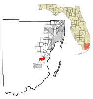 Location in Miami-Dade County and the state of Florida | |
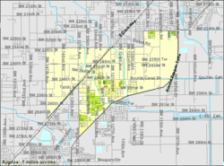 U.S. Census Bureau map showing CDP boundaries | |
| Coordinates: 25°32′8″N 80°23′51″W | |
| Country | |
| State | |
| County | Miami-Dade |
| Area | |
| • Total | 7.3 sq mi (19 km2) |
| • Land | 7.3 sq mi (19 km2) |
| • Water | 0 sq mi (0 km2) |
| Elevation | 10 ft (3 m) |
| Population (2010) | |
| • Total | 22,038 |
| • Density | 1,382.2/sq mi (531.1/km2) |
| Time zone | UTC-5 (Eastern (EST)) |
| • Summer (DST) | UTC-4 (EDT) |
| ZIP codes | 33032, 33092 |
| Area code(s) | 305 |
| FIPS code | 12-58975[1] |
| GNIS feature ID | 0289323[2] |
History
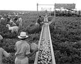
As a small town and depot along the Florida East Coast Railroad in the 1900s, the community was named by Gaston Drake after his alma mater, Princeton University. Many of the town buildings were even painted the school's colors: black and orange. Drake operated a saw mill and lumber company in Princeton supplying Miami, the Florida Keys and Cuba until the local timber gave out in 1923.[3]
Geography
Princeton is located at 25°32′8″N 80°23′51″W (25.535634, -80.397485).[4]
According to the United States Census Bureau, the CDP has a total area of 7.3 square miles (19 km2), all of it land.
Demographics
| Historical population | |||
|---|---|---|---|
| Census | Pop. | %± | |
| 1960 | 1,719 | — | |
| 1990 | 7,073 | — | |
| 2000 | 10,090 | 42.7% | |
| 2010 | 22,038 | 118.4% | |
| source:[5][6][7][8] | |||
As of the census[1] of 2000, there were 10,090 people, 2,732 households, and 2,341 families in the CDP. The population density was 1,373.3 people per square mile (530.0/km²). There were 2,906 housing units at an average density of 395.5/sq mi (152.7/km²). The racial makeup of the CDP was 53.78% White (18% were Non-Hispanic White,)[9] 32.54% African American, 0.34% Native American, 1.37% Asian, 0.06% Pacific Islander, 7.70% from other races, and 4.22% from two or more races. Hispanic or Latino of any race were 47.49% of the population.
Of the 2,732 households 52.4% had children under the age of 18 living with them, 56.8% were married couples living together, 22.4% had a female householder with no husband present, and 14.3% were non-families. 10.0% of households were one person and 2.3% were one person aged 65 or older. The average household size was 3.63 and the average family size was 3.85.
The age distribution was 36.1% under the age of 18, 10.2% from 18 to 24, 30.0% from 25 to 44, 17.7% from 45 to 64, and 6.0% 65 or older. The median age was 28 years. For every 100 females, there were 97.0 males. For every 100 females age 18 and over, there were 92.6 males.
The median household income was $39,556 and the median family income was $41,896. Males had a median income of $32,101 versus $23,634 for females. The per capita income for the CDP was $12,918. About 19.8% of families and 23.8% of the population were below the poverty line, including 33.1% of those under age 18 and 14.4% of those age 65 or over.
As of 2000, speakers of English as a first language accounted for 50.02% of residents, while Spanish made up 49.24%, and French Creole was the mother tongue for 0.72% of the population.[10]
As of 2000, Princeton had the thirty-seventh highest percentage of Cuban residents in the US, with 12.94% of the populace.[11] It had the seventy-ninth highest percentage of Puerto Rican residents in the US, at 10% of the population,[12] and the twenty-first highest percentage of Nicaraguan residents in the US, at 2.15% of its population.[13] It also had the ninety-third most Colombians in the US, at 1.77% (tied with South Miami and Westchester, FL,)[14] while it had the 118th highest percentage of Dominicans, at 1.33% of all residents (tied with Peabody, Massachusetts.)[15]
See also
- Naranja-Princeton, a single census area recorded during the 1980 Census.
References
- "U.S. Census website". United States Census Bureau. Retrieved 2008-01-31.
- "US Board on Geographic Names". United States Geological Survey. 2007-10-25. Retrieved 2008-01-31.
- Jean Cunningham Taylor (1985*). Villages of South Dade. B. Kennedy. pp. 126–7. OCLC 18906834. Check date values in:
|date=(help) - "US Gazetteer files: 2010, 2000, and 1990". United States Census Bureau. 2011-02-12. Retrieved 2011-04-23.
- "CENSUS OF POPULATION AND HOUSING (1790-2000)". U.S. Census Bureau. Retrieved 2010-07-31.
- In 1980, Princeton combined with Naranja to form Naranja-Princeton CDP, which enumerated a population of 10,381.
- Census of Population, 1960: Number of Inhabitants, General Population Counts. United States Census Bureau. Retrieved 2013-09-08.
- Not returned separately by enumerators in 1970
- "Demographics of Princeton, FL". MuniNetGuide.com. Retrieved 2007-11-08.
- "MLA Data Center Results of Princeton, FL". Modern Language Association. Retrieved 2007-11-08.
- "Ancestry Map of Cuban Communities". Epodunk.com. Retrieved 2007-11-08.
- "Ancestry Map of Puerto Rican Communities". Epodunk.com. Archived from the original on 2006-07-15. Retrieved 2007-11-08.
- "Ancestry Map of Nicaraguan Communities". Epodunk.com. Archived from the original on 2010-10-17. Retrieved 2007-11-08.
- "Ancestry Map of Colombian Communities". Epodunk.com. Retrieved 2007-11-08.
- "Ancestry Map of Dominican Communities". Epodunk.com. Archived from the original on 2010-10-17. Retrieved 2007-11-08.
Municipalities and communities of Miami-Dade County, Florida, United States | ||
|---|---|---|
| Cities | 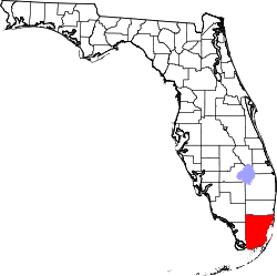 | |
| Towns | ||
| Villages | ||
| CDPs |
| |
| Unincorporated communities | ||
| Ghost town | ||
| Indian reservation | ||
| Footnotes | ‡This populated place also has portions in an adjacent county or counties | |