Columbia County, Florida
Columbia County is a county located in the north central portion of the U.S. state of Florida. As of the 2010 census, the population was 67,531.[2] Its county seat is Lake City.[3]
Columbia County | |
|---|---|
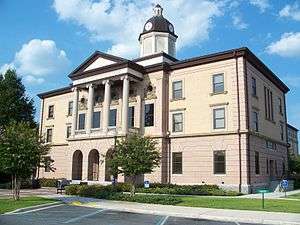 Columbia County Courthouse in Lake City | |
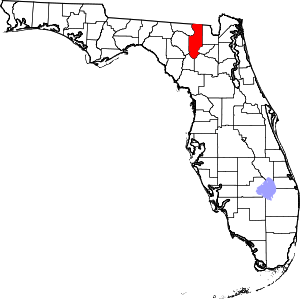 Location within the U.S. state of Florida | |
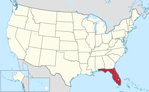 Florida's location within the U.S. | |
| Coordinates: 30°14′N 82°38′W | |
| Country | |
| State | |
| Founded | February 4, 1832 |
| Seat | Lake City |
| Largest city | Lake City |
| Area | |
| • Total | 801 sq mi (2,070 km2) |
| • Land | 798 sq mi (2,070 km2) |
| • Water | 3.8 sq mi (10 km2) 0.5%% |
| Population | |
| • Estimate (2019) | 71,686[1] |
| • Density | 87/sq mi (34/km2) |
| Time zone | UTC−5 (Eastern) |
| • Summer (DST) | UTC−4 (EDT) |
| Congressional districts | 2nd, 5th |
| Website | www |
Columbia County comprises the Lake City, FL Micropolitan Statistical Area, which is included in the Gainesville-Lake City, FL Combined Statistical Area. Osceola National Forest is partially in Columbia County.
History
After Florida became a territory of the United States in 1821, pioneer and immigrant settlers from the United States formed their own settlement adjacent to a Seminole village called Alligator Village, and called it Alligator.[4] Following the 1823 Treaty of Moultrie Creek, the residents of Alligator village relocated to the banks of Peace Creek in the newly established Seminole reservation, leaving Alligator Town on its own.
When Columbia County was formed in 1832 from Duval and Alachua counties, Alligator Town was designated as the seat of the county government. It was renamed as Columbia, the poetic form for the United States.[5] The county was developed for agriculture and the timber industry, with products such as turpentine, lumber, and plywood. From 1832 to 1839, the county seat was Newnansville, but that town and area were returned to Alachua County.
In November 1858 a railroad was completed connecting Jacksonville to Alligator, which opened the town to more commerce and passenger traffic. Alligator Town was incorporated and its name changed to Lake City in 1859; M. Whit Smith was elected as the town's first mayor.[6] According to an urban legend, the name was changed because the mayor's wife Martha Jane, who had recently moved to the town, refused to hang her lace curtains in a town named Alligator.[7]
During the American Civil War, the railroad between Lake City and Jacksonville was used to send beef and salt to Confederate soldiers. In February 1864 Union troops under Truman Seymour advanced west from Jacksonville. His objective was to disrupt Confederate supplies, and obtain African-American recruits and supplies.[8] Confederate General Joseph Finnegan assembled troops and called for reinforcements from P. G. T. Beauregard in response to the Union threat. On February 11, 1864, Finnegan's troops defeated a Union cavalry raid in Lake City.[8] After the Union cavalry was repulsed, Finnegan moved his forces to Olustee Station about ten miles east of Lake City. The Confederate presence at Olustee Station was reinforced to prepare for the Union troops coming from Jacksonville.
Union forces engaged the Confederates at the Battle of Olustee on February 20, 1864 near the Olustee Station. It was the only major battle in Florida during the war. Union casualties were 1,861 men killed, wounded or missing; Confederate casualties were 946 killed, wounded or missing. The Confederate dead were buried in Lake City.[9] In 1928 a memorial for the Battle of Olustee was established in downtown Lake City.
In 1874 Lake City's first newspaper was published in 1874, called the Lake City Reporter. In 1876 the Bigelow Building was completed; it later was adapted for use as the City Hall. The first fire department was established in 1883 to complement the police department. In 1891 Lake City became the first city in Florida to have electric lights from a local power and light company.
White violence rose against blacks in the late 19th century in a regionwide effort to establish and maintain white supremacy as Southern states disenfranchised most blacks and imposed Jim Crow. Whites lynched 20 African Americans in Columbia County from 1877-1950, mostly in the decades near the turn of the 20th century. It was tied with Polk County for the second-highest total of lynchings of any county in the state.[10]
Among these murders was the mass lynching on May 21, 1911, of six black men who were taken from the jail by a white mob in Lake City. They were being held on charges of murdering one white sawmill worker and wounding another in Leon County, after whites had attacked them at a private house following an earlier altercation between two men.[11] A group of a dozen white men, reportedly from Tallahassee, tricked the white youth guarding the jail by posing as officials and gained release of the suspects. They took the men outside town and shot them repeatedly to death.[12][11]
Geography
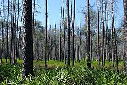
According to the U.S. Census Bureau, the county has a total area of 801 square miles (2,070 km2), of which 798 square miles (2,070 km2) is land and 3.8 square miles (9.8 km2) (0.5%) is water.[13] Osceola National Forest is partially within the county.
Adjacent counties
- Echols County, Georgia - north
- Clinch County, Georgia - northeast
- Baker County - east
- Union County - southeast
- Alachua County - south
- Gilchrist County - southwest
- Suwannee County - west
- Hamilton County - northwest
National protected area
- Osceola National Forest (part)
Demographics
| Historical population | |||
|---|---|---|---|
| Census | Pop. | %± | |
| 1840 | 2,102 | — | |
| 1850 | 4,808 | 128.7% | |
| 1860 | 4,646 | −3.4% | |
| 1870 | 7,335 | 57.9% | |
| 1880 | 9,589 | 30.7% | |
| 1890 | 12,877 | 34.3% | |
| 1900 | 17,094 | 32.7% | |
| 1910 | 17,689 | 3.5% | |
| 1920 | 14,290 | −19.2% | |
| 1930 | 14,638 | 2.4% | |
| 1940 | 16,859 | 15.2% | |
| 1950 | 18,216 | 8.0% | |
| 1960 | 20,077 | 10.2% | |
| 1970 | 25,250 | 25.8% | |
| 1980 | 35,399 | 40.2% | |
| 1990 | 42,613 | 20.4% | |
| 2000 | 56,513 | 32.6% | |
| 2010 | 67,531 | 19.5% | |
| Est. 2019 | 71,686 | [14] | 6.2% |
| U.S. Decennial Census[15] 1790-1960[16] 1900-1990[17] 1990-2000[18] 2010-2015[2] | |||
As of the census[19] of 2000, there were 56,513 people, 20,925 households, and 14,919 families residing in the county. The population density was 71 people per square mile (27/km²). There were 23,579 housing units at an average density of 30 per square mile (11/km²). The racial makeup of the county was 79.72% White, 17.03% Black or African American, 0.53% Native American, 0.67% Asian, 0.04% Pacific Islander, 0.60% from other races, and 1.42% from two or more races. 2.74% of the population were Hispanic or Latino of any race.
There were 20,925 households out of which 32.10% had children under the age of 18 living with them, 53.70% were married couples living together, 12.90% had a female householder with no husband present, and 28.70% were non-families. 23.80% of all households were made up of individuals and 9.80% had someone living alone who was 65 years of age or older. The average household size was 2.56 and the average family size was 3.02.
In the county, the population was spread out with 25.40% under the age of 18, 9.00% from 18 to 24, 27.70% from 25 to 44, 24.00% from 45 to 64, and 14.00% who were 65 years of age or older. The median age was 37 years. For every 100 females there were 102.90 males. For every 100 females age 18 and over, there were 101.70 males.
The median income for a household in the county was $30,881, and the median income for a family was $35,927. Males had a median income of $27,353 versus $21,738 for females. The per capita income for the county was $14,598. About 11.40% of families and 15.00% of the population were below the poverty line, including 17.10% of those under age 18 and 13.60% of those age 65 or over.
Politics
Voter registration
According to the Secretary of State's office, Democrats maintain a narrow plurality among registered voters in Columbia County.
| Columbia County Voter Registration & Party Enrollment as of September 30, 2015[20] | |||||
|---|---|---|---|---|---|
| Political Party | Total Voters | Percentage | |||
| Democratic | 15,157 | 42.04% | |||
| Republican | 14,412 | 39.97% | |||
| Independent | 5,530 | 15.34% | |||
| Third Parties | 959 | 2.66% | |||
| Total | 36,058 | 100% | |||
Statewide elections
| Year | Republican | Democratic | Third parties |
|---|---|---|---|
| 2016 | 70.57% 20,368 | 26.33% 7,601 | 3.10% 895 |
| 2012 | 67.69% 18,429 | 31.08% 8,462 | 1.23% 336 |
| 2008 | 66.17% 18,670 | 32.50% 9,171 | 1.33% 374 |
| 2004 | 67.06% 16,758 | 32.14% 8,031 | 0.81% 202 |
| 2000 | 59.24% 10,968 | 38.07% 7,049 | 2.68% 497 |
| 1996 | 46.48% 7,588 | 40.98% 6,691 | 12.54% 2,047 |
| 1992 | 43.41% 6,492 | 36.97% 5,528 | 19.62% 2,934 |
| 1988 | 65.13% 7,761 | 34.18% 4,073 | 0.69% 82 |
| 1984 | 67.41% 8,814 | 32.59% 4,261 | |
| 1980 | 48.45% 5,643 | 48.76% 5,680 | 2.79% 325 |
| 1976 | 36.66% 3,947 | 62.08% 6,683 | 1.26% 136 |
| 1972 | 80.16% 6,723 | 19.84% 1,664 | |
| 1968 | 21.13% 1,553 | 23.81% 1,750 | 55.06% 4,046 |
| 1964 | 56.06% 4,145 | 43.94% 3,249 | |
| 1960 | 36.17% 2,094 | 63.83% 3,695 | |
| 1956 | 36.19% 1,841 | 63.81% 3,246 | |
| 1952 | 38.73% 2,041 | 61.27% 3,229 | |
| 1948 | 16.60% 553 | 53.93% 1,797 | 29.47% 982 |
| 1944 | 17.88% 537 | 82.12% 2,467 | |
| 1940 | 13.30% 443 | 86.70% 2,888 | |
| 1936 | 6.58% 196 | 93.42% 2,783 | |
| 1932 | 6.51% 174 | 93.49% 2,497 | |
| 1928 | 24.36% 418 | 74.36% 1,276 | 1.28% 22 |
| 1924 | 8.94% 85 | 81.60% 776 | 9.46% 90 |
| 1920 | 10.50% 162 | 80.88% 1,248 | 8.62% 133 |
| 1916 | 19.06% 226 | 72.60% 861 | 8.35% 99 |
| 1912 | 9.85% 66 | 77.61% 520 | 12.53% 84 |
| 1908 | 31.28% 279 | 52.13% 465 | 16.59% 148 |
| 1904 | 32.09% 317 | 60.22% 595 | 7.69% 76 |
| Year | Republican | Democratic | Third parties |
|---|---|---|---|
| 2014 | 63.15% 11,604 | 31.63% 5,812 | 5.22% 958 |
| 2010 | 58.66% 11,089 | 37.39% 7,068 | 3.95% 748 |
| 2006 | 59.74% 9,313 | 36.97% 5,763 | 3.29% 514 |
| 2002 | 58.50% 9,554 | 40.43% 6,603 | 1.07% 174 |
| 1998 | 61.27% 7,698 | 38.71% 4,863 | 0.02% 3 |
| 1994 | 58.35% 7,408 | 41.65% 5,288 |
Education
The Columbia County School District operates public schools.
Library
The Columbia County Public Library consists of 3 branches.
- Main Branch
- West Branch
- Fort White Branch
Transportation
Airports
Columbia County's main airport is Lake City Municipal Airport. Private airports also exist throughout the county.
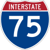
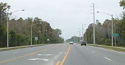
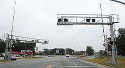
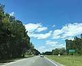
Major roads


Railroads
Columbia County has at least three existing railroad lines. The primary one is a Florida Gulf & Atlantic Railroad line formerly owned by CSX, Seaboard System Railroad, Seaboard Coastline Industries and Seaboard Air Line Railroad that served Amtrak's Sunset Limited until it was truncated to New Orleans in 2005 by Hurricane Katrina. Lake City (Amtrak station) was Columbia County's only active railroad station until that point. Another one is owned by the Georgia Southern and Florida Railway, and runs along US 41 from Lake City through Hamilton County. A third line runs along SR 100 into Union County.
Communities

City
Town
Census-designated places
Other unincorporated communities
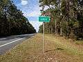
- Columbia City
- Lulu
- Mikesville
- Newco
References
- https://www.census.gov/quickfacts/fact/table/columbiacountyflorida/PST045217
- "State & County QuickFacts". United States Census Bureau. Archived from the original on August 6, 2011. Retrieved June 13, 2014.
- "Find a County". National Association of Counties. Archived from the original on 2011-05-31. Retrieved 2011-06-07.
- "Alligator Town Marker". Retrieved April 24, 2017.
- Publications of the Florida Historical Society. Florida Historical Society. 1908. p. 30.
- "Lake City Florida. Celebrating 150 Years. A Guide to the Sesquicentennial Celebration." Lake City, FL, 2009, pg. 21.
- Williams, Morris (March 8, 2008). "Lake City's 150th birthday — time for a celebration". Lake City Reporter. Archived from the original on September 7, 2012. Retrieved March 22, 2008.
- "Events Leading up to the Battle of Olustee". battleofolustee.org. Retrieved May 3, 2017.
- "Olustee Battlefield". Florida Public Archaeology Network. Archived from the original on March 14, 2014. Retrieved March 13, 2014.
- Lynching in America/ Supplement: Lynchings by County, 3rd Edition, 2017, p. 3
- Bill Bond, "[NAACP] Report On Lynchings Details Hideous Chapter In History", Orlando Sentinel, 25 January 1987; accessed 20 March 2018
- "Mob Fury Upon Six Negroes", The Tennessean (Nashville, Tennessee), 22 May 1911; accessed 20 March 2018
- "US Gazetteer files: 2010, 2000, and 1990". United States Census Bureau. 2011-02-12. Retrieved 2011-04-23.
- "Population and Housing Unit Estimates". Retrieved December 12, 2019.
- "U.S. Decennial Census". United States Census Bureau. Retrieved June 13, 2014.
- "Historical Census Browser". University of Virginia Library. Retrieved June 13, 2014.
- "Population of Counties by Decennial Census: 1900 to 1990". United States Census Bureau. Retrieved June 13, 2014.
- "Census 2000 PHC-T-4. Ranking Tables for Counties: 1990 and 2000" (PDF). United States Census Bureau. Retrieved June 13, 2014.
- "U.S. Census website". United States Census Bureau. Retrieved 2011-05-14.
- "Archived copy". Archived from the original on 2016-10-24. Retrieved 2016-10-24.CS1 maint: archived copy as title (link)
- Leip, David. "Dave Leip's Atlas of U.S. Presidential Elections". uselectionatlas.org.
External links
| Wikimedia Commons has media related to Columbia County, Florida. |
Government links/Constitutional offices
Special districts
Judicial branch
Tourism links
- Lake City Weather dot Com Get LIVE Weather Reports here.
- Columbia County Tourism Development Council
Places adjacent to Columbia County, Florida | ||||||||||
|---|---|---|---|---|---|---|---|---|---|---|
| ||||||||||
Municipalities and communities of Columbia County, Florida, United States | ||
|---|---|---|
| City | | |
| Town | ||
| CDPs | ||
| Unincorporated communities | ||
Region of Florida | ||
| Topics |  Map of North Florida | |
| Counties | ||
| Major cities | ||
| Cities and towns 100k+ | ||
| Cities and towns 25k–100k | ||
| Cities and towns 10k–25k | ||
| Metro areas |
| |
| Regions | ||
| Authority control |
|
|---|