Gulf County, Florida
Gulf County is a county located in the panhandle of the U.S. state of Florida. As of the 2010 census, the population was 15,863.[2] Its county seat is Port St. Joe.[3]
Gulf County | |
|---|---|
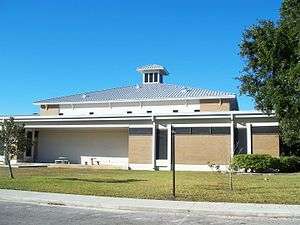 Gulf County Courthouse | |
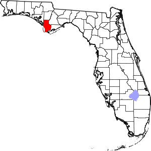 Location within the U.S. state of Florida | |
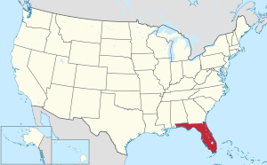 Florida's location within the U.S. | |
| Coordinates: 29°54′N 85°14′W | |
| Country | |
| State | |
| Founded | June 6, 1925 |
| Named for | Gulf of Mexico |
| Seat | Port St. Joe |
| Largest city | Port St. Joe |
| Area | |
| • Total | 756 sq mi (1,960 km2) |
| • Land | 564 sq mi (1,460 km2) |
| • Water | 192 sq mi (500 km2) 25.4%% |
| Population | |
| • Estimate (2019) | 13,639[1] |
| • Density | 28.6/sq mi (11.0/km2) |
| Time zones | |
| Southern portion | UTC−5 (Eastern) |
| • Summer (DST) | UTC−4 (EDT) |
| Northern portion | UTC−6 (Central) |
| • Summer (DST) | UTC−5 (CDT) |
| Congressional district | 2nd |
| Website | www |
Gulf County is included in the Panama City, FL Metropolitan Statistical Area.
History
Gulf County, created in 1925, was named for the Gulf of Mexico. Wewahitchka was its first county seat and the 1927 Gulf County Courthouse is still in existence. In 1965 the county seat was moved to Port Saint Joe, which under its original name Saint Joseph, had been the site of Florida's first Constitutional Convention in 1838.
Geography
According to the U.S. Census Bureau, the county has a total area of 756 square miles (1,960 km2), of which 564 square miles (1,460 km2) is land and 192 square miles (500 km2) (25.4%) is water.[4]
Time zones
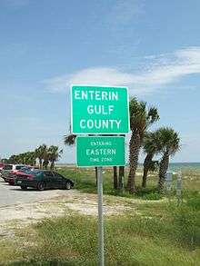
By way of the Intracoastal Waterway, Gulf County is one of a small number of counties in the United States to be under two time zones, Eastern and Central in this case.
Adjacent counties
- Calhoun County, Florida — north
- Liberty County, Florida — northeast
- Franklin County, Florida — east
- Bay County, Florida — west
National protected area
Demographics
| Historical population | |||
|---|---|---|---|
| Census | Pop. | %± | |
| 1930 | 3,182 | — | |
| 1940 | 6,951 | 118.4% | |
| 1950 | 7,460 | 7.3% | |
| 1960 | 9,937 | 33.2% | |
| 1970 | 10,096 | 1.6% | |
| 1980 | 10,658 | 5.6% | |
| 1990 | 11,504 | 7.9% | |
| 2000 | 13,332 | 15.9% | |
| 2010 | 15,863 | 19.0% | |
| Est. 2019 | 13,639 | [5] | −14.0% |
| U.S. Decennial Census[6] 1790-1960[7] 1900-1990[8] 1990-2000[9] 2010-2019[2] | |||
As of the census[10] of 2000, there were 13,332 people, 4,931 households, and 3,535 families residing in the county. The population density was 24 inhabitants per square mile (9.3/km2). There were 7,587 housing units at an average density of 14 per square mile (5/km²). The racial makeup of the county was 79.89% White, 16.94% Black or African American, 0.65% Native American, 0.40% Asian, 0.05% Pacific Islander, 0.53% from other races, and 1.55% from two or more races. 2.03% of the population were Hispanic or Latino of any race.
There were 4,931 households out of which 28.40% had children under the age of 18 living with them, 55.50% were married couples living together, 11.90% had a female householder with no husband present, and 28.30% were non-families. 25.50% of all households were made up of individuals and 11.40% had someone living alone who was 65 years of age or older. The average household size was 2.42 and the average family size was 2.87.
In the county, the population was spread out with 21.70% under the age of 18, 6.80% from 18 to 24, 29.40% from 25 to 44, 26.00% from 45 to 64, and 16.20% who were 65 years of age or older. The median age was 40 years. For every 100 females, there were 114.60 males. For every 100 females age 18 and over, there were 116.70 males.
The median income for a household in the county was $30,276, and the median income for a family was $36,289. Males had a median income of $27,539 versus $20,780 for females. The per capita income for the county was $14,449. About 13.70% of families and 16.70% of the population were below the poverty line, including 20.80% of those under age 18 and 14.10% of those age 65 or over.
Politics
Once heavily Democratic, in 2016 Gulf County transitioned to a majority Republican county. As of June 2020 Gulf County has 10,300 registered active voters. The Republican party holds a 52% (5,370 Voters) to 34% (3,494 voters) advantage over the Democratic Party. The remaining voters are registered with No Party Affiliation or are scattered across a number of minority parties.
The County Commission is a five member board consisting of three Republicans and two Democrats. Republicans control five of the six elected Constitutional Offices in the county including Sheriff, Superintendent of Schools, Property Appraiser, Clerk of the Court and Supervisor of Elections. The office of Tax Collector is the only Constitutional Office filled by a Democrat.
At the state level, Gulf County is represented by District 3 Democratic Senator Bill Montford and District 7 Republican Representative Jason Shoaf.
Gulf County is a part of Florida’s 2nd Congressional District and is represented by Neal Dunn.
| Year | Republican | Democratic | Other |
|---|---|---|---|
| 2016 | 72.69% 5,329 | 23.46% 1,720 | 3.85% 282 |
| 2012 | 70.10% 4,995 | 28.26% 2,014 | 1.64% 117 |
| 2008 | 68.99% 4,980 | 29.77% 2,149 | 1.23% 89 |
| 2004 | 66.03% 4,805 | 33.08% 2,407 | 0.89% 65 |
| 2000 | 57.79% 3,553 | 39.00% 2,398 | 3.21% 197 |
| 1996 | 40.55% 2,430 | 41.39% 2,480 | 18.06% 1,082 |
| 1992 | 45.29% 2,651 | 33.11% 1,938 | 21.61% 1,265 |
| 1988 | 62.44% 3,042 | 34.65% 1,688 | 2.91% 142 |
| 1984 | 66.70% 3,573 | 33.30% 1,784 | |
| 1980 | 43.18% 2,127 | 54.81% 2,700 | 2.01% 99 |
| 1976 | 37.00% 1,584 | 61.69% 2,641 | 1.31% 56 |
| 1972 | 78.54% 2,628 | 21.31% 713 | 0.15% 5 |
| 1968 | 9.58% 364 | 18.71% 711 | 71.71% 2,725 |
| 1964 | 54.67% 2,001 | 45.33% 1,659 | |
| 1960 | 21.86% 657 | 78.14% 2,348 | |
| 1956 | 24.12% 570 | 75.88% 1,793 | |
| 1952 | 21.69% 490 | 78.31% 1,769 | |
| 1948 | 9.25% 146 | 77.20% 1,219 | 13.56% 214 |
| 1944 | 6.15% 83 | 93.85% 1,267 | |
| 1940 | 6.01% 105 | 93.99% 1,642 | |
| 1936 | 7.76% 71 | 92.24% 844 | |
| 1932 | 4.42% 30 | 95.58% 648 | |
| 1928 | 34.98% 156 | 61.66% 275 | 3.36% 15 |
Education
Gulf County is served by Gulf County Schools.
Libraries
Gulf County is part of the Northwest Regional Library System (NWRLS), which serves Bay and Liberty Counties as well.
- Bay County Public Library
- Panama City Beach Public Library
- Parker Public Library
- Springfield Public Library
- Gulf County Public Library
- Charles Whitehead Public Library
- Harrell Memorial Library of Liberty County
- Jimmy Weaver Memorial Library
Communities
Cities
Unincorporated communities
- Cape San Blas
- Dalkeith
- Highland View
- Honeyville
- Indian Pass
- Oak Grove
- Overstreet
- White City
- Howard Creek
Transportation
Airports
- Costin Airport
References
- https://www.census.gov/quickfacts/fact/table/gulfcountyflorida/PST045217
- "State & County QuickFacts". United States Census Bureau. Archived from the original on June 7, 2011. Retrieved February 12, 2014.
- "Find a County". National Association of Counties. Retrieved 2011-06-07.
- "US Gazetteer files: 2010, 2000, and 1990". United States Census Bureau. 2011-02-12. Retrieved 2011-04-23.
- "Population and Housing Unit Estimates". Retrieved May 21, 2020.
- "U.S. Decennial Census". United States Census Bureau. Retrieved June 13, 2014.
- "Historical Census Browser". University of Virginia Library. Retrieved June 13, 2014.
- "Population of Counties by Decennial Census: 1900 to 1990". United States Census Bureau. Retrieved June 13, 2014.
- "Census 2000 PHC-T-4. Ranking Tables for Counties: 1990 and 2000" (PDF). United States Census Bureau. Retrieved June 13, 2014.
- "U.S. Census website". United States Census Bureau. Retrieved 2011-05-14.
- Leip, David. "Dave Leip's Atlas of U.S. Presidential Elections". uselectionatlas.org.
External links
| Wikimedia Commons has media related to Gulf County, Florida. |
Government links/Constitutional offices
Special districts
Judicial branch
- Gulf County Clerk of Courts
- Circuit and County Court for the 14th Judicial Circuit of Florida serving Bay, Calhoun, Gulf, Holmes, Jackson and Washington counties
Tourism links
Business links
Places adjacent to Gulf County, Florida | ||||||||||
|---|---|---|---|---|---|---|---|---|---|---|
| ||||||||||
Municipalities and communities of Gulf County, Florida, United States | ||
|---|---|---|
| Cities | | |
| Unincorporated communities | ||
| Ghost town | ||
Region of Florida | ||
| Topics |  Map of North Florida | |
| Counties | ||
| Major cities | ||
| Cities and towns 100k+ | ||
| Cities and towns 25k–100k | ||
| Cities and towns 10k–25k | ||
| Metro areas |
| |
| Regions | ||
| Authority control |
|
|---|