List of roads in Metro Manila
This list of roads in Metro Manila summarizes the major thoroughfares and the numbering system currently being implemented in Metro Manila, Philippines. Metro Manila's arterial road network consists of National Roads, the Circumferential Roads, and the Radial Roads, as well as the other major roads connecting the cities of Manila, Quezon, North and South Caloocan, Valenzuela, Malabon, Navotas, Pasay, Parañaque, Las Piñas, Taguig, Muntinlupa, Marikina, Pasig, Mandaluyong, Makati, Pateros, and San Juan as well as the surrounding provinces.[1][2]
| Manila's arterial road network | |
|---|---|
| R-6 C-4 Markers for Radial Road 6 (R-6) and Circumferential Road 4 (C-4) | |
 Simplified map of radial (solid and colored lines) and circumferential (dashed and gray lines) roads in Metro Manila | |
| System information | |
| Maintained by Department of Public Works and Highways and Metro Manila Development Authority | |
| Highway names | |
| Radial road | Rx, Rxx |
| Circumferential road | Cx |
| System links | |
| |
Numbered routes
Circumferential and Radial Roads
The first road numbering system in the Philippines was adapted in 1940 by the administration of President Manuel Quezon, and was very much similar to U.S. Highway numbering system. Portions of it are 70 roads labeled Highway 1 to Highway 60. Some parts of the numbering system are Admiral Dewey Boulevard (Highway 1), Calle Manila (Highway 50) and 19 de Junio (Highway 54).
In 1945, the Metropolitan Thoroughfare Plan was submitted by Quezon City planners Louis Croft and Antonio Kayanan which proposed the laying of 10 Radial Roads, which purposes in conveying traffic in and out of the City of Manila to the surrounding cities and provinces, and the completion of 6 Circumferential Roads, that will act as beltways of the city, forming altogether a web-like arterial road system.[3] The Department of Public Works and Highways (DPWH) is the government agency that deals with these projects.[1]

The road numbering for Radial Roads are R-1 up to R-10. The radial roads never intersect one another and they do not intersect circumferential roads twice; hence they continue straight routes leading out from the city of Manila to the provinces. The numbering is arranged in a counter-clockwise pattern, wherein the southernmost is R-1 and the northernmost is R-10. The Circumferential Roads are numbered C-1 to C-6. The innermost beltway in the city is C-1, while the outermost is C-6.
Radial roads
There are ten (10) radial roads that serves the purpose of conveying traffic in and out of the city of Manila to the surrounding cities of the metropolis and to the provinces, numbered in a counter clockwise pattern.[4] All radial roads starts at kilometre zero which is the flagpole fronting the Jose Rizal Memorial Monument in Rizal Park.[5][6]
| Name | Image | Route | City(s) | Road(s) | Length | Description | Refs |
|---|---|---|---|---|---|---|---|
| Radial Road 1 | 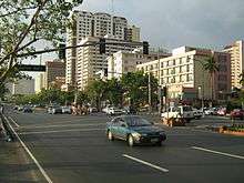  | City of Manila–Cavite | Manila Pasay Parañaque Las Piñas Bacoor, Cavite Kawit, Cavite Imus, Cavite Noveleta, Cavite General Trias, Cavite Tanza, Cavite Naic, Cavite | 41.5 kilometers or 25.8 miles | Radial Road 1 connects the City of Manila to the province of Cavite, officially starting at Mel Lopez Boulevard, just south of Pasig River. The road skirts the coastline of Manila Bay entering Bonifacio Drive and Roxas Boulevard and later, after crossing NAIA Road, as the Manila-Cavite Expressway. The road will keep skirting the coastline until it ends in a junction with the Governor's Drive in Naic, Cavite, spanning 41.5 kilometers (25.8 mi) from Rizal Park to Cavite. | [3] | |
| Radial Road 2 | 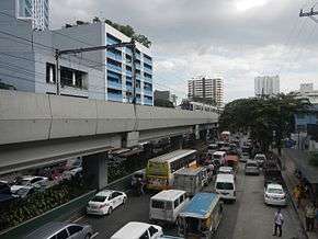  | City of Manila–Cavite | Manila Pasay Parañaque Las Piñas Bacoor, Cavite Imus, Cavite Dasmariñas, Cavite Silang, Cavite Tagaytay, Cavite | 64.2 kilometers or 39.9 miles | The road lies parallel to Radial Road 1, connecting the City of Manila to Cavite and Batangas. The road starts from the Lagusnilad Underpass in front of the National Museum in Ermita. The road, as Taft Avenue, will follow a straight route, and after crossing EDSA in Pasay, becomes Elpidio Quirino Avenue. E. Quirino Avenue serves as the main road in the suburb of Parañaque, until it becomes Diego Cera Avenue upon entering Las Piñas. The road then becomes the Aguinaldo Highway after crossing the Alabang–Zapote Road. Aguinaldo Highway serves as the main thoroughfare in the Province of Cavite, ending in the Tagaytay Rotunda, and becoming the Tagaytay-Talisay Road, which ends in front of the Taal Lake. The Manila LRT Line 1 follows the route of R-2 from Padre Burgos Avenue to EDSA. | [7] | |
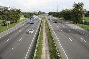
| Radial Road 3 | 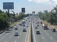  | City of Manila–Batangas | 19 cities and towns from Manila to Batangas City | 96 kilometers or 60 miles | The entire road is an expressway, except for its northern end starting from its junction with Sales Interchange. It is jointly operated by the Skyway Operation and Management Corporation (SomCo) and the Citra Metro Manila Tollways Corporation (CMMTC). Although the kilometer zero of the road is at Rizal Park, the road officially starts from the junction of South Luzon Expressway and Quirino Avenue. The road will follow a straight route starting from Paco, Manila, passing through the provinces of Laguna and Cavite, to Santo Tomas, Batangas, where it becomes the Southern Tagalog Arterial Road or the STAR Tollway. The STAR Tollway then connects Santo Tomas to the Batangas Port in Batangas City. | [8] | |
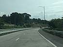
| Radial Road 4 |  _02.jpg) | City of Manila–Rizal | Manila Makati Pateros Taytay, Rizal |
|
23.5 kilometers or 14.6 miles | The road itself is incomplete. It starts from the junction of Pedro Gil Street and Quirino Avenue in San Andres, Manila, and it enters Makati before ending in an intersection with Rockwell Drive. A logical continuation of the road starts from the junction of EDSA and Kalayaan Avenue. The road again ends in a dead end in Kalawaan, Pateros. The continuation of the road starts from the east bank of the Manggahan Floodway, as Highway 2000. Highway 2000 becomes the Taytay Diversion Road after crossing Road 1 in Taytay, Rizal. The proposed Pasig River Expressway is also labeled R-4. The road currently spans 23.5 kilometers (14.6 mi). | [9] |
| Radial Road 5 |   | City of Manila–Laguna | 18 cities and towns from Manila to Pagsanjan, Laguna |
|
86.1 kilometers or 53.5 miles | Radial Road 5 starts from the upper banks of the Pasig River, parallel to Radial Road 4 on the lower banks. The road will enter Mandaluyong and will become an important thoroughfare in the industrial downtown of Pasig and the Ortigas Center. The road will eventually become the Manila East Road, the main transportation corridor of the Province of Rizal, and terminates in Pagsanjan, Laguna. | [10] |
| Radial Road 6 | 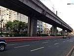 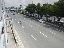 | City of Manila–Quezon | 11 cities and towns from Manila to Infanta, Quezon | 121.6 kilometers or 75.6 miles | Radial road 6 starts from the junction of Mendiola Street, Recto Avenue, and Legarda Street. The road will serve as an important thoroughfare in Santa Mesa, Manila, and will enter Quezon City before crossing G. Araneta Avenue to become Aurora Boulevard. The boulevard will then enter the city of San Juan and the districts of New Manila and Cubao in Quezon City and will serve as the main thoroughfare in Araneta Center. The road becomes Marikina–Infanta Highway (Marcos Highway) after crossing Katipunan Avenue. The highway will then pass through the cities of Marikina then in Pasig and transverse the province of Rizal. The road would continue further and will end in a dead end in Infanta, Quezon. The MRT Line 2 follows the route of R-6 from Legarda Street in Sampaloc, Manila to Marcos Highway in between the boundaries of Santolan, Pasig and Calumpang, Marikina. The road spans 88.6 kilometers (55.1 mi) long. | [11] | |
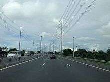
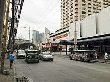
| Radial Road 7 |  (2018-02-07).jpg) | City of Manila–Bulacan | Quezon City Caloocan San Jose del Monte, Bulacan Norzagaray, Bulacan |
|
53.6 kilometers or 33.3 miles | Radial Road 7 starts from Quiapo, Manila. The road will follow a direct route towards Quezon City. After crossing the Quezon City Memorial Circle, it becomes Commonwealth Avenue, the widest road in the Philippines. The route then follows Regalado Highway in Fairview, Quezon City, and it ends in a junction with Quirino Highway in the Neopolitan Business Park in Lagro. The road drives north to Bulacan, until it ends with a junction with Fortunato Halili Avenue. The currently under construction North Luzon East Expressway or the R-7 Expressway is a continuation of this road. | [12][13] |
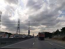
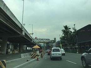
| Radial Road 8 | (2017-07-13).jpg) (2017-05-10).jpg) | City of Manila–La Union | 37 cities and towns from Manila to Rosario, La Union |
|
210.0 kilometers or 130.5 miles | Radial Road 8 starts from Quezon Bridge in Quiapo, Manila. The road will follow a direct route northwards, becoming the North Luzon Expressway after crossing EDSA. The road becomes SCTEX via Clark Spur Road in Mabalacat, Pampanga and then TPLEX in Tarlac City until its terminus in Rosario, La Union. It also has a spur segment in Quirino Highway, branching from the NLEX-Novaliches Interchange to Commonwealth Avenue, both in Quezon City. | [14][15] |
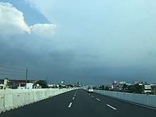
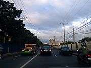
| Radial Road 9 | 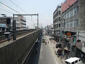 .jpg) | City of Manila–La Union | 23 towns and cities between Manila and Rosario, La Union | 228.0 kilometers or 141.7 miles | The Radial Road 9 consists of the northern portion of the Pan-Philippine Highway or AH-26.(R-2 takes the southern portion) The LRT-1 follows the route of R-9 from Manila to Monumento, Caloocan. R-9 starts as the Rizal Bridge from Padre Burgos Avenue. It follows a straight northward route parallel to R-8. The road becomes MacArthur Highway after crossing the Monumento Roundabout in Caloocan. The road officially ends in the road diversion in Rosario where it diverges into Kennon Road. | [16] | |
| Radial Road 10 |  | City of Manila–Bataan | Manila Navotas Bulacan Pampanga Bataan |
|
105.0 kilometers or 65.2 miles | The Radial Road 10 is currently a 6.7-kilometer-long (4.2 mi) highway from the Roxas Bridge over Pasig River in Manila to C-4 Road in Navotas. There was a proposed project of extending it to Bataan, as the Manila-Bataan Coastal Road. The proposed highway would be built over fishponds and would also serve as flood barriers for the coastal provinces of Bulacan, Pampanga, and Bataan. The project has long since died, but the top local government chiefs of Central Luzon led by RDC Chair and San Fernando City Mayor Oscar Rodriguez, and Zambales Governor Hermogenes Ebdane, Jr. revived the project and approved the CLIP for 2011 to 2016 in the recent 6th RDC meeting in Balanga. | [17][18] |
Circumferential roads
There are six (6) circumferential roads around the City of Manila that acts as beltways for the city. The first two (2) runs inside the City of Manila Proper, while the next three (3) runs outside the City of Manila. Another circumferential road, the C-6, will run outside Metro Manila and is under construction.
| Name | Image | Route | City(s) | Road(s) | Length | Description | Refs |
|---|---|---|---|---|---|---|---|
| Circumferential Road 1 |   | City of Manila |
|
5.9 kilometers or 3.7 miles | Circumferential Road 1 or C-1 is a route that runs inside the City of Manila proper, passing through the Tondo, San Nicolas, Binondo, Santa Cruz, Quiapo, Sampaloc, San Miguel, and Ermita districts. It starts from the North Port as Recto Avenue and becomes Legarda Street after crossing R-6. It then becomes Nepomuceno and P. Casal Streets in Quiapo. The road then crosses the Pasig River as Ayala Boulevard, which ends in Taft Avenue and enters Rizal Park as Finance Drive, which merges into the southern part of Padre Burgos Avenue, which ends in a junction with Roxas Boulevard. | ||
| Circumferential Road 2 |   | City of Manila |
|
10.0 kilometers or 6.2 miles | The C-2 Road starts from Tondo, Manila, passing through Santa Cruz, Sampaloc, Santa Mesa, Pandacan, Paco, and Malate districts. It starts from R-10 (Mel Lopez Boulevard) as Capulong Street, becomes Tayuman Street past Juan Luna Street, then continues on as Arsenio H. Lacson Avenue in Santa Cruz district and becomes Nagtahan Street past Nagtahan Interchange. It then crosses the Pasig River, then becomes President Quirino Avenue, which continues on until it reaches R-1 (Roxas Boulevard), passing through the Paco and Malate districts. | [19] | |
| Circumferential Road 3 |   | Navotas–Pasay | Navotas Caloocan Quezon City San Juan Makati Pasay |
|
21.7 kilometers or 13.5 miles | The C-3 Road is a route that lies outside the City of Manila. It starts as the C-3 Road in Navotas, and becomes 5th Avenue after entering Caloocan. It becomes Sergeant E. Rivera Avenue after crossing A. Bonifacio Street, and becomes G. Araneta Avenue after crossing the Santo Domingo Street in Quezon City. The road ends shortly after entering San Juan, only resuming at the junction of J.P. Rizal Avenue and South Avenue. South Avenue becomes Ayala Avenue Extension after crossing Metropolitan Avenue. The route is then rerouted west to Gil Puyat Avenue at its junction with Ayala Avenue. The proposed Metro Manila Skybridge will bridge the missing segment of the road. | [20] |
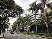
| Circumferential Road 4 |   | Navotas–Pasay | Navotas Malabon Caloocan Quezon City San Juan Mandaluyong Makati Pasay |
|
28.1 kilometers or 17.5 miles | The C-4 Road starts from Navotas. It becomes Paterio Aquino Avenue, then becomes Gen. San Miguel Street and then Samson Road after entering Caloocan. After crossing the Monumento Roundabout, C-4 becomes EDSA, the most important thoroughfare in the metropolis. With 2.34 million vehicles and almost 314,354 cars passing through it and its segments everyday, the road is also the most congested and busiest highway in the metropolis. The road ends at the Globe Rotunda fronting SM Mall of Asia in Pasay. The MRT-3 follows the route of C-4, from North Avenue to Taft Avenue. | [21][22] |
| Circumferential Road 5 | 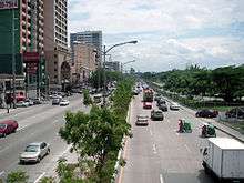 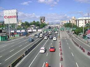 | Valenzuela–-Las Piñas | Valenzuela Quezon City Pasig Makati Taguig Pasay Parañaque Las Piñas |
|
55.0 kilometers or 34.2 miles | Several arising controversies regarding an expressway MCTEP, properties of Sen. Manny Villar, and the constant squatter demolishing issues in Quezon City causes the C-5 Road, although complete, have less than half of the length, only 32.5 kilometers (20.2 mi), be functional. The road from the Karuhatan Exit of the North Luzon Expressway (NLEX) segment that crosses the NLEX mainline and becomes Mindanao Avenue. The road will then follow the route of Congressional Avenue and Luzon Avenue, crossing Commonwealth Avenue and becoming Tandang Sora Avenue, which becomes Katipunan Avenue after crossing Magsaysay Avenue in the University of the Philippines Diliman campus. The road will then follow the route of Col. Bonny Serrano Avenue and become Eulogio Rodriguez, Jr. Avenue until Pasig and Carlos P. Garcia Avenue upon entering Makati. The road ends in the East Service Road in Taguig, parallel to the South Luzon Expressway (SLEX). A continuation of the road, which is now accessible by using the partially opened C-5 South Link Expressway across SLEX, starts from the West Service Road in Pasay to Coastal Road in Las Piñas. | [23][24][25] |
| Circumferential Road 6 |   | Marilao, Bulacan–Noveleta, Cavite | Marilao, Bulacan Meycauayan, Bulacan San Jose del Monte, Bulacan San Mateo, Rizal Antipolo, Rizal Taytay, Rizal Pasig Taguig Muntinlupa Bacoor, Cavite Imus, Cavite Kawit, Cavite Noveleta, Cavite |
|
49.1 kilometers or 30.5 miles | Currently operational in San Jose del Monte, Bulacan, San Mateo, Rizal, and from Taytay, Rizal to Taguig. It is planned to be extended north up to Marilao, Bulacan and south up to Noveleta, Cavite. The Southeast Metro Manila Expressway, a superhighway currently under construction, would be considered part of C-6. It will act as a beltway of Metro Manila, so that buses and other transportation vehicles coming from the southern provinces going to the northern provinces would not need to pass through Metro Manila, thus lessening traffic in the metropolis. | [26] |
Highway Network
The Radial and Circumferential Road numbers are being supplanted by a new highway number system, which the Department of Public Works and Highways have laid out in 2014. The new system classifies the national roads or highways as national primary roads, national secondary roads, and national tertiary roads. Primary national roads are numbered with one to two-digit numbers. Secondary national roads are assigned three-digit numbers, with the first digit being the number of the principal national road of the region. Secondary national roads around Manila mostly connect to N1 and are numbered with 100-series numbers.
Expressway network
Expressways are assigned numbers with the E prefix, to avoid confusion with numbered national roads. Expressways are limited-access roads, with crossing traffic limited to overpasses, underpasses, and interchanges. Some existing expressways serving Metro Manila also form part of the Radial Road system (see list above).
| Image | Route | From | To | Length | Toll roads | Areas served | Notes |
|---|---|---|---|---|---|---|---|
 |
Quezon City | Rosario | North Luzon Expressway Subic–Clark–Tarlac Expressway Tarlac–Pangasinan–La Union Expressway |
Northern Metro Manila, Bulacan, Pampanga, Tarlac, Pangasinan, La Union | Part of R-8 | ||
|
Makati | Batangas City | Skyway South Luzon Expressway Southern Tagalog Arterial Road |
Southern Metro Manila, Cavite, Laguna, Batangas | Part of R-3 | ||
 |
Muntinlupa | 4 km (2.5 mi) | Muntinlupa–Cavite Expressway | Southern Metro Manila, Cavite | Spur of E2 | ||
 |
Parañaque | Kawit | 14 km (8.7 mi) | Manila–Cavite Expressway | Southern Metro Manila, Cavite | Part of R-1 | |
 |
Valenzuela | Caloocan Future: Navotas |
NLEX Mindanao Avenue Link NLEX Karuhatan Link NLEX Harbor Link |
Northern Metro Manila including Manila North Harbor | NLEX Mindanao Avenue Link and NLEX Karuhatan Link are part of C-5. | ||
 |
Parañaque | Pasay | 11.6 km (7.2 mi) | NAIA Expressway | Southern Metro Manila including Ninoy Aquino International Airport | ||
Other major roads
Many other streets in the metropolis are considered major roads. Only Dr. A. Santos Ave (Sucat Road or N63) is designated a primary national road that is not part of the arterial road system. Roads with 3-number designations are secondary national roads.
Capital District

.jpg)

- Abad Santos Avenue (Tondo) – N151
- Adriatico Street (Ermita District)
- Ayala Boulevard (Downtown Manila) – N180
- Blumentritt Road (Sampaloc) – N160 (Rizal Ave – A. Bonifacio Ave), N161 (A. Bonifacio Ave – Espana Blvd)
- Bonifacio Drive (Intramuros-Port Area)
- Del Pilar Street (Ermita-Malate)
- Escolta Street (Binondo)
- Jose Laurel Street (San Miguel)
- Kalaw Avenue (Ermita) – N155
- Lacson Avenue (Sampaloc) – N140
- Legarda Street (Sampaloc) – N180
- Magsaysay Boulevard (Santa Mesa) – N180
- Maria Orosa Avenue (Ermita-Malate)
- Mel Lopez Boulevard (Tondo) – N120
- Mendiola Street (San Miguel)
- Pablo Ocampo Street (Malate-San Andres)
- Padre Burgos Avenue (Ermita) – N150
- Padre Faura Street (Ermita) – N157
- Pedro Gil Street (Ermita-Malate-Paco-Santa Ana)
- Quezon Boulevard (Quiapo) – N170
- Quirino Avenue (Malate-San Andres-Paco-Pandacan) – N140
- Tayuman Street (Juan Luna to Yuseco) – N140
- Tomas Claudio Street (Santa Mesa-Pandacan-Paco)
- United Nations Avenue (Ermita, Paco) – N156
- Victorino Mapa Street (Santa Mesa) – N183
- Zobel Roxas Street (San Andres)
Eastern Manila District
Mandaluyong

- Acacia Lane
- ADB Avenue
- Boni Avenue (Tomas Claudio Extension- EDSA)
- General Kalentong Street (P. Sanchez Street to Boni Avenue)
- Maysilo Circle
- Nueve de Febrero
- Pioneer Street
- San Miguel Avenue
- Shaw Boulevard (EDSA to Kalentong)
Marikina
- Amang Rodriguez Avenue
- Andres Bonifacio Avenue (Aurora Boulevard – Sumulong Highway)
- Bagong Farmers Avenue
- Bayanbayanan Avenue (Concepción Uno)
- Gen. Ordonez Avenue
- Gil Fernando Avenue (known as A. Tuazon Avenue)
- Marikina–Infanta Highway (also known as Marcos Highway) -R-6
- J. P. Rizal Avenue (Wawa, Rodriguez, Rizal to Calumpang district, Marcos Highway of Marikina; known as Gen. A. Luna Avenue in San Mateo Rizal)
- Sumulong Highway (Marikina to the highlands of Antipolo)
Pasig

- A. Luna Avenue (M.L. Quezon – M. Almeda)
- ADB Avenue
- Lanuza Avenue
- Julia Vargas Avenue (EDSA to C-5)
- Meralco Avenue (Ortigas Avenue to Shaw Boulevard in Pasig)
- Pioneer Street (EDSA – Pasig Boulevard)
- San Miguel Avenue
Quezon City


- Agham Road (East to North Avenue in Quezon City)
- Balete Drive (New Manila neighborhood of Quezon City)
- Baler Street (Project 7 neighborhood of Quezon City)
- Banawe Avenue (Santa Mesa Heights neighborhood of Quezon City)
- Batasan Road (Batasan Hills, Quezon City)
- Batasan-San Mateo Road (Batasan Road in Quezon City to San Mateo, Rizal)
- Broadway Avenue – (formerly Doña Juana Rodriguez; New Manila neighborhood of Quezon City)
- Bonny Serrano Avenue (formerly called Santolan Road; Katipunan Avenue to Ortigas Avenue) – N185
- Calle Industria (Pasig to C5)
- Cordillera Street (Santa Mesa Heights)
- D. Tuazon Avenue (Sgt. Rivera to E. Rodriguez, Sr. Avenue in Quezon City)
- Del Monte Avenue (San Francisco del Monte neighborhood of Quezon City)
- Don A. Roces Avenue (Quezon Avenue to Tomas Morato in Quezon City)
- Doña Hemady Avenue – (N. Domingo to E. Rodriguez, Sr. Ave.; New Manila neighborhood of Quezon City)
- East Avenue (Diliman neighborhood of Quezon City) – N174
- Eulogio Rodriguez, Sr. Avenue (Welcome Rotunda to Cubao District of Quezon City)
- Gilmore Avenue (New Manila neighborhood of Quezon City)
- Greenmeadows Avenue (C5 to Ortigas Avenue)
- Kalayaan Avenue (Elliptical Road to Kamuning Road)
- Kamias Road (EDSA to Kalayaan Avenue)
- Kamuning Road (EDSA to Tomas Morato in Quezon City)
- Mayon Avenue (La Loma neighborhood of Quezon City)
- Mindanao Avenue (Regalado to Commonwealth Avenue; not to be confused with Mindanao Avenue of C-5 Road)
- Norberto S. Amoranto Avenue (formerly called Retiro; G. Araneta Avenue to A. Maceda Avenue)
- North Avenue (Project 6 neighborhood of Quezon City) – N173
- Payatas Road (Commonwealth Avenue to Rodriguez, Rizal)
- Regalado Avenue (North Fairview District)
- Regalado Highway (Commonwealth Avenue to Quirino Highway in Fairview District, Quezon City)
- Roosevelt Avenue (Quezon Avenue to EDSA in Quezon City)
- Susano Road (Novaliches)
- Timog Avenue (Barangay Laging Handa of Quezon City; Timog is Tagalog for "south") – N172
- Times Street (Barangay West Triangle; exclusive neighborhood of Quezon City)
- Tomas Morato Avenue (ABS-CBN Compound in Barangay South Triangle to E. Rodriguez, Sr. Avenue in Quezon City)
- Visayas Avenue (Quezon Memorial Circle to Tandang Sora Avenue in Quezon City)
- West Avenue (Project 7 neighborhood of Quezon City) – N171
- White Plains Avenue (Temple Drive to EDSA)
- Zabarte Road (Quirino Highway to Caloocan)
San Juan
- Annapolis Street (EDSA to Greenhills neighborhood)
- Blumentritt Avenue (N. Domingo to Shaw Boulevard in Kalentong, Mandaluyong)
- N. Domingo (V. Mapa Boulevard to Gregorio Araneta Avenue)
- Pinaglabanan Street
Northern Manila District (Camanava)
Caloocan

- South Caloocan
- 5th Avenue – N130
- 10th Avenue
- Paterio Aquino Avenue
- Samson Road – N120
- North Caloocan
- Bagumbong Road
- Camarin Road
- Deparo Road
- Susano Road (Quezon City Boundary to Zabarte Road)
- Zabarte Road
Valenzuela
- Karuhatan Road
- Maysan Road (NLEX to MacArthur Highway) – N118
Southern Manila District
Las Piñas

- Alabang–Zapote Road – N411
- CAA Road
- Daang Hari Road (Las Piñas-Bacoor in Cavite)
- Diego Cera Avenue –
- J. Aguilar Avenue (CAA-BF International, Las Piñas)
- Marcos Alvarez Avenue (Talon district of Las Piñas, Molino district of Bacoor, Cavite)
- Naga Road (Pulanglupa district of Las Piñas)
Makati
- Amorsolo Street (Makati CBD)
- Arnaiz Avenue
- Ayala Avenue (Makati Central Business District)
- Chino Roces Avenue "formerly called and more commonly known as Pasong Tamo" (J.P. Rizal-SLEX)
- Estrella Street (Rockwell Center)
- Evangelista Street (Brgy. Bangkal)
- Gil Puyat Avenue (EDSA to Pres. Diosdado Macapagal Boulevard)
- J.P. Rizal Avenue (EDSA to Zobel Roxas Avenue)
- Kalayaan Avenue (Singkamas to Rockwell in Makati and Pinagkaisahan, Makati to Pasig)
- McKinley Road (Ayala Center- Bonifacio Global City, Taguig)
- Makati Avenue (San Lorenzo Village to Barangay Poblacion in Makati)
- Nicanor Garcia Street (Bel-Air Village)
- Paseo de Roxas (Buendia-Kalayaan Avenue)
- South Avenue (Makati CBD to Olympia)
Muntinlupa

- Don Jesus Boulevard
- Manila South Road (or Maharlika Highway)
- Muntinlupa–Cavite Expressway
- Susana Avenue
Parañaque

- Aseana Avenue
- Dr. A. Santos Avenue, or Sucat Road (Sucat district of Parañaque) – N63
- Doña Soledad Avenue (Better Living Subdivision, Parañaque)
- Elpidio Quirino Avenue
- Multinational Avenue
- NAIA Expressway – E6
- Ninoy Aquino Avenue – N195
- Pacific Avenue (Asiaworld City)
- Solaire Boulevard (Entertainment City)
Pasay
- Andrews Avenue (includes Airport and Sales Roads; Roxas Boulevard to SLEX in Pasay-Taguig boundary in front of Terminal 3) – N192
- Arnaiz Avenue "formerly called Libertad Street/Pasay Road"
- Domestic Road – in front of Domestic Terminal (Airport Road or Andrews Avenue to NAIA Road in Pasay) – N193
- Harrison Avenue
- Macapagal Boulevard – The main major road in Reclamation Area (Gil Puyat Avenue in Pasay to Pacific Avenue in Parañaque)
- NAIA Expressway
- NAIA Road (Diosdado Macapagal Boulevard to NAIA – 2 in Pasay) – N194
- Ninoy Aquino Avenue – Location of NAIA – 1 (NAIA Road in Pasay to Dr. Santos Avenue in Parañaque) – N195
- Tramo Street (Aurora Boulevard) (Andrews Avenue to EDSA)
Pateros
- B. Morcilla Street (Pateros town proper)
- J.P. Rizal Avenue Extension (also Guadalupe-Pateros Road, going to Guadalupe, Makati City)
- M. Almeda Street (from Gen. Luna Street, Taguig to R. Jabson Street, Pasig City)
- P. Rosales Street (going to Tipas area, Taguig)
Taguig
- 5th Avenue (Bonifacio Global City)
- 8th Avenue (Bonifacio Global City)
- 11th Avenue (Bonifacio Global City)
- 26th Street (Bonifacio Global City)
- 32nd Street (Bonifacio Global City)
- Arca Boulevard (formerly DBP Avenue) (Arca South)
- Bagong Calzada Street
- Bayani Road
- Carlos P. Garcia Avenue/C-5
- General Luna Street
- General Santos Avenue
- Lawton Avenue
- Le Grande Avenue (Bonifacio Global City/McKinley West)
- Levi B. Mariano Avenue (Cayetano Boulevard)
- McKinley Parkway (Bonifacio Global City)
- McKinley Road (Bonifacio Global City to Makati)
- Maria Rodriguez Tinga Avenue (To C-5 Road)
- M.L. Quezon Street
- South Diversion Road/South Luzon Expressway
- University Parkway (Bonifacio Global City)
- Upper McKinley Road (Bonifacio Global City/McKinley Hill)
See also
References
- DPWH Philippines. "DPWH Philippines". Retrieved March 20, 2012.
- URPO. "3rd Urpo" (PDF). Retrieved April 1, 2012.
- Tolentino, N. "The major roads of Metro Manila". Wordpress.com. Retrieved June 4, 2012.
- "Metro Manila Roads". Retrieved March 28, 2012.
- Maranga, Mark Anthony (2010). "Kilometer Zero: Distance Reference of Manila". Philippines Travel Guide. Retrieved February 28, 2011.
- Manila City Government. "Manila Map". Archived from the original on August 6, 2009. Retrieved March 28, 2012.
- Philippine Star. "Philippine Roads". Retrieved March 20, 2012.
- "South Metro Manila Skyway Project". Skyway Operation and Management Corporation (SomCo). Archived from the original on June 10, 2013. Retrieved May 16, 2013.
- El-Hifnawi, Baher; Jenkins, Glenn. "Pasig River Expressway" (PDF). Kingston, Canada: Queen’s University. Retrieved May 16, 2013.
- Habagat Central. "Baras Rizal and Beyond Manila East Road". Retrieved June 15, 2012.
- Fullerton, Laurie (1995). Philippines Handbook. Moon Publications. Marcos Highway, Retrieved June 2012
- Doy Cinco. "Commonwealth Avenue, the Killer Highway". Retrieved June 28, 2012.(in Tagalog)
- DPWH Philippines. "R-7 Expressway to be Built over Quezon Avenue". Archived from the original on June 16, 2012. Retrieved March 20, 2012.
- Marciano R. de Borja, Basques in the Philippines, University of Nevada Press, 2005, p. 132, accessed January 20, 2011
- mntc.com. "North Luzon Expressway". Retrieved July 2, 2012.
- Encyclopædia Britannica (1983). Pan Philippine Highway. United States of America: Britannica.
- "RDC Allots P8.7 Billion For Manila-Bataan Coastal Highway". August 19, 2012. Archived from the original on November 3, 2013. Retrieved May 26, 2013.
- Balabo, Dino (August 21, 2012). "Manila-Bataan coastal road pushed". Philippine Star. Retrieved July 31, 2015.
- Citiatlas Metro Manila. Asiatype, Inc. 2002. p. 183. ISBN 9719171952.
- Villas, Anna Liza T. (January 3, 2012). "P10-B 'Skybridge' to decongest EDSA". Manila Bulletin. Archived from the original on January 8, 2012. Retrieved March 6, 2012.
- Salaverria, Leila (July 7, 2009). "Inquirer Headlines: EDSA". Philippine Daily Inquirer. Archived from the original on November 12, 2014. Retrieved July 9, 2012.
- Jao-Grey, Margarte (December 27, 2007). "Too Many Buses, Too Many Agencies Clog Edsa". Philippine Center for Investigative Journalism. Archived from the original on February 8, 2012. Retrieved December 28, 2007.
- Flores, Asti (February 17, 2013). "MMDA, DPWH name the C-5 Road as an alternate route for EDSA overhaul". GMA News Online. Retrieved May 27, 2013.
- "Section of CAVITEX- C5 Southlink opens". ABS-CBN News. July 23, 2019. Retrieved June 7, 2020.
- "Taguig-Parañaque section of C5 South Link Expressway opens to motorists July 23". GMA News Online. Retrieved August 18, 2019.
- "Will C-6 road remain a metropolis dream?". Manila Standard Today. Manila Times. March 16, 2006. Archived from the original on June 27, 2006. Retrieved February 3, 2008.
External links
- DPWH Philippines official website
| Administrative divisions |
| ||||
|---|---|---|---|---|---|
| Geography | |||||
| Government | |||||
| History |
| ||||
| Economy | |||||
| Public services and utilities | |||||
| Education | |||||
| Culture | |||||
| Transportation |
| ||||
| Other topics | |||||