Port of Manila
The Port of Manila (Filipino: Pantalan ng Maynila) refers to the collective facilities and terminals that process maritime trade function in harbours that serve the Metro Manila Area. It is located in the Port Area and Tondo area of Manila, Philippines facing the Manila Bay. It is the largest and the premier international shipping gateway to the country. The Philippine Ports Authority, a government-owned corporation, manages the Port of Manila and most of the public ports in the country. It is composed of 3 major facilities namely Manila North Harbor, Manila South Harbor and the Manila International Container Terminal.
| Port of Manila Pantalan ng Maynila | |
|---|---|
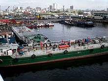
 Aerial view of the Manila International Container Terminal and Manila North Harbor | |
| Location | |
| Country | Philippines |
| Location | Port Area, Manila |
| Coordinates | 14°35′48″N 120°57′16″E |
| UN/LOCODE | PHMNL[1] |
| Details | |
| Opened | 12th century |
| Operated by | Philippine Ports Authority |
| Owned by | Government of Manila |
| Type of harbor | Natural/Artificial |
| Land area | 137.5 hectares |
| Available berths | 22 |
| Piers | 12 |
| Statistics | |
| Vessel arrivals | 20,828(2012)[2] |
| Annual cargo tonnage | 75,058,855(2012)[2] |
| Annual container volume | 4,523,339 TEU(2016)[3] |
| Passenger traffic | 72,438,609(2017)[2] |
| Website http://www.ppa.com.ph/ | |
History
Trade in Manila Bay dates at least 9th to 12th centuries when Manila traded with neighboring countries including China and Japan, with ties to India through the areas that are now Malaysia and Indonesia.[4] During the Spanish Colonial Era of the Philippines Manila handled trade with China and other East Asian countries, with Mexico, with Arab countries, and directly with Spain from the 16th to mid-19th century when the port was opened to all trade. This was the galleon trade that connected the Philippines to Spain via Mexico, another Spanish colony. From the end of the galleon trade, through the American Colonial Era of the Philippines and Philippine independence, until today, the Port of Manila has been the main port of the Philippines for both domestic and international trade.
Location
The entrance to Manila Bay is 19 kilometres (12 mi) wide and expands to a width of 48 kilometres (30 mi). Mariveles, in the province of Bataan, is an anchorage just inside the northern entrance, and Sangley Point is the former location of Cavite Naval Base. On either side of the bay are volcanic peaks topped with tropical foliage. 40 kilometres (25 mi) to the north is the Bataan Peninsula and to the south is the province of Cavite.
Facilities
Manila North Harbor
Manila North Harbor (seaport code:MNN),[5] occupies a 53 hectares (130 acres) area in Tondo, Manila and is operated by the Manila North Harbour Port Inc., a subsidiary of International Container Terminal Services Inc.. It has 7 piers (numbered with even numbers: 2, 4, 6, 8, 10, 12 and 14). North Harbor is through Radial Road 10.
The North Port Passenger Terminal, opened in 2013, can accommodate 2-3 million passengers sailing on inter-island ferries to cities throughout the archipelago.[6][7] It is the main hub of 2GO ferry company, the largest inter-island ferry company in the Philippines.
| Statistics | |||
| Year | Cargo Tonnage | Container Volume | Passengers |
|---|---|---|---|
| 2010[8] | 17,207,751 | 16,146,329 | 821,983 |
| 2011[9] | 17,806,136 | 18,442,473 | 728,662 |
| 2012[10] | 19,402,011 | 19,174,424 | 766,942 |
Manila South Harbor

Manila South Harbor (seaport code:MNS),[5] is a 80 hectares (200 acres) port facility located in Port Area, Manila operated by Asian Terminals Incorporated, with 5 piers numbered with odd-numbers 3, 5, 9, 13 and 15. It is accessible through Bonifacio Drive and has a passenger terminal located between Pier 13 and 15 namely Eva Macapagal Super Terminal. It was formerly the main hub of 2GO ferry company. As of April 29, 2014, The management has installed a new Liebherr quay crane to increase the efficiency of Manila South Harbor.[11]
| Statistics | |||
| Year | Cargo Tonnage | Container Volume | Passengers |
|---|---|---|---|
| 2010[12] | 40,816,716 | 12,958,525 | 1,004,780 |
| 2011[13] | 44,067,826 | 12,612,780 | 816,839 |
| 2012[14] | 40,317,702 | 11,130,626 | 161,500 |
Manila International Container Terminal

Manila International Container Terminal (seaport code:MNL)[5] is operated by International Container Terminal Services Inc. It is one of Asia's major seaports and one of the Philippines' most active ports. It is located between the Manila North Harbor and the Manila South Harbor and can be accessed by road through MICT South Access Road.
In 2011, Manila International Container Terminal ranked 38th in the list of world's busiest container ports with Twenty-foot equivalent units (TEUs) of 3,260,000. Inaugurated on July 7, 2012, Berth 6 became fully operational and increased the Port's annual capacity by 450,000 TEUs.[15]
| Statistics | |||
| Year | Number of Vessel | Cargo Tonnage | Container Volume |
|---|---|---|---|
| 2010[16] | 1,942 | 32,225,795 | 18,266,554 |
| 2011[17] | 1,941 | 34,377,129 | 18,689,936 |
| 2012[18] | 1,862 | 34,345,059 | 19,966,465 |
Future plans
With Berth 6 in operation, ICTSI is scheduled to finish Phase 1 development of Yard 7 by yearend and increase MICT's import capacity by 18 percent.[19]
South of Metro Manila, ICTSI's Laguna Gateway Inland Container Terminal (LGICT) has finished its Phase 1 development. The inland container depot (ICD),[20] which serves as an extension of the MICT, adds 250,000 TEUs to MICT's annual capacity. It will be connected to Manila through the revival of the Manila-Calamba cargo intermodal system, which ceased operations in 2000 due to lower demand.[21]
Transportation and infrastructure connections
Access to/from NLEX
The NLEX Karuhatan-Harbor Link is an expressway connects with the North Luzon Expressway(NLEX) main tollway at the Smart Connect Interchange located at Valenzuela up to R-10 in Navotas serves as an alternative road to the Manila North Harbor especially for the cargo trucks entering the port coming from Northern and Central Luzon, without a truck ban, and also eases traffic congestion at Andres Bonifacio Avenue, Quezon City and 5th Avenue.
The C-3 Road elevated portion of NLEx Harbor Link from Caloocan to Navotas was already opened to all motorists since June 15, 2020 more than 3 months after the opening of Karuhatan-Caloocan elevated portion located at the railway alignment of Philippine National Railways.
Future projects
Line 2 Pier 4 station
The Pier 4 station is the future western terminus of Manila Light Rail Transit System Line 2. It will constructed near the North Port Passenger Terminal located at Pier 4 of Manila North Harbor along Marcos Road. The west extension of Line 2 will also serve as a rail transport connection to the Port of Manila.
North Harbor-South Harbor Bridge
The Department of Public Works and Highways (DPWH) is also proposing to construct a bridge crossing the Pasig River between North Harbor and South Harbor.
See also
- Port Area, Manila
- List of East Asian ports
- North Port Passenger Terminal
References
- "UNLOCODE (PH) - PHILIPPINES". service.unece.org. Retrieved 26 April 2020.
- "Archived copy". Archived from the original on 2014-08-09. Retrieved 2014-12-13.CS1 maint: archived copy as title (link)
- "The CIA World Factbook – Philippines". Central Intelligence Agency. Retrieved September 20, 2017.
- Philippines, The. The Columbia Encyclopedia, Sixth Edition. 2001-07 Archived 2008-07-28 at the Wayback Machine
- Seaport Codes and Information
- Almonte, Liza (October 10, 2013). "After passenger terminal Manila North Harbour turns to work on container facility". PortCalls Asia. Retrieved December 27, 2014.
- Amojelar, Darwin G. (October 9, 2013). "Manila North Harbor operator spending another P5 billion to expand terminal". InterAksyon. Retrieved December 27, 2014.
- "Archived copy". Archived from the original on 2014-03-14. Retrieved 2014-07-28.CS1 maint: archived copy as title (link)
- "Archived copy". Archived from the original on 2014-03-14. Retrieved 2014-07-28.CS1 maint: archived copy as title (link)
- "Archived copy". Archived from the original on 2014-03-14. Retrieved 2014-07-28.CS1 maint: archived copy as title (link)
- "ATI deploys new quay crane to Manila South Harbor". The Manila Times. April 29, 2014. Retrieved 9 May 2020.
- "Archived copy". Archived from the original on 2014-03-14. Retrieved 2014-07-28.CS1 maint: archived copy as title (link)
- "Archived copy". Archived from the original on 2014-03-14. Retrieved 2014-07-28.CS1 maint: archived copy as title (link)
- "Archived copy". Archived from the original on 2014-03-14. Retrieved 2014-07-28.CS1 maint: archived copy as title (link)
- "President Aquino inaugurates Berth 6 of ICTSI Manila flagship". The Shipping Tribune. June 28, 2012. Retrieved July 2014. Check date values in:
|accessdate=(help) - "Archived copy". Archived from the original on 2014-03-14. Retrieved 2014-07-28.CS1 maint: archived copy as title (link)
- "Archived copy". Archived from the original on 2014-03-14. Retrieved 2014-07-28.CS1 maint: archived copy as title (link)
- "Archived copy". Archived from the original on 2014-03-14. Retrieved 2014-07-28.CS1 maint: archived copy as title (link)
- "Archived copy". Archived from the original on 2015-10-16. Retrieved 2015-10-23.CS1 maint: archived copy as title (link)
- "ICTSI setting aside $300M for Laguna depot, MICT". BusinessMirror. October 7, 2014. Retrieved December 27, 2014.
- "ICTSI to revive Manila-Calamba cargo train". Malaya Business Insight. August 14, 2014. Retrieved December 27, 2014.
Further reading
- Port of Manila: Review and History World Port Source, © 2005-2014
External links
- Manila North Harbor Port
- Manila South Harbor
- Manila International Container Terminal
- AAPA- Statistics
| Luzon |
|
|---|---|
| Visayas |
|
| Mindanao |
|
| Naval Bases |
|