Zobel Roxas Street
Zobel Roxas Street is an east-west street that forms the southeastern limit of the City of Manila, the northwestern city limit of Makati, and the northern city limit of Pasay, all in Metro Manila, Philippines. It stretches across western Metro Manila from Tramo Street in the Singalong area of Malate to Tejeron Street at the district boundary of San Andres Bukid and Santa Ana. It has a short extension northeast of the Tejeron Street–J.P. Rizal Avenue junction as Del Pan Street.
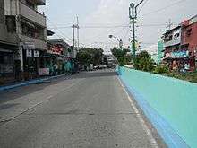 The street along the San Andres–Makati boundary | |
| Length | 2.2 km (1.4 mi) |
|---|---|
| Location | Manila, Makati and Pasay |
| West end | Tramo Street in Malate |
| Major junctions | Arellano Avenue Osmeña Highway (SLEX) Pablo Ocampo Street Kalayaan Avenue/Pasig Line Street |
| East end | Tejeron Street and J.P. Rizal Avenue along the San Andres–Santa Ana–Makati boundary |
Zobel Roxas and other streets in the area (e.g., Jacobo, Consuelo, Don Pedro and Ayala Streets) were named for the Zobel de Ayala family who developed middle class subdivisions in those areas of Singalong and San Andres in the 1930s.[1] These areas formed part of the vast Hacienda de San Pedro Macati which the Ayala family purchased and developed into commercial and residential villages in the City of Manila and Makati.
Landmarks
- Francisco Benitez Elementary School
- La Paz Elementary School
- Puregold Makati
- Rafael Palma Elementary School
References
- Ayala Land Group of Companies published by RealEstateCagayan.com; accessed 2013-10-28.