Circumferential Road 6
Circumferential Road 6, commonly referred to as C-6, is a 34.24-kilometre (21.28 mi), 6 lane, network of roads and bridges that altogether would form the sixth and outermost beltway of Manila in the Philippines.[1]
C-6 Circumferential Road 6 | |
|---|---|
| C-6 Expressway Southeast Metro Manila Expressway | |
 | |
| Route information | |
| Length | 34.24 km (21.28 mi) |
| Mainline (C-6) | |
| North end | Napindan Bridge in Pasig |
| South end | M.L. Quezon Street in Taguig |
| Extension (C-6 Expressway) | |
| North end | San Jose Del Monte |
| Southwest end | Noveleta, Cavite |
| Location | |
| Major cities | San Jose Del Monte, Pasig, Taguig, Muntinlupa, Antipolo, Bacoor, Imus |
| Towns | Rodriguez, San Mateo, Taytay, Kawit, Noveleta |
| Highway system | |
| |
The road will link Metro Manila with the provinces of Bulacan in the north, Rizal in the east, and Cavite in the south, passing through the cities of Pasig, Taguig and Muntinlupa.
It was originally intended to be a 59.5-kilometre (37.0 mi) long circumferential expressway linking North Luzon Expressway in San Jose del Monte and South Luzon Expressway in Muntinlupa passing through the Rizal cities and municipalities of Rodriguez, San Mateo, Antipolo and Taytay, and extending to Bacoor, Imus, Kawit and Noveleta in Cavite.[2]
Route description
San Jose Del Monte, Bulacan
There is a proposed C-6 Road that will traverse Tungkong Mangga in San Jose Del Monte, Bulacan.
San Mateo, Rizal
Circumferential Road 6 in the municipality of San Mateo, Rizal starts at the junction of the Batasan-San Mateo Road and Gen. Luna Avenue. It is known as the Batasan-San Mateo-Rodriguez Bypass Link Road. It then becomes the Kambal Road Extension heading northward, before turning eastward where it is now known as the Timberland Avenue. These roads are collectively known by the locals as the C-6 Road.
Taguig

C-6 in Taguig is a four-lane road which was built in 2009 along the shore of the Laguna de Bay. It was constructed as a two-lane road which runs for approximately 7 kilometres (4.3 mi) from M.L. Quezon Street in Barangay Lower Bicutan, Taguig to the Napindan Bridge over the Pasig River at the city's border with the municipality of Taytay, Rizal.[3] The road project was approved in 2002 as the Taguig Road Dike intended to run for 9.8 kilometres (6.1 mi) from the South Luzon Expressway towards Rizal and also to serve as a flood control for the city.[4] In February 2017, the road was widened to four lanes and has been renamed by the Department of Public Works and Highways as the Laguna Lake Highway.[5]
The road is planned to link to the proposed Laguna Lakeshore Expressway Dike.[6]
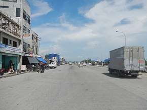
Circumferential Road 6 Components
| Road | Image | Description |
|---|---|---|
| San Jose Del Monte, Bulacan | ||
| Parang Road | ||
| C-6 Road | ||
| San Mateo, Rizal | ||
| Batasan-San Mateo-Rodriguez Bypass Link Road | ||
| Kambal Road Extension | ||
| C-6 Road | ||
| Timberland Avenue | Located within Timberland Heights, a mixed-use development by Filinvest | |
| Taguig | ||
| Laguna Lake Highway | ||
| General Santos Avenue | ||
Southeast Metro Manila Expressway
See also
References
- "Metro Manila Infrastructure Development" (PDF). University of the Philippines Diliman. Retrieved 12 July 2015.
- "Senate Bill No. 3548" (PDF). Senate of the Philippines. Retrieved 12 July 2015.
- Macairan, Evelyn (7 November 2009). "C6 Road done by yearend - DPWH". Philippine Star. Retrieved 12 July 2015.
- Dizon, Nikko (6 March 2002). "Taguig road dike project approved". Philippine Star. Retrieved 12 July 2015.
- Ignacio, R.J. (7 February 2017). "Laguna Lake Highway new lanes open Feb 9". The Manila Times. Retrieved 7 February 2017.
- Agcaoili, Lawrence (25 October 2013). "DPWH sets bidding for P62-B projects". Philippine Star. Retrieved 12 July 2015.
| Expressways |
| ||||||
|---|---|---|---|---|---|---|---|
| National roads |
| ||||||
| Expressways |
| ||||||
|---|---|---|---|---|---|---|---|
| National Roads |
| ||||||
| Expressways |
| ||||||||
|---|---|---|---|---|---|---|---|---|---|
| National roads |
| ||||||||
| Arterial Routes |
| ||||||||