Lacson Avenue
Lacson Avenue is the principal northwest-southeast artery located in Sampaloc district in northern Manila, Philippines. It is a 6-8 lane median divided avenue that runs approximately 2.9 kilometers (1.8 miles) from Tayuman Street in Santa Cruz to Nagtahan Bridge in Santa Mesa. It is a component of Circumferential Road 2 of the Manila arterial road network and N140 of the Philippine highway network.
| |
|---|---|
| Governor Forbes Street | |
 Lacson Avenue looking south towards Maria Clara Street | |
| Route information | |
| Length | 2.9 km (1.8 mi) |
| Component highways |
|
| Major junctions | |
| North end | Yuseco Street in Santa Cruz, Manila |
| |
| South end | |
| Location | |
| Major cities | Manila |
| Highway system | |
| |
.svg.png)
History
The avenue was originally named Forbes Street or Governor Forbes Street, after William Cameron Forbes, governor-general of the Philippines, under whose administration the road was begun. It was extended south to meet Calle Nagtahan (Nagtahan Street) at the boundary of Sampaloc, San Miguel and Santa Mesa at the old Carriedo Rotonda, when the pontoon bridge of Nagtahan that connected it to Pandacan south of the Pasig River was built. Nagtahan Bridge was renamed to Mabini Bridge in 1967,[1] while in 1971, Governor Forbes Street was renamed to Arsenio H. Lacson Street, after the former Manila mayor who served from 1952 to 1962.[2]
Route description
Travelling south, traffic emerges from Yuseco Street at the junction with Oroquieta Street in Santa Cruz. It then widens as it crosses Tayuman and Consuelo Streets across SM City San Lazaro. From here, it becomes a component of both Circumferential Road 2 (C-2) and route N140. The road then intersects with Dimasalang Street and España Boulevard in Sampaloc passing the University of Santo Tomas campus. The southern end of Lacson lies at the Nagtahan Interchange, where it extends south as Nagtahan Street towards Nagtahan Bridge and the districts of Pandacan, Paco, and Malate where C-2 terminates.
Landmarks
- Andalucia Basketball Court
- Dangwa flower market
- Dominican School of Manila
- EARIST
- Hospital of the Infant Jesus (corner Laong Laan)
- Mercury Drug (corner Laong Laan)
- Sampaloc Fire Station
- SM City San Lazaro
- SM Savemore Nagtahan
- University of Santo Tomas
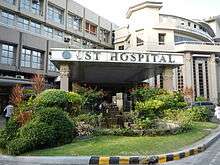
- University of Santo Tomas Hospital
References
- Proclamation No. 234, s. 1967 published by the Official Gazette of the Republic of the Philippines; accessed 2013-10-16.
- Republic Act No. 6215 published by Chan Robles; accessed 2013-10-16.
| Wikimedia Commons has media related to Lacson Avenue. |