Congressional Avenue, Quezon City
Congressional Avenue (Filipino: Abenida Kongresyonal), is a 12.4 km (7.7 mi) highway located in Quezon City, Philippines, which spans from 6 lanes. It is one of the secondary roads in Metro Manila and part of it is designated as part of Circumferential Road 5 (C-5) of the Manila arterial road system and N129 of the Department of Public Works and Highways national highway system.
| |
|---|---|
| Circumferential Road 5 | |
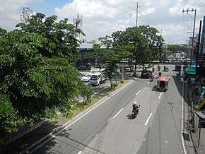 Congressional Avenue near EDSA | |
| Route information | |
| Maintained by Department of Public Works and Highways - Quezon City 1st District Engineering Office[1] and Metro Manila Development Authority | |
| Length | 6.0 km (3.7 mi) |
| Component highways | |
| Major junctions | |
| West end | |
| |
| East end | |
| Location | |
| Major cities | Quezon City |
| Highway system | |
| |
.svg.png)
Congressional Avenue starts from the intersection between EDSA and Roosevelt Avenue, passes through some of the Project Areas, Tandang Sora, Culiat, and Pasong Tamo, and ends at Luzon Avenue at the boundary of Matandang Balara.
The avenue, being located on Quezon City, is one of the rising food destinations in the city because many food establishments such as food parks set-up shop particularly along Congressional Avenue Extension.
Route description
Congressional Avenue follows an L route from EDSA to Luzon Avenue. The main segment, west of the intersection with Visayas Avenue, is characterized by numerous intersections, where major intersections are enforced with signal lights while minor intersections with either using an unsignaled intersection or improvised u-turn slots. The extension segment, east of the intersection with Visayas Avenue, is characterized by partial control of access, where at-grade intersections are replaced with U-turn slots.
History
According to the 1949 Master Plan of Quezon City, Congressional Avenue was supposed to stretch up to the National Government Center at Constitution Hills (present-day Batasan Hills),[2] which would house government offices including the Congress, where its name is apparently derived from. However, this plan was partially materialized as the road wasn't able to reach that area.
In the early 2010s, the avenue was envisioned to be extended into Luzon Avenue to complement the completion of the Circumferential Road 5 which includes the widening of the C.P. Garcia (through U.P. Campus) and Luzon Avenues, as well as the Extension of the Congressional Avenue and the construction of the C.P. Garcia-Luzon Flyover which aims to divert C-5 as well as traffic from the narrow Tandang Sora Avenue in going to the Project Areas as well as Mindanao Avenue towards the C-5 segment of NLEX.
Intersections
The entire route is located in Quezon City. This list includes the section of the avenue named Congressional Avenue Extension. Kilometers are measured from Rizal Park, the Kilometer Zero.
| km[3][4] | mi | Destinations | Notes | ||
|---|---|---|---|---|---|
| Western Terminus. Traffic light intersection (closed); U-turn at EDSA. Continues south as Roosevelt Avenue. | |||||
| Cagayan Street, S&R Service Road | Traffic light intersection. | ||||
| Shorthorn Street | Accessible from westbound lanes via U-turn slot at Hereford Street Intersection. Access to Project 8. | ||||
| Spring Drive and Sta. Gertrudes Street | Traffic light intersection. | ||||
| Traffic light intersection. West end of C-5 segment. | |||||
| Jupiter Street | Unsignaled Intersection. | ||||
| Visayas Avenue | Traffic light intersection. | ||||
| Intersection closed; Access from opposite directions via U-turn slot. | |||||
| Eastern terminus. East end of C-5 segment. | |||||
1.000 mi = 1.609 km; 1.000 km = 0.621 mi
| |||||
Notable landmarks
Commercial establishments and residential subdivisions have been built along the avenue.
Shopping centers
There are a few shopping centers along the avenue. The first mall to open along the avenue is the Cherry Foodarama which services people along the Congressional, Diliman and Project areas. There is also another serving the same area which is named Circle-C Square. The Muñoz Market and the S&R Shopping Center caters the Project areas, while Waltermart North EDSA and Jackman Plaza Muñoz are in close proximity of the EDSA terminus of the avenue.
Other buildings and structures
There are many foodparks and restaurants located along the avenue such as Grub Hub and Pitstop.
See also
- Major roads in Metro Manila
References
- "Quezon City 1st". Retrieved May 22, 2020.
- Bueza, Michael (October 12, 2014). "What Quezon City could have looked like". Rappler. Retrieved June 14, 2020.
- "Quezon City 1st". 2016 DPWH Road Data. Department of Public Works and Highways. Retrieved May 16, 2017.
- "Quezon City 2nd". 2016 DPWH Road Data. Department of Public Works and Highways. Archived from the original on December 2, 2017. Retrieved May 16, 2017.
| Wikimedia Commons has media related to Congressional Avenue (Quezon City). |