Greater Manila Area
The Greater Manila Area is the contiguous urbanization surrounding Metro Manila. This built-up zone includes Metro Manila and the neighboring provinces of Bulacan to the north, Cavite and Laguna to the south, and Rizal to the east.[1][2] Though sprawl continues to absorb new zones, some urban zones are independent clusters of settlements surrounded by non-urban areas.
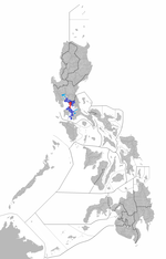
Map of the Philippines showing the Greater Manila Area, with Manila in maroon, Metro Manila in red, and the built up area of cities and municipalities outside Metro Manila in blue.
Statistics
| Province or region | Population (2015)[3] | Area[4] | Density (2015) | Region | Mun | Cities | Brgy |
|---|---|---|---|---|---|---|---|
| Metro Manila | 12,877,253 | 619.57 km2 (239.22 sq mi) |
20,784/km2 (53,830/sq mi) |
NCR | 1 | 16 | 1,706 |
| Bulacan | 3,292,071 | 2,796.10 km2 (1,079.58 sq mi) |
1,177/km2 (3,050/sq mi) |
III | 21 | 3 | 569 |
| Cavite | 3,678,301 | 1,574.17 km2 (607.79 sq mi) |
2,337/km2 (6,050/sq mi) |
IV-A | 16 | 7 | 829 |
| Laguna | 3,035,081 | 1,917.85 km2 (740.49 sq mi) |
1,583/km2 (4,100/sq mi) |
IV-A | 24 | 6 | 674 |
| Rizal | 2,884,227 | 1,191.94 km2 (460.21 sq mi) |
2,420/km2 (6,300/sq mi) |
IV-A | 13 | 1 | 188 |
Gallery
 Metro Manila (NCR) map showing its localities
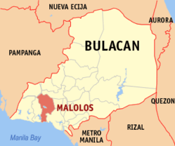

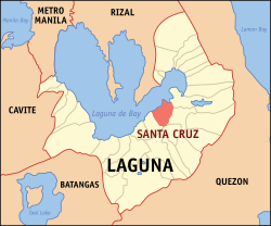 Laguna province map highlighting its capital Santa Cruz
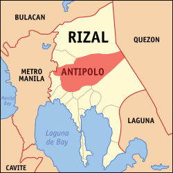
See also
References
- Hamnett, Stephen; Forbes, Dean (2012). "12". Planning Asian Cities: Risks and Resilience. Routledge. p. 287. ISBN 978-1-136-63927-2. Retrieved 23 March 2020.
- "Legarda Urges LGUs in Greater Metro Manila Area to Boost Defense against Disasters". Senate of the Philippines. 16 March 2012. Archived from the original on 6 October 2012. Retrieved 23 March 2020.
- Census of Population (2015). Highlights of the Philippine Population 2015 Census of Population. PSA. Retrieved 20 June 2016.
- "List of Provinces". PSGC Interactive. Makati City, Philippines: National Statistical Coordination Board. Archived from the original on April 19, 2016. Retrieved May 14, 2014.
World's 50 most-populous urban areas | |||||||
|---|---|---|---|---|---|---|---|
This article is issued from Wikipedia. The text is licensed under Creative Commons - Attribution - Sharealike. Additional terms may apply for the media files.