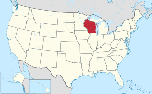
Door County, Wisconsin
Door County is the easternmost county in the U.S. state of Wisconsin. As of the 2010 census, the population was 27,785.[4] Its county seat is Sturgeon Bay.[5]
Door County | |
|---|---|
 | |
 Location within the U.S. state of Wisconsin | |
 Wisconsin's location within the U.S. | |
| Coordinates: 45.02°N 87.01°W | |
| Country | |
| State | |
| Founded | 1861 |
| Named for | Porte des Morts |
| Seat | Sturgeon Bay |
| Largest city | Sturgeon Bay |
| Area | |
| • Total | 2,370 sq mi (6,100 km2) |
| • Land | 482 sq mi (1,250 km2) |
| • Water | 1,888 sq mi (4,890 km2) 80% |
| Population (2010) | |
| • Total | 27,785 |
| • Estimate (2018) | 27,610 |
| • Density | 12/sq mi (4.5/km2) |
| Time zone | UTC−6 (Central) |
| • Summer (DST) | UTC−5 (CDT) |
| Congressional district | 8th |
| Website | Official website |
| Wisconsin county code 15 | |
The county was created in 1851 and organized in 1861.[6] It is named after the strait between the Door Peninsula and Washington Island. The dangerous passage, known as Death's Door, is scattered with shipwrecks and was known to Native Americans and early French explorers.
Door County is a popular Upper Midwest vacation destination.[7]
History

Paleo-Indian artifacts were found at the Cardy Site, including four Gainey points.[8][9] The relationship between Gainey points[lower-alpha 1] and the more ubiquitous Clovis points[lower-alpha 2] is being researched, but there are some similarities.[10] Most of the material collected from the Cardy site by 2003 was made of Moline chert,[lower-alpha 3][11] which is not found in Wisconsin.[8] As of 2007, seven Clovis points have been found in the county.[12] Careful study of certain Paleo-Indian artifacts from western Wisconsin suggests that they were made in the Door peninsula and carried across the state.[13]
Artifacts from an ancient village site at Nicolet Bay Beach date to about 400 BC. This site was occupied by various cultures until about 1300 AD.[14]
In 246 B.C (±25 years), a dog was buried in a Native American burial site on Washington Island.[15]
Native Americans and French
Porte des Morts legend
Door County's name came from Porte des Morts ("Death's Door"), the passage between the tip of Door Peninsula and Washington Island.[16] The name "Death's Door" came from Native American tales, heard by early French explorers and published in greatly embellished form by Hjalmar Holand, described a failed raid by the Ho-Chunk (Winnebago) tribe to capture Washington Island from the rival Pottawatomi tribe in the early 1600s. It has become associated with the number of shipwrecks within the passage.[17]
Potawatomi and Menominee
Before and during the 19th century, various Native Americans occupied the area that became Door County and its islands. 17th-century French explorers made contact with various tribes in the Door Peninsula. In 1634, the Jean Nicolet expedition landed at Rock Island. This is considered the first visit by men of European descent to what is now Wisconsin.[18] In 1665, Pierre-Esprit Radisson and Médard des Groseilliers spent the winter in the county with the Potawatomi. In 1669, Claude-Jean Allouez also wintered with the Potawatomi. He mentioned an area called "la Portage des Eturgeons." In 1673, Jacques Marquette and Louis Jolliet stayed in the county about three months as part of their exploration.[19] In 1679, the party led by La Salle purchased food from a village of Potawatomi in what is now Robert La Salle County Park.[20] During the 1670s Louis André ministered to about 500 Native Americans at Rowleys Bay, where he erected a cross. The cross stood until about 1870.[21] Around 1690, Nicolas Perrot visited the Potawatomi on Washington Island. In 1720, Pierre François Xavier de Charlevoix visited the area with eight experienced voyageurs.[19]
Six Jesuit rings marked with letters or symbols[22] and turquoise colored glass trade beads were found on Rock Island in remains left by Potowatomi, Odawa, and Huron-Peton-Odawa Native Americans during the 17th and 18th centuries.[23] The remains of four Native American buildings were documented at the Rock Island II Site during 1969–1973 excavations.[24]
By the end of French rule over the area in 1763, the Potawatomi had begun a move to the Detroit area, leaving the large communities in Wisconsin. Later, some Potawatomi moved back from Michigan to northern Wisconsin. Some but not all Potawatomi later left northern Wisconsin for northern Indiana and central Illinois.[25]
In 1815, Captain Talbot Chambers was falsely reported[26] to have died fighting Blackhawk Indians on Chambers Island; the island was named for him in 1816.[27] In the spring 1833, Odawa on Detroit Island were baptized during an eight day visit by Frederic Baraga.[28] During an attack in 1835, one of two fishermen squatting on Detroit Island was shot and killed along with one or more Native Americans.[29] The other fisherman was rescued by a passing boat.[30] From the 1840s to the 1880s, the Clark brothers operated a fishing camp at Whitefish Bay that employed 30 to 40 fishermen. Additionally, 200–300 Potawatomi extracted fish oil from the fish waste at the camp.[31]
The Menominee ceded their claim to the Door Peninsula to the United States in the 1836 Treaty of the Cedars after years of negotiations with the Ho-Chunk and the U.S. government over how to accommodate the incoming populations of Oneida, Stockbridge-Munsee, and Brothertown peoples who had been removed from New York.[32] As a result of this treaty, settlers could purchase land, but many fishermen still chose to live as squatters. At the same time, the more decentralized Potawatomi were divested of their land without compensation. Some Potawatomi as late as 1845 made sure to visit and gamble with the Menominee shortly after the periodic annuity payments were issued.[33] Many emigrated to Canada because of multiple factors. One factor was invitations from Native Americans already in Canada for the Potawatomi to join them. Another was British policies to invite and encourage as much Indian emigration from the United States as possible. Even prior to their final emigration, many Potowatomis had periodically migrated into Canada to receive compensation related to their service on the British side during the War of 1812 and to pledge their continued loyalty. Another factor was a desire to avoid the harsh terms of the 1833 Treaty of Chicago, which compensated the Wisconsin Potowatomi with less than what was paid to Potowatomi from the Chicago area. Although not all Potawatomi participated in the Treaty of Chicago, it was federal policy that any who did not relocate westward as the treaty stipulated would not be compensated for their land. Additionally, some preferred the climate of the Great Lakes area over that of the Plains, and American governmental policy for the area beginning in 1837 tended towards forced rather than voluntary Indian removal.[lower-alpha 4] Moving to Canada became a way to stay in the Great Lakes area without risking removal.[34][33]
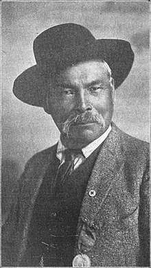
Potawatomi Chief Simon Kahquados traveled to Washington, D.C. multiple times in an attempt to get the land back. In 1906, Congress passed a law to establish a census of all Potawatomi formerly living in Wisconsin and Michigan as a first step toward compensation. The 1907 "Wooster" roll, named after the clerk who compiled it, documented 457 Potawatomi living in Wisconsin and Michigan and 1423 in Ontario. Instead of returning the land, a meager monthly payment was issued.[34] Although Kahquados was unsuccessful, he increased public awareness of Potawatomi history. In 1931, 15,000 people attended his burial in Peninsula State Park.[35]
Settlement and development
19th–20th century settlement

The 19th and 20th centuries saw the immigration and settlement of pioneers, mariners, fishermen, loggers, and farmers. The first white settler was Increase Claflin.[36] In 1851, Door County was separated from what had been Brown County.[19] In 1854 on Washington Island, the first post office opened in the county.[37] In 1855, four Irishmen were accidentally left behind by their steamboat, leading to the settlement of what is now Forestville.[38] In 1853, Moravians founded Ephraim as a religious community after Nils Otto Tank resisted attempts at land ownership reform at the old religious colony near Green Bay.[39] In the 19th century, a fairly large-scale immigration of Belgian Walloons populated a small region in southern portion of the county,[14] including the area designated as the Namur Historic District. They built small roadside votive chapels, some still in use today,[40] and brought other traditions over from Europe such as the Kermiss harvest festival.[41]
With the passage of the Homestead Act of 1862, people could purchase 80 acres of land for $18, provided they resided on the land, improved it, and farmed for five years. This made settlement in Door County more affordable.
When the 1871 Peshtigo fire burned the town of Williamsonville, sixty people were killed. The area of this disaster is now Tornado Memorial County Park, named for the whirlwinds of fire.[42][43][44] Altogether, 128 people in the county perished in the Peshtigo fire.[19] Following the fire, some residents decided to use brick instead of wood.[45]
In 1885 or 1886, what is now the Coast Guard Station was established at Sturgeon Bay.[46][47] The small seasonally open station on Washington Island was established in 1902.[48]
As the period of settlement continued, Native Americans lived in Door County as a minority. The 1890 census reported 22 Indians living in Door County. They were self-supporting, subject to taxation, and did not receive rations.[49] By the 1910 census their numbers had declined to nine.[50]
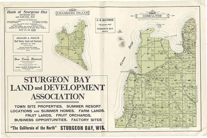
In 1894 the Ahnapee and Western Railway was extended to Sturgeon Bay. In 1969, a train ran north of Algoma into the county for the last time,[51] although further south trains continued to operate until 1986.[52]
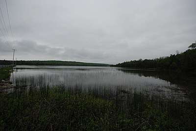
.jpg)

Early tourism
From 1865 through 1870, three resort hotels were constructed in and near Sturgeon Bay along with another one in Fish Creek. One resort established in 1870 charged $7.50 per week (a little over $150 in 2020 dollars). Although the price included three daily meals, extra was charged for renting horses, which were also available with buggies and buggy-drivers.[53] Besides staying in hotels, tourists also boarded in private homes. Tourists could visit the northern part of the county by Great Lakes passenger steamer, sometimes as part of a lake cruise featuring music and entertainment.[54] Reaching the peninsula from Chicago took three days. The air surrounding the agricultural communities was relatively free of ragweed pollen because grain crops matured slowly in the cool climate and were harvested late in the year. This prevented late-season ragweed infestations in the stubble. This made it especially attractive to those suffering from hay fever in the city.[55]
Improved highways of crushed stone facilitated motor tourism in the early 1900s.[19] By 1909 at least 1,000 tourists visited per year.[56] In 1938 Jens Jensen cautioned about negative cultural impacts of tourism. He wrote, "Door County is slowly being ruined by the stupid money crazed fools. This tourist business is destroying the little bit of culture that was."[57]
Orchard boosterism
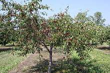
In 1865, the first commercial fruit operation was established when grapes were cultivated on one of the Strawberry Islands. By 1895, a large fruit tree nursery was established and fruit horticulture was aggressively promoted. Not only farmers but even "city-bred" men were urged to consider fruit husbandry as a career. The first of multiple fruit marketing cooperatives began in 1897. In addition to corporate-run orchards, in 1910 the first corporation was established to plant and sell pre-established orchards. Although apple orchards predated cherry orchards, by 1913 it was reported that cherries had outpaced apples.[58]
Cherry crop labor sources
Women and children were typically employed to pick fruit crops, but the available work outstripped the labor supply. By 1918, it was difficult to find enough help to pick fruit crops, so workers were brought in by the YMCA and Boy Scouts of America. Cherry picking was marketed as a good summer camp activity for teenage boys in return for room, board, and recreation activities. One orchard hired players from the Green Bay Packers as camp counselors. Additionally, members of the Oneida Nation of Wisconsin and other native tribes were employed to pick fruit crops.[59][60] In addition to their pay, Native American families were given fruit that was too ripe for marketing, which they preserved and stored for long term use.[61] A Civilian Conservation Corps camp was established at Peninsula State Park during the Great Depression. In the summer of 1945, Fish Creek was the site of a POW camp under an affiliation with a base camp at Fort Sheridan, Illinois.[62][63][64] The German prisoners engaged in construction projects, cut wood, and picked cherries in Peninsula State Park and the surrounding area.[65] During a brief strike, the POWs refused to work. In response the guards established a "no work, no eat" policy and they returned to work, picking 11 pails per day and eventually totaling 508,020 pails.[66]
The Wisconsin State Employment Service established an office in Door County in 1949 to recruit Tejanos to pick cherries. Work was unpredictable, as cherry harvests were poor during certain years and workers were paid by the amount they picked. In 1951, the Wisconsin Department of Public Welfare conducted a study documenting conflict between migrant workers and tourists, who resented the presence of migrant families in public vacation areas.[67] A list of recommendations was prepared to improve race relations.[68] The employment of migrants continues to the present day. In 2013, there were three migrant labor camps in the county, housing a total of 57 orchard laborers and food processors along with five non-workers.[69]
20th–21st-century events
In 1905, the Lilly Amiot was in Ellison Bay with a load of freight, dynamite, and gasoline when it caught fire. After being cut loose, it drifted until exploding; the explosion was heard up to 15 miles away.[70]
In 1912, the barnstormer Lincoln Beachey demonstrated his biplane during the county fair; this is believed to be the first takeoff and landing in the county.[71]
In 1913, The Old Rugged Cross was first sung at the Friends Church in Sturgeon Bay as a duet by two traveling preachers.[72]
In 1919, the first Army-Navy hydrogen balloon race was won by an Army team whose balloon splashed down in the Death's Door passage. Two soldiers endured 10-foot waves for an hour before their rescue by a fisherman.[73]
In 1925, a cow in Horseshoe Bay named Aurora Homestead Badger produced 30,000 pounds of milk, at the time a world record for dairy cattle.[74]
In June 1938, aerial photos were taken of the entire county; in 2011 the photos were made available online.[75]
In 1941, the Sturgeon Bay Vocation School opened. It is now the Sturgeon Bay campus of Northeast Wisconsin Technical College.
In December 1959, the Bridgebuilder X disappeared after leaving a shipyard in Sturgeon Bay where it had been repaired. Its intended destinations were Northport and South Fox Island. Possible factors included lack of ballast and a sudden development of 11-foot waves. The body of one of the two crew members was found the following summer.[76]
In 2004, the county began a sister cities relationship with Jingdezhen in southeastern China.[77]
Geography
According to the U.S. Census Bureau, the county has a total area of 2,370 square miles (6,100 km2), of which 482 square miles (1,250 km2) is land and 1,888 square miles (4,890 km2) (80%) is water.[78] It is the largest county in Wisconsin by total area. The county also has 298 miles (480,000 m) of shoreline. The county covers the majority of the Door Peninsula. With the completion of the Sturgeon Bay Shipping Canal in 1881,[79] the northern half of the peninsula became an artificial island.[80] This canal is believed to have somehow caused a reduction in the sturgeon population in the bay due to changes in the aquatic habitat.[81] The 45th parallel north bisects this "island," and this is commemorated by Meridian County Park.[82][83]
| Niagara Escarpment | |||
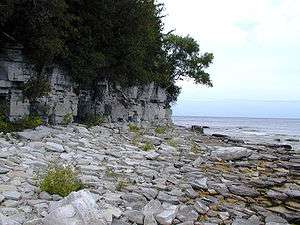   | |||
Escarpment
Dolomite outcroppings of the Niagara Escarpment are visible on both shores of the peninsula, but the karst formations of the cuesta ridge are especially prominent on the Green Bay side as seen at the Bayshore Blufflands. South of Sturgeon Bay the escarpment separates into multiple lower ridges without as many larger exposed rock faces.[84] Beyond the peninsula's northern tip, the partially submerged ridge forms the Potawatomi Islands, which stretch to the Garden Peninsula in the Upper Peninsula of Michigan. The largest of these is Washington Island. Most of them form the Town of Washington.[85]
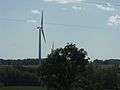
The escarpment is an attractive location for quarrying, homes, and communications towers.[86] A wind turbine project was completed in 1999. At the time the 30.5-acre (12.3-ha) Rosiere Wind Farm was the largest in the eastern United States.[87] High-tension power lines built partly along the escarpment carry electricity into the peninsula. Since the retirement of the Kewaunee Power Station in Carlton and the J. P. Pulliam Generating Station in Green Bay, power to Door County is primarily from the gas-powered plant in De Pere (Brown County) owned by SkyGen and the Point Beach Nuclear Plant in Kewaunee County.[88] An exception to this is Chambers Island, which has no electrical grid system.[89]
A former stone quarry on the escarpment five miles northeast of Sturgeon Bay is now a county park.[90]
Along the shore
Progressions of dunes have created much of the rest of the shoreline, especially on the easterly side. During years with receding lake levels, flora along the shore demonstrates plant succession. The middle of the peninsula is mostly flat or rolling cultivated land. Eskers are only found in the far southwest corner of the county, but drumlins and small moraines also occur further up the peninsula.[91]
| Sea caves of Door County | |||
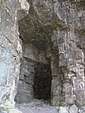   | |||
Caves and sinkholes
A pit cave containing the skeletal remains of both present-day and pre-Columbian animals opens at the southern base of Brussels Hill. It is the deepest known[18] pit cave and the fourth-longest known cave of any sort in Wisconsin. It was discovered by excavating three sinkholes in an extensive project.[92][93] Hundreds of sinkholes in the county have been found and marked on an electronic map.[94] Most sinkholes in the county are formed by gradual subsidence of material into the hole rather than a sudden collapse. Some are regularly filled by tilling or natural erosion, only to subside more due to meltwater or heavy rain.[95]
Many caves are found in the escarpment.[96][97] One of them, Horseshoe Bay Cave, is Wisconsin's second-longest and includes a 45-foot-high underground waterfall.[98][99][100] Horseshoe Bay Cave is home to rare invertebrates.[lower-alpha 5] Several tiny caves at Peninsula State Park are open and accessible to the public. Eagle Cave is larger but opens midway up the escarpment.[101]
Only one cave not formed by karst or lakeshore erosion has been discovered in the county. It opens in the basement of a nursing home in Sturgeon Bay.[102]

Oil
On three occasions in the early 1900s oil was found within a layer of shale in the middle and southern part of the county.[103] Additionally, solid bitumen has been observed in dolomite exposed along the Lake Michigan shore.[104]
Aquifers and springs
Door County has three types of aquifers. The newest is in a relatively shallow layer of sand and gravel, but tends to not to provide enough water except in the southeastern part of the county. Further down are layers of dolomite bedrock that are recharged by water percolating from the layer of sand and gravel. Past the dolomite is a layer of shale that does not contain water, although potentially it is a source of oil. Past the shale is a layer of sandstone that is also host to a bedrock aquifer. Only a few wells tap this deepest and oldest aquifer.[105] Due to the tilt of the layers and erosion, there are areas of the county missing certain layers. A study of three city wells serving Sturgeon Bay found that water from the surface fell anywhere from 13 to 115 feet per day from the surface down to the dolomite aquifer. When the snow melted in the spring, the water coming up from one well changed 9 days later to reflect the character of the new meltwater.[106]
Groundwater burbles up from the shallow aquifer through the fractured bedrock, forming fracture springs. It also may seep more slowly through the ground, forming seepage springs. Detailed measurements were taken of one fracture and three seepage springs during a 2014–2017 survey.[107] Although the fracture spring had large variations in output, it still had a greater flow rate than the other 409 springs surveyed. It had one of the highest specific conductance measurements (995 µS/cm) among the springs studied, due to the minerals dissolved in the water.[108] An earlier study comparing spring water and well water from five springs and 47 wells in Sevastopol found that spring water was more turbid than well water and more likely to be contaminated by coliform bacteria. Nitrates, chloride, and specific conductance were not significantly different between the springs and wells.[109]

High points
Old Baldy (44.920344°N 87.20192°W) is the state's tallest sand dune[110] at 93 feet above the lake level,[111]
The 102 ft high Brussels Hill[112] (44.75166°N 87.59093°W, elevation 851 feet) is the highest point in the county.[113] It has been explained as the result of a meteorite impact.[114][115][116] The hill is missing blocks of rock ripped off during glaciation. The broken rocks leave behind nearly horizontal and vertical rock surfaces along the pre-existing weaknesses (beds and joints) in the rock.[117] This is considered a feature of glaciokarst geology.[118] The nearby Red Hill Woods is the largest remaining maple–beech forest in the area.[119]
Structures on high points

- A tower on Brussels Hill is owned by the Wisconsin Public Service Corporation.[120]
- Boyer Bluff Lighthouse is an 80 foot (24 meters) tall skeleton tower[121] on Washington Island's Boyer Bluff 45.41998°N 86.93595°W, elevation 722 ft (220 meters)
- "The Mountain" at Mountain Park in Washington Island is the highest point on the island and has a lookout tower.[122]
- Eagle Bluff Lighthouse on Eagle Bluff 45.17415°N 87.22205°W, elevation 597 ft (182 meters)
- Pottawatomie Light on Pottawatomie Point on Rock Island.[123]
Other high points
- Deathdoor Bluff 45.29637°N 87.06539°W, elevation 728 ft (222 meters)
- Ellison Bluff 45.25888°N 87.10234°W, elevation 587 ft (179 meters)
- Mount Lowe 44.86805°N 87.37538°W, elevation 728 ft (222 meters)
- Sister Bluffs 45.1861°N 87.154°W, elevation 581 ft (177 meters)
- Svens Bluff 45.13416°N 87.23233°W, elevation 633 ft (193 meters)
- Table Bluff 45.29915°N 87.01651°W, elevation 623 ft (190 meters)
- Certain other high points are currently unnamed[124]
Soils, crops, gravel pits, and minerals

The most common USDA soil association in the northern two-thirds of the county is the Summerville[lower-alpha 6]-Longrie[lower-alpha 7]-Omena.[lower-alpha 8][125] These associated soils typically are less than three feet deep. Altogether, thirty-nine percent of the county is mapped as having less than three feet (about a meter) to the dolomite bedrock. This is a factor in lower agricultural productivity, basement flooding, and public health concerns.
Both sale prices and rental values of agricultural land are lower than most Wisconsin counties.[126] The most important field crops by acres harvested in 2017 were hay and haylage at 25,197 acres, soybeans at 16,790 acres, corn (grain) at 15,371 acres, corn (silage) at 9,314 acres, wheat at 8,790 acres, oats at 2,610 acres, and barley at 513 acres.[127] Despite lower productivity for other forms of agriculture, in the early 1900s the combination of thin soils and fractured bedrock was described by area promoters as beneficial to fruit horticulture, as the land would quickly drain during wet conditions and provide ideal soil conditions for orchard trees.[58] For apples, the influence of the calcium-rich dolomite on the soil was expected to promote good color.[128]
The prevalence of shallow soils hinders and even exposed bedrock hinders agriculture but is beneficial for mining. As of 2016, there are 16 active gravel pits and quarries in the county. They produce sand, gravel, and crushed rock for roadwork and construction use.[129] Six of them are county-owned and produce 75,000 cubic yards annually.[130]
Because there is relatively little soil over much of the peninsula and the bedrock is fractured, snowmelt quickly enters the aquifer. This causes seasonal basement flooding in some areas.[131]
Soils in the county are classified as "frigid" because they usually have an average annual temperature of less than 8 °C (46.4 °F). The implication of this classification is that county soils are expected to be wetter and have less microbial activity than soils in warmer areas classified as "mesic." County soils are colder than inland areas of Wisconsin due to the climate-moderating effects of nearby bodies of water.[132]
Minerals found in Door County include fluorite,[133] gypsum,[134] calcite,[135] dolomite,[136] quartz,[137] marcasite,[138] and pyrite.[139] Crystals may be found in vugs.[140]
Pollution

Wells, soils, and surface waters
The combination of shallow soils and fractured bedrock makes well water contamination more likely. At any given time, at least one-third of private wells may contain bacteria, and in situations with quickly flowing underground water, wells may test clean one day but contaminated the next. Some household wells turn brown every spring from nearby manure applications.[142] In September 2014, 16 people feel ill from drinking wellwater after rainwater washed manure went down a sinkhole in Jacksonport.[143]
The porous and fractured dolomite bedrock was implicated as a factor in a June 2007 epidemic when 229 patrons and employees of the newly opened Log Den restaurant were sickened by a norovirus. Six were hospitalized. The virus was found to have traveled from a septic field 188 m (617 ft) away to the restaurant's well, contaminating their water.[144] From September to December 2007 a study was conducted in which dyes were placed into the septic system. The dyes traveled through the groundwater at about 2 miles per year, and researchers concluded that viral contaminants could travel "many miles in their life times."[145] For transient non-community public wells such as the one supplying the restaurant, state only regulated for contaminants within a 200 foot radius unless flow studies had previously been done. Modeling research supporting this decision predicted that pathogens would be unlikely to travel more than 155 feet per year.[146]
After the Milwaukee Journal published an Insight article about septic system problems in the county in 1971, 28% of tourists surveyed in person and 57% of tourists surveyed by telephone reported having read the article. 13% of tourists surveyed by phone said that if water pollution increased, they would stop visiting the county. But the Chamber of Commerce spokesman and one other resort owner said they thought the publicity was good advertising. 14 out of 15 resort owners surveyed said their business had not declined from the previous year, although six thought the article hurt tourism and two thought their businesses had been negatively affected. A study found that those who thought bad water was the county's main problem were less likely to return, and that the water quality problem was hurting tourism.[147]
The Wisconsin Department of Natural Resources reports 137 leaking underground storage tank sites, 385 spill locations, and 104 other areas involving contamination, such as of soils and groundwater, including 24 cases which polluted one or more neighboring properties and 82 open cases such as cherry orchards left with arsenic and lead-contaminated soils from pesticide use during the 1960s and earlier.[148] Additionally, two landowners voluntarily cooperated with the DNR, limiting their future liability.[149] Mines, prior landfills, and former orchard sites are considered impaired lands and specially marked on an electronic county map.[94] A different electronic map shows the locations of private wells polluted with lead, arsenic, and other contaminants down to the section level.[150]
PCBs from Green Bay have been deposited into the county as windborn dust[151] and off of contaminated waters.[152] The state lists 6.85 miles of the Ahnapee River in Door County as an impaired waterway due to PCB pollution, a designation extending past the county line.[153] In 1975, PCBs were found in the eggs of red-breasted and common merganser ducks in the county and were implicated along with DDE and mercury as possible explanations for eggshell thinning.[154]
In 1964 on Little Sister Island only 41% of herring gull eggs hatched. High levels of DDT were found to be the main cause of death among the unhatched chicks.[155]
Between 1996 and 2006, impervious surfaces in the county increased by 0.6 square miles (about 400 acres). In 2006 a total of 1% of all land in the county was paved. Over the same period, 0.8 square miles (about 500 acres) were deforested and 0.6 square miles were lost to agriculture. As development increases water quality is expected to worsen and the risk of flooding is expected to increase.[156] During the 2018 to 2019 winter season, 9,470 tons of salt were applied to state, county, and town roads.[2] Road salt has been credited with fostering the growth of salt tolerant Phragmites australis (giant cane) and Typha angustifolia (narrowleaved cattail) in roadside ditches.[157] Across the Great Lakes region, roadside salt spread within 500 meters of lake has been credited with increasing the salinity of the lakewater.[158]
A 2009 study of Union, Gardener, and Nasewaupee property owners along with property owners in townships from other counties along southern Green Bay found that people owning bayfront properties valued a reduction in nonpoint source pollution more strongly than those owning properties further inland.[159] Another factor motivating opposition to nonpoint source pollution in the county has been a desire to have a suburban rather than agricultural neighborhood environment.[160] In 2017, farmers spent $2,825,000 on agricultural chemicals,[161] in addition to $5,295,000 on fertilizer, lime, and soil conditioners;[162] as a result agricultural practices are potential source of nonpoint-source pollution.
Air

Most air pollution in Door County comes from outside the county. This map shows how air travels to the pollution monitor in Newport State Park.[163] Because the monitor is near the shore, only the red lines (which show the lower air currents) meaningfully depict the path of ozone to the monitor. As shown on the map, these lower currents carry polluted air from major urban areas. But further inland, the air from higher up mixes more, so all color lines are significant when tracing the path of air pollution further inland. These higher currents (shown in green and blue) blow in from cleaner, mostly rural areas.[164]
The stability of air over the Lake Michigan shore along with the lake breezes[lower-alpha 9] may increase the concentration of ozone along the shoreline.[165]
Climate and weather
Fewer late spring freezes
The moderating effects of nearby bodies of water reduce the likelihood of damaging late spring freezes. Late spring freezes are less likely to occur than in nearby areas, and when they do occur, they tend not to be as severe.[166]
Climate data
The county has a humid continental climate (Köppen: Dfb) with warm summers and cold snowy winters. Data is from the city of Sturgeon Bay, which has an average temperature ranging from 68.7 °F (20.4 °C) in the summer down to 18.0 °F (−7.8 °C) in the winter.
| Peninsular Agricultural Research Station north of Sturgeon Bay | |||||||||||||||||||||||||||||||||||||||||||||||||||||||||||||||||||||||||||||||||||||||||||||||||||||||||||||||||||||||||||||||
| |||||||||||||||||||||||||||||||||||||||||||||||||||||||||||||||||||||||||||||||||||||||||||||||||||||||||||||||||||||||||||||||
| Climate data for Peninsular Agricultural Research Station north of Sturgeon Bay, 1981–2010 normals, extremes 1905–2017 | |||||||||||||
|---|---|---|---|---|---|---|---|---|---|---|---|---|---|
| Month | Jan | Feb | Mar | Apr | May | Jun | Jul | Aug | Sep | Oct | Nov | Dec | Year |
| Record high °F (°C) | 55 (13) |
58 (14) |
76 (24) |
85 (29) |
91 (33) |
100 (38) |
105 (41) |
102 (39) |
96 (36) |
86 (30) |
74 (23) |
60 (16) |
105 (41) |
| Mean maximum °F (°C) | 41.7 (5.4) |
44.8 (7.1) |
59.1 (15.1) |
72.6 (22.6) |
81.1 (27.3) |
87.5 (30.8) |
89.7 (32.1) |
89.0 (31.7) |
83.7 (28.7) |
73.3 (22.9) |
58.6 (14.8) |
44.9 (7.2) |
91.7 (33.2) |
| Average high °F (°C) | 25.7 (−3.5) |
29.0 (−1.7) |
38.6 (3.7) |
51.7 (10.9) |
63.6 (17.6) |
73.5 (23.1) |
78.7 (25.9) |
77.4 (25.2) |
69.5 (20.8) |
56.1 (13.4) |
42.7 (5.9) |
30.3 (−0.9) |
53.1 (11.7) |
| Daily mean °F (°C) | 18.0 (−7.8) |
20.7 (−6.3) |
30.3 (−0.9) |
42.4 (5.8) |
53.1 (11.7) |
63.2 (17.3) |
68.7 (20.4) |
67.8 (19.9) |
60.0 (15.6) |
47.7 (8.7) |
35.9 (2.2) |
23.6 (−4.7) |
44.3 (6.8) |
| Average low °F (°C) | 10.2 (−12.1) |
12.4 (−10.9) |
22.0 (−5.6) |
33.1 (0.6) |
42.6 (5.9) |
52.8 (11.6) |
58.6 (14.8) |
58.3 (14.6) |
50.6 (10.3) |
39.4 (4.1) |
29.0 (−1.7) |
17.0 (−8.3) |
35.5 (1.9) |
| Mean minimum °F (°C) | −8.9 (−22.7) |
−6.5 (−21.4) |
2.9 (−16.2) |
20.2 (−6.6) |
30.5 (−0.8) |
39.9 (4.4) |
46.4 (8.0) |
46.0 (7.8) |
35.9 (2.2) |
27.5 (−2.5) |
15.3 (−9.3) |
−1.3 (−18.5) |
−13.0 (−25.0) |
| Record low °F (°C) | −29 (−34) |
−29 (−34) |
−23 (−31) |
2 (−17) |
20 (−7) |
29 (−2) |
36 (2) |
32 (0) |
26 (−3) |
12 (−11) |
−6 (−21) |
−22 (−30) |
−29 (−34) |
| Average precipitation inches (mm) | 1.65 (42) |
1.25 (32) |
1.94 (49) |
2.75 (70) |
3.14 (80) |
3.64 (92) |
3.38 (86) |
3.47 (88) |
3.36 (85) |
3.05 (77) |
2.49 (63) |
1.82 (46) |
31.94 (811) |
| Average snowfall inches (cm) | 14.6 (37) |
10.6 (27) |
7.3 (19) |
2.4 (6.1) |
0.0 (0.0) |
0.0 (0.0) |
0.0 (0.0) |
0.0 (0.0) |
0.0 (0.0) |
0.1 (0.25) |
2.6 (6.6) |
13.1 (33) |
50.7 (129) |
| Average precipitation days (≥ 0.01 in) | 10.9 | 8.2 | 8.8 | 10.1 | 11.4 | 10.6 | 11.0 | 10.2 | 10.7 | 11.4 | 10.0 | 10.5 | 123.8 |
| Average snowy days (≥ 0.1 in) | 7.2 | 5.3 | 3.7 | 1.3 | 0.0 | 0.0 | 0.0 | 0.0 | 0.0 | 0.1 | 1.8 | 6.0 | 25.4 |
| Source: NOAA[167][168] | |||||||||||||
| Climate data for Washington Island | |||||||||||||
|---|---|---|---|---|---|---|---|---|---|---|---|---|---|
| Month | Jan | Feb | Mar | Apr | May | Jun | Jul | Aug | Sep | Oct | Nov | Dec | Year |
| Record high °F (°C) | 48.9 (9.4) |
52.0 (11.1) |
71.1 (21.7) |
77.0 (25.0) |
87.1 (30.6) |
91.9 (33.3) |
93.9 (34.4) |
98.1 (36.7) |
93.9 (34.4) |
84.0 (28.9) |
71.1 (21.7) |
57.9 (14.4) |
98.1 (36.7) |
| Average high °F (°C) | 25.9 (−3.4) |
28 (−2) |
36.9 (2.7) |
48.7 (9.3) |
59.9 (15.5) |
69.6 (20.9) |
76.3 (24.6) |
75.4 (24.1) |
67.3 (19.6) |
55.8 (13.2) |
42.6 (5.9) |
31.1 (−0.5) |
51.5 (10.8) |
| Daily mean °F (°C) | 18.7 (−7.4) |
20.1 (−6.6) |
28.8 (−1.8) |
39.9 (4.4) |
50.0 (10.0) |
59.9 (15.5) |
66.7 (19.3) |
66.4 (19.1) |
58.8 (14.9) |
48.4 (9.1) |
36.3 (2.4) |
25.2 (−3.8) |
43.3 (6.3) |
| Average low °F (°C) | 11.1 (−11.6) |
11.8 (−11.2) |
20.5 (−6.4) |
31.1 (−0.5) |
40.1 (4.5) |
50.2 (10.1) |
57.0 (13.9) |
57.2 (14.0) |
50.4 (10.2) |
40.8 (4.9) |
30.4 (−0.9) |
19.2 (−7.1) |
35.0 (1.7) |
| Record low °F (°C) | −27.0 (−32.8) |
−26.0 (−32.2) |
−26.0 (−32.2) |
1.9 (−16.7) |
19.9 (−6.7) |
24.1 (−4.4) |
35.1 (1.7) |
32.0 (0.0) |
26.1 (−3.3) |
18.0 (−7.8) |
1.0 (−17.2) |
−20.9 (−29.4) |
−27.0 (−32.8) |
| Average precipitation inches (mm) | 1.4 (36) |
0.9 (24) |
1.6 (40) |
2.4 (61) |
3.0 (75) |
3.2 (81) |
3.1 (78) |
3.2 (82) |
3.2 (82) |
2.6 (67) |
2.3 (59) |
1.5 (37) |
28.4 (721) |
| Average snowfall inches (cm) | 13.2 (33.5) |
9.6 (24.4) |
8.0 (20.3) |
2.8 (7.1) |
0.2 (0.5) |
0.0 (0.0) |
0.0 (0.0) |
0.0 (0.0) |
0.0 (0.0) |
0.1 (0.2) |
3.0 (7.6) |
10.5 (26.7) |
47.4 (120.4) |
| Average precipitation days | 7.7 | 5.5 | 6.5 | 8.3 | 9.0 | 9.2 | 8.9 | 9.0 | 9.6 | 8.2 | 9.1 | 8.2 | 99.3 |
| Source: Weatherbase [169] | |||||||||||||
Climate records
On January 7, 1967 Washington Island received 17 inches of snow, setting the county record for the greatest one-day snowfall.[170]
Ice accumulation during the winter of 2014 was the highest ever recorded on Lake Michigan.[171]
Tornadoes
Four tornadoes touched down between 1844 and 1880, and six from 1950 to 1989, but there were no fatalities in any of them. Two crossed the Door-Kewaunee county line.[172] From 1989 to 2019, there were 2 additional tornadoes, including the F3 "Door County tornado" which hit Egg Harbor in 1998.[173] Additionally there were 10 waterspouts between 1950 and 2018.[174]
| Date of Tornado | Time | F-Scale | Length | Width (yards)[175] |
|---|---|---|---|---|
| 7/1/1956 | 12:05 PM CST | F2 | 10.6 miles | 50 yards |
| 7/25/1966 | 6:20 PM CST | F0 | 2 miles | 17 yards |
| 4/22/1970 | 9:10 PM CST | F2 | 2.3 miles | 500 yards |
| 4/22/1970 | 9:30 PM CST | F2 | 4.3 miles | 500 yards |
| 7/12/1973 | 7:30 AM CST | F1 | 0 miles | 100 yards |
| 6/8/1985 | 8:00 PM CST | F2 | 5 miles | 150 yards |
| 8/23/1998 | 5:30 PM CST | F3 | 5.1 miles | 1,300 yards |
| 7/13/2000 | 2:55 PM CST | F0 | 0.1 miles | 50 yards |
Weather monitoring
Weather in the county is reported by WXN69 (FM 162.425), the NOAA weather radio station in Sister Bay.[176] Green Bay and Lake Michigan ice thickness reports and forecasts are produced by NOAA.[177]
Weather monitors in the county report terrestrial and marine weather conditions:
Attractions
.jpg)
In 1905, Theodore Roosevelt recommended that the Shivering Sands area be protected.[179] Today this area includes Whitefish Dunes, Kellner's Fen, Shivering Sands wetland complex,[180] and Cave Point County Park.[181] Hjalmar Holand, an Ephraim resident,[182] promoted Door County as a tourist destination in the first half of the 20th century. He served on a committee begun in 1927 to protect and promote historical sites,[183] and as a result of this effort the county historical society purchased lands that are now county parks, including Tornado Park, Robert LaSalle Park, Murphy Park, Increase Claflin Park, and the Ridges Sanctuary.[184]
Since then the tourism industry has grown. Most tourists and summer residents come from the metropolitan areas of Milwaukee, Chicago, Madison, Green Bay, and the Twin Cities,[185] although Illinois residents are the dominant group both in Door County and further south along the eastern edge of Wisconsin.[186]
In 2003, researchers found that compared to other Wisconsin counties, Door County had a middling amount of inland water acreage, forestland, county-owned acreage, and rail trail mileage and a high number of golf courses, amusement businesses,[lower-alpha 10] and downhill ski hills and campgrounds.[187] Despite the high number of campgrounds, in 2006 the Wisconsin DNR reported that "demand for camping far exceeds current supply."[188]
Recreational lands


Lands open to public use
Door County is home to six state parks. Four are on the peninsula: Newport State Park, northeast of Ellison Bay; Peninsula State Park, east of Fish Creek; Potawatomi State Park, along Sturgeon Bay; and Whitefish Dunes State Park along Lake Michigan. Two are located on islands: Rock Island State Park and Grand Traverse Island State Park.[lower-alpha 11] In addition to the nature centers located inside the state parks, there are three others outside the parks. There are four State Wildlife and Fishery Areas[lower-alpha 12] and also State Natural Areas that allow free public access.[192][lower-alpha 13]
Besides county,[193] town, and community parks,[194][195] there is a boy scout camp, a Christian camp,[196] and a public site operated by The Archaeological Conservancy.[197][8] A local land trust operates 14 privately owned parks open to the public,[198] and 3,277.3 acres (1326.3 ha) of privately owned lands are open to the public for hunting, fishing, hiking, sight-seeing and cross-country skiing under the Managed Forest Program.[199]
Beaches
Including both the Lake Michigan and Green Bay shores, there are 54 public beaches or boat launches[200] and 39 kayak launch sites,[201] leading to the area's promotion as "the Cape Cod of the Midwest."[202] Although Door County has fewer sunny days than most counties in Wisconsin and Illinois, it also has less rainfall and lower summer temperatures,[203] making for an optimal beach-going climate.
Lake breezes
On hot summer days, cool lake breezes start in around noon and grow more intense by mid-afternoon. This effect can be noticed at the shoreline and around a mile or so inland.[204] Although lake breezes are capable of penetrating considerably further inland, they are able to heat up quickly after passing onto land. After as little as a mile of travel inland, they may be nearly as warm as the air they push away.[205] When a lake breeze encounters an inward curving shoreline, such as at Sister Bay, the breeze becomes more intense. The curve of the shore guides the breezes from opposing sides of the bay and makes them converge upon each other at the middle.[206]

Contamination
35 beaches are routinely monitored for water quality advisories.[208] Before the state beach monitoring program, an outbreak at Nicolet Beach in Peninsula State Park sickened 68 people in July 2002.[209] A two-year study of selected Door County beaches concluded that neither the abundance of bird droppings nor bird populations reliably predicted E. coli contamination,[lower-alpha 14][210] although rainfall was associated with elevated E. coli levels in six out of eight beaches studied.[211] From 2011–2015, a beach improvement program worked to reduce runoff.[212]
Mats of Cladophora algae provide homes for Salmonella bacteria.[213]
Waters
Sturgeon Bay and Little Sturgeon are considered biodiversity hotspots because they support a large number of different fish species.[214]
North of the peninsula, warm water from Green Bay flows into Lake Michigan on the surface, while at the same time, cold lakewater enters Green Bay deep underneath.[215] This is a major reason why oxygen levels in the bay are often too low.[216]
Salmon
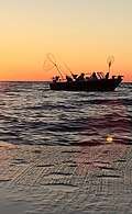
In 2018, Door County ranked second in the state in the Chinook salmon harvest, with 14,268 fish caught, below Kewaunee County, which had 26,557.[217] Chinook salmon are sought after by tourists enjoying chartered fishing trips.[218] Several state record salmon have been caught out of county waters on the Lake Michigan side. In 1994 the state record Chinook was taken; it weighed 44 pounds, 15 ounces, and was 47.5 inches long. In 2016 the state record for pinook (a hybrid of the pink and Chinook salmons) was set at a weight of 9 pounds, 1.6 ounces, and 27.87 inches.[219] Beginning in 1964, first coho and then Chinook salmon were stocked in Lake Michigan.[220] New Chinook fingerling stocking in the spring and egg and milt collection from late September to early November primarily takes place at the Strawberry Creek Chinook Facility in southern Door County. The facility is a public attraction during stocking and collection times.[221]
In recent years there has been concern that the alewife population will not support the salmon population,[222] especially as the Chinook population has already collapsed in Lake Huron.[223] A 2016 survey of Wisconsin anglers found they would on average pay $140 for a trip to catch Chinook salmon, $90 for lake trout, and $180 for walleye.[224] Should the Chinook salmon fishery be replaced with a native lake trout fishery, the economic value would decrease by 80%.[225]
| Commercial and recreational fishing | |||
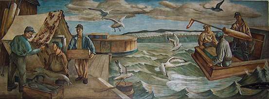      | |||
Spawning
There are numerous reefs of exposed bedrock in the Porte des Mortes passage and off both the Green Bay and Lake Michigan shores.[226] A 1995 study found the greatest abundance of spawning lake trout in Lake Michigan was on the Clay Banks Reef off of Door and Kewaunee counties.[227] County waters are also used for spawning by alewife, herring, lake whitefish, round whitefish, brown trout, brook trout, chubs, longnose suckers, white suckers, smallmouth bass, and burbot. It is assumed that longnose dace also spawn in county waters.[228]
Reefs and shoals
- Dunlap Reef 44.8375°N 87.38815°W
- Fisherman Shoal 45.36443°N 86.77984°W
- Four Foot Shoal 45.16082°N 87.00206°W
- Hanover Shoal 45.14804°N 87.31705°W
- Horseshoe Reefs 45.2211°N 87.20761°W
- Larsons Reef 44.88833°N 87.47621°W
- Middle Shoal 45.31665°N 86.93623°W
- Monument Shoal 44.99166°N 87.37371°W
- Nine Foot Shoal 45.27638°N 86.95595°W
- Outer Shoal 45.23388°N 86.96289°W
- Sherwood Point Shoal 44.91249°N 87.46205°W
- Sister Shoals 45.20027°N 87.16956°W
- Waverly Shoal 45.28193°N 86.95178°W
Other fishing
Walleye found in the Sturgeon Bay and Little Sturgeon area had 87% more PCBs[lower-alpha 15] than walleye from the western side of Green Bay at the mouth of the Oconto River. This fits what is known about the distribution of PCBs which spread from industries in the Fox River Valley.[229]
Round gobies eat mussels off the rocky shoreline.[230] In 2014 the state speargun record for the invasive round goby was taken by out of Door County waters on the Lake Michigan side. It weighed 5.0 ounces and was 8.25 inches long.[219]
Lake whitefish and yellow perch are caught commercially.[231] Lake whitefish are also caught commercially by ice fishing.[232] Tagging studies have shown whitefish migrating from Big Bay de Noc which has less food to the plentiful waters off the peninsula.[233]
Remains of sturgeon, catfish, sucker, smallmouth bass, white bass, walleye, and drum left behind by Native Americans were found near North Bay in the 1960s.[234]
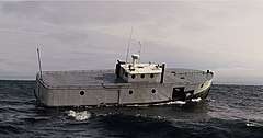
Boating
In 2012, 8,341 registered boats were kept in the county. Most of the county boating accidents reported in 2012 occurred in Green Bay.[235] A 1989–90 study of recreational boating in Wisconsin found that the county's Green Bay and Lake Michigan waters had a higher frequency of Great Lakes boating than any other county bordering Lake Michigan or Lake Superior. The typical motor used in the county's Green Bay and Lake Michigan waters had a horsepower over 90, while the typical motor used for inland county waters had a horsepower under 50. Overall, boaters perceived county waters as uncrowded and boater satisfaction was average.[236]
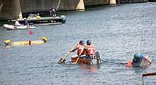
An annual race is held for which participants build small plywood boats.[237]
The county's longest river canoe route is on the Ahnapee River from County H south to the county line.[18]
Some itineraries connecting the Great Loop around the eastern U.S. and through the Mississippi include stops in Door County.[238]
A charity holds sailing classes each summer.[239] 1972–1973 surveys of high school juniors and seniors in northeast Wisconsin found that students from Door County were more likely to use sailboats than students from other counties.[240]
Lakes and ponds
Besides Lake Michigan and Green Bay, there are 25 lakes, ponds, or marshes and 37 rivers, creeks, streams, and springs in the county.[241]
| Body of Water | acres | Access[242] |
|---|---|---|
| Arbter Lake (Mud Lake; Schmok Lake) | 16 | partly within a DNR State Natural Area[243] |
| Bley Pond | 4.5 | private access only |
| Bradley Lake (Little Lake, Mud Lake, or The Duck Pond) | 19 | within Sunset Park[244] |
| Butler Pond | 3.2 | private access only |
| Clark Lake | 864 | public beach on the southwest corner and one other public area[245] in addition to public fee areas along the southeast within Whitefish Dunes State Park[246] and the north within the Ridges Sanctuary.[247] |
| Dunes Lake | 80.4 | public access only by boat through Dolans (also called Donlans) Creek or Shivering Sands Creek |
| Europe Lake | 273 | public boat access on southwest side of the lake; southeast side is part of Newport State Park[248] |
| Forestville Flowage | 72.1 | dam and southern shore is in Forestville Dam County Park |
| Kangaroo Lake | 1,109 | Much of the shoreline is owned by the DNR and other entities allowing public access[249] |
| Krause Lake | 3.7 | eastern shore enrolled in the DNR Managed Forest Program |
| Little Lake | 23.6 | access from dock on the southwest shore near museum[250] |
| Lost Lake | 91.2 | public access only by boat through Logan Creek[247] |
| Mackaysee Lake | 347 | large areas of the south and west shores are enrolled in the DNR Managed Forest Program |
| Mud Lake | 155 | DNR State Natural Area[251] |
| Pinney Lake | 2.3 | private access only |
| Pluff Pond | ? | formerly a 0.52-acre pond prior to nearby development; now only a small remnant remaining bordered by a wooded swamp |
| Rogers Lake | 69.5 | DNR State Natural Area (Mink River Estuary);[252] boat launch on Lake Michigan |
| Schwartz Lake | 30 | partly within a DNR State Natural Area[243] |
| Thorp Pond | 6.4 | private access only[253] |
| Unnamed Lake #2 | 4.1 | private access only |
| Unnamed Lake #3 | about 2 | within Lyle-Harter-Matter County Park[254] |
| Upper Lost Lake | 4.5 | private access only |
| Zoo Lake | 0.9 | public access only by boat through Three Springs Creek[255] |
| Select bodies of water and wetlands | |||
       | |||
Wetlands
4,631 ha (11,400 acres) of Door Peninsula Coastal Wetlands are listed under the Ramsar Convention as wetlands of international importance.[256] The listing includes three areas previously recognized as "Wetland Gems."[257]
| Wetland | Access[258] |
|---|---|
| Baileys Harbor Swamp | privately owned, although some parcels at the edge of the swamp on the east of Highway 57 are owned by the DNR as part of Mud Lake State Natural Area[251] |
| Big Marsh (Gunnerson Marsh) | 31.1 acres of water; partly within a DNR State Natural Area[259] |
| Button Marsh | privately owned, 81.6 acres of Managed Forest Land[260] to the west of it |
| Coffee Swamp | 2.2 acres of water; mostly within a DNR State Natural Area[261] |
| Ephraim Swamp | privately owned, although Ephraim Creek which runs through the swamp is a Class II[lower-alpha 16] trout stream and is open to the public up to the ordinary high water mark.[262] |
| Gardner Swamp | Gardner Swamp Wildlife Area[263] has three access sites[264] and 160 acres of adjacent Managed Forest Land[265] |
| Greenwood Swamp | privately owned |
| Larson Swamp | privately owned |
| Little Marsh (Wickman Marsh) | 14 acres of water; DNR State Natural Area[259] |
| Kellner's Fen | 60 to 80 acres of water; largely owned by an entity allowing public access[266] |
| Maplewood Swamp | privately owned, but the Ahnapee Trail runs through part of it[267] |
| May Swamp | privately owned |
| Stony Creek Swamp | privately owned, but the Ahnapee Trail runs past the far south end[268] |
| Voecks Marsh | 19.1 acres of water; within the Ridges Sanctuary which charges admission[269] |
Plants, algae, and fungi
Recognized natural areas
There are 29 state-defined natural areas in the county.[192]
| SNA # | SNA Name | Reference |
|---|---|---|
| 12 | Peninsula Park Beech Forest | [270] |
| 13 | Peninsula Park White Cedar Forest | [271] |
| 17 | The Ridges Sanctuary | [269] |
| 47 | Sister Islands | [272] |
| 57 | Toft Point | [273] |
| 90 | Newport Conifer-Hardwoods | [274] |
| 110 | Jackson Harbor Ridges | [275] |
| 125 | Mud Lake | [251] |
| 175 | Whitefish Dunes | [276] |
| 204 | Marshall's Point | [277] |
| 218 | Mink River Estuary | [252] |
| 233 | Moonlight Bay Bedrock Beach | [278] |
| 276 | Coffey Swamp | [261] |
| 284 | Baileys Harbor Boreal Forest and Wetlands | [279] |
| 335 | Kangaroo Lake | [249] |
| 377 | Bayshore Blufflands | [280] |
| 378 | Ellison Bluff | [281] |
| 379 | Europe Bay Woods | [248] |
| 381 | North Bay | [255] |
| 382 | Rock Island Woods | [282] |
| 383 | White Cliff Fen and Forest | [283] |
| 391 | Big and Little Marsh | [259] |
| 403 | Thorp Pond | [253] |
| 413 | Detroit Harbor | [284] |
| 543 | Logan Creek | [247] |
| 544 | Meridian Park | [254] |
| 554 | Little Lake | [250] |
| 559 | Cave Point-Clay Banks | [285] |
| 688 | Peninsula Niagara Escarpment | [286] |
| Select State Natural Areas | |||
             | |||
Rare plants
Along with nearby Marinette and Delta (see Garden Peninsula) counties, Door County is home to endemic plants and disjunct populations,[287] such as those protected at Plum Island, Coffee Swamp, Cave Point County Park, the adjacent Whitefish Dunes State Park, and The Ridges Sanctuary. The Grand Traverse islands have some of Wisconsin's richest rare plant reserves.[18]
Plant communities unique to the area
The county is home to a variety of plant communities, including some unique to the area. Boreal rich fen is called "rich" because the dolomite makes the soil more fertile.[288] Calcicole plants growing in these fens depend on minerals which the dolomite contributes to the soil.[289] The southernmost boreal forests in the state are on the eastern side of the peninsula.[290] In white cedar variant forests, white cedar coexists with hardwoods and balsam fir in upland stands that ordinarily would not support cedar. This forest cover is likely due to the alkaline soil and mostly grows on the Niagara Escarpment along the Green Bay side of the peninsula or near the Lake Michigan shoreline. A combination of high humidity, high levels of calcium and magnesium carbonates from the dolomite, and weathered, nutrient poor soils are thought to limit microbial activity. As a result, a layer of humus builds up from organic matter falling to the ground.[291] The escarpment also features the dry cliff natural community[292] and is home to two rare species of whitlow grass.[293][294] Other uncommon communities are alvar and the similar Great Lakes alkaline rockshore,[295][296] also home to rare plants.[287]
Individual trees
Some trees have attracted attention:
- One white cedar found on the escarpment was over 600 years old and near other old-growth cedars.[297]
- The largest tree in the county is a 170-year-old eastern cottonwood on the west side of Highway 57 passing through Institute. It is 110 feet tall and 35 feet in circumference.[298]
- In 1997, striped maple was discovered in a shoreline forest near Newport, the first time this species was documented in the state.[299]
- In 1969, Franklin Gilbert introduced the Viking apple, an early Macintosh moderately resistant to apple scab and fireblight.[300][301] The original Viking tree is exhibited to the public at the Peninsular Research Station.
| Select plants, fungi, and algae found in the county | |||
Plant species lists
As of 2019, 1201 species and hybrids of vascular plants have been identified in the county,[302] including the yellow lady's-slipper Cypripedium parviflorum, the official county flower.[303] 255 unique taxa of mosses, liverworts, and hornworts[304] have been identified in Door County.
Islands
In 2001, species lists were compiled for the county's islands. Snake Island had 156 species, Cana Island had 111, Hat Island 22, Chambers Island 398, Adventure Island 58, Little Strawberry Island 44, Jack Island 28, Horseshoe Island 49, Sister Island 6, Spider Island 42, Plum Island 259, Detroit Island 25, Pilot Island 40, Washington Island 626, Hog Island 34, Rock Island 333, and Gravel and Fish islands were devoid of plant life.[305] In particular, Washington Island is one of only two places in Wisconsin where the fern Asplenium viride (green spleenwort) is found.[306]
Lakes
In 2006, 60 species of aquatic plants or macrophytic algae were found in Clark Lake and nearby upstream, including spotted pondweed, Potamogeton pulcher, which is endangered in Wisconsin.[307][308] In 2017, 9 species of aquatic plants were found in the Forestville Millpond, also called the Forestville Dam or Forestville Flowage.[309]

Invasive species
In 2019, 25 miles of roadsides were surveyed for invasive species.[2] A county-wide electronic map of Japanese knotweed, Phragmites, teasel, and wild parsnip infested locations is updated annually.[94] Locations of other problem species have also been documented.[310]
Vegetation during low lake levels
Yearly fluctuations in lake levels alternately kill off vegetation during periods of high water and promote succession during times of low water. Even during times of high water when low-lying plants are inundated, the populations may persist uphill by clonal expansion and spreading their seeds. Lake Michigan has more diverse shoreline vegetation than Lake Ontario, which has a more stable water level due to human intervention. Without the changing lake levels the shoreline would be dominated by woody plants or highly competitive and even invasive water-loving species such as cattails, reed canary grass, or purple loosestrife. Wet meadows like this one thrive when flooding does not occur often enough to allow emergent vegetation to prevail but is still too frequent to allow the establishment of trees and shrubs.[311]
Living collections
Orchids
Although The Ridges Sanctuary is home to wild orchids, it also operates an orchid restoration project to cultivate and introduce rare orchids into otherwise natural plant communities.[312] 25 native orchid species are currently kept at the Ridges.[313] A 1998 survey of wild, native orchids was carried out in response to continued theft of the sanctuary orchids. 28 species were identified.[314]
Potatoes
The U.S. Potato Genebank at the Peninsular Research Station just north of Sturgeon Bay[315] is the world's second largest living collection of wild potatoes with 65 wild species in 2010. Altogether in 2010 it held 5,277 total collections, the fifth highest number of total collections worldwide and accounting for a little over 5% of the total worldwide.[316] During fiscal year 2019, 10,042 samples from the collection were distributed to academics and businesses with 6,659 distributed domestically and 3,383 exported to other nations.[317]
Garden plants
A master gardeners association operates a one-acre botanical garden on the Peninsular Research Station grounds with about 350 varieties of plants.[318]
Macrofungi species lists
As of 2019, 243 species of mushrooms and other macrofungi have been identified north of the canal,[319] with 326 species for the county as a whole, including those found in lichens.[320] Several of the more uncommon lichens found in the county are Cetraria arenaria, which grows on the ground,[321] and Anaptychia crinalis, which grows on tree bark.[322]
Hybrid yeast
In 2009, a unique hybrid of Saccharomyces cerevisiae yeast was found on fallen cherries near Fish Creek. This strain of S. cerevisiae descended from both oak-tree and vineyard lineages.[323]

Vertebrate animals
Animal species lists
From 1971 through 1976, 11 species of small mammals were found at Toft Point,[325] the Newport State Park Mammals Checklist has 34 species,[326] and in 1972 44 mammals were listed for the entire county.[327] From 1981 through 1995, 7 species of frogs and toads were recorded in the county.[328] In 1992 six amphibians and eight reptiles were found in and around Potawatomi State Park.[329]
As of 2018, 166 species of birds have been confirmed to live in Door County, excluding birds seen which lack the habitat to nest and must only be passing through.[330] Reverse migration is occasionally observed in the county. When birds traveling north reach the tip of the peninsula and the islands beyond, the long stretches of water sometimes unnerves them. Instead of crossing over to the Garden Peninsula, they turn around and fly back down the peninsula.[331] Brood parasitism by red-breasted mergansers has been observed on Gravel and Spider islands and on another island known informally as "The Reef." They laid eggs into the nests of mallards, gadwalls, and lesser scaups.[332]
In 1999, the Wisconsin Natural Heritage Inventory listed 24 aquatic and 21 terrestrial animals in Door County as "rare."[333]

Herring gulls
During the 20th century, thousands of herring gulls were banded on Hat Island[334] to determine their migratory patterns.[335] Banded birds were found as far north as Hudson Bay and as far south as Central America.[189]
Endemic chipmunk
Tamias striatus doorsiensis, a subspecies of eastern chipmunk, was described in 1971.[336][337] It is only found in Door, Kewaunee, Northeastern Brown, and possibly Manitowoc counties.[338] Compared to other chipmunks nearby in Michigan and Wisconsin, they have brighter patches behind their ears, grayer hair along their backs, and more white on their tails.[339] It is smaller than T. s. griseus but larger than the least chipmunk (Neotamias minimus).[338]
Invertebrates
Rare snails
From 1996 to 2001, researchers identified 69 species of snails in Door County, the most out of the 22 counties in the study. Most of these were found on rock outcrop habitats. Ranking second was Brown County with 62 species. 48 species were found in Kewaunee County, ranking eighth. Slugs were found in all three counties. Peninsula State Park is home to the northernmost known population of Strobilops aenea. The species Vertigo hubrichti and Vertigo morsei are endemic to the upper Midwest. These two species had the highest occurrence frequencies along the Door and Garden Peninsulas. Door County is also home to several uncommon species from the genus Oxychilus, which is non-native and introduced from Europe. One was found near a vacation home and may have been introduced by landscape plantings. Within the county, Brussels Hill, North Kangaroo Lake, Rock Island and the escarpment with its cool algific habitat supports populations of rare snails.[340][18] Out of 63 locations in the county where snails were found, the most species (28) were located on a cliff in Rock Island.[341]
Rare bees
The sweat bee Lasioglossum sagax was collected on Ridges Road in 2006. Aside from a single collection from Manitowoc County in 2005, it had previously been found only in Colorado.[342]
The kleptoparasitic bee Stelis labiata is considered very rare.[343] It was collected at Toft point in 2006. This was only the second time this species had been found in Wisconsin; the earlier collection's county of origin is unknown.[344]
Mayflies
In June 2016, an estimated several thousand mayflies hatched in Sawyer Bay, which is part of Sturgeon Bay. This was the result of an experiment to stock millions of eggs from the species Hexagenia limbata and Hexagenia bilineata in the lower Green Bay area in an attempt to reintroduce the species. The last mayfly from the genus Hexagenia had been collected in the lower Green Bay area in 1955. As mayfly populations can be unstable and not all stocking locations appeared to be successful, as of 2017 it was not yet known whether it would be possible for populations of Hexagenia mayflies to become self-sustaining.[345]
Horseshoe Bay Cave
In 2014 an invertebrate survey of Horseshoe Bay Cave found an apparently groundwater-dwelling amphipod of the genus Crangonyx. Groundwater-dwelling Crangonyx species had never been documented in Wisconsin before.[346] A springtail of the genus Pygmarrhopalites (a genus name synonymous with Arrhopalites) was "found on the surface of drip pools." It appeared to be adapted to cave life and the study concluded that it "could represent an undescribed cave species."[347]
Toft Point
In 2004, an invertebrate species list for Toft Point was published listing five isopods, four millipedes, six daddy longlegs, and 113 spiders. Of these, two of the millipedes and 14 of the spiders had never been documented in Wisconsin before.[348]
Spiders
The local climate may allow for the better survival of the northern black widow spider.[349]
Additionally, the county is home to the fishing spider Dolomedes tenebrosus, which can grow to about three inches, half the size of a tarantula.[350]
Others
Kangaroo Lake State Natural Area has the largest breeding population of the endangered Hine's Emerald Dragonfly in the world.[351]
The Lake Huron locust lives on dunes in the county and is not found anywhere else in the state.[352]
Research on apple maggots infesting cherries in Door County contributed to the study of sympatric speciation in the 1970s.[353]
In the 20th century, seven fish parasites were found in Hibbards Creek and 13 in Sturgeon Bay.[354]
By season
Although Door County has a year-round population of about 27,610, it experiences an influx of tourists each summer between Memorial Day and Labor Day, with over 2.1 million visitors per year.[355] Most businesses are targeted to tourism and operate seasonally. Based on room tax collections from 2017–18, July is the busiest month of the year, although sales tax revenue is higher in August. The fewest room taxes are collected for January, and the fewest sales taxes are collected for April.[356]


.jpg)

Springtime
Maple syrup production[358] was 983 gallons in 2017 from seven operations. This was similar to figures from 2012, but down from 2007 when 15 operations produced 2,365 gallons.[359]
The sucker run, which was a popular fishing event in the 19th century,[360] occurs in March and April.[361] Suckers may be taken by frame dip nets,[362] and the sucker run is also sought out as viewing opportunity.[363] Another permitted method of fishing for suckers is by speargun. In April 2018, the state speargun record for longnose sucker was taken by out of Door County waters on the Lake Michigan side. It weighed 3 pounds, 9.9 ounces and was 21.25 inches long.[219]
Another attraction is mushroom hunting on public land.[364][365] Additionally, as of 2017 there are two commercial mushroom operations.[366]
Summer
In 2017, there were ten operations growing 14 acres of strawberries.[367]
In 2017, there were eight operations harvesting five acres of fresh cut herbs, up from four acres in 2012.[368] Two of these operations grow lavender on Washington Island.[369][370]
In Baileys Harbor, religious tourism includes the Blessing of the Fleet.[371]
Door County has a history of strawberry,[372] apple, cherry, and plum growing that dates back to the 19th century.[373][58] Farmers were encouraged to grow fruit on the basis of the relatively mild climate on the peninsula. This is due to the moderating effects of the lake and bay on nearby land temperatures. U-pick orchards and fruit stands can be found along country roads when in season, and there are two cherry processors.[374]
However, the cherry and apple businesses have declined[375] since peaking in 1941[376] and 1964[58][377] respectively due to concerns about pesticides,[378] lack of migrant labor and a difficulty in finding local help, the closure of all processing plants save one, unpredictable harvests, the introduction of Drosophila suzukii, land-use competition with tourism and residential development, better growing conditions to the east in the fruit belt, such as the nearby Traverse City area,[379][58] and intentional destruction of a portion of the crop ordered by the processor in order to drive up prices.[380] In 2017, there were only 1,945 acres of tart cherry orchards, down from 2012 when there were 2,429 acres.[381]
Lightening bugs become common by the end of June.[382]

Fall
Additionally, there were 400 acres of apple orchards in 2017, down from 468 acres in 2012.[383] In 2017, there were 12 acres of pear orchards, spread among 11 operations.[384] In 2017, there was only one acre of plum orchards, spread among four operations.[385] In 2007, there were two acres of apricot orchards, spread among six operations.[386] Research on the development of cold-hardy peaches has continued since the 1980s.[387] In 2012, there were two acres of peach orchards, spread among seven operations.[388]
In 2017, there were 40 acres of vineyards, down from 78 acres in 2012.[389] The county was recognized as part of a larger federally designated wine grape-growing region in 2012.
In 2018, a county total of 4,791 deer were killed as a total of all deer hunting seasons, down from the total harvest of 5,264 deer in 2017.[390] Chronic wasting disease as of 2018 has never been detected within the county.[391]
Another autumn activity is leaf peeping.[392]
| Skiing and skating at Sturgeon Bay High School | |||
    | |||
Winter
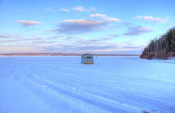
Winter attractions include ice fishing, sledding,[lower-alpha 17] cross-country skiing,[397] camping,[398] broomball,[399] pond hockey,[400] snowmobiling,[401] watching lake freighters in Sturgeon Bay,[402] and Christmas tree farms.[403][404] In 2017, 860 Christmas trees were cut, down from 1,929 in 2012.[405] Nearly 60% of the time, Door County has a white Christmas.[406]
Culture
Significant structures and sites
Lighthouses
Including both lake and Green Bay shorelines, there are eleven lighthouses and sets of range lights. Most were built during the 19th century and are listed in the National Register of Historic Places: Baileys Harbor Range Lights, Cana Island Lighthouse,[407] Chambers Island Lighthouse, Eagle Bluff Lighthouse, Pilot Island Lighthouse, Plum Island Range Lights,[408] Pottawatomie Lighthouse, and Sturgeon Bay Canal Lighthouse. The other lighthouses in the county are: Boyer Bluff Lighthouse,[121] Baileys Harbor Lighthouse, Sherwood Point Lighthouse, and the Sturgeon Bay Canal North Pierhead Light.[409]
Historical sites
Thirteen historical sites are marked[410] in the state maritime trail for the area[411] in addition to eight roadside historical markers.[412] In Sturgeon Bay, the tugboat John Purves is operated as a museum ship. Including lighthouses, the county has 72 properties and districts listed on the National Register of Historic Places. There are 214 known confirmed and unconfirmed shipwrecks listed for the county,[413] including the SS Australasia, Christina Nilsson, Fleetwing, SS Frank O'Connor, Grape Shot, Green Bay, Hanover, Iris, SS Joys, SS Lakeland, SS Louisiana, Meridian, Ocean Wave, and Success. Some shipwrecks are used for wreck diving.[414]
Buildings made from cordwood construction survive in the county, especially in the Bailey's Harbor area. Some, such as the Blacksmith Inn, are covered with clapboards on the outside.[415][416] It has been speculated that the use of stovewood in the county was associated with German immigrants and was also due to the lack of manpower needed to haul heavy logs.[417]
Food
| Some foods of Door County | |||
        |
Agritourism and culinary tourism supports local food production.[418] Cooking classes are offered to tourists.[419]
Distinctive local foods include:
- cherry pie[420]
- Belgian pie[421]
- rhubarb pie[422]
- cherry kuchen[422]
- apple kuchen[422]
- rødgrød[422]
- rhubarb salad[422]
- rhubarb cake[422]
- rhubarb torte[422]
- cherry torte[422]
- raspberry marmalade Linzer torte[423]
- chicken caps–broiled mushroom caps coated in chicken spread and nuts[422]
- chocolate kraut cookies[422]
- cooked rhubarb juice diluted with water and sweetened with sugar[424]
- apricot pockets[425]
- cherry tarts[425]
- chopped cherry jam[426]
- cherry soup[427]
- Norwegian frugt suppe[428]
- cherry bread pudding[429]
- dried cherries[430]
- limpa bread[429]
- skorpa[lower-alpha 18][429]
- æbleskiver–Icelandic pancakes[431][432]
- Norwegian and Swedish pancakes[433]
- green tomato jam[434]
- plum pudding with flaming brandy sauce[435]
- baked pears with cheese[436]
- cheese curds[437]
- fried perch[438]
- smoked chubs[439]
- fish boil–fuel oil flare up originated locally to entertain tourists[440][lower-alpha 19]
- booyah[441]–did not originate in Europe[442]
- Belgian trippe–sausage made with stomach lining[443]
- lapskaus–Norwegian potato stew[444]
- hash brown sandwich[443]

Scandinavian heritage
Scandinavian heritage-related attractions include The Clearing Folk School, two stave churches,[445] structures in Rock Island State Park furnished with rune-inscribed furniture,[446] and Al Johnson's Swedish Restaurant, which features goats on its grassy roof. In Ephraim, the Village Hall, the Moravian and Lutheran churches, and the Peter Peterson House are listed in the National Register of Historic Places, as is the L. A. Larson & Co. Store building in Sturgeon Bay. Although fish boils have been attributed to Scandinavian tradition,[447] several ethnicities present on the peninsula have traditions of boiling fish. The method common in the county is similar to that of Native Americans.[448][lower-alpha 20]
Industry
In Sturgeon Bay, industrial tourism includes tours of the Bay Shipbuilding Company,[449] CenterPointe Yacht Services[450][451] and other manufacturers.[452] In particular, Bay Ship owns a blue gantry crane that dominates the skyline.[453] A cheese factory in Clay Banks conducts public tours.[454]
Arts
Tourism supports an arts community, including weavers,[455] painters,[456] decorative artists,[457] blacksmiths,[458] actors,[lower-alpha 21] songwriters,[459] musicians,[460] and hymn-singers.[461]
A quilt trail along roadside barns was organized in 2010.[462]
The interesting landscape makes it an attractive target for photography. Several photographs have been used for commemorative stamps. A Town of Sturgeon Bay farm was featured on a stamp commemorating the Wisconsin Sesquicentennial in 2004,[463] and a cherry orchard near Brussels was featured on 2012 Earthscapes series stamp.
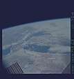
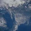
Astronauts on missions using every space shuttle and living in three different space stations have photographed the county. In 2014, one picture was featured as the NASA Earth Observatory Image of the Day.[171]
| Select astronaut photography of Door County | |||
           | |||
Radio stations
Sports
| Door County Fairgrounds | |||
   | |||
Sports tourism includes an underwater hockey team,[464] a motor racetrack in Sturgeon Bay,[465] and a semi-pro football team in Baileys Harbor.[466]
A county-wide men's baseball league has eight teams.[467]
High school sports teams play in the Packerland Conference, except for girls' swimming and golf, which compete in the Bay Conference.
In 2014, Door County ranked 264th out of all 3,141 U.S. counties by number of golf courses and country clubs. The county has nine courses, tying with 42 other counties. Door County had the 87th highest number of courses per resident of all U.S. counties.[468]
Surfing
Lake Michigan shoreline is used for lake surfing.[469] One guidebook names the shore off Cave Point County Park as the best surfing area.[30] Another water sport is windsurfing.[470]
Motorcycling
In 2018, 3,476 motorcycles were registered in the county, up from 1,806 in 2018.[471] A local motorcycle club hosts a regional burning man event[472] involving a large wooden cow and maintains the adjacent Wisconsin Motorcycle Memorial.[473]
Flying
In 2019, 46 aircraft were registered in the county, most owned by individuals.[474] During the EAA AirVenture Oshkosh, a fish boil is held as a $100 hamburger event at the Washington Island Airport to entice AirVenture conventiongoers to land on the island.[475]

Ephraim no longer dry
In 2014–15, there were 257 liquor licenses in the county,[476] including one issued for a tavern on Washington Island which sells more Angostura bitters than any other tavern worldwide.[477] The county also has businesses that produce alcoholic beverages.[478] To encourage tourism, Ephraim residents passed referenda in 2016 to allow beer and/or wine sales within the village. Until then, Ephraim had been the state's last dry municipality.[479]
Economics of tourism
Door County's economy is similar to that of Bayfield, Iron, Oneida, Sawyer, and Vilas counties. These six northern Wisconsin counties have been categorized as having "forestry-related tourism"-based economies.[480]
An analysis comparing 1999 data for select Wisconsin counties found that Door County was especially strong in the retail of building and materials, groceries, apparel and accessories, miscellaneous retail, and restaurants. For services, it ranked strong in amusement, movie, and recreation and lodging. Door County ran a fiscal surplus in all categories to all other counties, with the exception of furniture & home furnishing, in which Door County had a leakage of sales to other counties.[481]
Real estate
House pricing, real estate, and development
Between 2000 and 2017, prices for houses in Door County rose only 1.3% annually, less than the U.S. average of 2.5%.[482] In a 2008 survey of county residents, the most frequent local concern was the need to control rampant overdevelopment, including condos.[483] In 2006, nonresidents paid about 60% of the property taxes in the northern half of the county.[484]

Shoreline development
As of 2011, 7,889 residential buildings were located in within a quarter mile (402 meters) of the shore. Shoreline developments are vulnerable to erosion[141] and destruction from ice shoves.[485] Seiches on Green Bay cycle about every 11 hours but are highly variable and are capable of reversing the flow of water from rivers.[156]
Shoreline parcels, which tend to be the most highly valued real estate, are typically owned by non-Wisconsin residents unless they are public property.[486]
Effects of high property values
In 2017 the county had the second highest property values per capita in the state.[487] The high property values combined with low enrollment serve to punish local school districts in the state funding formula.[488] Since 1959, the Wisconsin Department of Public Instruction has wanted more school consolidation in Door County in order to achieve their statewide goal of having every district supported by a large tax base and offering a sufficiently comprehensive high school program. However, only the Southern Door School District complied with the DPI's expectations by consolidating into a single site in 1962.[489] As a result, the county's school districts often have referenda for additional property tax funding.[488]
For forested lands, high property values drive up property tax levies, which in turn encourages landowners to enroll their land in the Managed Forest Program to reduce their taxes.[490]
Effects of protected areas on nearby development
A 2012 report found that Door County's preserved open spaces reduced the likelihood that nearby land would be subdivided, but if it was subdivided, areas near the open space were divided into more parcels than those further away. It did not appear to affect agriculture-related development.[491]
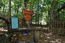
Arts spending
In 2015, Door County arts and cultural organizations spent $9.7 million, of which 70.9% was spent locally, in addition to $15.0 million spent by attendees. An estimated 1,582 volunteers for arts and cultural organizations averaged 35.7 hours each. In 2015, 194,424 people attended arts and cultural events in the county, 78.0% of them non-residents. In 2016, the average arts event attendee from the county spent $28.96, while the average nonresident spent $90.53. In 2016, 50.6% of non-residents said the arts event was the primary reason they made the trip to the county. 66.0% of county resident attendees in 2016 were 65 or older, while 48.6% of non-resident attendees were 65 or older.[492]
County finances
Revenues
County spending in Door County is supported by property taxes, sales taxes, and state aid. In 2017, the county had the highest per capita property tax burden in the state,[487] although when compared by amount levied per $1,000 of property the tax was comparatively low with the county having the fifteenth lowest per capita property tax rate per $1,000 out of all 72 Wisconsin counties.[487] The county also collected $140 in per capita sales taxes in 2017, the second highest in the state,[487] and received the ninth highest level of per capita state financial assistance to the county government in 2015 figures.[487]
Expenses

In 2015, Door County had the third-highest level of per capita county spending in Wisconsin.[487] It was Wisconsin's only county with high per capita government spending in 2005 that did not also have a large low-income population. High per capita county government spending in Wisconsin is typically due to poverty.[496] Door County's spending can be explained by both the need to provide services to people present only during the tourism season[497] and by development patterns. A 2004 study showed that residential and commercial land tends to require more in government services than property taxes generate. These in turn are subsidized by taxes on industrial, agricultural, and open lands, which generally require few government services.[498]
The dispersal of residential developments is a compounding factor. A 2002 study found that Wisconsin town residents are typically subsidized by city and village residents.[499] The effect of seasonal residents on persons-per-housing unit figures was once masked by larger family sizes among year-round inhabitants. Beginning in the 1980 census the number of persons per housing unit fell below typical figures for Wisconsin as the number of children in the county dropped.[55]
Seasonality in both employment and housing
Door County unemployment rates during the summer and fall are considerably lower than in winter.[500][501] Annual earnings in Door County are typically less than similar jobs in other areas of Wisconsin. This has been attributed to the seasonal nature of much of the employment. For example, in 2009, it was found that people were 4.85 times more likely to be employed by hotels and motels in Door County as opposed to the rest of the nation.[502]
22.0% of the county's 13,728 employed workers[lower-alpha 22] in 2018 served in the leisure and hospitality sector, more than any other sector. However, because leisure and hospitality jobs tend not to pay very well, they only earned 12.9% of all wages earned in the county. In contrast, manufacturing employees received 24.5% of the wages paid in 2018, even though they only made up 17.0% of the workforce. This is despite the average annual wage for leisure and hospitality workers being 109.3% of the state average wage for leisure and hospitality in 2018. In contrast, workers employed in manufacturing received 86.7% of the state average wage for manufacturing. Wages in Door County trailed state averages for every sector except leisure and hospitality.[503] The effects of the low earnings are compounded by average housing prices; other areas in Wisconsin with low wages tend to have low housing prices.[504] The unaffordability of housing has been linked to the labor shortage problem, as new employees may be unable to afford housing and decide to leave.[505] A 2019 study found the county to have the eighth highest cost of living out of all Wisconsin counties.[506]

Reliance on immigrant and foreign student labor
As high school enrollment in the county has dwindled,[lower-alpha 23] employers have turned to J-1 visas to fill seasonal positions instead.[510]
J-1 visas issued for work in Door County, 2016–2019


Because foreign workers brought in under the Summer Work Travel Program are sometimes housed in a different community from where they are employed, some have ended up bicycling 10–15 miles a day since they lack cars and the county has limited public transportation.[511] Additionally, illegal or undocumented immigrants who work in the tourism industry often lack drivers' licenses.[512] In 2012, Door County District Attorney Ray Pelrine said the "illegal immigrant workforce is now built into the structure of a lot of businesses here."[513]
For reported labor, people in the county tend to work in the county, and jobs in the county tend to be performed by county residents. According to 2011–2015 ACS data, out of 17 counties in northeastern Wisconsin, Door County had the second lowest percentage of residents commuting out-of-county to work. Only Brown County residents were less likely to commute out of their county to work. 89.08% of reported jobs Door County are performed by workers residing in the county, the highest percentage in the 17-county area. The cause of this has been attributed to the county being on a peninsula, which limits the directions people can practically commute.[514]
Equitable and inequitable costs and benefits
Geographic distribution of tourist spending
The economic impact of tourism is not the same throughout the county. A 2018 survey of tourists reported that Forestville and Brussels were the county's least visited communities.[515] Due to tourism's impact on restaurant prices, some residents of the more rural southern part of the county cannot afford to eat at restaurants in the northern part.[516]
Income inequality
Measures of income inequality show mixed results in Door County. Using the ACS five-year estimates from 2012–2016, the household income ratio between the 80th to 20th percentiles was only 3.76, the 352nd lowest such ratio out of 3,140 U.S. counties. On the other hand, 23.1% of all household income in the county was earned by the top 5th percentile, the 452nd greatest percentage out of 3,135 U.S. counties reporting data.[517]
Housing inequality
Most of the homeless in Door County are couch surfers, although in the summer many will camp or live out of their vehicles.[518]
The largest single-family house in the state is in Liberty Grove.[519] It was built in 1996 and is about 35,000 square feet. Although in 2005 it sold for about $20 million, in 2016 it sold for only $2.7 million,[520] and in 2019 was assessed at $2.625 million.[521] Additionally, an earth house in Sevastopol has been considered the "strangest home in Wisconsin."[522]
Elderly and housing
A 2019 report by the Wisconsin Bureau of Aging and Disability Resources based on data from 2013 to 2017 found that while only 12.7% of Door County residents aged 65 and older rented (compared to 23.5% statewide), 59.8% of those who did rent spent 30% or more of their income on rental costs (compared to 55.4% statewide).[523]
Transportation

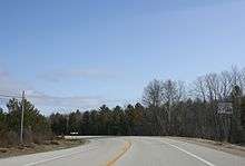

Land
According to the Wisconsin Department of Transportation, in 2017 Door County had 1,270 miles of roadways.[525]
State highways


- Door County Coastal Byway (WIS 42 and WIS 57) north of Sturgeon Bay to Northport is classified as a Coastal Byway.[526]
Rustic roads
- There are five rustic roads in the county.[527] In addition to state-recognized rustic roads, Liberty Grove manages a heritage roads program. As of 2019 there were 12 heritage roads in the town.[528]
Snowmobile
Non-motorized
- The Ahnapee State Trail connects Sturgeon Bay to Kewaunee, winter snowmobile access is dependent on weather and trail grooming.[531] Although the Ice Age Trail coincides with most of the Ahnapee State Trail, the Ice Age Trail forks away in the City of Sturgeon Bay and reaches its northern terminus at Potawatomi State Park.[532]
- WIS 42 and 57 are part of the Lake Michigan Circle Tour.[533]
- Egg Harbor operates a free public bicycle-sharing system, limited to daylight hours within the village during the tourist season.[534]
Bridges across Sturgeon Bay
- Sturgeon Bay Bridge, (also called Michigan Street Bridge) (11.5 feet clearance, overhead-truss, Scherzer-type, double-leaf, rolling-lift bascule)[535]
- Oregon Street Bridge (reinforced concrete slab, rolling lift bascule girder with mechanical driven center locks)[536]
- Bayview Bridge (monolithic concrete placed on structural deck with steel girder superstructure, open grating on deck, bascule)[537]
Air
A daily private shuttle service operates between Green Bay–Austin Straubel International Airport and Sturgeon Bay.[538] The nearest intercity bus station with regular service is in Green Bay.[539] There are eleven airports in the county, including private or semi-public airports.
- Door County Cherryland Airport (KSUE), public use, three miles west of Sturgeon Bay, Wisconsin
- Ephraim–Gibraltar Airport (3D2), public use, one mile southwest of Ephraim, Wisconsin
- Washington Island Airport (2P2), public use
- Crispy Cedars Airport, Brussels (7WI8), private, but open to visitors with advance notice[540]
- Door County Memorial Hospital Heliport, allows for air ambulance service to the hospital from remote areas of the county[541] and for flying patients to Green Bay.
- Chambers Island Airport, private[542]
- Five other small airports[lower-alpha 24]

Water
Ferries
- Washington Island is served by two ferry routes. The first route is to take a 30-minute ferry ride from the Door Peninsula to Detroit Harbor on the island from a freight, automobile, and passenger ferry that departs daily from the Northport Pier at the northern terminus of Highway 42. This ferry makes approximately 225,000 trips per year.[538] The second route is a passenger-only ferry that departs from the unincorporated community of Gills Rock on a 20-minute route.[548]
- Rock Island State Park is reachable by the passenger ferry Karfi from Washington Island.[549] (During winter Rock Island is potentially accessible via snowmobile and foot traffic.)
- Although Chambers Island has no regularly scheduled ferry, there are boat operators which transport people to the island on call from Fish Creek.
Boat ramps and marinas
- There are 30 public boat access sites in the county.[550] The Lake Michigan State Water Trail follows most county shorelines.[551]
Population and its health


Demographics
2000 Census
As of the 2000 census,[552] there were 27,961 people, 11,828 households, and 7,995 families residing in the county. The population density was 58 people per square mile (22/km²). There were 19,587 housing units at an average density of 41 per square mile (16/km²). The racial makeup of the county was 97.84% White, 0.19% Black or African American, 0.65% Native American, 0.29% Asian, 0.01% Pacific Islander, 0.33% from other races, and 0.69% from two or more races. 0.95% of the population were Hispanic or Latino of any race. 39.4% were of German and 10.3% Belgian ancestry. A small pocket of Walloon speakers forms the only Walloon-language region outside of Wallonia and its immediate neighbors.[553][554]
Out of a total of 11,828 households, 58.10% were married couples living together, 6.50% had a female householder with no husband present, and 32.40% were non-families. 28.10% of all households were made up of individuals and 12.70% had someone living alone who was 65 years of age or older. The average household size was 2.33 and the average family size was 2.84.
| Historical population | |||
|---|---|---|---|
| Census | Pop. | %± | |
| 1860 | 2,948 | — | |
| 1870 | 4,919 | 66.9% | |
| 1880 | 11,645 | 136.7% | |
| 1890 | 15,082 | 29.5% | |
| 1900 | 17,583 | 16.6% | |
| 1910 | 18,711 | 6.4% | |
| 1920 | 19,073 | 1.9% | |
| 1930 | 18,182 | −4.7% | |
| 1940 | 19,095 | 5.0% | |
| 1950 | 20,870 | 9.3% | |
| 1960 | 20,685 | −0.9% | |
| 1970 | 20,106 | −2.8% | |
| 1980 | 25,029 | 24.5% | |
| 1990 | 25,690 | 2.6% | |
| 2000 | 27,961 | 8.8% | |
| 2010 | 27,785 | −0.6% | |
| Est. 2018 | 27,610 | [555] | −0.6% |
| U.S. Decennial Census[556] 1790–1960[557] 1900–1990[558] 1990–2000[559] 2010–2018[4] | |||
For every 100 females there were 97.10 males. For every 100 females age 18 and over, there were 94.50 males. In the county, the population was spread out with 22.10% under the age of 18 (a decrease from 25.9% being under the age of 18 in the 1990 census[560]), 6.10% from 18 to 24, 25.40% from 25 to 44, and 27.70% from 45 to 64.
Births, abortions, deaths, migration
In 2017, there were 217 births, giving a general fertility rate of 59 births per 1000 women aged 15–44, the 49th highest rate out of 72 Wisconsin counties.[561] Additionally, there were eleven reported induced abortions performed on women of Door County residence in 2017.[562]
Between April 2010 and January 2019, there were an estimated 1,869 births and 2,904 deaths in the county. Although the greater number of deaths served to decrease the population by an estimated 1,035 people, this was more than offset by a net gain of 1,900 people who moved in from outside the county. Altogether, the population increased by an estimated 865 persons during this period.[563]
Most elderly and youthful communities
From ACS data from 2014–2018, the most elderly community in the county was the village of Ephraim with a median age of 65.4, the seventh most elderly out of all 1965 cities, towns, and villages having available data. Following Ephraim was Egg Harbor with a median age of 64.0, the 14th most elderly in the state, Sister Bay with a median age of 63.4, tied with Sherman in Iron County as the 18th most elderly, Washington Island with a median age of 62.9, tied with Union in Burnett County as the 22nd most elderly, Liberty Grove with a median age of 62.4, tied with Lakewood in Oconto County as the 26th most elderly, Egg Harbor with a median age of 59.8, tied with three other towns as the 55th most elderly, Gibraltar with a median age of 59.4, tied with the town of Raddison in Sawyer county as the 64th most elderly, and Bailey's Harbor with a median age of 58.5, tied with Big Bend in Rusk County as the 83rd most elderly.
The youngest community in Door County was the village of Forestville with a median age of 39.0. It tied with 12 other communities as the 429th youngest community in the state. Following the village of Forestville was the city of Sturgeon Bay with a median age of 42.8, tied with 9 other communities as the 742nd youngest in the state, Brussels with a median age of 46.9, tied with 8 other communities as the 1163rd youngest in the state, the town of Forestville with a median age of 47.4, tied with 9 other communities as the 1222nd youngest in the state, and Gardner with a median age of 49.4, tied with 15 other communities as the 1434th youngest in the state.[564]
| Children, Sturgeon Bay, 1917 | |||
   | |||
Based on ACS data from 2013 to 2017, the county had a median age of 52.4 years old, tied with Florence as the fifth most elderly of all Wisconsin counties.[523] This was an increase from the 2000 census, which reported a county median age of 43 years. In the 2000 census, 18.70% of the county population was 65 years of age or older. By 2015, the percentage of elderly climbed, with 25.8% of the population being 65 or older, the third highest in the state.[487]
Declining youth and overall population
According to ACS estimates, the number of people under 18 in the county dropped from 5,119 in 2010 to 4,479 in 2017.[565] In 2013, a researcher predicted that by 2040, the county's population would decline 4.2%, the 10th-largest percentage decline among all Wisconsin counties.[566]
From 2013 to 2017, 36.8% of the 9,358 households in the county included children, based on the ACS 5-year estimate, compared to 44.2% for Wisconsin in 2017, based on the ACS one-year estimate.[567]
Declining public school enrollment
With the exception of the preschool program in Sevastopol, all county districts saw enrollment declines from 2000–2019 at the elementary, middle, and high school levels.[568] The Door County Charter School in Sturgeon Bay is not listed as it was only in operation from 2002–2005.[569]
| District | School | 2000 enrollment | 2019 enrollment | % Change |
|---|---|---|---|---|
| Gibraltar School District | Gibraltar High School | 233 | 192 | -17.6% |
| Gibraltar School District | Gibraltar Middle School | 167 | 84 | |
| Gibraltar School District | Gibraltar Elementary School | 293 | 278 | |
| Gibraltar School District | Gibraltar, combined statistics for the elementary and middle schools | 460 | 362 | -21.3% |
| Sevastopol School District | Sevastopol High School | 270 | 194 | -25.6% |
| Sevastopol School District | Sevastopol Elementary School (2000, K-5; 2018, K-6) | 284 | 258 | |
| Sevastopol School District | Sevastopol Junior High (7–8) in 2000; Sevastopol Middle School (6–8) in 2018 | 102 | 122 | |
| Sevastopol School District | Sevastopol, combined statistics for elementary and jr. high/middle school (K-8) | 386 | 380 | -1.6% |
| Sevastopol School District | Sevastopol Special Education, 2000, in 2018 the name is Sevastopol Pre-School | 13 | 28 | 115.4% |
| Southern Door School District | Southern Door High School | 453 | 331 | -26.9% |
| Southern Door School District | Southern Door Middle School | 298 | 279 | -6.4% |
| Southern Door School District | Southern Door Elementary School | 576 | 463 | -19.6% |
| Sturgeon Bay School District | Sturgeon Bay High School | 515 | 389 | -21.0% |
| Sturgeon Bay School District | T. J. Walker Middle School | 350 | 253 | -27.1% |
| Sturgeon Bay School District | Sunset Elementary School (in 2018, PreK–K) | 197 | 157 | |
| Sturgeon Bay School District | Sawyer Elementary School (in 2018, 1–2) | 164 | 131 | |
| Sturgeon Bay School District | Sunrise Elementary School (in 2018, 3–5) | 214 | 208 | |
| Sturgeon Bay School District | Sturgeon Bay, combined statistics for Sunset, Sawyer, and Sunrise Elementary Schools | 575 | 496 | -13.7% |
| Washington School District | Washington Island Elementary | 87 | 53 | -39.1% |
| Washington School District | Washington Island High School | 37 | 27 | -27.0% |
| All county districts | 4,253 | 3,453 | -18.8% |
Declining high school enrollment[568][lower-alpha 27] has been blamed for the shortage of seasonal workers, and credited with prompting the expansion of the J-1 visa program.[570][lower-alpha 28]
Total 9–12 enrollment at all five Door County high schools, 2000–2019

Marriages
Five-year ACS data from 2012 to 2016 show that an estimated 24.6% of women aged 45–54 in the county had never been married, the 69th highest percentage of never-married women in this age bracket out of 3,130 U.S. counties reporting data. The ACS estimate also found that 75.9% of women aged 35–44 were married, the 389th highest number of married women in this age bracket out of 3,136 counties reporting data, and that the county was tied with three other counties in having the 180th lowest percentage of births to unmarried women out of 3,021 counties reporting data. 13.4% of births were to unmarried women.[517]
In 2015, the county had the 20th-most marriages and 43rd-most divorces out of all Wisconsin counties. August and September tied as the months with the most weddings, with 75 each.[571] In 2016 the county was the 45th-most populous in the state.[572]

Religious statistics
In 2010 statistics, the largest religious group in Door County was the Catholics, with 9,325 adherents worshipping at six parishes, followed by 2,982 ELCA Lutherans with seven congregations, 2,646 WELS Lutherans with seven congregations, 872 Moravians with three congregations, 834 United Methodists with four congregations, 533 non-denominational Christians with six congregations, 503 LCMS Lutherans with two congregations, 283 LCMC Lutherans with one congregation, 270 Converge Baptists with three congregations, 213 Episcopalians with one congregation, 207 UCC Christians with one congregation, and 593 other adherents. Altogether, 69.3% of the population was counted as adherents of a religious congregation.[574]
In 2014, Door County had the 719th-most religious organizations per resident out of all 3,141 U.S. counties, with 34 religious organizations in the county.[468]
Median incomes
According to 2014–2018 ACS data, four communities had median incomes lower than the median for the county, which was $58,287. Of these, Sister Bay had the lowest median household income at $40,944, ranking the 135th lowest in the state out of 1,951 cities, villages, and towns which had available data. Following Sister Bay was the village of Forestville at $49,500 and ranking 444th lowest in a tie with New London in Waupaca County, the city of Sturgeon Bay at $52,917 and ranking 610th lowest, and Washington Island at $55,341 and ranking 737th lowest.
Gibraltar had the highest median income in the county at $80,602, the 232nd highest in the state, followed by Ephraim at $77,500 and ranking 305th highest, Egg Harbor at $75,833 and ranking 343rd highest, and Jacksonport at $70,625 at 483rd highest.[564]
In 2016, the county had the third highest per capita personal income in the state[487] and in 2015 it had the seventh lowest poverty level in the state.[487] In 2015, 39.0% of the population had an associate degree or more, making Door County the 12th most educated out of all 72 Wisconsin counties.[487]

Cattle and deer
In 2018, there were an estimated 23,500 head of cattle in the county.[575] In 2017, Door and Kewaunee counties were reported to have equal deer-to-human ratios, although Kewaunee County had a considerably greater cow-to-human ratio.[576]
Public health

In most measures of public health for 2015, the county has figures as healthy as or healthier than those of the entire state.[578] According to calculations based on 2010–2014 data, children born in Door County have a life expectancy of 80.9 years, the ninth highest of Wisconsin's 72 counties.[579] From 2000 to 2010, the county's premature death rate for people under 75 fell 35.0%, the second-greatest reduction in Wisconsin.[580]
In December 2018, Door County residents aged 18–64 were less likely to be receiving government payments for disability than the averages for Wisconsin and the United States as a whole.[581] Five-year ACS estimates for 2012–2016 found that Door County tied with 24 other counties in having the 573rd lowest percentage of disabled residents under 65 out of all 3,145 U.S. counties. 9.3% were disabled.[517]
From 2009 to 2013 the county had the highest skin cancer rate in the state.[582]
In 2017, three people died from drug abuse, up from two in 2016.[583]
In 2019, the county Behavioral Health Unit had 185 clients, up from 142 in 2018.[2] A CDC survey of people reporting frequent mental distress (14–30 mentally unhealthy days in the last 30 days, data aggregated over 2003–2009) found that people in Door County were more likely to be distressed than those in most Wisconsin counties, but less likely to be distressed than those in the heavily urbanized southeast portion of the state.[584]
COVID-19
- For statistical graphs, see COVID-19 pandemic data / Wisconsin medical cases charts § Door County
The first person in the county testing positive for the SARS-CoV-2 virus received confirmed test results on March 30th, 2020.[585] 44 out of Wisconsin's 72 counties already had confirmed cases March 30th,[586] and on March 31st, Door County was added to the Coronavirus disease 2019 map on the state Department of Public Services website on March 31st, along with three other Wisconsin counties[lower-alpha 29] which also reported confirmed cases of the disease for the first time.[587] Prior to this, a local politician had been infected during a vacation elsewhere and returned infected on March 13, although it was unknown at the time.[588]
Prior to the first confirmed case, hundreds of vehicles with out-of-state license plates license plates were seen across multiple communities, even though the shops were still boarded up for the winter.[589] The president of the county visitor bureau complained, "It seems like everybody thinks this is the hiding place and they all want to come here."[590] As the county under ordinary circumstances only has capacity to support twenty-five hospital patients[lower-alpha 30] (including four[lower-alpha 31] intensive care beds), the county government along with multiple community governments advised seasonal residents not to come to the county yet, or if they do anyway, to self-isolate for 14 days upon arrival.[589] The mayor of Sturgeon Bay advised, "There’s nothing to do, so you're probably better off staying at home because you’re not going to find any entertainment here."[593] Postal address change records indicated that prior to April 3rd, 2020 at least 420 seasonal residents relocated to the county. That was considered unusual as usually seasonal residents tend to arrive later on.[592]
The publisher of several county related periodicals[594] argued that locals should stop being so mean to those who support the local economy and advised people not shoot the golden goose. He also wanted locals to remember that resources such as the hospital were available to the community because of donations from seasonal residents.[595] Private campgrounds were permitted to allow people with sufficiently advanced campers to camp beginning on April 24th.[596]
On May 1st, the public health department announced that they had documented community spread[lower-alpha 32] within the county for the first time.[597] Previously, all confirmed cases in the county involved people who had recently been out of the county[598] and were geographically scattered rather than clustered in one location.[599] From May 8 and 13, three employees at Bay Shipbuilding were diagnosed with the virus.[600] It had never closed due to the quarantine and was permitted by authorities to remain open as an essential business.[601]
A responsible business brand promise program was announced on May 15th.[602] It is not a certification and intentionally lacks enforceability with either the visitor bureau or hospital in order to direct any liability to the individual businesses should someone get infected.[603] Also on May 15th, the county extended quarantine restrictions locally.[604] This extension was ended one day early on May 19th when the county reopened all businesses, but asked people to limit travel and follow other voluntary safety precautions on the basis of "scientific data, local information, and the benefits associated with continuation/resumption of local personal activities and business" and the expectation "that individuals and businesses will voluntarily" obey the precautions.[605] Out of 10,430 potential visitors returning surveys from May 14th–18th, 9,083 (87.1%) said they were willing to wear a mask, and 1,347 (12.9%) said they were not willing to wear a mask.[606] The Communications and Public Relations Director of the county visitor bureau was concerned about what locals were posting on social media and warned people to "mind your Ps and Qs" because it would impact traveler sentiment.[607]
In Egg Harbor, a manufacturer made components needed to make ventilators,[608] and a distillery made hand sanitizer.[609] In Sturgeon Bay, one manufacturer switched to producing reusable face masks and intubation boxes,[610] while another designed a device intended to kill viruses and other pathogens on face masks and other personal protective equipment.[611]
Tick-borne illnesses
A study of the risk of getting Lyme disease in Door County between 1991 and 1994 found it to be relatively low, possibly due to its having less vegetation than most Wisconsin counties.[612] From 2015 through 2017 reported cases of Lyme disease increased from 4 cases in 2015 to 30 cases in 2017.[613] As of 2017, no cases of babesiosis have been reported in the county, but the range of this disease now includes Brown County after considerable expansion into Northeastern Wisconsin from 2001 to 2015.[614][583]
Vehicle accidents

Most fatal or incapacitating vehicle accidents in the county between 2010 and 2014 involved visitors. 6% of those involved in these accidents were from Illinois, 3% from Florida, and 7% from other states.[616] In a study of car accident data from 1992 to 2001, the risk of incurring a severe traffic injury during a stretch of driving was found to be lower in Door County than in Kewaunee County, but Door County had more fatalities per 100 people severely injured than Kewaunee, Brown, Manitowoc, and Sheboygan counties. This was thought to be due to the relatively long distance it takes to get people injured in Door County to treatment, as the nearest hospital with a high level of trauma certification was St. Vincent Hospital in Green Bay.[617] Currently, St. Vincent's and Aurora BayCare are certified as level II trauma centers.[618]
From January 2001 through June 7th, 2020, there were 67 collisions reported in the county involving fatalities. Out of 66 of the fatal collisions, 29 occurred south of the canal, 36 occurred on the peninsula north of the canal, and one occurred on Washington Island. One additional fatal crash was not mapped by the state Department of Transportation. Out of 66 of the fatal collisions, 29 occurred along or at the intersection of the main route of a state highway, not including business routes. Three fatal crashes involving motorcycles occurred, with one each in the towns of Jacksonport, Baileys Harbor, and Liberty Grove.[615]
From January 2010 through June 2nd, 2020 there were 308 reported collisions involving alcohol within the county, which resulted in 9 fatalities and 187 injuries.[615]
From January 2010 through June 2nd, 2020 there were 41 reported collisions involving drugs. Out of 39 collisions involving drugs, 6 occurred south of the canal (with one involving fatalities), 32 occurred on the peninsula north of the canal, (with three involving fatalities) and one crash with no fatalities occurred on Washington Island. Two additional crashes involving drugs were not mapped.[615]
From January 2010 through July 2018 there were 48 reported collisions involving bicycles. Out of 46 of the collisions involving bicycles, 5 occurred south of the canal, 37 occurred on the peninsula north of the canal, and four occurred on Washington Island. Two additional crashes involving bicycles were not mapped.[615]
From January 2010 through April 2020 there were 28 reported collisions involving work zones, resulting in 12 injuries and no fatalities.[615]
From January 2010 through through January 2020 there were 43 reported collisions involving pedestrians. Out of 33 of the crashes involving pedestrians, 6 occurred south of the canal and 27 occurred on the peninsula north of the canal. 10 additional crashes involving pedestrians were not mapped.[615]
Crime

In 2019 there were 176 felony cases prosecuted by the county, up from 171 in 2018. Of these, 3 went to trial, down from 6 in 2018.[2]
The county has been a focus of sex-trafficking enforcement efforts.[619]
Child maltreatment
In 2019, there were 433 complaints of child neglect, abuse, or emotional damage/abuse in the county. At 9.6 reports per 100 children, Door County had the ninth highest rate of allegations out of all 72 Wisconsin counties. Among the 433 allegations, 105 passed the screening and were considered credible enough to investigate. At 2.3 screened-in complaints per 100 children, Door County ranked the 23rd highest in the state.[620]
113 reports were placed by "not documented" sources, 98 were placed by educational personnel, 47 were placed by mental health professionals, 45 were placed by legal/law enforcement, 26 were placed by others, 23 were placed by social services workers, 22 were placed by medical professionals, 17 were placed by relatives, and 16 were placed by parents of the child victims.[621]

Decisions were made about whether to investigate the complaints 87 times within 24–48 hours and 309 times within five business days. The number of complaints peaked in February, April, July, and October, with the month of October having the greatest number of allegations at 57.[621]
321 reports (93 deemed worth investigating) concerned a white child victim, while 20 reports (6 deemed worth investigating) concerned African American children. Most reports concerning African American children were generated by educational personnel. 103 reports (12 considered worth investigating) concerned children of a race besides white or African American, or whose race was unknown or was not provided. Due to multiracial children, the total number exceeds 433.[621]
198 of the reports alleged neglect, with 56 of the reports coming from "not documented" sources, 36 reports from educational personnel, and 23 reports from legal/law enforcement. 137 of the reports alleged physical abuse, with 46 reports from educational personnel, 27 reports from "not documented" sources, and 21 reports from mental health professionals. 94 of the reports alleged sexual abuse, with 28 from "not documented" sources, 17 from mental health professionals, 15 from legal/law enforcement, and 10 from educational personnel. Out of the 43 reports alleged emotional damage/abuse, 15 came from educational personnel.[621]
Communities

Incorporated communities
City
- Sturgeon Bay (county seat)
Villages
Towns
- Baileys Harbor (Cana Island is in the Town of Baileys Harbor)
- Brussels
- Clay Banks
- Egg Harbor
- Forestville
- Gardner
- Gibraltar (the Strawberry Islands, Hat, Horseshoe, and Chambers Island are in the Town of Gibraltar)
- Jacksonport
- Liberty Grove (Gravel Island, Spider Island, and the Sister Islands are in the Town of Liberty Grove)
- Nasewaupee
- Sevastopol
- Sturgeon Bay
- Union
- Washington Island
Historical county border adjustments
.jpg)
In 1818, Michilimackinac and Brown counties were formed by the Michigan territorial legislature. The border between the two ran through the peninsula at Sturgeon Bay. What is now the southern part of Door County was in Brown County, while the northern part was in Michilimackinac County.

In 1836, the northern part of Door County was taken from Michilimackinac County and added to Brown County as part of an overall border adjustment limiting Michilimackinac to areas within the soon-to-be-reduced Michigan Territory.

When Door County was separated off from Brown County in 1851, it included what is now Kewaunee County. Kewaunee County was separated off of Door County in 1852.[624]
Although the Door–Marinette county lines within the Wisconsin part of Green Bay were assigned to the "center of the main channel of Green Bay,"[625] not all maps drew the positions of the islands and the main channel of Green Bay correctly.[lower-alpha 33] In particular, some once incorrectly considered Green Island in what is now the town of Peshtigo in Marinette County to be in the town of Egg Harbor in Door County.[626]
In 1923, Michigan claimed ownership of Plum, Detroit, Washington, and Rock islands in Door County, although it did not take possession of them. In 1926, the Supreme Court dismissed Michigan's claim. In doing so, the court mistakenly appeared to award islands north of Rock Island in Delta County to Wisconsin (and by extension to Door County). Door County never assumed jurisdiction over these Michigan islands, and the matter was fixed again before the Supreme Court in the 1936 Wisconsin v. Michigan decision,[627] which left governance of the islands in Door and Delta counties as they had been before the litigation.
The more tourism-dominated northern part of the peninsula was acculturated from the professional and business classes of the tourists, while the more agriculture-dominated southern remained more rural in character.[628] Due to economic, ethnic, and cultural differences between the northern and southern parts of the present-day Door County, arguments are sometimes started about the most appropriate place to draw the Door–Kewaunee line.[516]
Present-day adjacent counties
- Kewaunee County - south
- Brown County - southwest
- Oconto County - west
- Marinette County - northwest
- Menominee County, Michigan - northwest
- Delta County, Michigan - north
Notable people
- Robert C. Bassett (1911–2000), U.S. presidential advisor[629]
- Jule Berndt (1924–1997), pastor
- Norbert Blei (1935–2013), writer
- Gene Brabender (1941–1996), baseball player[630]
- Hans Christian (born 1960), musician
- Jessie Kalmbach Chase (1879–1970), painter
- Eddie Cochems (1877–1953), "Father of the Forward Pass"
- Erik Cordier (born 1986), baseball player
- Katherine Whitney Curtis (1897–1980), originator of synchronized swimming
- Mary Maples Dunn (1931–2017), historian
- Jim Flanigan (born 1971), football player[631]
- Lou Goss (born 1987), racecar driver
- Chris Greisen (born 1976), Milwaukee Iron quarterback (AFL)
- Nick Greisen (born 1979), Denver Broncos linebacker (NFL)
- Stuart Hagmann (born 1942), film and television director
- Bernard Hahn (1860–1931), Wisconsin State Representative, hotel and opera house owner, arsonist
- Arthur G. Hansen (1925–2010), engineer, university president and chancellor.
- Hjalmar Holand (1872–1963), historian
- Jens Jensen (1860–1951), landscape architect
- M. J. Jischke (born 1885), butcher, postmaster
- Al Johnson, (born 1979), football player
- Ben Johnson (born 1980), football player
- Bill Jorgenson (1930 – 2007), bluegrass musician
- Al C. Kalmbach (1910–1981), publisher
- Henry Killilea (1863–1929), helped found American League[632]
- Curly Lambeau (1898–1965), football player and coach[633]
- Doug Larson (1926–2017), newspaper writer
- James Larsin (b. 1855), saved seven people from drowning
- Lester Leitl (1899–1980), football player and coach
- Pat MacDonald (born 1952), once part of Timbuk 3, runs Steel Bridge Songfest
- Eli Mattson (born 1981), musician
- Amy McKenzie (born 1959), producer/director
- Edward S. Minor (1840–1924), U.S. Representative
- Conrad P. Olson (1882–1952), Oregon Supreme Court justice
- Sigurd F. Olson (1899–1982), wilderness guide
- Alexander Noble (1829–1905), town official in Fish Creek
- Charles L. Peterson, (born 1927), painter
- Casey Rabach (born 1977), Washington Redskins center (NFL)
- David M. Raup (1933–2015), paleontologist
- Hugh M. Raup (1901–1995), ecologist
- Dennis A. Reed (born 1822), Wisconsin State Representative, Civil War lieutenant
- Charles Reynolds (1839–1914), Wisconsin State Representative, Civil War captain
- Thomas Reynolds (1840–1919), Wisconsin State Representative, patriarch of Wisconsin political dynasty
- Jack Ritchie (1922–1983), writer of detective fiction
- Paul J. Schlise, U.S. Navy admiral
- John Shinners (born 1947), football player
- Paul Sills (1927–2008), director, improvisation teacher
- Allen Thiele (1940–2017), Coast Guard officer
- Chester Thordarson (1867–1945), inventor, erected buildings on Rock Island
- Madeline Tourtelot (1915–2002), artist, founder of the Peninsula School of Art
- James Valcq (born 1963), writer of musicals
- Richard Warch (1939–2013), president of Lawrence University
- Lloyd Wasserbach (1921–1949), football player
- Charles Mitchell Whiteside (1854–1924), helped merge Sawyer and Sturgeon Bay
- Randy Wright (born 1961), Green Bay Packers quarterback (NFL)
- Albert Zahn (1894–1953), folk artist known as the birdman
Politics
Door County has voted for the winning candidate in every presidential election since 1996.
| Year | Republican | Democratic | Third parties |
|---|---|---|---|
| 2016 | 48.8% 8,580 | 45.6% 8,014 | 5.7% 998 |
| 2012 | 46.0% 8,121 | 53.0% 9,357 | 1.1% 193 |
| 2008 | 40.7% 7,112 | 58.0% 10,142 | 1.3% 227 |
| 2004 | 50.9% 8,910 | 47.8% 8,367 | 1.2% 214 |
| 2000 | 51.3% 7,810 | 43.1% 6,560 | 5.6% 850 |
| 1996 | 40.4% 4,948 | 45.6% 5,590 | 14.0% 1,713 |
| 1992 | 39.7% 5,468 | 34.4% 4,735 | 25.9% 3,574 |
| 1988 | 55.6% 6,907 | 43.7% 5,425 | 0.7% 90 |
| 1984 | 67.4% 8,264 | 31.9% 3,916 | 0.7% 91 |
| 1980 | 55.2% 7,170 | 38.2% 4,961 | 6.6% 851 |
| 1976 | 57.4% 6,557 | 39.9% 4,553 | 2.7% 307 |
| 1972 | 64.3% 6,503 | 33.9% 3,430 | 1.9% 188 |
| 1968 | 63.3% 5,647 | 30.6% 2,728 | 6.1% 541 |
| 1964 | 49.2% 4,289 | 50.7% 4,416 | 0.1% 9 |
| 1960 | 61.5% 5,790 | 38.4% 3,610 | 0.2% 14 |
| 1956 | 78.0% 6,722 | 21.6% 1,859 | 0.5% 41 |
| 1952 | 80.8% 7,621 | 19.0% 1,790 | 0.2% 19 |
| 1948 | 65.8% 4,911 | 32.7% 2,440 | 1.5% 108 |
| 1944 | 68.3% 5,668 | 31.3% 2,599 | 0.5% 38 |
| 1940 | 66.1% 5,461 | 33.3% 2,750 | 0.6% 49 |
| 1936 | 41.1% 3,146 | 51.6% 3,952 | 7.4% 566 |
| 1932 | 37.0% 2,488 | 61.6% 4,149 | 1.4% 97 |
| 1928 | 59.3% 3,636 | 40.0% 2,456 | 0.7% 42 |
| 1924 | 38.6% 1,891 | 4.8% 235 | 56.6% 2,778 |
| 1920 | 88.3% 3,817 | 8.9% 385 | 2.8% 119 |
| 1916 | 56.3% 1,656 | 40.9% 1,204 | 2.9% 84 |
| 1912 | 41.2% 1,167 | 27.1% 769 | 31.7% 900 |
| 1908 | 73.9% 2,463 | 23.3% 778 | 2.8% 93 |
| 1904 | 80.5% 2,689 | 15.4% 515 | 4.1% 136 |
| 1900 | 76.3% 2,362 | 21.8% 674 | 1.9% 60 |
| 1896 | 71.3% 2,402 | 26.6% 895 | 2.1% 72 |
| 1892 | 58.2% 1,596 | 36.7% 1,007 | 5.1% 140 |
Gallery
 Sister Bay Sunset
 Wigwam display at Whitefish Dunes State Park
 Cave Point County Park
 The Ahnapee River below the dam at Forestville
 Sturgeon Bay Shipping Canal
Notes
- For more on Gainey points, see the entry on Gainey points on projectilepoints.net
- For more on Clovis points, see the entry on Clovis points on projectilepoints.net
- For more on Moline chert, see the entry on Moline chert on projectilepoints.net
- See Forest County Potawatomi Community for who are descended from those chose to remain in Wisconsin despite the risk of Indian removal.
- See § Horseshoe Bay Cave
- Summerville soil series information, also see inceptisol as Summerville soils are inceptisols.
- Longrie soil series information, also see spodosol, as Longrie soils are spodosols.
- Omena soil series information, also see alfisol, as Omena soils are alfisols.
- See § Lake breezes
- such as go-kart tracks, water parks, and mini-golf
- Grand Traverse Island State Park was founded in 1970 and protects sightly more than 5 acres (2.0 ha) of land on Detroit Island.[190] As it consists of five discontiguous parcels[191] and there is no ferry access this park is ordinarily unadvertised.
- Gardner Swamp Wildlife Area, Mud Lake Wildlife Area, Reibolts Creek Public Access, and Schuyler Creek State Fishery Area
- Access to SNAs depends on ownership, but most are free and open to the public. Complex ownership complicates a straightforward listing of the parks, as besides the local land trust, the Nature Conservancy manages five preserves in the county.
- Bird counts at 10 beaches in the summer of 2004 (first year of this study) found that Whitefish Dunes had the most birds, followed by Portage Park, Ellison Bay, Egg Harbor, and Bailey's Harbor. Random grid sampling of avian waste found that the beach at Whitefish Dunes had the greatest number of droppings, followed by Portage Park in second place and Bailey's Harbor in third, with Ellison Bay and Sister Bay tying as the beaches with the fourth most droppings. Meanwhile, the five beaches with the highest average E. coli concentrations were at Sunset Park, Otumba, Ellison Bay, Fish Creek, and Egg Harbor.[207]
- This figure came from comparing an average concentration of PCBs from the whole body of the fish.
- See Trout stream classifications, Wisconsin DNR
- There are two public sledding hills in Sturgeon Bay,[393] one in Sister Bay,[394] one in Peninsula State Park,[395] and a small sledding hill in Potawatomi State Park.[396]
- See Skorpa for fika by Bonnie Sparrman in Pietisten 12(2), Fall/Winter 2017
- As a food preparation ritual, fish boils in the county have been compared to the Lūʻau parties of Hawaii, the barbecues of the South, and the clambakes of the Northeast.[55]
- For a description of Belgian acculturation towards Native Americans, see The Walloon Immigrants Of Northeast Wisconsin An Examination Of Ethnic Retention by Jacqueline Tinkler, MA Thesis, UT-Arlington, May 2013, pp. 26–27 (pp. 33–34 of the pdf)
- See Peninsula Players and Northern Sky Theater
- Excluding unreported workers
- See § Declining public school enrollment
- The other five private airports:
- This ferry is named after Robert Noble, who was a shipwreck survivor and 19th century ferry operator across Sturgeon Bay.[547]
- For an updated pyramid, see 2010-2040CoPyramids.xlsx
- Due to incomplete reporting or reporting of statistics identical to the previous year by one or more county schools in 2002, 2003, these years are omitted from the graph; also the Washington Island data for 2018 is reflected in the total for 2019 as the most recent data was not reported.
- See § Reliance on foreign students and immigrant laborers
- Ashland, Buffalo, and Oconto counties
- hospital capacity could be expanded to fifty patients,[589] and was granted a waiver by the state in 2020 to add as many beds to the hospital as needed.[591]
- Due to preparations, as of April 3rd there was a capacity for 12 ICU patients; however the need for adequate staffing for all ICU units complicates the potential for further increases in ICU capacity.[592] Although the hospital ordinarily has only 6 ventilators, hospital personnel as of April 9th were able to repurpose other medical equipment for use as ventilators, for a total of 15.[591]
- Community spread (or community transmission) is a phrase used to describe cases where people have gotten sick and it is not possible to trace how or where they got sick. It implies that there are other people with the disease in the community that are potentially infecting other people without medical professionals knowing about it.
- For an example of a map assigning Green Island to Door County, see Johnson’s Map of Michigan and Wisconsin, 1863.
References
- Door County: County Courthouse – Sturgeon Bay, courthouses.co
- County of Door 2019 Annual Reports, felonies: page 17, road salt: page 26, behavioral health: page 40, snowmobile trails and Government Center: page 46, invasive species: page 70
- Door County: County Courthouse – Sturgeon Bay, courthouses.co
- "State & County QuickFacts". United States Census Bureau. Archived from the original on June 6, 2011. Retrieved January 18, 2014.
- "Find a County". National Association of Counties. Archived from the original on May 31, 2011. Retrieved June 7, 2011.
- "Wisconsin: Individual County Chronologies". Wisconsin Atlas of Historical County Boundaries. The Newberry Library. 2007. Retrieved August 13, 2015.
- [https://www.midwestliving.com/travel/wisconsin/door-county/top-things-to-do-door-county-wisconsin/ Top Things to Do in Door County
- Life During The End Of The Ice Age: The Cardy site could inform archaeologists about how humans dealt with a challenging environment., American Archaeology Vol. 14, No. 3, Fall 2010
- Older than the Egyptian pyramids, stone tools found in Sturgeon Bay go on display by Liz Welter, Green Bay Press-Gazette Aug. 14, 2018
- Iowa's Archaeological Past by Lynn M. Alex, Iowa City, Iowa: University of Iowa Press, 2000, p. 50
- Midwest Archeological Conference, 49th Annual Meeting, Milwaukee, October 16–19, 2003, p. 26 (p. 27 of the pdf)
- A Survey of Wisconsin Fluted Points by Thomas J. Loebel, Current Research in the Pleistocene 24:118–119
- Sourcing of an Unidentified Chert from Western Wisconsin Paleo-Indian Assemblages by Eric Bailey, Journal of Undergraduate Research 5, p. 255–260
- Soucek, G. (2011). Door County Tales: Shipwrecks, Cherries and Goats on the Roof. American Chronicles. Arcadia Publishing Incorporated. ISBN 978-1-61423-383-1. Retrieved April 23, 2017.
- Analysis of Canis sp. remains recovered from the Richter Site (47DR80), a North Bay Phase Middle Woodland occupation on Washington Island, Wisconsin by Emily M. Epstein, Wisconsin Archaeologist, 2010
- Gannett, Henry (1905). The Origin of Certain Place Names in the United States. Washington, D.C.: U.S. Government Printing Office. p. 108. Retrieved May 7, 2018 – via Internet Archive.
- Kohl, Cris & Joan Forsberg, Shipwrecks at Death's Door, p. 10.
- A Guide to Significant Wildlife Habitat and Natural Areas Of Door County, Wisconsin, March, 2003, by the Wisconsin Department of Natural Resources Sturgeon Bay Service Center, p. 128, p. 52, p. 23, p. 127 and pp. 52, 83, 85, and 99 (note: pagination in the pdf is one page past the numerical pagination)
- Door County Comprehensive Plan 2030. Chapter 3 – Historical and Cultural Resources. Volume II, Resource Report., Table 3.1: Timeline of Historic Events in Door County, pp. 19–20 (pp. 4–5 of the pdf)
- Robert LaSalle County Park kiosk historical notes
- Liberty Grove Historical Museum, small sign engraved on the replica cross
- Iconographic (Jesuit) Rings in European/Native Exchange by Carol I. Mason and Carol I. Kathleen L. Ehrhardt, in French Colonial History 10, 2009, a photo of one of rings together with five other rings from other sites is on p. 56 of the article (p. 2 of the pdf), p. 63 of the article (p. 9 of the pdf) associates the rings with the Pottawatomi and Ottawa, and details about each ring are described on pp. 72–73 of the article (pp. 18–19 of the pdf)
- Stylistic and Chemical Investigation of Turquoise-Blue Glass Artifacts from the Contact Era of Wisconsin by Walder, Heather, Midcontinental Journal of Archaeology 38(1) Spring 2013 p. 123 (p. 5 of the pdf) For pictures of the two remelted pendents found at Rock Island and possibly of a later origin than the beads, see p. 127 (p. 19 of the pdf)
- Mason, Ronald J. (1986). Rock Island: Historical Indian Archaeology in the Northern Lake Michigan Basin. Kent State University Press.
- Edmunds, R. David (1988). The Potawatomis: Keepers of the Fire. Norman, OK: University of Oklahoma Press (Civilization of the American Indian Series); ISBN 0-8061-2069-X
- Forgotten Charms of Chambers Island by Patty Williamson, Peninsula Pulse, August 25th, 2017
- Town of Gibraltar 20-Year Comprehensive Plan, chapter 2, p. 3 (p. 35 of pdf)
- Some Missionary Activities of the Lake Superior Region of the United States by Mary Stilla Martin, M.A. Thesis, Marquette University, Page 60 (page 76 of the pdf) and The Life of Bishop Frederic Baraga by Glenn Phillips, page 3, Bishop Baraga Association, 1997
- Book Excerpt, Island Tales: “History and Anecdotes of Washington Island” by Jessie Miner
- Exploring Door County by Craig Charles, NorthWord Press, Minoqua, Wisconsin, 1990, pages 178 (Detroit Island) and 158 (surfing)
- Whitefish Dunes State Park History, Wisconsin DNR, January 7, 2015
- "Menominee Treaties and Treaty Rights". Indian Country Wisconsin. Retrieved October 5, 2018.
- Chapter on The Migrations: 1835–1845 in Place of refuge for all time by James A. Clifton, University of Ottawa Press, 1975, pages 65, 73, and 86–87 (pages 2, 10, and 23–24 of the pdf)
- "Potawatomi Migration from Wisconsin & Michigan to Canada". Geni. Retrieved January 23, 2019.
- "Kahquados, Chief Simon". Wisconsin Hometown Stories: Door County. Wisconsin Public Television. Retrieved January 22, 2019.
- Hjalmar Holand. History of Door County Wisconsin, The County Beautiful. Chicago: S. J. Clarke, 1917, p. 77.
- Going For The Mail: A History Of Door County Post Offices by James B. Hale, Brown County Historical Society: Green Bay, WI. 1996. Full text on Internet Archive
- Village of Forestville Comprehensive Plan, September 11th, 2009, pages 14–16 of the document
- Inventory of the Church Archives of Wisconsin: Moravian Church, by the Historical Records Survey, Division of Women's and Professional Projects, Works Progress Administration, 1938, p. 21 and "History of Ephraim, Door County, Wisconsin". by Hjalmar R. Holand, 1917
- Lott, Katie (May 1, 2009). "Southern Door County's Belgian Wayside Chapels". Door County Living. Retrieved January 22, 2019.doorcounty.com. "Where to Find Belgian Chapels in Door County". Door County Visitor Bureau. Retrieved January 22, 2019., also Wisconsin Belgian Roadside Chapels in Google Maps
- Holand, Hjalmar Rued, Wisconsin's Belgian community: an account of the early events in the Belgian settlement in northeastern Wisconsin with particular reference to the Belgians in Door County, Chapter VII Belgian Characteristics and Customs, p. 82 ff, 1933. See also the Table of Contents for the entire book.
- Tornadoes of Fire at Williamsonville, Wisconsin, October 8, 1871 by Joseph M. Moran and E. Lee Somerville, 1990, Wisconsin Academy of Sciences, Arts, and Letters, 31 pp.
- Skiba, Justin (2 September 2016). "The Fire That Took Williamsonville". Door County Living. Retrieved 22 January 2019.
- Tornado Memorial Park kiosk historical notes, also see p. 19 of the County C Park and Ride lot panel draft pdf
- Brick by Brick: A Comparative pXRF Analysis of Brickworks and Structures in the Belgian-American Community of the Door Peninsula by Lisa Marie Zimmerman, unpublished M.S. thesis, University of Wisconsin Milwaukee, 2013 and Old World Wisconsin: around Europe in the Badger State by Fred L. Holmes. E. M. Hale and Company, 1944, p. 163 (169 of the pdf)
- II. Transportation Profile Draft, by the Door County Comprehensive Plan 2030 Transportation Advisory Workgroup, p. 5 of the pdf
- "Station Sturgeon Bay Canal, Wisconsin" (PDF). U.S. Coast Guard History Program. United States Coast Guard. Archived from the original (PDF) on 25 September 2008. Retrieved November 23, 2011.
- "USCG Station Washington Island" (PDF). United States Coast Guard. January 2012. Retrieved November 23, 2012.
- Total Indian Population as of June 1, 1890 Bureau of the Census, page 1 of the pdf.
- Table 7. Indians, Chinese, and Japanese, For Counties and For Cities of 25,000 or More: 1920, 1920, and 1900. Fourteenth Census of the United States: State Compendium: Wisconsin Bureau of the Census, 1925, page 33 (page 35 of the pdf)
- The Rise and Fall of the Ahnapee & Western Railway by Myles Dannhausen Jr. and Patty Williamson, Door County Living November 15th, 2011
- Mailer, Stan (1989). Green Bay & Western The First 111 Years. Hundman Publishing.
- Door County Wisconsin's Peninsular Jewel by Bruce Thomas, 1993, pages 33–34, and 41, also see the inflation calculator from measuringworth.com
- Ships and Shipwrecks in Door County, Wisconsin, Volume 2 by Arthur C. and Lucy F. Frederickson, Frankfort, Michigan, 1963, page 3 (page 5 of the pdf)
- Hart, John Fraser. Resort Areas in Wisconsin. Geographical Review 74(2) 1984, pages 206, 207, and 198–200 and A Bee-keeper's Vacation Spent in Wisconsin by C. F. Dadant, September 19, 1901 in American Bee Journal 41(38): Chicago, page 957
- State parks for Wisconsin. Report of John Nolen, Landscape Architect, With Letter of Transmittal by State Park Board, by John Nolen, 1909, p. 31 (p. 47 of the pdf)
- quotation taken from the Green Bay Press Gazette, June 15, 1938 on p. 194 of Door County's Emerald Treasure: A History of Peninsula State Park by William H. Tishler, Madison, Wisconsin: The University of Wisconsin Press, 2006
- Cain, Cortney (May 2006). "Chapter 4, Door County Apple Horticulture". The Development of Apple Horticulture in Wisconsin, 1850s-1950s: Case Studies of Bayfield, Crawford, and Door Counties (M.A. thesis). UW-Madison. Retrieved September 15, 2019.
- Geography of Apple Orchards in Wisconsin: Examining the Core of Cultivation by Kody Bankston, Morgan Jarocki, and Adrienne Miller, unpublished student paper, UW-Madison, 2012
- Migrant Labor and Door County Cherries by Emily Irwin, July 1, 2017
- Good Seeds: A Menominee Indian Food Memoir by Thomas Pecore Weso, Wisconsin Historical Society Press, 2016, page 29
- Mariah Goode. "The Harvest of 1945: German POW Camps Filled Door County’s Labor Shortage". Door County Pulse, July 1, 2005.
- cheyenne Lentz. "Story Of Wisconsin's German POWs Is A Piece Of Hidden History, Author Says". Wisconsin Public Radio, June 23, 2015.
- Damien Jaques. "Cherry picking with German POWs in Door County". On Milwaukee, July 9, 2012.
- Tishler, W.H. (2006). Door County's Emerald Treasure: A History of Peninsula State Park. Wisconsin Land and Life. University of Wisconsin Press. ISBN 978-0-299-22073-0. Retrieved 2017-04-23.
- Stalag Wisconsin: Inside WW II Prisoner-of-war Camps, by Betty Cowley, Oregon, Wisconsin: Badger Books, 2002, Section on Camp Sturgeon Bay 1945, pp. 240 and 243
- Mexicans in Wisconsin by Sergio González, Wisconsin Historical Society Press, 2017
- The list is found on pp. 51 ff of Migrant agricultural workers in Door County by the Division for Children and Youth, State Department of Public Welfare, Wisconsin, 1951
- Developing Strategies to Improve Farm Labor Camp Housing Policy in Massachusetts, by Daniel MacVeigh-Fierro Samantha Ricci Damani Walder, Worcester Polytechnic Institute Boston Project Center B.S. Interactive Qualifying Project, p. 65 (p. 79 of the pdf)
- Shipwrecks of Lake Michigan by Benjamin J. Shelak, Black Earth, Wisconsin: Trails Books, 2003, p. 41
- They Wanted Wings: A History of Door County Aviation by John Enigl and Wallace "Bud" Felhofer, 2001, p. 5 (p. 11 of the pdf)
- Hidden History of Sturgeon Bayby Heidi Hodges and Kathy Steebs, Charleston, North Carolina: The History Press, 2018, p. 113
- They Wanted Wings: A History of Door County Aviation by John Enigl and Wallace "Bud" Felhofer, 2001, p. 13 (p. 19 of the pdf) and U.S. Air Services, Volumes 2–4, p. 33
- Horseshoe Bay Farms Still Stands Tall by Myles Dannhausen Jr., Door County Living May 1, 2013
- They are available from the WHAIFinder application, for reference see Wisconsin historic aerial photographs now available online by Howard Veregin, Wisconsin Geospatial News, February 23, 2011
- More Mysteries in the Great Lakes (Archived February 7, 2020) by Meghan Morelli, UpNorthLive, December 14, 2012, also see 1959 Bridgebuilder X (Archived November 23, 2019) by Ross Richardson, Michigan Mysteries
- Door County and Jingdezhen, China: Sister Cities by Door County Pulse, Door County Living, July 1, 2004, accessed December 12, 2019
- "2010 Census Gazetteer Files". United States Census Bureau. August 22, 2012. Archived from the original on September 4, 2015. Retrieved August 4, 2015.
- Wardius, K.; Wardius, B. (2013). Wisconsin Lighthouses: A Photographic and Historical Guide, Revised Edition. Wisconsin Historical Society Press. pp. 100–25. ISBN 978-0-87020-610-8. Retrieved April 23, 2017.
- Great Lakes Island Escapes by Maureen Dunphy, chapter on Washington Island, Wisconsin, page 64 (page 3 of the pdf), Wayne State University Press, 2016
- City of Sturgeon Bay Comprehensive Plan Update, 2010, chapter 2 p. 2 (p. 14 of the pdf)
- "Meridian County Park". Door County Parks. Retrieved May 18, 2020.
- Meridian County Park and Harter-Matter Sanctuary Map and trail guide
- [Chapter 8: Central Lake Michigan Coastal Ecological Landscape], subsection on Bedrock Geology from The ecological landscapes of Wisconsin: An assessment of ecological resources and a guide to planning sustainable management. Madison: Wisconsin Department of Natural Resources, 2015. PUB-SS-1131Q 2015, page J-5 (page 15 of the pdf)
- "Soil Survey of Door County, Wisconsin" (PDF). USDA SCS. December 1978. Retrieved January 22, 2019.
- The Niagara Escarpment: Inventory Findings 1999–2001 and Considerations for Management. Final Report, Craig Anderson, Eric Epstein, William Smith, Nicole Merryfield, May 2002, Natural Heritage Inventory Program Bureau of Endangered Resources Wisconsin Department of Natural Resources, p. 32 (p. 40 of the pdf)
- "Rosière Wind Farm". Madison Gas and Electric. Retrieved July 8, 2009. and "MGE Celebrates 10th Anniversary of State's First Wind Farm". Wisconsin Ag Connection. July 7, 2009. Retrieved July 8, 2009.
- Town of Union 20-Year Comprehensive Plan, May 2007, Chapter 9, p. 1, p. 181 of the pdf
- Chambers Island: An Escape to Simpler Pleasures by Susan Glenn, Door County Living, July 1st, 2005
- George Pinney County Park kiosk information
- Wisconsin Geology electronic map, in the Layer List, "Landforms features (lines)" was selected to show the glacial landforms
- Wisconsin Section of the American Institute of Professional Geologists Field Trip, May 30–31, 2009, p. 85 (p. 87 of the pdf)
- Beneath the Door Peninsula: The Story of Paradise Pit Cave by Gary K. Soule, p. 239–246, NSS News, June 1986
- Web-Map of Door County, Wisconsin ... For All Seasons!, Door County Land Information Office, Accessed September 7th, 2019
- p. 23 (p. 27 of the pdf) of Effects of Geological Processes on Environmental Quality, Door Peninsula, Wisconsin by Ronald D. Stiegliz in The Silurian Dolomite Aquifer of the Door Peninsula: Facies, Sequence Stratigraphy, Porosity, and Hydrogeology: Field Trip Guidebook (Revised Version) for the 1996 Fall Field Conference of the Great Lakes Section of the SEPM, Green Bay, Wisconsin and Pre-meeting field trip for the 1997 Meeting of the North-Central Section of the GSA, Madison Wisconsin
- Geology and Ground Water in Door County, Wisconsin, with Emphasis on Contamination Potential in the Silurian Dolomite By M. G. Sherrill, United States Geological Survey Water-Supply Paper 2047. 1978, locations of caves are shown on Plate 1
- Man Goes Deep To Explore, Preserve The Hidden Treasures Of Door County’s Caves, by Joel Waldinger, October 14, 2014, Wisconsin Life PBS
- Door County Coastal Byway Interpretive Master Plan by Schmeeckle Reserve Interpreters, p. 36, (p. 42 of the pdf), 2014
- Horseshoe Bay Cave tour video, August 9, 2017, Door County WI Travel Show series, YouTube, Door County Visitor Bureau
- Door County's Legendary Horseshoe Bay Cave (Tecumseh Cave) Egg Harbor, WI by Gary K. Soule, Prepared for the Spelean History Section Series 22, July 2014
- Wisconsin Underground: A Guide to Caves, Mines, and Tunnels in and Around the Badger State by Doris Green, Black Earth, Wisconsin: Trails Books, 2000, p. 47
- Dorchester Cave–An Unusual Urban Discovery, NSS News, June 2010, p. 18–24
- At an exploratory hole drilled by the Tornado Oil & Gas Co. near Brussels, oil showings were reported at 760, 820, and 947–950 feet in depth. A water well dug for the City of Sturgeon Bay found oil at 650 to 800 feet in depth, but mostly at about 800 feet. The report states: "it was of dark color and very offensive smell. So much was obtained that he said that they feared they would get oil rather than water." This problem was solved when they drilled deeper, past the layer of shale into sandstone. The inflow of water from the deepest aquifer washed away the oil. Similar findings were reported at the well dug for Sawyer on the northern side of the Sturgeon Bay. Structure and oil possibilities in Door County, Wisconsin by F. T. Thwaites and R. C. Lentz, Oil Indications, pp. 14–15 (pp. 16–17 of the pdf)
- Hydrocarbons in Minerals of Wisconsin by William S. Cordua, Wisconsin Geological and Natural History Survey, 1998
- Geology and ground water in Door County, Wisconsin, with emphasis on contamination potential in the Silurian dolomite by M.G. Sherrill Section: "Hydrologic Characteristics of Rock Units," 1978, U.S. Geological Survey Water-Supply Paper 2047, pp. 11–12
- Field Verification of Capture Zones for Municipal Wells at Sturgeon Bay, Wisconsin by Kenneth R. Bradbury, Todd W. Rayne, and Maureen A. Muldoon, 2002, Open-File Report 2001-01, p. 3
- Wisconsin Springs: Data, see the four points located in the county on the electronic map, Susan Swanson, Wisconsin Geological and Natural History Survey
- An inventory of springs in Wisconsin by Susan K. Swanson, Grace E. Graham, and David J. Hart, Wisconsin Geological and Natural History Survey Bulletin 113, 2019, p. 8 (p. 14 of the pdf) and p. 13 (p. 19 of the pdf)
- Hydrogeology and Groundwater Monitoring of Fractured Dolomite in the Upper Door Priority Watershed, Door County, Wisconsin by Bradbury, K.R., Muldoon, M.A., Wisconsin Geological & Natural History Survey # WOFR1992-02, January 1992
- Get A Bird's Eye View of Wisconsin's Fall Color by Travel Wisconsin, Sept. 21, 2017
- Note that lake level changes from year to year. Whitefish Dunes State Park Trail descriptions, Wisconsin DNR, March 20th 2016, accessed September 7th, 2019
- Town of Gardner 20 Year Comprehensive Plan, January 2010, Chapter 5, p. 15 (p. 78 of the pdf)
- Town of Brussels 2020 Comprehensive Plan, Chapter 2, p. 30 (p. 56 of the pdf)
- Crater map, Wisconsin Geology electronic map attachment
- A previously unrecognized impact structure at Brussels Hill, Door County, Wisconsin: Brecciation and shock-metamorphic features. by E. E. Zawacki, October 2014, presented at the 2014 Geological Society of America annual meeting
- Crater Hunters Find New Clues to Ancient Impact Storm by Becky Oskin, LiveScience, October 31, 2014
- Rosen, Carol & Day, Michael & Piepenburg, Kurt. (2013) Glaciokarst depressions in the Door peninsula, Wisconsin. Physical Geography 8(2). 160–168. 10.1080/02723646.1987.10642318
- Glaciated Karst Terrain in the Door Peninsula of Wisconsin by Rosen, Carol J. and Day, Michael J. Transactions of the Wisconsin Academy of Sciences, Arts and Letters 78 (1990), p. 39–44
- Wisconsin Land Legacy Report, Central Lake Michigan Coastal ecological landscape, subsection "Red Hill Woods – Brussels Grassland", page 134 (page 7 of the pdf), 2006, Wisconsin DNR
- Resolution No. 2018-16, Door County Board of Supervisors, March 27, 2018
- Boyer Bluff (Wisconsin), United States Lighthouse Society
- Washington Island Comprehensive Outdoor Recreation Plan (2011-2015), Town of Washington, October 2011, page 12 (page 18 of the pdf)
- Geology of Washington Island and its Neighbors, Door County Wisconsin by Robert R. Schrock, Transactions of the Wisconsin Academy of Sciences, Arts and Letters XXXII, 1940, pp. 205 and 216 (pp. 11 and 24 of the pdf)
- PeakVisor Door County Named Mountains
- Map 6.1: General Soil Association, Door County Comprehensive and Farmland Preservation Plan 2035
- See the map of soils by suitability for agriculture for context. In 2016, the average rental value was $81.00 per acre, less than the Wisconsin average of $131.00 per acre and $144.00 per acre for Kewaunee County. The average sale price of agricultural land in 2016 was $3,861 per acre, less than the Wisconsin average of $5,306 per acre and $6,568 per acre for Kewaunee County. Statistics from the 2017 Wisconsin Agricultural Statistics pp. 5 and 10 and (9 and 14 of the pdf), by the USDA National Agricultural Statistics Service, September 2017
- Quick Stats data from the USDA National Agricultural Statistics Service.
- The Encyclopedia of Practical Horticulture: A Reference System of Commercial Horticulture, Volume 1 by Granville Lowther and William Worthington, Seattle: Lowman and Hanford, 1914, p. 90
- Pit locations spreadsheet, Wisconsin Department of Transportation, 1/21/2016
- 2019 Annual Report Door County Highway and Airport Department, pages 35 and 37
- Village of Ephraim Comprehensive Plan 2009 Chapter 6, p. 5 (p. 66 of the pdf)
- Modeling Soil Temperatures and the Mesic-Frigid Boundary in the Central Great Lakes Region, 1951–2000 by Schaetzl, Randall J.; Knapp, Bruce D.; Isard, Scott A., Soil Science Society of America Journal 69(6), 2005, pp. 2033–2040, DOI: 10.2136/sssaj2004.0349
- Fluorite in Minerals of Wisconsin by William S. Cordua, Wisconsin Geological and Natural History Survey, 1998
- Gypsum in Minerals of Wisconsin by William S. Cordua, Wisconsin Geological and Natural History Survey, 1998
- Calcite in Minerals of Wisconsin by William S. Cordua, Wisconsin Geological and Natural History Survey, 1998
- Dolomite in Minerals of Wisconsin by William S. Cordua, Wisconsin Geological and Natural History Survey, 1998
- Quartz in Minerals of Wisconsin by William S. Cordua, Wisconsin Geological and Natural History Survey, 1998
- Marcasite in Minerals of Wisconsin by William S. Cordua, Wisconsin Geological and Natural History Survey, 1998
- Pyrite in Minerals of Wisconsin by William S. Cordua, Wisconsin Geological and Natural History Survey, 1998
- Tales of the wild: a year with nature by Roy Lukes, (entry on worldcat.org) Egg Harbor, Wisconsin: Nature-Wise, 2000, p. 47
- Door County Hazard Mitigation Plan by the Door County Planning Department, June 28, 2016, Chapter 2: Risk Assessment, p. 22 (erosion) and p. 43 (spills)
- Protect the Water You Drink pamphlet, by Debbie Beyer, UW-Extension Basin Education Initiative; Shelby Giguere, and the Door County Soil and Water Conservation Department. See also Groundwater Quality Changes in a Karst Aquifer of Northeastern Wisconsin, USA: Reduction of Brown Water Incidence and Bacterial Contamination Resulting from Implementation of Regional Task Force Recommendations by Kevin Erb, Eric Ronk, Vikram Koundinya, and John Luczaj, published in Resources 2015, 4, 655–672; doi:10.3390/resources4030655
- Residents seek answers after Jacksonport manure spill, December 4, 2014, Door Couty Advocate
- Norovirus outbreak caused by a new septic system in a dolomite aquifer, by Mark A. Borchardt, Kenneth R. Bradbury, Elizabeth C. Alexander, Rhonda J Kolberg, S Catherine. P Alexander, John R. Archer, Laurel A Braatz, Brian M. Forest, Jeffrey Alan Green, Susan K. Spencer, published in Ground Water. 2011 Jan-Feb;49(1):85–97. doi: 10.1111/j.1745-6584.2010.00686.x.
- Plum Bottom Closed Depression Groundwater Trace Final Report by E. Calvin Alexander, Jr., Jeffrey A. Green, and Scott C. Alexander 25 January 2008
- Jay Y. Hodgson. (2002). Source Water Assessment Implementation Obstacles: Are Transient Noncommunity Wells Not As Important? Water Resources IMPACT, 4(2), page 18
- Appendix H of Groundwater quality, Door County, Wisconsin: an assessment of the institutional and physical constraints on economic development, recreational growth, and ground water quality, edited by Harry Leslie. Report of the Water Resources Management Workshop held May, 1973. Madison: Institute for Environmental Studies, University of Wisconsin-Madison, pp. 153–172 (pp. 187–206 of the pdf)
- Door County Well Monitoring Program - Fall 2019 Summary by the UW Oshkosh Environmental Research and Innovation Center, December 9–10, 2019, p. 35 and RR Sites Map, Wisconsin DNR Remediation and Redevelopment
- Door County Comprehensive and Farmland Preservation Plan 2035: Volume II, Resource Report, Chapter 5: Economic Development p. 89 (p. 31 of the pdf)
- Groundwater Quality Viewer, UW-Stevens Point, College of Natural Resources, Groundwater Center
- A Case Study of Atmospheric Dry Deposition by Jim J. Lin, Department of Life Sciences, National Air University, Tapeii, 1998
- Atmospheric Deposition of PCBs into Green Bay (link to abstract), Journal of Great Lakes Research Volume 19, Issue 1, 1993, pp. 109–123, authors: Clyde W. Sweet, Thomas J. Murphy, James H. Bannasch, Cynthia A. Kelsey, and John Hong
- Wisconsin Finds 240 More Impaired Waterways by Jackson Parr, Peninsula Pulse – November 22nd, 2017
- White, D., & Cromartie, E. (1977). Residues of Environmental Pollutants and Shell Thinning in Merganser Eggs. The Wilson Bulletin, 89(4), pages 537–540
- Keith, J. (1966). Table 2: Reproductive success of Larus argentatus on page 61 of Reproduction in a Population of Herring Gulls (Larus argentatus) Contaminated by DDT. Journal of Applied Ecology 3, 57–70. doi:10.2307/2401445
- State of the Bay Report 2013 by Theresa Qualls, H.J. (Bud) Harris, and Victoria Harris; land use data and analysis on page 84 provided by Peter Wolter of Iowa State University for the University of Wisconsin Sea Grant Institute, The State of the Bay The Condition of the Bay of Green Bay/Lake Michigan 2013, pages 84 and 63
- Chapter 6. Invasive species and wetland management from the Wetland Restoration Handbook, Wisconsin DNR, pages 70 and 72 (pages 13 and 15 of the pdf)
- Salting our freshwater lakes by Hilary A. Dugan, Sarah L. Bartlett, Samantha M. Burke, Jonathan P. Doubek, Flora E. Krivak-Tetley, Nicholas K. Skaff, Jamie C. Summers, Kaitlin J. Farrell, Ian M. McCullough, Ana M. Morales-Williams, Derek C. Roberts, Zutao Ouyang, Facundo Scordo, Paul C. Hanson, and Kathleen C. Weathers, Proceedings of the National Academy of Sciences, April 2017, 201620211; doi: 10.1073/pnas.1620211114
- Valuing a Spatially Variable Environmental Resource: Reducing Non-Point Source Pollution in Green Bay, WI by Rebecca Moore, Bill Provencher and Richard C. Bishop, University of Wisconsin-Madison Department of Agricultural & Applied Economics, Staff Paper No. 538, May 2009
- No trespassing in the Dairy Gateway: boundary work in deliberative cooperation in Wisconsin, USA by Tamara Metze, Working Paper for ECPR Joint Sessions, April 2006, p. 4
- USDA NASS Quick Stats database results for chemical expenditures, 1997 through 2017
- USDA NASS Quick Stats database results for fertilizer expenditures, 1997 through 2017
- Photo of the monitoring station on p. 128 of WI DNR. "Air Monitoring Network Plan 2016 June 2015" (PDF). EPA. Retrieved 6 February 2019.
- U.S. EPA. "Wisconsin: Northern Milwaukee/Ozaukee Shoreline Area, Sheboygan County Area, Manitowoc County Area, Door County Area Final Area Designations for the 2015 Ozone National Ambient Air Quality Standards Technical Support Document (TSD)" (PDF). Green Book. Retrieved February 7, 2019.
- Relations between Meteorology and Ozone in the Lake Michigan Breeze by Steven R. Hanna and Joseph C. Chang, Journal of Applied Meteorology 34, March 1995, p. 678 (p. 9 of the pdf)
- A Climatology of Late-spring Freezes in the Northeastern United States by Brian E. Potter and Thomas W. Cate, USDA Forest Service, General Technical Report NC - 204, 1999, p. 2 (p. 4 of the pdf). Also see maps on pp. 15 and 29 (pp. 17 and 31 of the pdf)
- "National Weather Service Climate". National Oceanic and Atmospheric Administration. Retrieved 2013-05-04.
- "WMO Climate Normals for Sturgeon Bay Exp Farm". National Oceanic and Atmospheric Administration. Retrieved November 18, 2017.
- "Weatherbase: Historical Weather for Washington Island, Wisconsin". Weatherbase. Retrieved 2012-07-26.
- Wisconsin 1-Day Snowfall Extremes, NOAA National Centers for Environmental Information, October 22, 2018
- Ice stringers, Lake Michigan, Earth Observatory, Image of the Day for March 10, 2014
- A Tornado Climatology for Wisconsin by Pamela Naber Knox and Douglas Norgord, Wisconsin Geological and Natural History Survey Bulletin 100, 2000, p. 9 (p. 17 of the pdf) and p. 13 (p. 21 of the pdf)
- Development of the Door County Supercell on 23 August 1998 by James R. Jelinek, Department of Atmospheric and Ocean Sciences, University of Wisconsin-Madison, Madison, Wisconsin, May 2006
- Door County Tornado Guide, weather.gov
- Door County Hazard Mitigation Plan – Chapter 2: Risk Assessment by the Door County Planning Department, June 28, 2016, p. 16 and NOAA Storm Events Database results for tornadoes in Door County
- Stations in Northeast and North-Central Wisconsin, NOAA Weather Radio-All Hazards by the Green Bay, WI Weather Forecast Office.
- Latest Nowcast & Forecast GLCFS Winds, Waves, Surface Currents, Water Temps, Ice, and GLSEA SST & NIC Ice via Google Maps, glerl.noaa.gov
- Green Bay Buoy, Great Lakes Observing System, UW-Milwaukee
- Town of Sevastopol Comprehensive Plan 2028, November 2008, Chapter 6, p. 7, p. 104 of the pdf
- Landings, Journal of the Door County Land Trust, Spring 2012, pp. 6–7
- A Data Compilation and Assessment of Coastal Wetlands of Wisconsin’s Great Lakes, 2002 (See M-16. Shivering Sands Area on p. 37 of the document and p. 43 of the pdf)
- My first eighty years by Holand, Hjalmar Rued, 1957, Twayne Publishers, New York, p. 10 (p. 16 of the pdf)
- Old peninsula days; the making of an American community, Chapter 26, "The Peninsula's County Parks" by Holand, Hjalmar Rued, 8th revised edition, 1959, p. 242 and following (p. 254 and following of the pdf)
- Door County’s Original Historian: Hjalmar R. Holand by Steve Grutzmacher, Door County Living, September 4, 2015
- Lyttle, Bethany (September 11, 2008). "The Cape Cod of the Midwest". The New York Times. Archived from the original on October 22, 2017. Retrieved 2008-09-25.
- Rebecca L. Schewe; Donald R. Field; Deborah J. Frosch; Gregory Clendenning; Dana Jensen (May 15, 2012). Condos in the Woods: The Growth of Seasonal and Retirement Homes in Northern Wisconsin. University of Wisconsin Press. pp. 22–. ISBN 978-0-299-28533-3.
- Standardizing county-level recreation supply components: A precursor to the Wisconsin SCORP, 2005 Working Paper 03-2 November 2003 by Peter Herreid, Dave Marcouiller, and Jeff Prey
- Wisconsin Land Legacy Report, Northern Lake Michigan Coastal ecological landscape, subsection "Recreation Uses and Opportunities", page 119 (page 2 of the pdf), 2006, Wisconsin DNR
- Door County’s Islands by Sally Slattery, Door County Living, July 1, 2014
- "Payment of State Aid to Municipalities for the payment year of 2005" (PDF). Wisconsin Department of Natural Resources. Retrieved 2016-02-26.
- Hunting & Trapping Map Grand Traverse Island State Park, Wisconsin DNR PUB PR-2090, Rev. 9/11/2014
- Wisconsin DNR. "Door". State natural areas by county. Retrieved 22 January 2019.
- Interactive map of State and County Parks
- Parks (list)
- Far From the Madding Crowd: Liberty Grove Town Parks
- Camp Zion listing in the CCCA campgrounds directory, accessed December 10th, 2019
- Ice Age Trail Guidebook 2014, Points of interest: Cardy Paleo-Indian Camp Archaeological Site, p. 353 (p. 6 of the pdf)
- "Explore Our Preserves". Archived from the original on 2018-04-10. Retrieved 2019-01-22.
- Lands enrolled in the tax program are shown on the DNR Private Forest Lands Open for Public Recreation interactive map and Managed Forest Law 2019 Acreage Summary Report by Municipality by the Wisconsin Department of Natural Resources, February 25, 2019, p. 17
- Map of Door County Beaches on Lake Michigan and Wisconsin's Great Lake Public Access Guide, electronic map
- Bicycle and other silent sports map 2016, Door County Visitor Bureau
- Lyttle, Bethany (September 11, 2008). "The Cape Cod of the Midwest". New York Times. Retrieved 23 April 2017.
- See map at bottom of "Door County, Wisconsin, - Sperling's BestPlaces". Bestplaces.net. Retrieved December 12, 2019.
- The Land and Sea Breeze of Door Peninsula, Wisconsin by Eric R. Miller, Bulletin of the American Meteorological Society 20(5), 1939, pp. 209–211
- The climatology and prediction of the Chicago lake breeze by W. A. Lyons, Journal of Applied Meteorology 11, December 1972, p. 1262 (p. 4 of the pdf)
- Some Uses of High-Resolution GOES Imagery in the Mesoscale Forecasting of Convection and Its Behavior by James F. W. Purdom, Monthly Weather Review 104 December 1976, p. 1476 (p. 3 of the pdf)
- Door County Avian Waste Survey by Colleen McDermott, UW-Oshkosh, co.door.wi.us, pp. 11 and 13, Archived December 7, 2015
- Wisconsin Beach Advisories on the Wisconsin Beach Health website; counties are located in the dropdown menu
- Detection of escherichia coli in northern Lake Michigan waters using QPCR method C by Roland Hernandez Jr, May 2018, M.S. thesis, UW-Oshkosh
- Evaluation of Avian Waste and Bird Counts as Predicators of Escherichia coli Contamination at Door County, Wisconsin Beaches by Gregory T. Kleinheinz, Colleen M. McDermott, and Vinni Chomeau, J. Great Lakes Res. 32:117–123 Internat. Assoc. Great Lakes Res., 2006
- Impact of Rainfall on Escherichia Coli Concentrations at Beaches in Door County, Wisconsin, Amanda M. Griesbach, unpublished M.S thesis, University of Wisconsin-Oshkosh, 2013
- Implementation of BMP’s at Beaches to Improve Water Quality, Final Report, Door County Soil & Water Conservation Department, March 29, 2016
- Seasonal stability of Cladophora-associated Salmonella in Lake Michigan watersheds by Muruleedhara N. Byappanahalli, Richard Sawdey, Satoshi Ishii, Dawn A. Shivelya, John A. Ferguson, Richard L. Whitman, and Michael J. Sadowsky, Water Research 43(2009), pp. 806–814
- Hotspots and bright spots in functional and taxonomic fish diversity by Katya E. Kovalenko, Lucinda B. Johnson, Valerie J. Brady, Jan J. H. Ciborowski, Matthew J. Cooper, Joseph P. Gathman, Gary A. Lamberti, Ashley H. Moerke, Carl R. Ruetz III, and Donald G. Uzarski, Freshwater Science 38(3), July 2, 2019, pages 484 and 486 (pages 5 and 7 of the pdf)
- Currents and Temperatures in Green Bay, Lake Michigan, Journal of Great Lakes research 11(2):97–109, 1985, by page 108 (page 12 of the pdf)
- Currents and heat fluxes induce stratification leading to hypoxia in Green Bay, Lake Michigan by H. R. Bravo, S. A. Hamidi, J. V. Klump, and J. T. Waples, E-proceedings of the 36th IAHR World Congress, 28 June – 3 July 2015, The Hague, the Netherlands
- Kewaunee/Door Peninsula Again Top in Chinook Harvest by Kevin Naze, Peninsula Pulse, May 1, 2019
- It’s No Fish Tale… Charter Boat Captain Is Living His Dream by Joel Waldinger, November 5, 2015, Wisconsin Life, PBS
- Wisconsin Record Fish List, September 2018, Wisconsin DNR (The records are current as of September 2018.)
- The Salmon Experiment: The invention of a Lake Michigan sport fishery, and what has happened since, Updated Jan 21, 2019; Posted Apr 18, 2011 By Howard Meyerson, The Grand Rapids Press
- Chinook Salmon Program at Strawberry Creek by Jim Lundstrom, Peninsula Pulse, October 16, 2015, also see the brochure for the Strawberry Creek Strawberry Creek Chinook Facility, Wisconsin DNR
- Red flags signal possible trouble for Lake Michigan salmon where chinooks are king, by Howard Meyerson, The Grand Rapids Press, Updated Jan 21, 2019; Posted Apr 17, 2011
- Charter Captain Meeting March 12, 2015, see pp. 56–57, Archived November 1, 2019 also see Lake Huron’s Chinook salmon fishery unlikely to recover due to ongoing food shortage by Jim Erickson, March 14, 2016
- Wisconsin Sea Grant documents value of recreational fishing in Lake Michigan by Aaron R. Conklin, Wisconsin Sea Grant, July 10, 2017
- Can Native Species Compete with Valuable Exotics? Measuring Willingness to Pay for Recreational Fishing in Lake Michigan by Raynor, Jennifer and Phaneuf, Daniel, Presentation for the 2018 International Institute of Fisheries Economics & Trade
- Submerged Terra Incognita: Lake Michigan's Abundant but Unknown Rocky Zones by J. Janssen, M. B. Berg, and S. J. Lozano, published in State of Lake Michigan: Ecology, Health and Management, edited by T. Edsall and M. Munawar, Michigan State University Press: East Lansing, Michigan, 2005, see map on p. 117 (p. 5 of the pdf)
- Edsall, T. A., M. E. Holey, B. A. Manny and G. W. Kennedy 1995 An Evaluation of Lake Trout Reproductive Habitat on Clay Banks Reef, Northwestern Lake Michigan. Journal of Great Lakes Research 21 (Supplement 1):418–432
- Atlas of the Spawning and Nursery Areas of Great Lakes Fishes, Volume IV Goodyear C. D., T. Edsall D. M. Ormsby Dempsey G 0 Moss and P. E. Polanski 1982 Fish and wildlife Service FNS/0BS-82/52,
- Association between PCBs, Liver Lesions, and Biomarker Responses in Adult Walleye (Stizostedium vitreum vitreum) Collected from Green Bay, Wisconsin by Mace G. Barron, Michael Anderson, Doug Beltman, Tracy Podrabsky, William Walsh, Dave Cacela, and Josh Lipton, April 13, 1999, Journal of Great Lakes Research 3, p. 11 (p. 12 of the pdf)
- Impact of Round Gobies (Neogobius melanostomus) on Dreissenids (Dreissena polymorpha and Dreissena bugensis) and the Associated Macroinvertebrate Community Across an Invasion Front by Amanda Lederer, Jamie Massart, and John Janssen, Journal of Great Lakes Research 32:1–10, 2006 (also see the revision) and Impacts of the Introduced Round Goby (Apollonia melanostoma) on Dreissenids (Dreissena polymorpha and Dreissena bugensis) and on Macroinvertebrate Community between 2003 and 2006 in the Littoral Zone of Green Bay, Lake Michigan by Amanda M. Lederer, John Janssen, Tara Reed, and Amy Wolf, Journal of Great Lakes Research 34(690-697), 2008, pp. 690–697
- WI Natural Resources Board Agenda Item #6.B. by Bradley Eggold, August 2019 webcast
- Commercial Ice Fishing Has Door County Resident Hooked by Joel Waldinger, December 15, 2017
- Lake whitefish feeding habits and condition in Lake Michigan by Kelly-Anne Fagan, Marten A. Koops, Michael T. Arts, Trent M. Sutton, and Michael Power, Advanced Limnology 63, 2008, pp. 401–410 (pp. 3 and 12 of the pdf)
- The Inland Shore Fishery of the Northern Great Lakes: Its Development and Importance in Prehistory by Charles E. Cleland, American Antiquity 47(4), October, 1982, p. 770, (p. 11 of the pdf)
- 2012 Wisconsin Boating Program Report, Wisconsin Department of Natural Resources Bureau of Law Enforcement Pub-LE-314-2012
- Boating Pressure on Wisconsin's Lakes and Rivers: Results of the 1989–1990 Wisconsin Recreational Boating Study, Phase 1, 1991, Technical Bulletin No. 174 Department of Natural Resources: Madison, Wisconsin
- Jon Gast: It's safe to say Sturgeon Bay's Sikaflex 'boat' race is like no other by Jon Gast, Green Bay Press Gazette, August 7, 2018
- Kim Russo (July 6, 2017). "Both Sides of Lake Michigan". blogtalkradio.com (Podcast). Great Loop Radio., at 10:36 there is a discussion of Sister Bay, at 13:04 there is a discussion of anchorages off of Door County, at 14:00 there is a discussion of Fish Creek, and at 16:50 there is a discussion of fish boils. Also see the map of the Great Loop Segment: Drummond Island to Chicago, America's Great Loop Cruisers' Association website, Accessed February 10, 2020
- Sturgeon Bay (#405), YouTube, Around the Corner with John McGivern, February 4, 2015, Milwaukee PBS and Sailing Classes - Info and Schedules, Sail Training Foundation website, Accessed December 31, 2019
- Marine Recreational Uses of Green Bay: A Survey of Human Behavior and Attitude Patterns of High School Juniors and Seniors. by RB Ditton and PK Johnsen, UW-Wisconsin Sea Grant Program, February 1974, p. 29 (p. 36 of the pdf)
- Wisconsin DNR (November 27, 2009). "P. 20 of the pdf, Tables 4.15 and 4.16" (PDF). Door County Comprehensive Plan 2030: Chapter 4, Agricultural and Natural Resources. Archived from the original (PDF) on 2020-01-13. Retrieved January 22, 2019.
- Door County Soil and Water Conservation Department (27 June 1999). "Figure 9: Door County Lakes and Ponds, pages 32–39 (pages 36–43 of the pdf); Rodgers lake is covered on page 23 (page 27 of the pdf)" (PDF). Surface Water Inventory of Door County. Archived from the original (PDF) on 2020-01-13. Retrieved 22 January 2019. and Find A Lake database, Wisconsin DNR; areas of public ownership or DNR Managed Forest Land are shown on the Door County Web Map
- [https://dnr.wi.gov/topic/lands/naturalareas/documents/topomaps/map559b.pdf Map: Cave Point-Clay Banks Shivering Sands Unit State Natural Area #559], Door County, Wisconsin DNR
- Sunset Park Master Plan by the City of Sturgeon Bay and several private contractors, January 16, 2019, page 5
- Town Parks/Launch Area, "Clark Lake beach" and "Town Line Boat Launch into Clark Lake", Town of Sevastopol
- Whitefish Dunes State Park Summer Trail Map, Wisconsin DNR, 2019
- Logan Creek (No. 543), Wisconsin DNR, January 31, 2020
- Europe Bay Woods (No. 379), Wisconsin DNR, January 31, 2020
- Kangaroo Lake (No. 335), Wisconsin DNR, January 31, 2020
- Little Lake (No. 554), Wisconsin DNR, January 31, 2020
- Mud Lake (No. 125), Wisconsin DNR, January 31, 2020
- Mink River Estuary (No. 218), Wisconsin DNR, January 31, 2020
- The pond itself and its shore are not part of the State Natural Area Thorp Pond (No. 403), Wisconsin DNR, January 31, 2020
- Meridian Park (No. 544), Wisconsin DNR, January 31, 2020 and Lyle-Harter-Matter Sanctuary, Door County Parks website
- North Bay (No. 381), Wisconsin DNR, January 31, 2020, also see the Three Springs Nature Preserve Door County Land Trust map
- United States designates its 37th Ramsar Site, April 27, 2015 United States of America
- Document RIS 2218: Door Peninsula Coastal Wetlands, Ramsar Information Service, March 25, 2015, also see Door Peninsula Coastal Wetlands in the Ramsar Sites Information Service
- Door County Soil and Water Conservation Department (27 June 1999). "Figure 9: Door County Lakes and Ponds, pages 32–39 (pages 36–43 of the pdf); Rodgers lake is covered on page 23 (page 27 of the pdf)" (PDF). Surface Water Inventory of Door County. Archived from the original (PDF) on 2020-01-13. Retrieved 22 January 2019. and Find A Lake database, Wisconsin DNR; areas of public ownership or DNR Managed Forest Land are shown on the Door County Web Map
- Big and Little Marsh (No. 391), Wisconsin DNR, January 31, 2020
- Managed Forest Land Map 14-005-2006, Wisconsin DNR
- Coffey Swamp (No. 276), Wisconsin DNR, January 31, 2020
- Door County Trout Map, Wisconsin DNR, January 6, 2017 and Waterway and wetland permits: Ordinary High Water Mark, Wisconsin DNR
- Gardner Swamp Wildlife Area, Wisconsin DNR
- Gardner 2014 Public Access inventory in the Town of Gardner Open Space and Recreation Plan, October 17th 2014, page 8 and pages 21–23
- Managed Forest Land Map 15-224-1998, Wisconsin DNR
- Recent Purchase Protects Centerpiece Parcel at DCLT’s Kellner Fen Nature Preserve, October 26, 2010 and [http://www.doorcountylandtrust.org/wp-content/uploads/2018/03/Kellner-Fen-Hunting-Map-4-2018.pdf Kellner Fen Natural Area Hunting Map ], Door County Land Trust, 2018; description of the Fen is included at [https://dnr.wi.gov/topic/Lands/naturalareas/index.asp?SNA=559 Wisconsin State Natural Areas Program Cave Point-Clay Banks (No. 559)] overview section, Wisconsin DNR
- Maplewood Swamp and the Ahnapee Trail, Ice Age Trail Interactive Hiker Resource Map
- Stony Creek Swamp and the Ahnapee Trail, Ice Age Trail Interactive Hiker Resource Map
- The Ridges Sanctuary (No. 17), Wisconsin DNR, January 31, 2020
- Peninsula Park Beech Forest (No. 12), Wisconsin DNR, January 31, 2020
- Peninsula Park White Cedar Forest (No. 13), Wisconsin DNR, January 31, 2020
- Sister Islands (No. 47), Wisconsin DNR, January 31, 2020
- Toft Point (No. 57), Wisconsin DNR, January 31, 2020
- Newport Conifer-Hardwoods (No. 90), Wisconsin DNR, January 31, 2020
- Jackson Harbor Ridges (No. 110), Wisconsin DNR, January 31, 2020
- Whitefish Dunes (No. 175), Wisconsin DNR, January 31, 2020
- Marshall's Point (No. 204), Wisconsin DNR, January 31, 2020
- Moonlight Bay Bedrock Beach (No. 233), Wisconsin DNR, January 31, 2020
- Baileys Harbor Boreal Forest And Wetlands (No. 284), Wisconsin DNR, January 31, 2020
- Bayshore Blufflands (No. 377), Wisconsin DNR, January 31, 2020
- Ellison Bluff (No. 378), Wisconsin DNR, January 31, 2020
- Rock Island Woods (No. 382), Wisconsin DNR, January 31, 2020
- White Cliff Fen And Forest (No. 383), Wisconsin DNR, January 31, 2020
- Detroit Harbor (No. 413), Wisconsin DNR, January 31, 2020
- Cave Point-Clay Banks (No. 559), Wisconsin DNR, January 31, 2020
- Peninsula Niagara Escarpment (No. 688), Wisconsin DNR, January 31, 2020
- Emmet Judziewicz and David Kopitzke (September 1999). "Wisconsin's Lake Michigan Islands Plant Survey-II" (PDF). Wisconsin Department of Natural Resources, Bureau of Endangered Resources. Retrieved January 23, 2019.
- Boreal rich fen, Detailed Community Description from Ecological Landscapes of Wisconsin General natural community overview, Wisconsin DNR, accessed September 9th, 2019
- Biodiversity Investment Areas: Coastal Wetland Ecosystems by Patricia Chow-Fraser and Dennis A. Albert, State of the Lakes Ecosystem Conference 1998, July 1999, Table 5.6 Lake Michigan shoreline reaches and their characteristic wetlands, p. 46 (p. 51 of the pdf)
- Boreal forest, Detailed Community Description from Ecological Landscapes of Wisconsin General natural community overview, Wisconsin DNR, accessed January 20, 2020.
- The Origins and Properties of Alkaline Raw Humus by Harry Merrill Galloway, MS thesis, UW-Wisconsin, 1938
- Dry cliff, Detailed Community Description from Ecological Landscapes of Wisconsin General natural community overview, Wisconsin DNR, accessed September 10th, 2019
- Hoary Whitlow-grass (Draba cana), Wisconsin DNR, accessed September 10th, 2019
- Rock Whitlow-grass (Draba arabisans), Wisconsin DNR, accessed September 10th, 2019
- Alvar, Detailed Community Description from Ecological Landscapes of Wisconsin General natural community overview, Wisconsin DNR, accessed September 9th, 2019.
- Great Lakes alkaline rockshore, Detailed Community Description from Ecological Landscapes of Wisconsin General natural community overview, Wisconsin DNR, accessed September 9th, 2019
- Door County Comprehensive Forest Plan, completed about 2008, see also for reference the map of all Door county woodlands
- Door County Coastal Byway Interpretive Master Plan by Schmeeckle Reserve Interpreters, p. 25, (p. 30 of the pdf), 2014
- Chapter 15, Northern Lake Michigan Coastal Ecological Landscape. from The ecological landscapes of Wisconsin: An assessment of ecological resources and a guide to planning sustainable management. Madison: Wisconsin Department of Natural Resources, 2015. PUB-SS-1131Q 2015, p. Q-23 (p. 33 of the pdf)
- Growing Fruit in the Upper Midwest by Don Gordon, University of Minnesota Press: Minneapolis, 1991, p. 47
- History of the Department of Horticulture, Chronology of the Department’s Research Highlights and Growth, University of Wisconsin Madison, 2014, p. 16
- Wisflora Species list
- Green Fund: Friends and Donors, archived October 2, 2011.
- Mycology Collections Portal. "Consortium of North American Bryophyte Herbaria". (CNABH). Retrieved 24 January 2019.
- Flora and vegetation of the Grand Traverse Islands (Lake Michigan), Wisconsin and Michigan by Judziewicz, EJ., The Michigan Botanist, Vol. 40. 2001, p. 85
- Conservation Assessment for Green Spleenwort (Asplenium trichomanes-ramosum) L by the USDA Forest Service, Eastern Region, March 2002, subsection "Habitat and Ecology, p. 9
- Darrin Hoverson and Nancy Turyk (November 2006). "2006 Summary and Comparisons of Clark Lake - Door County Aquatic Macrophyte Community Surveys" (PDF). University of Wisconsin, Stevens Point Center for Watershed Science and Education. Retrieved January 22, 2019.
- Potamogeton pulcher Tuck. spotted pondweed, USDA PLANTS database, Accessed December 13, 2019
- Door County Soil and Water Conservation Department (June 2018). "Table 7-2. Plant Species, p. 41 (page 46 of the pdf)". Final Report for Comprehensive Lake Management Planning Grant Project #LPL162317 Forestville Millpond. Retrieved January 22, 2019.
- Priority Invasive Species Lists in Wisconsin, electronic map
- p. 828 of Hydrogeomorphic Factors and Ecosystem Responses in Coastal Wetlands of the Great Lakes by Janet R. Keough, Todd A. Thompson, Glenn R. Guntenspergen, and Douglas A. Wilcox, December 1999, Environmental Science and Ecology Faculty Publications Vol. 51
- Orchid Restoration Work at The Ridges By Door County Pulse, Peninsula Pulse, January 20, 2017
- Jones, Meg (September 17, 2013). "Rare native orchids in Door County get a helping hand". Jsonline. Retrieved January 22, 2019.
- Knudson, Kip (2005). "An Orchid Survey of the Ridges Sanctuary, Selbyana 26(1/2), 1/2, Proceedings of the Second International Orchid Conservation Congress, pages 46–48". Marie Selby Botanical Gardens, Inc. JSTOR 41760172.
- Jones, Gary (September 16, 2009). "Door County's Potato Genebank". Door County Pulse. Retrieved January 22, 2019., also see NRSP6: The US Potato Genebank: Acquisition, Classification, Preservation, Evaluation and Distribution of Potato (Solanum) Germplasm
- Table 3 List of holders of ex situ collections of potato germplasm (Solanum sp.) in Diversity of potato genetic resources by Ryoko Machida-Hirano, Breed Sci. 65(1), 2015 March, pages 26–40
- Annual Report FY 2019 by the NRSP-6: United States Potato Genebank , page 6
- The Garden Door Fact Sheet by the Door County Master Gardeners Association, Accessed December 18, 2019
- Charlotte Lukes. "Biodiversity of Macrofungi in Northern Door County, WI". UWGB Cofrin Center for Biodiversity. Retrieved 22 January 2019.
- Mycology Collections Portal. "Search for Door, Wisconsin". Mycoportal. Retrieved January 24, 2019.
- Lichens: Alluring but Little-Known Plants by Roy and Charlotte Lukes, Peninsula Pulse, November 21st, 2011
- Hanging Fringed Lichen (Anaptychia crinalis), Wisconsin DNR, accessed September 10th, 2019
- Clowers, K. J.; Will, J. L.; Gasch, A. P. (2015). "A unique ecological niche fosters hybridization of oak-tree and vineyard isolates of Saccharomyces cerevisiae". Molecular Ecology. 24 (23): 5886–5898. doi:10.1111/mec.13439. PMC 4824287. PMID 26518477.
- Feeding Flights of Breeding Double-Crested Cormorant at Two Wisconsin Colonies by Thomas W. Custer and Christine Bunck, J. Field Ornithology 63(2), pages 203–211
- Johnson, Wendel J. (1978). "Small mammals of the Toft Point scientific area, Door County, Wisconsin: a preliminary survey". The State of Wisconsin Collection. Retrieved February 6, 2019.
- Melinda Kleinedler (March 2017). "Newport State Park Mammals Checklist" (PDF). Newport Wilderness Society. Retrieved 22 January 2019.
- Col. James M. Miller (October 1974). "Draft Environmental Statement for the Sturgeon Bay and Lake Michigan Canal, Wisconsin". U.S. Army Corps of Engineers. Retrieved 6 February 2019.
- Monitoring long-term trends in Wisconsin frog and toad populations, chapter 21 in Status and Conservation of Midwestern Amphibians ed. Mossman, M. J. chapter by M. J. Mossman, L. M. Hartman, R. Hay, J. R. Sauer, and B. J. Dhuey, University of Iowa Press, 1998, pages 169–198, county level species distribution maps are found on pp. 185–186, (pp. 16–18 of the pdf)
- Dreux J. Watermolen (December 1992). "page 6 of the pdf, Amphibians and Reptiles of the Potawatomi State Park Area with Notes on Other Door County Localities" (PDF). Chicago Herpetological Society. Archived from the original (PDF) on 2019-01-23. Retrieved 22 January 2019.
- Nick Anich (October 2, 2018). "Season 4 Preliminary Results and Stats". UWGB Cofrin Center for Biodiversity. Retrieved January 22, 2019. and ebird.org. "Wisconsin Breeding Bird Atlas". Cornell Lab of Ornithology. Retrieved January 22, 2019. Species distribution maps showing locations within counties are found on the individual species entries accessible from the Richter Museum of Natural History’s Online Guide to Wisconsin Bird Eggs.
- Reverse migration of Juvenile Broad-winged hawks by Robert Demars, The Passenger Pigeon 63(4), 2001, pp. 301–304, (pp. 3–6 of the pdf)
- Nest Parasitism by Red-Breasted Mergansers in Wisconsin by Henry W. Pelzl, The Auk 88(1), January 1, 1971, pp. 184–185
- Door County Soil and Water Conservation Department (27 June 1999). "Figure 11 General Distribution of Rare Species and Habitats in Door County, p. 62 of the pdf" (PDF). Surface Water Inventory of Door County. Archived from the original (PDF) on 2020-01-13. Retrieved 22 January 2019.
- The Herring Gulls of Hat Island, Wisconsin by Murl Deusing, The Wilson Bulletin, September, 1939 Vol. 51, No. 3
- Door to Nature column by Roy and Charlotte Lukes, June 12, 2008
- ITIS Report for Tamias striatus doorsiensis, accessed 10 September 2019
- Long, C.A. (2008). The Wild Mammals of Wisconsin. Pensoft Series Faunistica. Coronet Books Incorporated. p. 181. ISBN 978-954-642-313-9. Retrieved September 10, 2019.
- Tales of the wild: a year with nature by Roy Lukes, (entry on worldcat.org) Egg Harbor, Wisconsin: Nature-Wise, 2000, p. 73
- Thorington, Richard W., Jr.; Koprowski, John L.; Steele, Michael A.; Whatton, James F. (2012). Squirrels of the World. Johns Hopkins University Press. p. 354. ISBN 9781421404691. Retrieved September 10, 2019.
- Terrestrial gastropod fauna of Northeastern Wisconsin and the Southern Upper Peninsula of Michigan, Jeffrey C. Nekola, 2003, American Malacological Bulletin 18(1-2)
- Terrestrial gastropod richness of carbonate cliff and associated habitats in the Great Lakes region of North America by J. C. Nekola, Malacologia 41(1), 2000, p. 246 (p. 16 of the pdf)
- See Lasioglossum sagax (article in Swedish), Bees of Wisconsin (Hymenoptera: Apoidea: Anthophila) by A. T. Wolf, J. S. Ascher, Great Lakes Entomologist, 2009, p. 153
- Stelis labiata, F, Side, NC, Moore County, usgs.gov, picture taken December 17, 2019
- Bees of Wisconsin (Hymenoptera: Apoidea: Anthophila) by A. T. Wolf, J. S. Ascher, Great Lakes Entomologist, 2009, page 156
- Evaluation of lower Green Bay benthic fauna with emphasis on re-ecesis of Hexagenia mayfly nymphs by Jerry L. Kaster, Christopher M. Groff, J. Val Klump, Danielle L. Rupp, Suneil Iyer, Ashely Hansen, Samantha Barbour, and Louisa Hall, doi.org/10.1016/j.jglr.2018.06.006, Journal of Great Lakes Research (2018), p. 14
- Horseshoe Bay Cave Update (cont’d) Echolocator, January 2015, p. 12
- Rapid Inventory & Assessment of Horseshoe Bay Cave by Redell, Jennifer and Schuster, William, sections "Conclusions from the invertebrate inventory" and "Invertebrate fauna of Horseshoe Bay Cave, Door County, Wisconsin, with notes on habitats and management recommendations" by Taylor, Steven J. and Soto-Adames, Felipe, pp. 71, 197, 220, and 264, also see the Horseshoe Bay Cave presentation, 2014
- Preliminary Survey of the Terrestrial Isopods (Isopoda), Millipedes (Diplopoda), Harvestmen (Opiliones), and Spiders (Araneae) of Toft Point Natural Area, Door County, Wisconsin by Bruce A. Snyder, Michael L. Draney, John L. Kaspar, and Joel Whitehouse, October 2004, The Great Lakes Entomologist 37(3–4), pp. 105ff.
- Wisconsin's Top 10 Trends Of 2017 For Insects (And Other Pests) Reports Of Familiar And Invasive Species Points To 2018 Possibilities by PJ Liesch, UW-Extension April 26, 2018
- Eeek! Spiders so big you will 'freak' by Scott Cooper Williams, Green Bay Press-Gazette, Aug. 22, 2014
- "Hines Dragonfly". Hinesdragonfly.org. Archived from the original on September 28, 2007. Retrieved August 3, 2007.
- Factors affecting the distribution of the threatened Lake Huron locust, (Orthoptera: Acrididae) by Scholtens, Brian G., Reznik, Joseph, and Holland, Janet, Journal of Orthoptera Research 14(1), p. 47 (p. 4 of the pdf), DOI: 10.1665/1082-6467(2005)14[45:FATDOT]2.0.CO;2
- The Evolution of Key Tree-Fruit Pests: Classical Cases by Stewart H. Berlocher and Jeffrey L. Feder, p. 32 and following (p. 49 of the pdf), published by CAB international in Biorational tree fruit pest management, 2009
- Parasites of Fish from the Great Lakes: A Synopsis and Review of the Literature, 1871-2010 by Patrick M. Muzzall and Gary Whelan, February 2011, Great Lakes Fishery Commission Miscellaneous Publication 2011-01
- Town of Sevastopol Comprehensive Plan 2028, November 2008, Chapter 4, p. 11, (page 64 of the pdf)
- Monthly Report, December 2019, Door County Visitor Bureau, pp. 1 and 5
- Administrator's Monthly Reports by Kim Roberts, Door County Tourism Zone website, Accessed June 18th, 2020
- Door County Syrup: It Depends by Jackie Nelson, Door County Visitor's Bureau, accessed September 7th, 2019 and The sweet taste of Door County maple syrup by Alyssa Bloechl, Green Bay Press-Gazette, April 1, 2016
- NASS Quick Stats, 1997–2017
- History of Little Lake, Sturgeon Bay, Wisconsin by John L. Herlache, 2018, Rotary Club of Sturgeon Bay, p. 5
- Atlas of the Spawning and Nursery Areas of Great Lakes Fishes, Volume IV Goodyear C. D., T. Edsall D. M. Ormsby Dempsey G 0 Moss and P. E. Polanski 1982 Fish and wildlife Service FNS/0BS-82/52, p. 155, 164 of the pdf
- Spearing, Netting, and Bait Harvest Regulations 2019–2020, Wisconsin DNR, p. 12
- Door County Spring Information by the Door County Visitor's Bureau, 2017, p. 1, Archived July 13, 2017
- Shortcut to Door County’s Mushrooms by Jackson Parr, Door County Living, May 2, 2016
- Morel mushroom hunt in Door County by Eric Peterson, Thursday, May 19th 2016, FOX 11 news
- USDA NASS Quick Stats data for mushrooms, 2017
- USDA NASS Quick Stats data for strawberries, 2007–2017
- USDA NASS Quick Stats data for fresh cut herbs, 1997–2017
- Scandinavian heritage, quirky charm await on winsome Washington Island, by Kurt Chandler, Chicago Tribune, June 30, 2017
- The Largest Lavender Farm In The Midwest Calls Washington Island Home by Joel Waldinger, October 13, 2016, Wisconsin Life, PBS
- Baileys Harbor’s Blessing of the Fleet June 1 by Door County Pulse, Peninsula Pulse – May 29, 2019, accessed December 11, 2019.
- The Marketing of Door County Cherries (Google books) by Walter Ernest Paulson, Ph.D. thesis, University of Wisconsin, June 26, 1923, p. 13
- Apple & Cherry Orchards: Door County Wisconsin Archived October 6, 2008, at the Wayback Machine
- "Archived copy". Archived from the original on 2014-12-07. Retrieved 2014-12-04.CS1 maint: archived copy as title (link)
- Mariah Goode (1 September 2008). "Agriculture in Door County". Door County Living. Retrieved 22 January 2018.
- The Flavor of Wisconsin: An Informal History of Food and Eating in the Badger State by Harva Hachten and Terese Allen, Madison, Wisconsin: Wisconsin Historical Society Press, Second edition, 2009, p. 111.
- 1964 U.S Census of Agriculture, Volume 1, Part 14: Wisconsin, County Tables, Table 13: Acreage, Quantity, and Sales of Crops Harvested: 1964 and 1959
- Bearing Fruit: The Fight For The FDA’s Food Safety Reforms by Shelley A. Hearne, Health Affairs, November 2015
- Jay Jones (April 1, 2015). "Cherries are always in season for Door County". Chicago Tribune. Retrieved 22 January 2018. See also Varietal and Developmental Susceptibility of Tart Cherry (Rosales: Rosaceae) to Drosophila suzukii (Diptera: Drosophilidae) by Matthew T Kamiyama, Christelle Guédot, Journal of Economic Entomology, Volume 112, Issue 4, August 2019, pp. 1789–1797
- Cherry industry at odds over restricted crop rules by Jennifer Kiel, farmprogress.com/, July 22, 2019
- USDA NASS Quick Stats database results for tart and sweet cherries
- Door County Outdoors: A Guide to the Best Hiking, Biking, Paddling, Beaches, and Natural Places by Magill Weber, Madison, Wisconsin: University of Wisconsin Press, 2011, page 22 and Blinking beetles: Fireflies get glowing reviews from their fans but remain mysterious by Amanda Laurenzi, DNR Magazine, August 2013
- USDA NASS Quick Stats database results for apples
- USDA NASS Quick Stats database results for pears, 2002–2017
- USDA NASS Quick Stats database results for plums, 2017
- USDA NASS Quick Stats database results for apricots, 2007–2017
- Current state of cold hardiness research on fruit crops by Pauliina Palonen and Deborah Buszard, Canadian Journal of Plant Science 77(3) December 1996
- USDA NASS Quick Stats database results for peaches, 2002–2012
- USDA NASS Quick Stats database results for grapes, 2017–2002 data
- WI DNR Harvest Trends database, accessed September 5th, 2019
- Door County avoids CWD in 2018, DoorCountyDailyNews.com, Jonathan Bregman, January 2018
- Fall Aerial Tour video, July 15, 2011, Explore The Door, Door County Visitor Bureau
- Explore Like a Local: Sledding in Big Hill Park by the Sturgeon Bay Visitor Center, Accessed December 30, 2019
- Play: Sledding Hill, Village of Sister Bay, Archived July 10, 2019
- Winter Use Map: Peninsula State Park, Wisconsin DNR, January 2015 and Door County is a winter wonderland for families by Amy Carr, Time Out Chicago, November 21, 2011
- Potawatomi State Park: Activities and recreation, Wisconsin DNR, April 2, 2018
- 3 summer resort towns in Wisconsin worth visiting in winter by Chelsey Lewis, Milwaukee Journal Sentinel, Feb. 21, 2019
- "at least seven plowed sites"–Great Wisconsin Winter Weekends by Candice Gaukel Andrews, Madison, Wisconsin: Trails Books, 2006, p. 64
- Door County Ice Rinks, Door County Tourism bureau website, accessed September 10th, 2019
- Door County Pond Hockey Tournament, doorcountypondhockey.com, Accessed February 6, 2020
- Snowmobile Trail Conditions by the Door County Parks System, Accessed September 7th, 2019
- Winter Fleet early arrivals in Sturgeon Bay by Eric Peterson, FOX 11, December 17th 2018
- Growing Trees For Seasonal Holiday Is A Year-Round Job by Zac Schultz, December 15, 2017, Wisconsin Life, PBS
- 7 Fun Places to Cut Your Own Christmas Tree in Northeast Wisconsin by November 26, 2013 BY Ashley Steinbrinck, whoonew.com
- USDA NASS Quick Stats database results for Christmas trees, 1997–2017
- This is defined as one inch of snow or more on the ground at 6 am Christmas morning, from 1984–2014. El Niño: White Christmas Unlikely
- Keeper Of The Light: A Modern Lighthouse Keeper by Patty Murray, September 25, 2017 Wisconsin Originals, PBS
- Women Learn Life Skills While Preserving Maritime Landmarks by Joel Waldinger, October 15, 2015, Wisconsin Life, PBS
- More Door County Lighthouses Archived 2018-05-07 at the Wayback Machine. Door County Maritime Museum and Wisconsin Coastal Lighthouses Tour electronic map, Wisconsin Coastal Management Program
- Maritime Trail video, July 15, 2011, Explore the Door, Door County Visitor Bureau and also see the Maritime trail markers for Door County listed by the Maritime Preservation Program of the Wisconsin Historical Society
- On the Wisconsin DNR website, see Door County/Green Bay Trail (Marinette, Oconto, Brown, Door and Kewaunee counties)
- Official List of Wisconsin’s State Historic Markers by the Wisconsin Historical Society, June 21, 2018 and Wisconsin Historical Marker, electronic map, Wisconsin Historical Society
- Wisconsin Shipwrecks: Door County
- Guide to Door County Shore Dives by Chuck Larsen and Wisconsin's Door County Full of Treasures for Scuba Divers by Brian E. Clark, July 7, 2012, updated November 9, 2015, Twin Cities Pioneer Press
- Around the Shores of Lake Michigan: A Guide to Historic Sites by Margaret Beattie Bogue, University of Wisconsin Press, 1985, page 220
- Stovewood: Pioneer Construction by Mariah Goode, Door County Living, November 15, 2005
- Richard W. E. Perrin. (1963). Wisconsin "Stovewood" Walls: Ingenious Forms of Early Log Construction. The Wisconsin Magazine of History, 46(3), pages 217–219.
- Localizing Linkages for Food and Tourism: Culinary Tourism as a Community Development Strategy Gary Paul Green and Michael L. Dougherty COMMUNITY DEVELOPMENT: Journal of the Community Development Society, Vol. 39, No. 3 and Local Food Tourism Networks and Word of Mouth by Michael L. Dougherty and Gary Paul Green, April 2011 Volume 49 Number 2 Article Number 2FEA5, Journal of Extension and 2017 Door County Local Producers Guide, UW-Extension, January 2017 and Apple & Cherry Orchards and Farm Markets of Door County 2020, Door County Visitor Bureau
- Savory Spoon Cooking School video, YouTube, Explore the Door, July 15, 2011, Door County Visitor Bureau, also see Cooking classes: The Flour Pot, Travel Wisconsin Website, Accessed December 31, 2019, The Flavor of Wisconsin: An Informal History of Food and Eating in the Badger State by Harva Hachten and Terese Allen, Madison, Wisconsin: Wisconsin Historical Society Press, Second edition, 2009, p. 138, and Private Hands On Cooking Classes at Eagle Harbor Inn with Chef Terri Milligan, April 23, 2013, Door County Chefs website
- The Ephraim Cook Book, compiled by the Ladies' Aid Society of the Moravian Church at Ephraim, Wisconsin, 1921, p. 126 (p. 134 of the pdf)
- Southern Door’s Dessert: The Belgian Pie by Gina Guth, Door County Living August 1, 2018 and Belgian pie entry in the Dictionary of American Regional English, Quarterly Update 4, Spring 2016, UW-Madison
- Immanuel Cookbook: from members and friends of Immanuel Lutheran Church, Baileys Harbor, Wisconsin. Compiled by Immanuel Luther League, Printed by On Time Publishing, Sister Bay, Wisconsin, 1996, pp. 174, 193, 199, 41, 161, 187, 183, 7, and 125
- Coming Home to Door by the Door County Literary Guild, Wisconsin Rapids: Home Brew Press, 1998, page 129
- The Gift to Be Simple bread book : --a Door County journey with recipes (worldcat entry) by Carol Hoehn and Bill Hoehn, Fish Creek, Wisconsin: Dancing Bears' Press, 1995, p. 53, recipe is titled "Door County Mai Tai alias Rhubarb Juice Cocktail," variations given are plain, with ice, with lemon-lime soda, and with alcohol
- The Gift to Be Simple bread book : --a Door County journey with recipes (worldcat entry) by Carol Hoehn and Bill Hoehn, Fish Creek, Wisconsin: Dancing Bears' Press, 1995, pp. 33 and 35
- Northern Door County (#213), YouTube, Around the Corner with John McGivern, April 11, 2013, Milwaukee PBS
- Mango, W.P. (1994). Grandma's Home Kitchen: Where Lessons and Life Were Mixed with Love : Family Recipes & Traditions of Grandma's Swedish Bakery, Door County. Wan'a Press. p. 40. ISBN 978-0-942495-38-6.
- The Flavor of Wisconsin: An Informal History of Food and Eating in the Badger State by Harva Hachten and Terese Allen, Madison, Wisconsin: Wisconsin Historical Society Press, Second edition, 2009, p. 205
- Door County's Quiet Side (#811), YouTube, Around the Corner with John McGivern, March 21, 2019, Milwaukee PBS
- The Flavor of Wisconsin: An Informal History of Food and Eating in the Badger State by Harva Hachten and Terese Allen, Madison, Wisconsin: Wisconsin Historical Society Press, Second edition, 2009, p. 111
- Abelskiver and Community on Washington Island by Heidi Hodges, February 18, 2015, Wisconsin Life, PBS
- Recipe for Icelandic pancakes in The Flavor of Wisconsin: An Informal History of Food and Eating in the Badger State by Harva Hachten and Terese Allen, Madison, Wisconsin: Wisconsin Historical Society Press, Second edition, 2009, p. 192
- The Flavor of Wisconsin: An Informal History of Food and Eating in the Badger State by Harva Hachten and Terese Allen, Madison, Wisconsin: Wisconsin Historical Society Press, Second edition, 2009, p. 191
- Underwater & Underground, Henriksen Fisheries & Door County Underground, Wisconsin Foodie, February 7, 2019
- The Flavor of Wisconsin: An Informal History of Food and Eating in the Badger State by Harva Hachten and Terese Allen, Madison, Wisconsin: Wisconsin Historical Society Press, Second edition, 2009, p. 330
- Baked pears with cheese, YouTube, April 29, 2013, Renard's Cheese
- Cheese Curds: A Wisconsin Delicacy by Brittany Jordt, Door County Living, November 15, 2012 and Take a Cheese Tour of Door County, Wisconsin by the Wisconsin Milk Marketing Board, Cheese Talk, July 13, 2017
- The Lake Michigan Cottage Cookbook, by Amelia Levin, North Adams, Massachusetts: Storey Publishing, 2018, pp. 16–17
- The Flavor of Wisconsin: An Informal History of Food and Eating in the Badger State by Harva Hachten and Terese Allen, Madison, Wisconsin: Wisconsin Historical Society Press, Second edition, 2009, p. 196
- The Flavor of Wisconsin: An Informal History of Food and Eating in the Badger State by Harva Hachten and Terese Allen, Madison, Wisconsin: Wisconsin Historical Society Press, Second edition, 2009, pp. 85–86
- Booyah, a hearty Belgian soup-stew, is revered tradition in Green Bay by Molly Bergin, September 25, 2018, Milwaukee Journal Sentinel
- The Flavor of Wisconsin: An Informal History of Food and Eating in the Badger State by Harva Hachten and Terese Allen, Madison, Wisconsin: Wisconsin Historical Society Press, Second edition, 2009, p. 206
- Brussels Countryside Diner entry, travelwisconsin.com, accessed December 10, 2019
- Cruising Green Bay in "Explore the Door," October 15, 2014 Lakeland boating: Voice of the Great Lakes
- The Björklunden stave church is called Boynton Chapel and it is just south of Baileys Harbor. The Washington Island Stavkirke is part of and adjacent to Trinity Lutheran Church on Washington Island.
- Whisked Away to Rock Island by Benson Gardner, Portal Wisconsin, 2010; the page links to a panoramic tour of the boathouse
- In The Upper Midwest, Summertime Means Fish Boils by Amanda Vinicky, The Salt, section on npr.org, August 18, 2015; also see Joy Marquardt. "Fish boils serve up food, fun". Wausau Daily Herald, August 31, 2016.
- Sagamité and Booya: French Influence in Defining Great Lakes Culinary Heritage by Janet C. Gilmore in Material History Review 60 (Fall 2004) and "Pretty Hungry For Fish": Fish Foodways Among Commercial Fishing People of the Western Shore of Lake Michigan's Green Bay by Janet C. Gilmore, in Midwestern folklore. v.28–29 2002–2003, p. 46 (page 158 of the pdf)
- Wisconsin Life # 701: Headfirst, October 3, 2019, hosted by Angela Fitzgerald, PBS
- Duct Tape Guys Tour Palmer Johnson Yacht Company, Ultimate Originals television show pilot, accessed December 11, 2019
- Public offered rare opportunity to tour Sturgeon Bay shipyards, Staff Report, April 25, 2019, Door County Advocate
- Industrial Park Opens for Manufacturing Days by Jim Lundstrom, Peninsula Pulse, October 13, 2017
- Sturgeon Bay's Gantry Crane, accessed December 11, 2019
- Renard's Cheese, YouTube, Explore the Door, January 28, 2015, Door County Visitor Bureau
- Textile Artists’ Work And Lives Intertwined by Joe Astrouski, February 4, 2014, Wisconsin Life, PBS
- Venezuelan Artist Now Lives in Door County, Paints Scenes by Zac Schultz, April 16, 2018, Wisconsin Life, PBS
- Door County Woman Is Known As "Egg Lady Of Egg Harbor" by Zac Schultz, February 25, 2014, Wisconsin Life, PBS
- Small Towns: The art of blacksmithing in Door County, NBC 26, Small Towns series, August 29, 2017
- Holiday Music Motel by Todd Witter, June 11, 2010, Wisconsin Life, PBS
- Cellist Turns Classics Into Bluegrass Music by Zac Schultz, November 17, 2016, Wisconsin Life, PBS
- Ephraim by the Ephraim Historical Foundation, Charleston, South Carolina: Arcadia Publishing, 2008, p. 8
- Barn Quilts of Door County Location Guide, by the UW-Extension and 4-H program, 2014
- Town of Sturgeon Bay Comprehensive Plan 2030, 2012
- Sturgeon Bay Team Plays Hockey Under Water by Joe Astrouski February 25, 2014, Wisconsin Life, PBS
- The Hill Raceway scales back to reinvent its local short-track success Mike Shaw, May 18, 2018, Green Bay Press-Gazette
- About the Door County Destroyers
- Door County Baseball League as popular as ever by Jonathan Bregman, Door County Daily News, June 2019, accessed December 13, 2019.
- Social Capital Variables Spreadsheet for 2014, PennState College of Agricultural Sciences, Northeast Regional Center for Rural Development
- Surf’s Up in Door, Ryan Heise, Door County Living – August 1st, 2018
- Sturgeon Bay Visitor Center News, Sturgeon Bay Visitor Center, archived February 8, 2020
- Facts & Figures 2018 by the Wisconsin Division of Motor Vehicles, p. 110 (p. 129 of the pdf) and Facts & Figures 2008 by the Wisconsin Division of Motor Vehicles, p. 110 (p. 129 of the pdf)
- Celebrating the Cow…and Music by Door County Pulse, Peninsula Pulse, July 15, 2015
- Wisconsin Motorcycle Memorial supporters, Accessed, September 21, 2019
- FAA Registry State Entered: WISCONSIN County Entered: DOOR, database accessed September 23, 2019.
- Door County’s Aviation History: Coming! Coming! A Flying Circus! by Jackson Parr and Sean Zak, Door County Living, July 30, 2018
- Wisconsin Epidemiological Profile on Alcohol and Other Drug Use, 2016, P-4578-16, November 2016, Wisconsin Department of Health Services
- Kunkel, Leigh (5 March 2018). "How a Tiny Wisconsin Island Became the World's Biggest Consumer of Bitters". Atlas Obscura. Retrieved 6 March 2018.
- "Door County Wine Trail". Door County Visitor Bureau. Retrieved May 7, 2018. and "Archived copy". Archived from the original on December 9, 2014. Retrieved December 4, 2014.CS1 maint: archived copy as title (link) and "About Us - Island Orchard Cider". islandorchardcider.com. Archived from the original on October 22, 2017. Retrieved May 7, 2018.
- Roberts, Rhonda (April 6, 2016). "After 163 years, Door County's Ephraim no longer dry". WBAY-TV, Green Bay. Archived from the original on April 18, 2016. Retrieved April 6, 2016.
- Clustering Wisconsin Counties for Analytical Comparisons by Martin Shields and Steven C. Deller, CCED Staff Paper # 96.7, October 1996, pp. 11 and 16 (pp. 13 and 19 of the pdf)
- Trade Area Analysis of Select Wisconsin Counties by Steven C. Deller, August 2001, Staff Paper No. 428, University of Wisconsin-Madison, Staff Paper Series. Archived January 17, 2020
- Door County Housing Analysis from the Door County Economic Development Corporation, January 25, 2019
- 2008 Door County Citizen's Survey
- The Future of Farming and Rural Life in Wisconsin: Findings, Recommendations, Steps to a Healthy Future by the Wisconsin Academy of Sciences, Arts and Letters, p. 100
- Ice Shove Plows into Home in Southern Door County by Jim Lundstrom, April 6, 2018, Door County Pulse and Guide to Hazard Mitigation Planning for Wisconsin Coastal Communities by the Bay–Lake Regional Planning Commission, June 2007, Section on Coastal Shove Ice and Jams, pp. 36–37 (pp. 43–44 of the pdf)
- Who owns the coast? Applications of an integrated digital parcel map for the Lake Michigan coast of Wisconsin, by David Hart and Alberto Vargas, Proceedings of the 2nd Biennial Coastal GeoTools Conference Charleston, SC, January 8–11, 2001, pp. 12–13
- The Green Book: A book of county facts, Forward Analytics, Wisconsin Counties Association, 2019, property values: p. 47 (p. 53 of the pdf); tax burden: p. 29 (p. 35 of the pdf); property tax rate: p. 31 (p. 37 of the pdf); sales tax: p. 33 (p. 39 of the pdf); state financial assistance: p. 27 (p. 33 of the pdf); county spending: p. 21 (p. 27 of the pdf); 65 or older: p. 13, (p. 19 of the pdf); personal income: p. 39 (p. 45 of the pdf); poverty level: p. 45 (p. 51 of the pdf); educated: p. 15, (p. 19 of the pdf)
- School Referendum Round-Up, by Door County Pulse, March 28th, 2013
- Chapter on "The Fight for Funding" in The Fight for Local Control: Schools, Suburbs, and American Democracy by Campbell F. Scribner, Cornell University Press, 2016, pages 109–112 (pages 17–20 of the pdf)
- Small-Diameter Timber Utilization in Wisconsin: A Case Study of Four Counties by Scott A. Bowe and Matthew S. Bumgardner, NJAF 23(4) 2006, p. 253
- The effects of open-space conservation on ecosystems: An application of a joint ecological-economic model by Katherine Y. Zipp, presentation at the Agricultural & Applied Economics Association’s 2012 AAEA Annual Meeting, Seattle, Washington, August 12–14, 2012 Archived, January 14, 2020
- Arts and Economic Prosperity 5, National Statistical Report by Americans for the Arts, pp. B–25, B–73, B–189, B–205, B–333, B–365, B–381, B–413, B–445 (pp. 57, 105, 221, 237, 365, 397, 413, 445, and 477 of the pdf)
- Annual Audit Reports Door County Tourism Zone website, accessed February 14, 2020
- Rural Wisconsin Today 2016, UW-Extension, p. 27
- Checking in, a look at Wisconsin Room Tax Trends by Jason Stein, Matt Tompach, and Rob Henken, Wisconsin Policy Forum, May 2019. Individual spending by each municipality is described on the Wisconsin State Department of Revenue Room Tax Reports
- A Snapshot of County Finances: 2005, The Wisconsin Taxpayer, October 2007
- Estimating the Seasonal Population of Door County by Greg Lamb, Door County University Extension
- The Cost of Community Services in the Towns of Gibraltar and Nasewaupee Door County, Wisconsin by Mary Edwards, November, 2004
- County Spending and the Implicit Subsidy to "Urban Sprawl" by M. Kevin McGee, Revised March 2002
- Monthly Unemployment Rate for Door County, WI, 1991-2019, graph by FRED Economic Research, Federal Reserve Bank of St. Louis, accessed December 12, 2019.
- Year 2025 Comprehensive Plan Town of Nasewaupee Door County, Wisconsin, September 2003, p. 117 of the pdf, Figure 6-1
- The Economic Impacts of Agriculture in Wisconsin Counties by Steven C. Deller and David Williams.
- 2019 Workforce profile: Door County by Ryan Long, Bay Area Regional Economist for the State of Wisconsin Department of Workforce Development, 2019, p. 7, section "Industry Employment and Wages, 2018 Employment and Wage Distribution by Industry, Door County"
- Village of Sister Bay 2020 Comprehensive Plan Chapter 1, p. 16 (p. 31 of the pdf), 2003
- Town of Liberty Grove Comprehensive Plan 2003 Chapter 1, p. 12 (p. 32 of the pdf)
- This was for a two-parent family with one school-age child and one preschooler, the annual self-sufficiency standard was $63,001. The Self-Sufficiency Standard for Wisconsin 2019 by Diana M. Pearce and the Wisconsin Department of Workforce Development, May 2019, Center for Women’s Welfare, University of Washington School of Social Work, p. 11 (p. 13 of the pdf)
- 2018 Annual Meeting Report by the Door County Tourism Zone, table: 2008–2019: A Historical Look at Permit Totals By Year June 20, 2019, p. 24
- Proliferation of Airbnb-type rentals hits Door Co. housing market, traditional lodging by Liz Welter, Green Bay Press-Gazette, January 24, 2019
- A Place of Our Own: The Challenge of ‘Home’ in Door County, Peninsula Pulse – April 19th, 2019
- J-1 Visa Program Growing in Door County by Jackson Parr, Peninsula Pulse May 4, 2018 and Door County's seasonal, J-1 Visa workers need housing. This Illinois couple hopes to help by Sammy Gibbons, Green Bay Press-Gazette, August 15, 2019
- Administrative Relationships, Agency Theory, and the Summer Work Travel Program: 2012–2013 by Mark Reardon, Ph.D. thesis, Clemson University, p. 134 (143 of the pdf)
- Building Bridges Between Cultures by Gary Jones, Peninsula Pulse, February 4, 2011
- The Immigration Debate – and Why it Matters to Door County More than You Think by Myles Dannhausen Jr., Peninsula Pulse, July 5, 2012
- 2019 Workforce profile: Door County by Ryan Long, Bay Area Regional Economist for the State of Wisconsin Department of Workforce Development, 2019, p. 5, section "Door County Worker Commute"
- 2018 Satisfaction Survey, p. 330 of the document, p. 103 of the pdf
- Drawing Lines: Door County’s Geographic Rivalries, Myles Dannhausen Jr., Door County Living – July 1st, 2011
- Social Capital Project: Social Capital Index Data accompanying the U.S. Congress, Joint Economic Committee, Social Capital Project. “The Geography of Social Capital in America.” Report prepared by the Vice Chairman’s staff, 115th Cong., 2nd Sess. (April 2018)
- Donations to United Way, Salvation Army Red Kettles help homeless Door County families Liz Welter, Green Bay Press Gazette Dec. 15, 2017
- Video tour of Sur la Baie, Door County mansion, Nov 1, 2012, Door County Advocate
- Ellison Bay mansion, largest in Wisconsin, is sold, Samantha Hernandez, Journal Sentinel Online, April 21, 2016
- 2019 Parcel Tax Bill Detail, Door County Treasurer's Office and State of Wisconsin Property Tax Bill for 2019, Town of Liberty Grove
- 'Mushroom House' Is Wisconsin's Strangest Property For Sale by Scott Anderson, patch.com, January 20, 2019
- Profiles of Persons Ages 65 and Older, Wisconsin Bureau of Aging and Disability Resources, Eric Grosso
- Traffic Count Map, continuous traffic monitor located on Wisconsin Highway 57 in Baileys Harbor, Wisconsin DOT
- Wisconsin DOT Door County Map
- Door County Coastal Byway Map, Door County Visitor Bureau
- Rustic Roads Guide, 2018, Wisconsin DOT
- Heritage Rd. Information, Town of Liberty Grove, accessed 12/10/2019
- Map of Snowmobile Trails in Door County, also see the Snowmobile Trails Tour, YouTube, July 15, 2011, Explore the Door, Door County Visitor Bureau
- Door County Winter Snow Report
- Wisconsin Snow Report
- Ice Age National Scenic Trail Hiker Resource Map
- Lake Michigan Circle Tour, Great Lakes Circle Tour website.
- Green Tier Legacy Community 2018 Annual Report, Village of Egg Harbor, Wisconsin DNR, p. 4
- Michigan Street Bridge entry on http://bridgehunter.com
- Oregon Street Bridge entry on bridgereports.com
- Bayview Bridge entry on bridgereports.com
- Table 7.6: Transportation Service Providers, Door County, p. 176 (p. 16 of the pdf), found in Chapter 7: Transportation, October 27, 2009, Door County Comprehensive Plan, 2030 Volume II, Resource Report
- Bus to Wisconsin, jeffersonlines.com, accessed January 12, 2020
- Crispy Cedars Private Airfield website, 2014 and Crispy Cedars Airport entry on airport-data.com
- Changes and Constants in Health Care Delivery by Karen Grota Nordahl, Door County Living May 1, 2010
- Chambers Island Airport entry on airport-data.com
- Town of Egg Harbor 20-Year Comprehensive Plan, 2009, Chapter 8, p. 8 (p. 157 of the pdf)
- Mick Schier Field Airport entry on airplanemanager.com
- Mave's Lakeview Road Airport entry on airport-data.com
- Sunny Slope Runway Airport entry on airport-data.com
- Sturgeon Bay by Ann Jinkins and Maggie Weir, Charleston, South Carolina: Arcadia Publishing, 2006, p. 23
- "The Island Clipper & The Viking Train". www.islandclipper.com. Retrieved June 26, 2018.
- "Rock Island Ferry". www.wisferry.com. Retrieved July 3, 2018.
- Fishing Guide of Door County: Door County Boat Access Sites Map, Archived August 4, 2016 for detailed mapping, see the Wisconsin DNR interactive boating map: Door County
- Wisconsin’s Lake Michigan Water Trail Project: Inventory and Analysis of Access Sites in Support of a Lake Michigan Water Trail, December 2011, Wisconsin DNR, pp. 13–23, also see Map 3, Map 4, Map 5, and the electronic Lake Michigan State Water Trail map
- "U.S. Census website". United States Census Bureau. Retrieved May 14, 2011.
- A Forgotten Language Sparks A Love To Remember by Zac Schultz, December 24, 2015, Wisconsin Life, PBS.
- "Belgian-American Research Collection" Archived January 6, 2011, at the Wayback Machine, University of Wisconsin and Quantity-to-Quality Contrast Shift and Phonemic Merger in Wisconsin Walloon High Front Vowels by Kelly Biers and Ellen Osterhaus, Selected Proceedings of the 9th Workshop on Immigrant Languages in the Americas (WILA 9), ed. Kelly Biers and Joshua R. Brown, 11-19. Somerville, Massachusetts: Cascadilla Proceedings Project.
- "Population and Housing Unit Estimates". Retrieved July 26, 2019.
- "U.S. Decennial Census". United States Census Bureau. Retrieved August 4, 2015.
- "Historical Census Browser". University of Virginia Library. Archived from the original on August 11, 2012. Retrieved August 4, 2015.
- Forstall, Richard L., ed. (March 27, 1995). "Population of Counties by Decennial Census: 1900 to 1990". United States Census Bureau. Archived from the original on July 18, 2015. Retrieved August 4, 2015.
- "Census 2000 PHC-T-4. Ranking Tables for Counties: 1990 and 2000" (PDF). United States Census Bureau. April 2, 2001. Archived (PDF) from the original on December 18, 2014. Retrieved August 4, 2015.
- Table 1. Summary of General Characteristics of Persons: 1990, p. 20 of the pdf
- Annual Wisconsin Birth and Infant Mortality Report, 2017 P-01161-19 (June 2019): Detailed Tables
- Reported Induced Abortions in Wisconsin, Office of Health Informatics, Division of Public Health, Wisconsin Department of Health Services. Section: Trend Information, 2013–2017, Table 18, pp. 17–18
- Final Estimated Components of Population Change for Wisconsin Counties: April 2010 - January 2019, Wisconsin Demographic Services Center, October 2019
- p01213b spreadsheet by Eric Grosso, Office on Aging, Bureau of Aging and Disability Resources, Wisconsin Department of Health Services
- ACS 5-year estimate, Accessed December 12, 2019
- Wisconsin’s Future Population Projections for the State, Its Counties and Municipalities, 2010–2040, by David Egan-Robertson, UW-Madison Applied Population Laboratory, Prepared for the Wisconsin Department of Administration Demographic Services Center, December 2013, p. 20 (p. 24 of the pdf)
- Door County Families: Structure and Composition, Livestories Statistics, compared to Wisconsin Families: Structure and Composition, Livestories Statistics, accessed September 6, 2019
- 2000-2019 enrollment figures come from the Wisconsin DPI Program Statistics Archives, Wisconsin School Free/Reduced Eligibility Data and the Wisconsin DPI School Nutrition Program Statistics reports for school level enrollment and participation data, except for Washington Island, which was missing for 2019. Instead, 2018 WISEdash elementary and high school statistics for Washington Island are used.
- Closed charters by state, The Center for Education Reform, February 2009, p. 61
- J-1 Visa Program Growing in Door County by Jackson Parr, Peninsula Pulse May 4, 2018
- 2015 Wisconsin Marriages and Divorces by the State Vital Records Office, May 2016, p. 7 and following (p. 11 and following of the pdf)
- Wisconsin Blue Book 2017–2018 Basic data on Wisconsin counties, Basic data on Wisconsin counties, p. 590 (p. 3 of the pdf)
- Stella Maris Parish website, About Us: Locations, accessed December 14, 2019
- County Membership Report: Door County (Wisconsin), The Association of Religion Data Archives
- All cattle and calves in Wisconsin as of January 1, 2017–2018, by the USDA National Agricultural Statistics Service
- Where Cows and Deer Outnumber People In Wisconsin A Badger State Approach to Rural Identity, Malia Jones, UW Applied Population Lab, November 17, 2017, Accessed December 12, 2019
- Table: 2019 Drug Incidents in Agenda: Public Safety Committee, June 8, 2020, page 42
- Wisconsin: Overall Rankings, countyhealthrankings.org and Wisconsin Public Health Profile for Door County, 2017 compared to Wisconsin Public Health Profile for Wisconsin, 2017, Office of health informatics, Division of Public Health, Wisconsin Department of Health Services.
- Life Expectancy in Wisconsin by Karl Pearson and Reka Sundaram-Stukel, August 2016, Wisconsin Department of Health Services, Office of Health Informatics, pp. 13–4 (pp. 15–16 of the pdf)
- Progress in Reducing Premature Deaths in Wisconsin Counties, 2000–2010 by Thomas Nonnweiler, Elizabeth A. Pollock, Barbara Rudolph, and Patrick L. Remington, Wisconsin Medical Journal, Vol. 112, October 2013, p. 212
- SSI Recipients by State and County, 2018, Number of recipients in state (by eligibility category, age, and receipt of OASDI benefits) and amount of payments, by county, December 2018, Table 3.p. 101
- Door County skin cancer rate highest in state by Liz Welter, USA Today Network-Wisconsin, June 27, 2017
- For 2016 statistics, see Wisconsin Public Health Profile for Door County, 2016, Office of health informatics, Division of Public Health, Wisconsin Department of Health Services For 2017 statistics, see Wisconsin Public Health Profile for Door County, 2017, Office of health informatics, Division of Public Health, Wisconsin Department of Health Services
- A look at the prevalence of mental illness in California and the U.S. by Kurt Snibbe, Orange County Register, November 11, 2017, accessed December 11, 2019.
- COVID-19 Update Confirmed in Door County by Susan Powers, Door County—Department of Health and Human Services, March 30, 2020
- Door County Public Health Covid-19 Situation Update March 30, 2020, co.door.wi.gov website, Accessed March 30, 2020
- COVID-19: County Data, Wisconsin Department of Health Services, archived from the original on March 31, 2020
- Door County Board Chair Reveals He Had COVID-19 by Myles Dannhausen Jr., May 5, 2020, doorcountypulse.com
- ‘We are Trying to Protect Our Own’: The Towns Keeping Part-Timers Out by Dionne Searcey, New York Times, March 28, 2020
- Up North Michigan residents to everyone else: Please don't come here by Elizabeth Hosang, Petoskey News-Review, March 27, 2020, reprinted in the Detroit Free Press
- Prepping for a Surge: Door County Medical Center adapts to treat community by Myles Dannhausen Jr., Peninsula Pulse, April 9, 2020
- Closing the Door: How Door County Decided to Ask People to Stay Away by Myles Dannhausen Jr., Peninsula Pulse April 3, 2020
- by Nate Stewart, Apr 1, 2020, Lakeshore Regional News, wearegreenbay.com
- An Entrepreneur’s Story: Peninsula Publishing by Door County COIN, a fund of the Door County Community Foundation
- Door County Tourism Zone Executive Committee Meeting April 16, 2020, page 2
- Wisconsin campgrounds that are open under safer-at-home by Chelsey Lewis, April 24, 2020, Milwaukee Journal Sentinel
- Coronavirus-Disease-2019-COVID-19 by the Door County Public Health Department, archived from the original on May 2nd, 2020
- Door County coronavirus updates: County ends week with nine cases, more tests by Sammy Gibbons, Green Bay Press-Gazette, Published April 5, 2020, Updated April 10, 2020
- Coronavirus-Disease-20192-COVID-19 by the Door County Public Health Department, archived from the original on April 12, 2020
- Door County extends safer-at-home order, reports six new cases by Sammy Gibbons, Green Bay Press-Gazette, May 14, 2020
- US Shipyards Forge Ahead Through COVID-19 by Eric Haun, Marine News, April 1, 2020
- businesses outline cleanliness standards by Tim Kowols, Door County Daily News, May 15, 2020
- Door County Tourism Zone Executive Committee Meeting April 7, 2020, page 3
- Order of the Door County Health Officer by Susan Powers, May 15, 2020, Door County Public Health Department
- Let's Safely Re-Open Door County by Susan Powers, Door County Public Health Office, May 19, 2020
- Door County Travel Sentiment Visitor Survey, Door County Visitor Bureau, page 14
- Door County Tourism Zone Executive Committee Meeting May 21, 2020, page 2
- Engineering Solutions by Tom Groenfeldt, Peninsula Pulse, April 24, 2020
- Lending a hand (sanitizer): Egg Harbor distillery to give out free sanitizer on Saturday by Sammy Gibbons, Green Bay Press-Gazette, April 22, 2020
- Sturgeon Bay company builds reusable masks during coronavirus pandemic supply shortage by Sammy Gibbons, Green Bay Press-Gazette, March 31, 2020
- Sturgeon Bay manufacturer stepping up to sanitize PPEs by Paul Schmitt, Door County Daily News, April 11, 2020
- Spatial Analysis of the Distribution of Lyme Disease in Wisconsin, American Journal of Epidemiology, Vol. 145, No. 6, 1997, by Uriel Kitron and James J. Kazmierczak
- EPHTracker, Wisconsin Department of Public Health, Accessed December 19, 2019
- Babesiosis Surveillance — Wisconsin, 2001–2015 by Elizabeth Stein, Lina I. Elbadawi, James Kazmierczak, AND Jeffrey P. Davis, Morbidity and Mortality Weekly Report, Volume 66, Issue Number XX, pp. 687–691.
- Community Maps - Wisconsin County TSC Crash Mapping, Wisconsin DOT
- More Than Half of County Vehicle Accidents Involve Visitors by Door County Pulse, Peninsula Pulse, November 10, 2016
- Geographic analysis of traffic injury in Wisconsin: impact on case fatality of distance to level I/II trauma care. by Maureen Durkin, Jane A. Mcelroy, Hui Guan, Wayne Bigelow, Tom Brazelton, Wisconsin Medical Journal 2005 Feb; 104(2):26–31.
- Wisconsin Trauma Facilities electronic map, Wisconsin Department of Health Services
- Door County Part of Targeted Sex Trafficking Stings, September 15, 2017 by Roger Levendusky, WDOR radio
- US Census Bureau Quick Facts. "Quick Facts". Census.gov. U.S. Census Bureau. Retrieved June 19, 2020. and Division of Safety and Permanence Bureau of Compliance, Research, and Analytics. "Child Protective Services (CPS) Reports Dashboard". dcf.wisconsin.gov. Wisconsin Department of Children and Families. Retrieved June 19, 2020.CS1 maint: multiple names: authors list (link)
- Division of Safety and Permanence Bureau of Compliance, Research, and Analytics. "Child Protective Services (CPS) Reports Dashboard". dcf.wisconsin.gov. Wisconsin Department of Children and Families. Retrieved June 19, 2020.CS1 maint: multiple names: authors list (link)
- A Gazetteer of the Province of Upper Canada by David William Smyth, New York: Prior and Dunning, 1813
- The American Gazetteer by Jedidiah Morse, Boston: S. Hall and Thomas & Andrews, 1797, page 584
- Door County Board of Supervisors Comprehensive Planning Program by the Door County Board of Supervisors, Assisted by the Department of Resource Development, Chapter Three, "Development in Door County," Section "Political Boundaries," 1964, p. 49
- Private and Local Acts Passed by the Legislature of Wisconsin, Chapter 114, Section 2, 1879, p. 113, detailing the county borders for Marinette County
- Discovering Door County's past: a comprehensive history of the Door Peninsula in two volumes, Volume 1 by M. Marvin Lotz, Holly House Press, 1994, p. 76
- Wisconsin: Individual County Chronologies, Wisconsin Atlas of Historical County Boundaries by John H. Long, Peggy Tuck Sinko, Gordon DenBoer, Douglas Knox, Emily Kelley, Laura Rico-Beck, Peter Siczewicz, and Robert Will, Chicago: The Newberry Library, 2007
- Women in Print by James P. Danky, Wayne A. Wiegand, and Elizabeth Long, chapter A "Bouncing Babe," a "Little Bastard": Women, Print, and the Door-Kewaunee Regional Library, 1950–52 by Christine Pawley, pages 210–211 (pages 4-5 of the pdf), University of Wisconsin Press, 2006.
- Arlington National Cemetery. Robert C. Bassett. "Bassett, who was born in Sturgeon Bay on March 2, 1911"
- Gene Brabender by Rory Costello, Society for American Baseball Research
- Traveling Back: In 2003, Door County was 'football capital of the world' by Robert Johnson, USA TODAY NETWORK-Wisconsin, November 16, 2018
- Henry Killilea by Dennis Pajot, Society for American Baseball Research
- Five worst fires in Packers history by Cliff Christl, Green Bay Packers, May 6, 2015
- Leip, David. "Dave Leip's Atlas of U.S. Presidential Elections". uselectionatlas.org. Archived from the original on March 23, 2018. Retrieved May 7, 2018.
Further reading
- Holand, Hjalmar R. History of Door County, Wisconsin, The County Beautiful. Chicago: S. J. Clarke, 1917.
- Martin, Chas. I. History of Door County, Wisconsin. Sturgeon Bay, Wis.: Expositor Job Print, 1881.
External links
| Wikimedia Commons has media related to Door County, Wisconsin. |
| Wikivoyage has a travel guide for Door County. |
- Door County map from the Wisconsin Department of Transportation
- Door County Historical Society
- Maps of Door County articles on Wikipedia and photos from Wikimedia Commons
Places adjacent to Door County, Wisconsin | ||||||||||
|---|---|---|---|---|---|---|---|---|---|---|
| ||||||||||
Municipalities and communities of Door County, Wisconsin, United States | ||
|---|---|---|
| City | | |
| Villages | ||
| Towns | ||
| CDPs | ||
| Unincorporated communities | ||
| Footnotes | ‡This populated place also has portions in an adjacent county or counties | |
| Authority control |
|
|---|