Rock County, Wisconsin
Rock County is a county in the U.S. state of Wisconsin. As of the 2010 census, the population was 160,331.[1] Its county seat is Janesville.[2]
Rock County | |
|---|---|
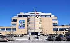 Rock County Courthouse | |
 Seal | |
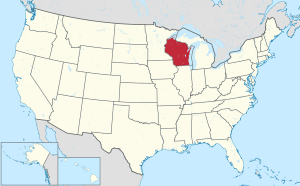
 Location within the U.S. state of Wisconsin | |
 Wisconsin's location within the U.S. | |
| Coordinates: 42°40′N 89°04′W | |
| Country | |
| State | |
| Founded | 1839 |
| Named for | Rock River |
| Seat | Janesville |
| Largest city | Janesville |
| Area | |
| • Total | 726 sq mi (1,880 km2) |
| • Land | 718 sq mi (1,860 km2) |
| • Water | 8.0 sq mi (21 km2) 1.1%% |
| Population (2010) | |
| • Total | 160,331 |
| • Estimate (2019) | 163,354 |
| • Density | 220/sq mi (85/km2) |
| Time zone | UTC−6 (Central) |
| • Summer (DST) | UTC−5 (CDT) |
| Congressional districts | 1st, 2nd |
| Website | www |
Rock County comprises the Janesville-Beloit, WI Metropolitan Statistical Area and is included in the Madison-Janesville-Beloit, WI Combined Statistical Area.
History
Rock County was created in 1836 as a territorial county on December 7, 1836 from Milwaukee County and fully organized February 19, 1839.[3] The county is named for the Rock River, which bisects the county from north to south.[4]
Geography
According to the U.S. Census Bureau, the county has a total area of 726 square miles (1,880 km2), of which 718 square miles (1,860 km2) is land and 8.0 square miles (21 km2) (1.1%) is water.[5]
Cook Memorial Arboretum, a natural area with birding and nature trails, is located northwest of Janesville. It is owned by the Janesville School District.[6]
Transportation
Major highways


Airport
Southern Wisconsin Regional Airport (KJVL) serves Rock County and the surrounding communities.
Adjacent counties
- Green County – west
- Dane County – north
- Jefferson County – northeast
- Walworth County – east
- Boone County, Illinois – south
- Winnebago County, Illinois – south
Demographics
| Historical population | |||
|---|---|---|---|
| Census | Pop. | %± | |
| 1840 | 1,701 | — | |
| 1850 | 20,750 | 1,119.9% | |
| 1860 | 36,690 | 76.8% | |
| 1870 | 39,030 | 6.4% | |
| 1880 | 38,823 | −0.5% | |
| 1890 | 43,220 | 11.3% | |
| 1900 | 51,203 | 18.5% | |
| 1910 | 55,538 | 8.5% | |
| 1920 | 66,150 | 19.1% | |
| 1930 | 74,206 | 12.2% | |
| 1940 | 80,173 | 8.0% | |
| 1950 | 92,778 | 15.7% | |
| 1960 | 113,913 | 22.8% | |
| 1970 | 131,970 | 15.9% | |
| 1980 | 139,420 | 5.6% | |
| 1990 | 139,510 | 0.1% | |
| 2000 | 152,307 | 9.2% | |
| 2010 | 160,331 | 5.3% | |
| Est. 2019 | 163,354 | [7] | 1.9% |
| U.S. Decennial Census[8] 1790–1960[9] 1900–1990[10] 1990–2000[11] 2010–2019[1] | |||
As of the census[12] of 2000, there were 152,307 people, 58,617 households, and 40,387 families residing in the county. The population density was 211 people per square mile (82/km²). There were 62,187 housing units at an average density of 86 per square mile (33/km²). The racial makeup of the county was 91.01% white, 4.63% black or African American, 0.28% Native American, 0.78% Asian, 0.04% Pacific Islander, 1.77% from other races, and 1.50% from two or more races. 3.91% of the population were Hispanic or Latino of any race. 32.8% were of German, 13.0% Norwegian, 10.1% Irish, 7.5% English and 5.5% American ancestry.
There were 58,617 households out of which 33.60% had children under the age of 18 living with them, 53.50% were married couples living together, 10.90% had a female householder with no husband present, and 31.10% were non-families. 25.10% of all households were made up of individuals and 9.70% had someone living alone who was 65 years of age or older. The average household size was 2.54 and the average family size was 3.03.
In the county, the population was spread out with 26.50% under the age of 18, 8.60% from 18 to 24, 29.80% from 25 to 44, 22.30% from 45 to 64, and 12.70% who were 65 years of age or older. The median age was 36 years. For every 100 females there were 97.00 males. For every 100 females age 18 and over, there were 94.10 males.
Communities
Cities
- Beloit
- Brodhead (mostly in Green County)
- Edgerton (partly in Dane County)
- Evansville
- Janesville
- Milton
- Whitewater
Villages
Towns
Census-designated place
Unincorporated communities
- Afton
- Anderson
- Avon
- Avalon
- Bergen
- Cainville
- Center
- Charlie Bluff
- Cooksville
- Coopers Shores
- Crestview
- Emerald Grove
- Fairfield (partial)
- Foxhollow
- Fulton
- Indianford
- Johnstown
- Johnstown Center
- Koshkonong (partial)
- Leyden
- Lima Center
- Magnolia
- Maple Beach
- Newark
- Newville
- Porters
- Shopiere
- Stebbinsville
- Tiffany
- Union
Ghost towns/neighborhoods
- Fellows
- Jefferson Prairie Settlement
Politics
Hillary Clinton carried the county in 2016, but it was the smallest margin of victory since Michael Dukakis in 1988.
| Year | Republican | Democratic | Third parties |
|---|---|---|---|
| 2016 | 41.4% 31,493 | 51.7% 39,339 | 6.9% 5,242 |
| 2012 | 37.8% 30,517 | 61.0% 49,219 | 1.2% 954 |
| 2008 | 34.6% 27,364 | 63.8% 50,529 | 1.6% 1,276 |
| 2004 | 41.2% 33,151 | 57.9% 46,598 | 0.9% 730 |
| 2000 | 39.0% 27,467 | 57.5% 40,472 | 3.5% 2,465 |
| 1996 | 33.3% 20,096 | 53.8% 32,450 | 12.9% 7,774 |
| 1992 | 31.8% 21,942 | 45.1% 31,154 | 23.1% 15,929 |
| 1988 | 48.4% 28,178 | 50.8% 29,576 | 0.8% 434 |
| 1984 | 54.8% 32,491 | 44.6% 26,433 | 0.7% 410 |
| 1980 | 50.6% 30,960 | 40.4% 24,740 | 9.0% 5,482 |
| 1976 | 49.0% 28,325 | 48.6% 28,048 | 2.4% 1,389 |
| 1972 | 58.0% 30,361 | 40.2% 21,033 | 1.8% 925 |
| 1968 | 51.0% 25,229 | 41.6% 20,567 | 7.5% 3,697 |
| 1964 | 41.9% 20,372 | 58.0% 28,257 | 0.1% 55 |
| 1960 | 60.6% 29,675 | 39.2% 19,194 | 0.2% 76 |
| 1956 | 67.4% 28,980 | 32.2% 13,834 | 0.4% 173 |
| 1952 | 64.6% 27,837 | 35.3% 15,183 | 0.1% 45 |
| 1948 | 50.7% 17,068 | 47.9% 16,150 | 1.4% 474 |
| 1944 | 52.2% 18,477 | 47.4% 16,766 | 0.4% 133 |
| 1940 | 53.2% 20,141 | 46.3% 17,543 | 0.6% 214 |
| 1936 | 43.6% 14,693 | 53.3% 17,991 | 3.1% 1,045 |
| 1932 | 56.1% 16,825 | 42.0% 12,612 | 1.9% 571 |
| 1928 | 70.8% 21,497 | 28.7% 8,726 | 0.5% 161 |
| 1924 | 60.9% 14,815 | 6.0% 1,453 | 33.1% 8,052 |
| 1920 | 83.5% 16,152 | 12.7% 2,447 | 3.8% 738 |
| 1916 | 61.1% 7,011 | 35.0% 4,015 | 3.9% 451 |
| 1912 | 43.2% 4,276 | 30.6% 3,032 | 26.1% 2,587 |
| 1908 | 66.8% 7,839 | 27.5% 3,227 | 5.7% 668 |
| 1904 | 71.7% 7,972 | 21.1% 2,348 | 7.3% 807 |
| 1900 | 70.0% 8,249 | 26.2% 3,094 | 3.8% 447 |
| 1896 | 67.5% 8,282 | 29.8% 3,655 | 2.8% 340 |
| 1892 | 55.2% 6,052 | 38.6% 4,231 | 6.1% 673 |
Tree cities
- Beloit
- Clinton
- Edgerton
- Evansville
- Janesville
References
- "State & County QuickFacts". United States Census Bureau. Retrieved January 23, 2014.
- "Find a County". National Association of Counties. Retrieved June 7, 2011.
- "Wisconsin: Individual County Chronologies". Wisconsin Atlas of Historical County Boundaries. The Newberry Library. 2007. Retrieved August 15, 2015.
- "Rock County, origin of place name" Dictionary of Wisconsin History.
- "2010 Census Gazetteer Files". United States Census Bureau. August 22, 2012. Retrieved August 8, 2015.
- Great Wisconsin Birding & Nature Trail. Cook Memorial Arboretum.
- "Population and Housing Unit Estimates". Retrieved May 21, 2020.
- "U.S. Decennial Census". United States Census Bureau. Retrieved August 8, 2015.
- "Historical Census Browser". University of Virginia Library. Retrieved August 8, 2015.
- Forstall, Richard L., ed. (March 27, 1995). "Population of Counties by Decennial Census: 1900 to 1990". United States Census Bureau. Retrieved August 8, 2015.
- "Census 2000 PHC-T-4. Ranking Tables for Counties: 1990 and 2000" (PDF). United States Census Bureau. April 2, 2001. Retrieved August 8, 2015.
- "U.S. Census website". United States Census Bureau. Retrieved 2011-05-14.
- Leip, David. "Dave Leip's Atlas of U.S. Presidential Elections". uselectionatlas.org. Retrieved April 6, 2018.
Further reading
- Brown, William F. Rock County, Wisconsin: A New History... Vol. 1, Chicago: Cooper, 1908.
- Brown, William F. Rock County, Wisconsin: A New History... Vol. 2, Chicago: Cooper, 1908.
- Commemorative Biographical Record of the Counties of Rock, Green, Grant, Iowa, and Lafayette, Wisconsin, Containing Biographical Sketches of Prominent and Representative Citizens, and of Many of the Early Settled Families. Chicago: J. H. Beers and Co., 1901.
- The History of Rock County, Wisconsin. Chicago: Western Historical Company, 1879.
- Portrait and Biographical Album of Rock County, Wisconsin. Chicago: Acme Publishing Company, 1889.
- Sayre, David F. "Early Life in Southern Wisconsin", Wisconsin Magazine of History, vol. 3, no. 4 (June 1920), pp. 420–427.
- Smith, Isaac T. "Early Settlement of Rock County" in Wisconsin Historical Collections, vol. VI. Madison, Wis.: Atwood & Culver, 1872, pp. 416–425.
- Walterman, Thomas. There Stands "Old Rock": Rock County, Wisconsin and the War to Preserve the Union. Friendship, Wis.: New Past Press, 2001. ISBN 0-938627-50-3
External links
- Rock County government website
- Rock County map from the Wisconsin Department of Transportation
- Rock County 5.0
- Rock County Historical Society
- Rock County Genealogical Society
- Beloit Janesville Symphony
Places adjacent to Rock County, Wisconsin | ||||||||||
|---|---|---|---|---|---|---|---|---|---|---|
| ||||||||||
Municipalities and communities of Rock County, Wisconsin, United States | ||
|---|---|---|
| Cities | | |
| Villages | ||
| Towns | ||
| CDP | ||
| Unincorporated communities |
| |
| Ghost towns/neighborhoods | ||
| Footnotes | ‡This populated place also has portions in an adjacent county or counties | |
| Authority control |
|
|---|