Veilleins
| Veilleins | |
|---|---|
| Commune | |
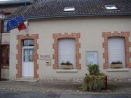 Town hall | |
 Veilleins Location within Centre-Val de Loire region  Veilleins | |
| Coordinates: 47°25′18″N 1°40′16″E / 47.4217°N 1.6711°ECoordinates: 47°25′18″N 1°40′16″E / 47.4217°N 1.6711°E | |
| Country | France |
| Region | Centre-Val de Loire |
| Department | Loir-et-Cher |
| Arrondissement | Romorantin-Lanthenay |
| Canton | Romorantin-Lanthenay |
| Intercommunality | Sologne des étangs |
| Government | |
| • Mayor (2014–2020) | François d'Espinay-Saint-Luc |
| Area1 | 43.26 km2 (16.70 sq mi) |
| Population (2015)2 | 159 |
| • Density | 3.7/km2 (9.5/sq mi) |
| Time zone | UTC+1 (CET) |
| • Summer (DST) | UTC+2 (CEST) |
| INSEE/Postal code | 41268 /41230 |
| Elevation |
93–127 m (305–417 ft) (avg. 109 m or 358 ft) |
|
1 French Land Register data, which excludes lakes, ponds, glaciers > 1 km2 (0.386 sq mi or 247 acres) and river estuaries. 2 Population without double counting: residents of multiple communes (e.g., students and military personnel) only counted once. | |
Veilleins is a commune of the Loir-et-Cher department in central France.[1]
Population
| Historical population | ||
|---|---|---|
| Year | Pop. | ±% |
| 1793 | 383 | — |
| 1806 | 352 | −8.1% |
| 1821 | 369 | +4.8% |
| 1831 | 489 | +32.5% |
| 1841 | 535 | +9.4% |
| 1851 | 556 | +3.9% |
| 1861 | 521 | −6.3% |
| 1872 | 554 | +6.3% |
| 1881 | 525 | −5.2% |
| 1891 | 583 | +11.0% |
| 1901 | 581 | −0.3% |
| 1911 | 561 | −3.4% |
| 1921 | 476 | −15.2% |
| 1931 | 456 | −4.2% |
| 1946 | 433 | −5.0% |
| 1954 | 363 | −16.2% |
| 1962 | 330 | −9.1% |
| 1968 | 273 | −17.3% |
| 1975 | 227 | −16.8% |
| 1982 | 185 | −18.5% |
| 1990 | 190 | +2.7% |
| 1999 | 180 | −5.3% |
| 2006 | 141 | −21.7% |
| 2015 | 159 | +12.8% |
See also
References
- ↑ http://veilleins.a3w.fr/. Retrieved 20 December 2013. Missing or empty
|title=(help)
| Wikimedia Commons has media related to Veilleins. |
This article is issued from
Wikipedia.
The text is licensed under Creative Commons - Attribution - Sharealike.
Additional terms may apply for the media files.