Villebarou
| Villebarou | |
|---|---|
| Commune | |
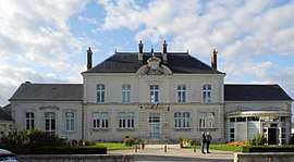 Town hall | |
 Villebarou Location within Centre-Val de Loire region  Villebarou | |
| Coordinates: 47°37′24″N 1°19′27″E / 47.6233°N 1.3242°ECoordinates: 47°37′24″N 1°19′27″E / 47.6233°N 1.3242°E | |
| Country | France |
| Region | Centre-Val de Loire |
| Department | Loir-et-Cher |
| Arrondissement | Blois |
| Canton | Blois-2 |
| Intercommunality | Communauté d'agglomération de Blois |
| Government | |
| • Mayor (2016–2020) | Philippe Masson |
| Area1 | 9.11 km2 (3.52 sq mi) |
| Population (2015)2 | 2,478 |
| • Density | 270/km2 (700/sq mi) |
| Time zone | UTC+1 (CET) |
| • Summer (DST) | UTC+2 (CEST) |
| INSEE/Postal code | 41276 /41000 |
| Elevation |
108–121 m (354–397 ft) (avg. 120 m or 390 ft) |
|
1 French Land Register data, which excludes lakes, ponds, glaciers > 1 km2 (0.386 sq mi or 247 acres) and river estuaries. 2 Population without double counting: residents of multiple communes (e.g., students and military personnel) only counted once. | |
Villebarou is a commune in the Loir-et-Cher department in central France.
Population
| Historical population | ||
|---|---|---|
| Year | Pop. | ±% |
| 1793 | 1,372 | — |
| 1806 | 1,349 | −1.7% |
| 1821 | 1,208 | −10.5% |
| 1831 | 1,194 | −1.2% |
| 1841 | 1,143 | −4.3% |
| 1851 | 1,103 | −3.5% |
| 1861 | 1,104 | +0.1% |
| 1872 | 1,011 | −8.4% |
| 1881 | 1,017 | +0.6% |
| 1891 | 936 | −8.0% |
| 1901 | 878 | −6.2% |
| 1911 | 767 | −12.6% |
| 1921 | 690 | −10.0% |
| 1931 | 679 | −1.6% |
| 1946 | 802 | +18.1% |
| 1954 | 793 | −1.1% |
| 1962 | 955 | +20.4% |
| 1968 | 1,307 | +36.9% |
| 1975 | 1,475 | +12.9% |
| 1982 | 1,573 | +6.6% |
| 1990 | 1,793 | +14.0% |
| 1999 | 1,946 | +8.5% |
| 2004 | 2,269 | +16.6% |
| 2015 | 2,478 | +9.2% |
See also
| Wikimedia Commons has media related to Villebarou (Loir-et-Cher). |
This article is issued from
Wikipedia.
The text is licensed under Creative Commons - Attribution - Sharealike.
Additional terms may apply for the media files.