Talcy, Loir-et-Cher
| Talcy | ||
|---|---|---|
| Commune | ||
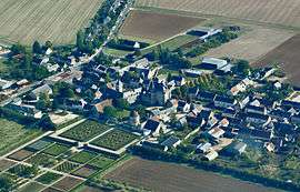 Talcy with its château | ||
| ||
 Talcy Location within Centre-Val de Loire region  Talcy | ||
| Coordinates: 47°46′11″N 1°26′40″E / 47.7697°N 1.4444°ECoordinates: 47°46′11″N 1°26′40″E / 47.7697°N 1.4444°E | ||
| Country | France | |
| Region | Centre-Val de Loire | |
| Department | Loir-et-Cher | |
| Arrondissement | Blois | |
| Canton | La Beauce | |
| Intercommunality | Beauce ligérienne | |
| Government | ||
| • Mayor (2014–2020) | Étienne Lhomme | |
| Area1 | 15.21 km2 (5.87 sq mi) | |
| Population (2015)2 | 252 | |
| • Density | 17/km2 (43/sq mi) | |
| Time zone | UTC+1 (CET) | |
| • Summer (DST) | UTC+2 (CEST) | |
| INSEE/Postal code | 41253 /41370 | |
| Elevation |
107–126 m (351–413 ft) (avg. 120 m or 390 ft) | |
|
1 French Land Register data, which excludes lakes, ponds, glaciers > 1 km2 (0.386 sq mi or 247 acres) and river estuaries. 2 Population without double counting: residents of multiple communes (e.g., students and military personnel) only counted once. | ||
.svg.png)
Talcy is a commune of the Loir-et-Cher department in central France.
It is known for the Château de Talcy.
Population
| Historical population | ||
|---|---|---|
| Year | Pop. | ±% |
| 1793 | 480 | — |
| 1806 | 438 | −8.8% |
| 1821 | 517 | +18.0% |
| 1831 | 572 | +10.6% |
| 1841 | 567 | −0.9% |
| 1851 | 564 | −0.5% |
| 1861 | 540 | −4.3% |
| 1872 | 563 | +4.3% |
| 1881 | 504 | −10.5% |
| 1891 | 459 | −8.9% |
| 1901 | 435 | −5.2% |
| 1911 | 402 | −7.6% |
| 1921 | 361 | −10.2% |
| 1931 | 314 | −13.0% |
| 1946 | 267 | −15.0% |
| 1965 | 285 | +6.7% |
| 1962 | 262 | −8.1% |
| 1968 | 235 | −10.3% |
| 1975 | 223 | −5.1% |
| 1982 | 241 | +8.1% |
| 1990 | 240 | −0.4% |
| 1999 | 247 | +2.9% |
| 2005 | 249 | +0.8% |
| 2015 | 252 | +1.2% |
See also
| Wikimedia Commons has media related to Talcy (Loir-et-Cher). |
This article is issued from
Wikipedia.
The text is licensed under Creative Commons - Attribution - Sharealike.
Additional terms may apply for the media files.