Selles-sur-Cher
| Selles-sur-Cher | ||
|---|---|---|
| Commune | ||
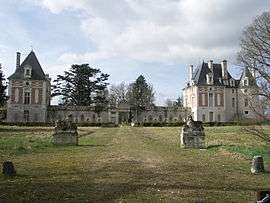 Château | ||
| ||
 Selles-sur-Cher Location within Centre-Val de Loire region  Selles-sur-Cher | ||
| Coordinates: 47°16′35″N 1°33′20″E / 47.2764°N 1.5556°ECoordinates: 47°16′35″N 1°33′20″E / 47.2764°N 1.5556°E | ||
| Country | France | |
| Region | Centre-Val de Loire | |
| Department | Loir-et-Cher | |
| Arrondissement | Romorantin-Lanthenay | |
| Canton | Selles-sur-Cher | |
| Intercommunality | Cher-Sologne | |
| Government | ||
| • Mayor (2014–2020) | Francis Monchet | |
| Area1 | 25.74 km2 (9.94 sq mi) | |
| Population (2015)2 | 4,625 | |
| • Density | 180/km2 (470/sq mi) | |
| Time zone | UTC+1 (CET) | |
| • Summer (DST) | UTC+2 (CEST) | |
| INSEE/Postal code | 41242 /41130 | |
| Elevation |
68–104 m (223–341 ft) (avg. 86 m or 282 ft) | |
|
1 French Land Register data, which excludes lakes, ponds, glaciers > 1 km2 (0.386 sq mi or 247 acres) and river estuaries. 2 Population without double counting: residents of multiple communes (e.g., students and military personnel) only counted once. | ||
.svg.png)
Selles-sur-Cher is a commune in the Loir-et-Cher department of central France.
The name of the commune is known internationally for its goat cheese, Selles-sur-Cher, that was first made in the village in the 19th century.
Population
| Historical population | ||
|---|---|---|
| Year | Pop. | ±% |
| 1962 | 3,884 | — |
| 1968 | 4,143 | +6.7% |
| 1975 | 4,642 | +12.0% |
| 1982 | 5,018 | +8.1% |
| 1990 | 4,751 | −5.3% |
| 1999 | 4,775 | +0.5% |
| 2007 | 4,633 | −3.0% |
| 2015 | 4,625 | −0.2% |
See also
| Wikimedia Commons has media related to Selles-sur-Cher. |
| Authority control |
|---|
This article is issued from
Wikipedia.
The text is licensed under Creative Commons - Attribution - Sharealike.
Additional terms may apply for the media files.