Nourray
| Nourray | ||
|---|---|---|
 | ||
| ||
 Nourray Location within Centre-Val de Loire region  Nourray | ||
| Coordinates: 47°43′06″N 1°03′34″E / 47.7183°N 1.0594°ECoordinates: 47°43′06″N 1°03′34″E / 47.7183°N 1.0594°E | ||
| Country | France | |
| Region | Centre-Val de Loire | |
| Department | Loir-et-Cher | |
| Arrondissement | Vendôme | |
| Canton | Montoire-sur-le-Loir | |
| Intercommunality | Beauce et Gâtine | |
| Government | ||
| • Mayor (2008–2014) | Dominique Dhuy | |
| Area1 | 12.17 km2 (4.70 sq mi) | |
| Population (2014)2 | 116 | |
| • Density | 9.5/km2 (25/sq mi) | |
| Time zone | UTC+1 (CET) | |
| • Summer (DST) | UTC+2 (CEST) | |
| INSEE/Postal code | 41163 /41310 | |
| Elevation |
103–133 m (338–436 ft) (avg. 115 m or 377 ft) | |
|
1 French Land Register data, which excludes lakes, ponds, glaciers > 1 km2 (0.386 sq mi or 247 acres) and river estuaries. 2 Population without double counting: residents of multiple communes (e.g., students and military personnel) only counted once. | ||
.svg.png)
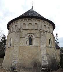
Nourray is a commune in the Loir-et-Cher department of central France. The commune is located in the region of Centre-Val de Loire.
Population
| Historical population | ||
|---|---|---|
| Year | Pop. | ±% |
| 1793 | 231 | — |
| 1806 | 105 | −54.5% |
| 1821 | 108 | +2.9% |
| 1821 | 197 | +82.4% |
| 1831 | 191 | −3.0% |
| 1841 | 180 | −5.8% |
| 1851 | 191 | +6.1% |
| 1861 | 192 | +0.5% |
| 1872 | 235 | +22.4% |
| 1881 | 218 | −7.2% |
| 1891 | 224 | +2.8% |
| 1901 | 216 | −3.6% |
| 1911 | 192 | −11.1% |
| 1921 | 159 | −17.2% |
| 1931 | 159 | +0.0% |
| 1946 | 169 | +6.3% |
| 1954 | 173 | +2.4% |
| 1962 | 169 | −2.3% |
| 1975 | 112 | −33.7% |
| 1982 | 135 | +20.5% |
| 1990 | 140 | +3.7% |
| 2005 | 107 | −23.6% |
| 2014 | 116 | +8.4% |
References
See also
| Wikimedia Commons has media related to Nourray. |
This article is issued from
Wikipedia.
The text is licensed under Creative Commons - Attribution - Sharealike.
Additional terms may apply for the media files.