Morée
| Morée | ||
|---|---|---|
| Commune | ||
 | ||
| ||
 Morée Location within Centre-Val de Loire region  Morée | ||
| Coordinates: 47°54′13″N 1°14′07″E / 47.9036°N 1.2353°ECoordinates: 47°54′13″N 1°14′07″E / 47.9036°N 1.2353°E | ||
| Country | France | |
| Region | Centre-Val de Loire | |
| Department | Loir-et-Cher | |
| Arrondissement | Vendôme | |
| Canton | Le Perche | |
| Intercommunality | Haut Vendômois | |
| Government | ||
| • Mayor (2014–2020) | Alain Bourgeois | |
| Area1 | 25.83 km2 (9.97 sq mi) | |
| Population (2014)2 | 1,100 | |
| • Density | 43/km2 (110/sq mi) | |
| Time zone | UTC+1 (CET) | |
| • Summer (DST) | UTC+2 (CEST) | |
| INSEE/Postal code | 41154 /41160 | |
| Elevation |
86–152 m (282–499 ft) (avg. 96 m or 315 ft) | |
|
1 French Land Register data, which excludes lakes, ponds, glaciers > 1 km2 (0.386 sq mi or 247 acres) and river estuaries. 2 Population without double counting: residents of multiple communes (e.g., students and military personnel) only counted once. | ||
.svg.png)
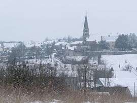
Morée is a commune in the Loir-et-Cher department of central France.
Population
| Historical population | ||
|---|---|---|
| Year | Pop. | ±% |
| 1793 | 1,012 | — |
| 1806 | 877 | −13.3% |
| 1821 | 1,018 | +16.1% |
| 1831 | 1,218 | +19.6% |
| 1841 | 1,282 | +5.3% |
| 1851 | 1,309 | +2.1% |
| 1861 | 1,327 | +1.4% |
| 1872 | 1,379 | +3.9% |
| 1881 | 1,383 | +0.3% |
| 1891 | 1,354 | −2.1% |
| 1901 | 1,267 | −6.4% |
| 1911 | 1,139 | −10.1% |
| 1921 | 1,001 | −12.1% |
| 1931 | 982 | −1.9% |
| 1946 | 996 | +1.4% |
| 1954 | 905 | −9.1% |
| 1962 | 962 | +6.3% |
| 1968 | 979 | +1.8% |
| 1975 | 1,012 | +3.4% |
| 1982 | 1,104 | +9.1% |
| 1990 | 1,061 | −3.9% |
| 1999 | 994 | −6.3% |
| 2005 | 1,051 | +5.7% |
| 2014 | 1,100 | +4.7% |
See also
References
| Wikimedia Commons has media related to Morée (Loir-et-Cher). |
This article is issued from
Wikipedia.
The text is licensed under Creative Commons - Attribution - Sharealike.
Additional terms may apply for the media files.