Ouzouer-le-Doyen
| Ouzouer-le-Doyen | ||
|---|---|---|
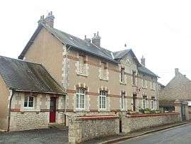 Town hall | ||
| ||
 Ouzouer-le-Doyen Location within Centre-Val de Loire region  Ouzouer-le-Doyen | ||
| Coordinates: 47°56′33″N 1°20′28″E / 47.9425°N 1.3411°ECoordinates: 47°56′33″N 1°20′28″E / 47.9425°N 1.3411°E | ||
| Country | France | |
| Region | Centre-Val de Loire | |
| Department | Loir-et-Cher | |
| Arrondissement | Vendôme | |
| Canton | Le Perche | |
| Intercommunality | Haut Vendômois | |
| Government | ||
| • Mayor (2014–2020) | Robert Bouchet | |
| Area1 | 16.59 km2 (6.41 sq mi) | |
| Population (2014)2 | 238 | |
| • Density | 14/km2 (37/sq mi) | |
| Time zone | UTC+1 (CET) | |
| • Summer (DST) | UTC+2 (CEST) | |
| INSEE/Postal code | 41172 /41160 | |
| Elevation |
116–133 m (381–436 ft) (avg. 130 m or 430 ft) | |
|
1 French Land Register data, which excludes lakes, ponds, glaciers > 1 km2 (0.386 sq mi or 247 acres) and river estuaries. 2 Population without double counting: residents of multiple communes (e.g., students and military personnel) only counted once. | ||
.svg.png)
Ouzouer-le-Doyen is a commune in the Loir-et-Cher department of central France.
Population
| Historical population | ||
|---|---|---|
| Year | Pop. | ±% |
| 1793 | 406 | — |
| 1806 | 440 | +8.4% |
| 1821 | 430 | −2.3% |
| 1831 | 461 | +7.2% |
| 1841 | 487 | +5.6% |
| 1851 | 520 | +6.8% |
| 1861 | 538 | +3.5% |
| 1872 | 501 | −6.9% |
| 1881 | 478 | −4.6% |
| 1891 | 514 | +7.5% |
| 1901 | 504 | −1.9% |
| 1911 | 460 | −8.7% |
| 1921 | 422 | −8.3% |
| 1931 | 443 | +5.0% |
| 1946 | 407 | −8.1% |
| 1954 | 409 | +0.5% |
| 1962 | 369 | −9.8% |
| 1968 | 332 | −10.0% |
| 1975 | 271 | −18.4% |
| 1982 | 238 | −12.2% |
| 1990 | 208 | −12.6% |
| 1999 | 167 | −19.7% |
| 2004 | 199 | +19.2% |
| 2014 | 238 | +19.6% |
References
See also
| Wikimedia Commons has media related to Ouzouer-le-Doyen. |
This article is issued from
Wikipedia.
The text is licensed under Creative Commons - Attribution - Sharealike.
Additional terms may apply for the media files.