Marcilly-en-Gault
| Marcilly-en-Gault | |
|---|---|
| Commune | |
 | |
 Marcilly-en-Gault Location within Centre-Val de Loire region  Marcilly-en-Gault | |
| Coordinates: 47°27′57″N 1°52′28″E / 47.4658°N 1.8744°ECoordinates: 47°27′57″N 1°52′28″E / 47.4658°N 1.8744°E | |
| Country | France |
| Region | Centre-Val de Loire |
| Department | Loir-et-Cher |
| Arrondissement | Romorantin-Lanthenay |
| Canton | La Sologne |
| Intercommunality | La Sologne des rivières |
| Government | |
| • Mayor (2014–2020) | Agnès Thibault |
| Area1 | 50.31 km2 (19.42 sq mi) |
| Population (2014)2 | 758 |
| • Density | 15/km2 (39/sq mi) |
| Time zone | UTC+1 (CET) |
| • Summer (DST) | UTC+2 (CEST) |
| INSEE/Postal code | 41125 /41210 |
| Elevation |
94–129 m (308–423 ft) (avg. 127 m or 417 ft) |
|
1 French Land Register data, which excludes lakes, ponds, glaciers > 1 km2 (0.386 sq mi or 247 acres) and river estuaries. 2 Population without double counting: residents of multiple communes (e.g., students and military personnel) only counted once. | |
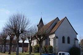
Marcilly-en-Gault is a commune in the Loir-et-Cher department of central France.
Population
| Historical population | ||
|---|---|---|
| Year | Pop. | ±% |
| 1793 | 784 | — |
| 1806 | 768 | −2.0% |
| 1821 | 822 | +7.0% |
| 1831 | 856 | +4.1% |
| 1841 | 798 | −6.8% |
| 1851 | 785 | −1.6% |
| 1861 | 802 | +2.2% |
| 1872 | 857 | +6.9% |
| 1881 | 888 | +3.6% |
| 1891 | 1,020 | +14.9% |
| 1901 | 1,022 | +0.2% |
| 1911 | 1,039 | +1.7% |
| 1921 | 962 | −7.4% |
| 1931 | 939 | −2.4% |
| 1946 | 844 | −10.1% |
| 1954 | 908 | +7.6% |
| 1962 | 803 | −11.6% |
| 1968 | 752 | −6.4% |
| 1975 | 577 | −23.3% |
| 1982 | 683 | +18.4% |
| 1990 | 752 | +10.1% |
| 1999 | 755 | +0.4% |
| 2007 | 744 | −1.5% |
| 2014 | 758 | +1.9% |
See also
References
| Wikimedia Commons has media related to Marcilly-en-Gault. |
This article is issued from
Wikipedia.
The text is licensed under Creative Commons - Attribution - Sharealike.
Additional terms may apply for the media files.