Saint-Rimay
| Saint-Rimay | ||
|---|---|---|
| Commune | ||
 | ||
| ||
 Saint-Rimay Location within Centre-Val de Loire region  Saint-Rimay | ||
| Coordinates: 47°45′47″N 0°55′24″E / 47.7631°N 0.9233°ECoordinates: 47°45′47″N 0°55′24″E / 47.7631°N 0.9233°E | ||
| Country | France | |
| Region | Centre-Val de Loire | |
| Department | Loir-et-Cher | |
| Arrondissement | Vendôme | |
| Canton | Montoire-sur-le-Loir | |
| Intercommunality | Pays de Ronsard | |
| Government | ||
| • Mayor (2014–2020) | Yves Rolland | |
| Area1 | 7.36 km2 (2.84 sq mi) | |
| Population (2015)2 | 292 | |
| • Density | 40/km2 (100/sq mi) | |
| Time zone | UTC+1 (CET) | |
| • Summer (DST) | UTC+2 (CEST) | |
| INSEE/Postal code | 41228 /41800 | |
| Elevation |
65–125 m (213–410 ft) (avg. 76 m or 249 ft) | |
|
1 French Land Register data, which excludes lakes, ponds, glaciers > 1 km2 (0.386 sq mi or 247 acres) and river estuaries. 2 Population without double counting: residents of multiple communes (e.g., students and military personnel) only counted once. | ||
.svg.png)
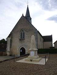
Saint-Rimay is a commune in the Loir-et-Cher department of central France.
Population
| Historical population | ||
|---|---|---|
| Year | Pop. | ±% |
| 1793 | 263 | — |
| 1806 | 318 | +20.9% |
| 1821 | 311 | −2.2% |
| 1831 | 318 | +2.3% |
| 1841 | 334 | +5.0% |
| 1851 | 398 | +19.2% |
| 1861 | 372 | −6.5% |
| 1872 | 377 | +1.3% |
| 1881 | 451 | +19.6% |
| 1891 | 418 | −7.3% |
| 1901 | 378 | −9.6% |
| 1911 | 363 | −4.0% |
| 1921 | 325 | −10.5% |
| 1931 | 300 | −7.7% |
| 1946 | 270 | −10.0% |
| 1954 | 324 | +20.0% |
| 1962 | 318 | −1.9% |
| 1968 | 317 | −0.3% |
| 1975 | 284 | −10.4% |
| 1982 | 292 | +2.8% |
| 1990 | 323 | +10.6% |
| 1999 | 311 | −3.7% |
| 2006 | 295 | −5.1% |
| 2015 | 292 | −1.0% |
See also
References
| Wikimedia Commons has media related to Saint-Rimay. |
This article is issued from
Wikipedia.
The text is licensed under Creative Commons - Attribution - Sharealike.
Additional terms may apply for the media files.