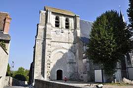
Saint-Dyé-sur-Loire
| Saint-Dyé-sur-Loire | ||
|---|---|---|
| Commune | ||
 | ||
| ||
 Saint-Dyé-sur-Loire Location within Centre-Val de Loire region  Saint-Dyé-sur-Loire | ||
| Coordinates: 47°39′24″N 1°29′22″E / 47.6567°N 1.4894°ECoordinates: 47°39′24″N 1°29′22″E / 47.6567°N 1.4894°E | ||
| Country | France | |
| Region | Centre-Val de Loire | |
| Department | Loir-et-Cher | |
| Arrondissement | Blois | |
| Canton | Chambord | |
| Intercommunality | Pays de Chambord | |
| Government | ||
| • Mayor (2014–2020) | Didier Heitz | |
| Area1 | 5.51 km2 (2.13 sq mi) | |
| Population (2015)2 | 1,139 | |
| • Density | 210/km2 (540/sq mi) | |
| Time zone | UTC+1 (CET) | |
| • Summer (DST) | UTC+2 (CEST) | |
| INSEE/Postal code | 41207 /41500 | |
| Elevation |
72–92 m (236–302 ft) (avg. 80 m or 260 ft) | |
|
1 French Land Register data, which excludes lakes, ponds, glaciers > 1 km2 (0.386 sq mi or 247 acres) and river estuaries. 2 Population without double counting: residents of multiple communes (e.g., students and military personnel) only counted once. | ||
.svg.png)
Saint-Dyé-sur-Loire is a commune in the Loir-et-Cher department of central France.
Population
| Year | 1962 | 1968 | 1975 | 1982 | 1990 | 1999 | 2006 | 2015 |
|---|---|---|---|---|---|---|---|---|
| Population | 511 | 629 | 587 | 762 | 895 | 945 | 1007 | 1139 |
| From the year 1962 on: No double counting—residents of multiple communes (e.g. students and military personnel) are counted only once. | ||||||||
See also
References
| Wikimedia Commons has media related to Saint-Dyé-sur-Loire. |
This article is issued from
Wikipedia.
The text is licensed under Creative Commons - Attribution - Sharealike.
Additional terms may apply for the media files.