Saint-Laurent-Nouan
| Saint-Laurent-Nouan | ||
|---|---|---|
| Commune | ||
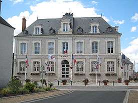 Town hall | ||
| ||
 Saint-Laurent-Nouan Location within Centre-Val de Loire region  Saint-Laurent-Nouan | ||
| Coordinates: 47°43′03″N 1°36′45″E / 47.7175°N 1.6125°ECoordinates: 47°43′03″N 1°36′45″E / 47.7175°N 1.6125°E | ||
| Country | France | |
| Region | Centre-Val de Loire | |
| Department | Loir-et-Cher | |
| Arrondissement | Blois | |
| Canton | Chambord | |
| Intercommunality | Pays de Chambord | |
| Government | ||
| • Mayor (2014–2020) | Christian Lalleron | |
| Area1 | 60.98 km2 (23.54 sq mi) | |
| Population (2015)2 | 4,324 | |
| • Density | 71/km2 (180/sq mi) | |
| Time zone | UTC+1 (CET) | |
| • Summer (DST) | UTC+2 (CEST) | |
| INSEE/Postal code | 41220 /41220 | |
| Elevation |
72–112 m (236–367 ft) (avg. 93 m or 305 ft) | |
|
1 French Land Register data, which excludes lakes, ponds, glaciers > 1 km2 (0.386 sq mi or 247 acres) and river estuaries. 2 Population without double counting: residents of multiple communes (e.g., students and military personnel) only counted once. | ||
.svg.png)
Saint-Laurent-Nouan is a commune in the Loir-et-Cher department of central France.
History
Saint-Laurent-Nouan was formed in 1972 from the merger of the two former communes, Saint-Laurent-des-Eaux and Nouan-sur-Loire.
Population
| Historical population | ||
|---|---|---|
| Year | Pop. | ±% |
| 1793 | 972 | — |
| 1806 | 1,125 | +15.7% |
| 1821 | 1,020 | −9.3% |
| 1831 | 1,159 | +13.6% |
| 1841 | 1,388 | +19.8% |
| 1851 | 1,516 | +9.2% |
| 1861 | 1,565 | +3.2% |
| 1872 | 1,657 | +5.9% |
| 1881 | 1,540 | −7.1% |
| 1891 | 1,484 | −3.6% |
| 1901 | 1,308 | −11.9% |
| 1911 | 1,209 | −7.6% |
| 1921 | 1,103 | −8.8% |
| 1931 | 1,055 | −4.4% |
| 1946 | 1,038 | −1.6% |
| 1954 | 961 | −7.4% |
| 1962 | 992 | +3.2% |
| 1968 | 1,725 | +73.9% |
| 1975 | 2,139 | +24.0% |
| 1982 | 3,079 | +43.9% |
| 1990 | 3,399 | +10.4% |
| 1999 | 3,686 | +8.4% |
| 2006 | 4,068 | +10.4% |
| 2015 | 4,234 | +4.1% |
See also
References
| Wikimedia Commons has media related to Saint-Laurent-Nouan. |
| Authority control |
|---|
This article is issued from
Wikipedia.
The text is licensed under Creative Commons - Attribution - Sharealike.
Additional terms may apply for the media files.