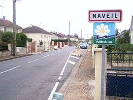
Naveil
| Naveil | ||
|---|---|---|
| Commune | ||
 | ||
| ||
 Naveil Location within Centre-Val de Loire region  Naveil | ||
| Coordinates: 47°47′39″N 1°01′50″E / 47.7942°N 1.0306°ECoordinates: 47°47′39″N 1°01′50″E / 47.7942°N 1.0306°E | ||
| Country | France | |
| Region | Centre-Val de Loire | |
| Department | Loir-et-Cher | |
| Arrondissement | Vendôme | |
| Canton | Montoire-sur-le-Loir | |
| Intercommunality | Vendômois Rural | |
| Government | ||
| • Mayor (2014–2020) | Claude Bordier | |
| Area1 | 13.24 km2 (5.11 sq mi) | |
| Population (2014)2 | 2,253 | |
| • Density | 170/km2 (440/sq mi) | |
| Time zone | UTC+1 (CET) | |
| • Summer (DST) | UTC+2 (CEST) | |
| INSEE/Postal code | 41158 /41100 | |
| Elevation |
72–137 m (236–449 ft) (avg. 70 m or 230 ft) | |
|
1 French Land Register data, which excludes lakes, ponds, glaciers > 1 km2 (0.386 sq mi or 247 acres) and river estuaries. 2 Population without double counting: residents of multiple communes (e.g., students and military personnel) only counted once. | ||
.svg.png)
Naveil is a commune in the Loir-et-Cher department of central France.
Population
| Historical population | ||
|---|---|---|
| Year | Pop. | ±% |
| 1793 | 1,050 | — |
| 1806 | 953 | −9.2% |
| 1821 | 1,155 | +21.2% |
| 1831 | 1,208 | +4.6% |
| 1841 | 1,206 | −0.2% |
| 1851 | 1,184 | −1.8% |
| 1861 | 1,160 | −2.0% |
| 1872 | 1,116 | −3.8% |
| 1881 | 1,162 | +4.1% |
| 1891 | 1,024 | −11.9% |
| 1901 | 967 | −5.6% |
| 1911 | 1,014 | +4.9% |
| 1921 | 928 | −8.5% |
| 1931 | 972 | +4.7% |
| 1946 | 1,048 | +7.8% |
| 1954 | 1,119 | +6.8% |
| 1962 | 1,259 | +12.5% |
| 1968 | 1,368 | +8.7% |
| 1975 | 1,358 | −0.7% |
| 1982 | 1,657 | +22.0% |
| 1990 | 1,855 | +11.9% |
| 1999 | 1,833 | −1.2% |
| 2005 | 1,980 | +8.0% |
| 2014 | 2,253 | +13.8% |
See also
References
| Wikimedia Commons has media related to Naveil. |
This article is issued from
Wikipedia.
The text is licensed under Creative Commons - Attribution - Sharealike.
Additional terms may apply for the media files.