Tourailles
| Tourailles | ||
|---|---|---|
| Commune | ||
 | ||
| ||
 Tourailles Location within Centre-Val de Loire region  Tourailles | ||
| Coordinates: 47°41′09″N 1°09′34″E / 47.6858°N 1.1594°ECoordinates: 47°41′09″N 1°09′34″E / 47.6858°N 1.1594°E | ||
| Country | France | |
| Region | Centre-Val de Loire | |
| Department | Loir-et-Cher | |
| Arrondissement | Vendôme | |
| Canton | Montoire-sur-le-Loir | |
| Intercommunality | Beauce et Gâtine | |
| Government | ||
| • Mayor (2014–2020) | Michel Randuineau | |
| Area1 | 7.46 km2 (2.88 sq mi) | |
| Population (2015)2 | 133 | |
| • Density | 18/km2 (46/sq mi) | |
| Time zone | UTC+1 (CET) | |
| • Summer (DST) | UTC+2 (CEST) | |
| INSEE/Postal code | 41261 /41190 | |
| Elevation |
117–134 m (384–440 ft) (avg. 122 m or 400 ft) | |
|
1 French Land Register data, which excludes lakes, ponds, glaciers > 1 km2 (0.386 sq mi or 247 acres) and river estuaries. 2 Population without double counting: residents of multiple communes (e.g., students and military personnel) only counted once. | ||
.svg.png)
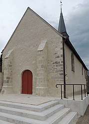
Tourailles is a commune of the Loir-et-Cher department in central France.
Population
| Historical population | ||
|---|---|---|
| Year | Pop. | ±% |
| 1793 | 194 | — |
| 1806 | 173 | −10.8% |
| 1821 | 187 | +8.1% |
| 1831 | 193 | +3.2% |
| 1841 | 224 | +16.1% |
| 1851 | 227 | +1.3% |
| 1861 | 238 | +4.8% |
| 1872 | 228 | −4.2% |
| 1881 | 235 | +3.1% |
| 1891 | 264 | +12.3% |
| 1901 | 232 | −12.1% |
| 1911 | 212 | −8.6% |
| 1921 | 196 | −7.5% |
| 1931 | 181 | −7.7% |
| 1946 | 208 | +14.9% |
| 1954 | 180 | −13.5% |
| 1962 | 168 | −6.7% |
| 1968 | 171 | +1.8% |
| 1975 | 158 | −7.6% |
| 1982 | 135 | −14.6% |
| 1990 | 149 | +10.4% |
| 1999 | 133 | −10.7% |
| 2006 | 138 | +3.8% |
| 2015 | 133 | −3.6% |
See also
| Wikimedia Commons has media related to Tourailles. |
This article is issued from
Wikipedia.
The text is licensed under Creative Commons - Attribution - Sharealike.
Additional terms may apply for the media files.