Marolles, Loir-et-Cher
| Marolles | |
|---|---|
| Commune | |
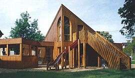 Ecole Maternelle | |
 Marolles Location within Centre-Val de Loire region  Marolles | |
| Coordinates: 47°38′55″N 1°18′28″E / 47.6486°N 1.3078°ECoordinates: 47°38′55″N 1°18′28″E / 47.6486°N 1.3078°E | |
| Country | France |
| Region | Centre-Val de Loire |
| Department | Loir-et-Cher |
| Arrondissement | Blois |
| Canton | Onzain |
| Intercommunality | Communauté d'agglomération de Blois |
| Government | |
| • Mayor (2014–2020) | Yannick Sevrée |
| Area1 | 9.88 km2 (3.81 sq mi) |
| Population (2014)2 | 746 |
| • Density | 76/km2 (200/sq mi) |
| Time zone | UTC+1 (CET) |
| • Summer (DST) | UTC+2 (CEST) |
| INSEE/Postal code | 41128 /41330 |
| Elevation |
87–117 m (285–384 ft) (avg. 144 m or 472 ft) |
|
1 French Land Register data, which excludes lakes, ponds, glaciers > 1 km2 (0.386 sq mi or 247 acres) and river estuaries. 2 Population without double counting: residents of multiple communes (e.g., students and military personnel) only counted once. | |
Marolles is a commune in the Loir-et-Cher department of central France.
Population
| Historical population | ||
|---|---|---|
| Year | Pop. | ±% |
| 1793 | 519 | — |
| 1806 | 579 | +11.6% |
| 1821 | 539 | −6.9% |
| 1831 | 550 | +2.0% |
| 1841 | 521 | −5.3% |
| 1851 | 503 | −3.5% |
| 1861 | 529 | +5.2% |
| 1872 | 500 | −5.5% |
| 1881 | 556 | +11.2% |
| 1891 | 540 | −2.9% |
| 1901 | 462 | −14.4% |
| 1911 | 419 | −9.3% |
| 1921 | 387 | −7.6% |
| 1931 | 375 | −3.1% |
| 1946 | 382 | +1.9% |
| 1954 | 389 | +1.8% |
| 1962 | 412 | +5.9% |
| 1968 | 460 | +11.7% |
| 1975 | 557 | +21.1% |
| 1982 | 681 | +22.3% |
| 1990 | 708 | +4.0% |
| 1999 | 715 | +1.0% |
| 2006 | 698 | −2.4% |
| 2014 | 746 | +6.9% |
See also
References
| Wikimedia Commons has media related to Marolles (Loir-et-Cher). |
This article is issued from
Wikipedia.
The text is licensed under Creative Commons - Attribution - Sharealike.
Additional terms may apply for the media files.