Urban areas of New Zealand

Statistics New Zealand defines urban areas of New Zealand for statistical purposes (they have no administrative or legal basis).[1] The urban areas comprise cities, towns and other conurbations (an aggregation of urban settlements) of a thousand people or more. In combination, the urban areas of the country constitute New Zealand's urban population.[1] At the 2001 census, the urban population made up 86% of New Zealand's total population.
There are three classes of urban area:[2][3]
- Main urban areas, with a population of 30,000 or more. These 17 areas mostly correspond to the places known by New Zealanders as cities.
- Secondary urban areas are the 14 urban areas with a population of 10,000 to 29,999.
- Minor urban areas make up the remainder of the urban population of the country, towns with 1,000 to 9,999 people. There are 103 minor urban areas.
Statistics New Zealand also defines rural centres with a population of 300 to 999 people.[3][4] While these do not fit the standard international definition of an urban population, they serve to distinguish between true rural dwellers and those in rural settlements or towns.
The current placement of urban areas into the three classes is based on populations at the 2013 census, and does not reflect population changes since then. Placements are revised after every census.[1]
Description of main urban areas
The population figures shown are Statistics New Zealand's resident population estimates at the June 2018.[5] For rankings in various criteria see the ranked list of New Zealand urban areas. Four main urban areas are subdivided into urban zones. The following cities are listed by location from north to south.
North Island
- Whangarei (58,800): from Hikurangi to Portland.
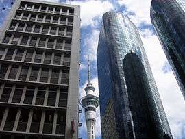
- Auckland (1,628,900) is divided into four urban zones:
- Northern Auckland Urban Zone (323,500):
- the part of Rodney District known as the Hibiscus Coast, from Waiwera south, including Orewa and the Whangaparaoa Peninsula
- all of North Shore City
- Western Auckland Urban Zone (242,300):
- the part of Rodney District around Kumeu
- the urban part of Waitakere City
- Central Auckland Urban Zone (525,900): Auckland City, excluding the Hauraki Gulf islands
- Southern Auckland Urban Zone (478,400):
- the urban part of Manukau City
- Papakura District
- Whangapouri Creek and Runciman in Franklin District
- Northern Auckland Urban Zone (323,500):
- Hamilton (241,200) is divided into three urban zones:
- Hamilton Urban Zone (203,100): all of Hamilton City and neighbouring parts of Waikato and Waipa districts including Ngaruawahia, Taupiri and Ohaupo
- Cambridge Urban Zone (20,600): includes Leamington
- Te Awamutu Urban Zone (17,500): includes Kihikihi
- Tauranga (141,600): Omokoroa to Papamoa Beach; and Mount Maunganui to Tauriko and Pyes Pa
- Rotorua (59,500): Ngongotaha to Owhata
- Gisborne (37,200): Makaraka to Okitu
- Napier-Hastings (134,500) is a conurbation of two urban zones:
- New Plymouth (58,300): Oakura to Bell Block
- Wanganui (40,900): Westmere to Marybank
- Palmerston North (86,600): Including Longburn, Kairanga and Stony Creek, but excluding Ashhurst and rural areas in the Tararua foothills
- Kapiti (42,700): Pekapeka to Paekakariki
- Wellington (418,500) is divided into four urban zones:
- Upper Hutt (41,200): Te Marua to Pinehaven
- Lower Hutt (105,200): includes Wainuiomata, Petone and the eastern bays, excludes farmland adjacent to Wainuiomata
- Porirua (56,700): all of Porirua City except Paekakariki Hill and Mana Island; includes Pukerua Bay and Pauatahanui
- Wellington City (215,400): from Linden south, includes Horokiwi but excludes Makara and Ohariu
South Island
- Nelson (67,500): from Glenduan to the Wairoa River, includes Richmond but excludes Whangamoa
- Blenheim (31,600): From Renwick to Riverlands and south to Wither Hills
- Christchurch (404,500): Christchurch City, Kaiapoi, and up to the Waimakariri River, Prebbleton, Tai Tapu and Lyttelton Harbour including Diamond Harbour
- Dunedin (122,000): from Mosgiel and Brighton to Pine Hill, Ravensbourne to Aramoana
- Invercargill (51,200): Makarewa to Woodend and west to Otatara
Description of secondary urban areas
The population figures shown are Statistics New Zealand's resident population estimates at the June 2018.[5] The following towns are listed by location from north to south.
North Island
- Pukekohe (31,400): From Paerata to Tuakau. Excludes Bombay.
- Whakatane (19,750): From Coastlands to Ohope Beach and south to Poroporo.
- Tokoroa (14,050): From Tokoroa to Kinleith.
- Taupo (24,700): From Wairakei to Taupo Airport.
- Hawera (12,150): From Normanby to Mokoia.
- Feilding (16,850): From Halcombe to Aorangi.
- Levin (21,200): From Waitarere Beach to Ohau.
- Masterton (22,200): From Opaki to Waingawa.
South Island
- Greymouth (9,700): From Runanga to Southbeach and Camerons.
- Rangiora (18,300): From the Ashley River to Flaxton
- Ashburton (20,200): From Fairton to Winslow and Argyle Park.
- Timaru (29,100): From Washdyke to Scarborough and west to Gleniti.
- Queenstown (15,850): From Fernhill and Kelvin Heights to Frankton
- Oamaru (13,950): From Pukeuri to Weston and Holmes Hill.
Minor urban areas
North Island
- Taipa Bay-Mangonui (2,050)
- Kaitaia (5,860)
- Kerikeri (7,520)
- Paihia (2,010)
- Kawakawa (1,520)
- Moerewa (1,680)
- Kaikohe (4,560)
- Dargaville (5,180)
- Ngunguru (1,810)
- Mangawhai Heads (1,530)
- Wellsford (2,100)
- Warkworth (4,890)
- Snells Beach (5,040)
- Helensville (3,150)
- Waiheke Island (9,770)
- Waiuku (9,780)
- Coromandel (1,750)
- Whitianga (5,080)
- Tairua (1,430)
- Thames (7,350)
- Whangamata (3,960)
- Ngatea (1,420)
- Paeroa (4,410)
- Waihi (5,150)
- Te Kauwhata (1,820)
- Huntly (8,150)
- Raglan (3,310)
- Otorohanga (2,750)
- Te Kuiti (4,640)
- Te Aroha (4,350)
- Morrinsville (7,870)
- Matamata (7,920)
- Putaruru (4,100)
- Turangi (3,320)
- Waihi Beach (2,220)
- Katikati Community (4,710)
- Te Puke Community (8,350)
- Edgecumbe (1,780)
- Kawerau (7,080)
- Murupara (1,780)
- Opotiki (4,320)
- Wairoa (4,290)
- Waipawa (2,160)
- Waipukurau (4,220)
- Waitara (7,040)
- Inglewood (3,630)
- Stratford (5,740)
- Eltham (2,070)
- Opunake (1,360)
- Patea (1,160)
- Taumarunui (4,720)
- Ohakune (1,160)
- Raetihi (1,140)
- Waiouru (930)
- Taihape (1,730)
- Marton (4,950)
- Bulls (1,770)
- Dannevirke (5,360)
- Woodville (1,500)
- Pahiatua (2,570)
- Foxton Community (4,720)
- Shannon (1,390)
- Otaki (6,410)
- Carterton (5,320)
- Greytown (2,380)
- Featherston (2,480)
- Martinborough (1,680)
South Island
- Takaka (1,330)
- Motueka (8,450)
- Mapua (2,270)
- Brightwater (2,040)
- Wakefield (2,360)
- Picton (4,350)
- Westport (3,960)
- Reefton (990)
- Hokitika (3,590)
- Kaikoura (2,150)
- Amberley (1,790)
- Oxford (2,170)
- Woodend (3,110)
- Darfield (2,230)
- Rolleston (16,250)
- Lincoln (6,100)
- Leeston (1,870)
- Methven (1,880)
- Rakaia (1,240)
- Geraldine (2,500)
- Temuka (4,370)
- Pleasant Point (1,390)
- Twizel Community (1,280)
- Waimate (2,890)
- Wanaka (8,890)
- Arrowtown (2,950)
- Cromwell (5,160)
- Alexandra (5,510)
- Waikouaiti (1,170)
- Milton (1,950)
- Balclutha (3,990)
- Te Anau (2,140)
- Gore (9,910)
- Winton (2,370)
- Riverton (1,490)
- Bluff (1,870)
Changes to classification
- 1992
Original classification
- 1996
No change
- 2001
- Kapiti promoted from secondary to main urban area
- Rolleston added as minor urban area
- Pauanui Beach dropped to rural centre
- 2006
- Edgecumbe Community renamed Edgecumbe
- 2013
- Blenheim promoted from secondary to main urban area
- Rangiora and Queenstown promoted from minor to secondary urban areas
- Gore demoted from secondary to minor urban area
- Ngunguru, Mangawhai Heads, Te Kauwhata, Ngatea, Mapua, Amberley, Methven, Rakaia and Waikouaiti added as minor urban areas
- Russell, Mangakino, Manaia and Hanmer Springs dropped to rural centres
Lists
References
- 1 2 3 "Urban area: Definition". Statistics New Zealand. Archived from the original on 13 November 2013. Retrieved 8 August 2017.
- ↑ "Subnational Population Estimates Geographic Areas". Statistics New Zealand. Retrieved 8 August 2017.
- 1 2 "Geographic definitions". Statistics New Zealand. Retrieved 8 August 2017.
- ↑ "Defining urban and rural New Zealand". Statistics New Zealand. Retrieved 8 August 2017.
- 1 2 "Subnational Population Estimates: At 30 June 2018 (provisional)". Statistics New Zealand. 23 October 2018. Retrieved 23 October 2018. For urban areas, "Subnational population estimates (UA, AU), by age and sex, at 30 June 1996, 2001, 2006-18 (2018 boundary)". Statistics New Zealand. 23 October 2018. Retrieved 23 October 2018.