Darfield, New Zealand
| Darfield | |
|---|---|
| Minor urban area | |
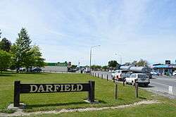 Darfield sign on New Zealand State Highway 73, the main street of Darfield | |
 Darfield | |
| Coordinates: 43°29′S 172°07′E / 43.483°S 172.117°ECoordinates: 43°29′S 172°07′E / 43.483°S 172.117°E | |
| Country |
|
| Region | Canterbury |
| Territorial authority | Selwyn District |
| Electorates |
Selwyn Te Tai Tonga[1] |
| Population (June 2017)[2] | |
| • Total | 2,200 |
| Time zone | UTC+12 (NZST) |
| • Summer (DST) | UTC+13 (NZDT) |
| Postcode(s) | 7510 |
| Area code(s) | 03 |
| Local iwi | Ngāi Tahu |
Darfield is a town in the Selwyn District of the South Island of New Zealand. It is 35 kilometres west of the outskirts of Christchurch on State Highway 73 (Great Alpine Highway) and on the Midland railway line, route of the TranzAlpine train service. Its population (GeoNames geographical database 2011) is 1,593.
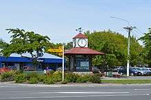
Darfield is the main town between Christchurch and the West Coast region. It is often called "The township under the nor'west arch" in reference to a characteristic weather phenomenon that often creates an arch of cloud in an otherwise clear sky to the west of the township. This is caused by the condensation of water particles channelled upwards over the Southern Alps. Darfield has an intermediate/high school, and a primary school, as well as several shops.
Darfield lies in the Malvern district's arable and pastoral farming area. It is a gateway to the scenic Waimakariri and Rakaia rivers and the Southern Alps, and is also a popular lift-off place for hot air ballooning.
Fonterra has a milk powder factory near the town. The factory has a series of sidings and a container loading centre.[3]
A magnitude 7.1 earthquake occurred near Darfield at 4:35 am on 4 September 2010, causing widespread damage to both the town and to surrounding areas including the city of Christchurch.[4]
Notable people from Darfield
- John Wright (5 July 1954), New Zealand cricketer and former coach of the Indian national cricket team
- Mary Clinton (8 May 1960), New Zealand field hockey player
- Brian Connell (23 April 1956), politician
- James Te Huna (29 September 1981), first New Zealander to enter the UFC, 2010 (Ultimate Fighting Championships)
References
- ↑ http://www.elections.org.nz/mapping/
- ↑ "Subnational Population Estimates: At 30 June 2017 (provisional)". Statistics New Zealand. 24 October 2017. Retrieved 24 October 2017. For urban areas, "Subnational population estimates (UA, AU), by age and sex, at 30 June 1996, 2001, 2006-16 (2017 boundary)". Statistics New Zealand. 24 October 2017. Retrieved 24 October 2017.
- ↑ "KiwiRail opens South Island Freight Link". International Railway Journal. 20 April 2013.
- ↑ Booker, Jarrod (4 September 2010). ""Extremely violent" 7.4 quake hits Christchurch". The New Zealand Herald.
External links
| Wikimedia Commons has media related to Darfield, New Zealand. |