Socorro Mission
|
Socorro Mission | |
 Socorro Mission | |
 Socorro Mission  Socorro Mission | |
| Location | 328 S. Nevarez Rd, Socorro, Texas |
|---|---|
| Coordinates | 31°39′33.64″N 106°18′12.55″W / 31.6593444°N 106.3034861°WCoordinates: 31°39′33.64″N 106°18′12.55″W / 31.6593444°N 106.3034861°W |
| Area | 11 acres (4.5 ha) |
| Built | 1682 |
| NRHP reference # | 72001359[1] |
| TSAL # | 8200000247 |
| RTHL # | 3407 |
| Significant dates | |
| Added to NRHP | March 16, 1972 |
| Designated TSAL | December 18, 1992 |
| Designated RTHL | 1963 |
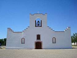
The original Franciscan mission, Nuestra Señora de la Concepción del Socorro, was founded in 1682 by the Franciscan order, to serve displaced Spaniard families, American Indians (the Piro, Tano and Jemez) from New Mexico, who fled the central New Mexico region during the Pueblo Revolt. The present Socorro Mission was constructed around 1840 to replace an earlier 18th-century mission destroyed in 1829 by flooding of the Rio Grande. The mission, constructed of adobe surfaced with stucco, is particularly notable for its interior. The finely painted and decorated beams, or vigas, are from the 18th-century mission and were reused when the present church was constructed. The massing, details and use of decorative elements of the Socorro Mission show strong relationships to the building traditions of 17th-century Spanish New Mexico.
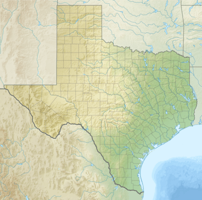
The Socorro Mission is located at 328 S. Nevarez Rd. south of El Paso on I-10 at Moon Rd. and FM 258. It is open to the public Monday-Friday, 8:00am to 4:00pm.
See also
References
- ↑ National Park Service (2010-07-09). "National Register Information System". National Register of Historic Places. National Park Service.
External links
| Wikimedia Commons has media related to Socorro Mission. |
- National Park Service site
- El Paso Diocese: La Purísima Parish –Socorro Mission
- Socorro Mission Preservation Project - El Paso County

