Southern Albemarle Rural Historic District
|
Southern Albemarle Rural Historic District | |
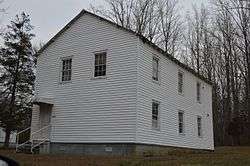 Masonic building at Alberene and Plank Roads | |
  | |
| Location | Roughly bounded by the Rivanna River, Virginia State Route 20, Green Mt., James River, Blenheim, Jefferson Mill Rolling & Milton Rds. & Monroe Parkway, near Charlottesville, Virginia |
|---|---|
| Coordinates | 37°52′22″N 78°31′02″W / 37.87278°N 78.51722°WCoordinates: 37°52′22″N 78°31′02″W / 37.87278°N 78.51722°W |
| Area | 83,627 acres (33,843 ha) |
| Built | 1729 |
| Architect | multiple |
| Architectural style | Georgian, Federal, et al. |
| NRHP reference # | 07001236[1] |
| VLR # | 002-5045 |
| Significant dates | |
| Added to NRHP | November 28, 2007 |
| Designated VLR | June 6, 2007[2] |
Southern Albemarle Rural Historic District is a national historic district located near Charlottesville, Albemarle County, Virginia. The district encompasses 1,284 contributing buildings, 96 contributing sites, 486 contributing structures, and 3 contributing objects. It includes a variety of large farms, historic villages, and crossroads communities. The district includes 23 properties previously listed on the National Register of Historic Places.[3]
It was added to the National Register of Historic Places in 2007.[1]
References
- 1 2 National Park Service (2010-07-09). "National Register Information System". National Register of Historic Places. National Park Service.
- ↑ "Virginia Landmarks Register". Virginia Department of Historic Resources. Retrieved 2013-05-12.
- ↑ Jennifer Hallock; Gardiner Hallock & Kristie Baynard (February 2007). "National Register of Historic Places Inventory/Nomination: Southern Albemarle Rural Historic District" (PDF). , Accompanying four photos, and Accompanying map


This article is issued from
Wikipedia.
The text is licensed under Creative Commons - Attribution - Sharealike.
Additional terms may apply for the media files.