Mtwara Region
| Mtwara Region Mkoa wa Mtwara (Swahili) | |
|---|---|
| Region | |
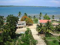 The Mikindani Bay. | |
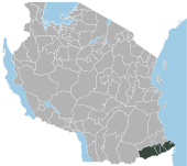
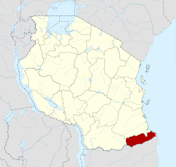 Location in Tanzania | |
| Country | Tanzania |
| Capital | Mtwara |
| Area | |
| • Total | 16,710 km2 (6,450 sq mi) |
| Population (2012) | |
| • Total | 1,270,854 |
| • Density | 76/km2 (200/sq mi) |
| Time zone | UTC+3 (EAT) |
| Postcode | 63xxx |
| Area code(s) | 023 |
| Website | Regional website |
Mtwara Region is one of Tanzania's 31 administrative regions. The regional capital is the municipality of Mtwara. According to the 2012 national census, the region had a population of 1,270,854, which was lower than the pre-census projection of 1,374,767.[1]:page 2 For 2002-2012, the region's 1.2 percent average annual population growth rate was the 26th highest in the country.[1]:page 4 It was also the fourteenth most densely populated region with 76 people per square kilometer.[1]:page 6
The boundary with Mozambique to the south is formed by the Ruvuma River. To the west, Mtwara is bordered by Ruvuma Region, to the north by Lindi Region, and to the east is the Indian Ocean.
Development of the Mtwara Region has been constrained by the lack of highway and energy infrastructures. The Dar es Salaam-Kibiti-Lindi-Mtwara road has been improved by the completion of the Mkapa Bridge over the Rufiji River. Mnazi Bay gas promises to provide reliable and adequate electricity for powering industrial and commercial activities in the region.
The regional commissioner of the Mtwara Region is Anatoli A. Tarimo.[2]
History
The Groundnut Scheme
In 1948, the British Government formulated the "Tanganyika groundnut scheme" through the Overseas Food Corporation (OFC). The purpose was to alleviate the worldwide shortage of vegetable oils; however, inadequate research and adverse environmental conditions due to poor planning resulted in the complete and disastrous failure of the scheme. In this region the exported crop was to go through the port of Mtwara which was created for the scheme and linked to the growing areas near Nachingwea by a new railway.
Districts
The region is administratively divided as five districts with Mtwara Municipal and Masasi Town having separate councils:
| Districts of Mtwara Region | |||||
|---|---|---|---|---|---|
| Map | District | Population (2012) | |||
 |
Masasi | 350,689 | |||
| Mtwara | 336,302 | ||||
| Nanyumbu | 150,857 | ||||
| Newala | 205,492 | ||||
| Tandahimba | 227,514 | ||||
| Total | 1,270,854 | ||||
https://web.archive.org/web/20140413063741/http://www.nbs.go.tz/sensa/popu2.php
References
| Mainland | ||
|---|---|---|
| Zanzibar | ||