Les Roches-l'Évêque
| Les Roches-l'Évêque | ||
|---|---|---|
| Commune | ||
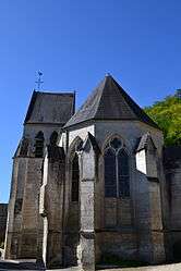 Church of Saint-Almire | ||
| ||
 Les Roches-l'Évêque Location within Centre-Val de Loire region  Les Roches-l'Évêque | ||
| Coordinates: 47°46′38″N 0°53′32″E / 47.7772°N 0.8922°ECoordinates: 47°46′38″N 0°53′32″E / 47.7772°N 0.8922°E | ||
| Country | France | |
| Region | Centre-Val de Loire | |
| Department | Loir-et-Cher | |
| Arrondissement | Vendôme | |
| Canton | Montoire-sur-le-Loir | |
| Intercommunality | Pays de Ronsard | |
| Government | ||
| • Mayor (2014–2020) | Jocelyne Pesson | |
| Area1 | 2.4 km2 (0.9 sq mi) | |
| Population (2014)2 | 278 | |
| • Density | 120/km2 (300/sq mi) | |
| Time zone | UTC+1 (CET) | |
| • Summer (DST) | UTC+2 (CEST) | |
| INSEE/Postal code | 41192 /41800 | |
| Elevation |
66–134 m (217–440 ft) (avg. 134 m or 440 ft) | |
|
1 French Land Register data, which excludes lakes, ponds, glaciers > 1 km2 (0.386 sq mi or 247 acres) and river estuaries. 2 Population without double counting: residents of multiple communes (e.g., students and military personnel) only counted once. | ||
.svg.png)
Les Roches-l'Évêque is a commune in the Loir-et-Cher department in central France.
Population
| Historical population | ||
|---|---|---|
| Year | Pop. | ±% |
| 1793 | 585 | — |
| 1806 | 615 | +5.1% |
| 1821 | 569 | −7.5% |
| 1831 | 624 | +9.7% |
| 1841 | 675 | +8.2% |
| 1851 | 640 | −5.2% |
| 1861 | 589 | −8.0% |
| 1872 | 595 | +1.0% |
| 1881 | 573 | −3.7% |
| 1891 | 537 | −6.3% |
| 1901 | 509 | −5.2% |
| 1911 | 487 | −4.3% |
| 1921 | 412 | −15.4% |
| 1931 | 356 | −13.6% |
| 1946 | 297 | −16.6% |
| 1954 | 312 | +5.1% |
| 1962 | 320 | +2.6% |
| 1968 | 322 | +0.6% |
| 1975 | 284 | −11.8% |
| 1982 | 256 | −9.9% |
| 1990 | 302 | +18.0% |
| 1999 | 283 | −6.3% |
| 2007 | 290 | +2.5% |
| 2014 | 278 | −4.1% |
See also
| Wikimedia Commons has media related to Les Roches-l'Évêque. |
This article is issued from
Wikipedia.
The text is licensed under Creative Commons - Attribution - Sharealike.
Additional terms may apply for the media files.