Corinth Township, Humboldt County, Iowa
| Corinth Township | |
|---|---|
| Township | |
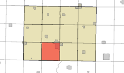 Location in Humboldt County | |
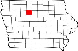 Humboldt County's location in Iowa | |
| Coordinates: 42°41′N 94°16′W / 42.683°N 94.267°WCoordinates: 42°41′N 94°16′W / 42.683°N 94.267°W | |
| Country |
|
| State |
|
| County | Humboldt |
| Established | 1876 |
| Area | |
| • Total | 32.8 sq mi (85 km2) |
| • Land | 32.7 sq mi (85 km2) |
| • Water | 0.1 sq mi (0.3 km2) |
| Elevation | 1,129 ft (344 m) |
| Population (2000) | |
| • Total | 366 |
| • Density | 11/sq mi (4/km2) |
| Time zone | UTC-6 (CST) |
| • Summer (DST) | UTC-5 (CDT) |
| ZIP codes | 50548 (Humboldt) |
| GNIS feature ID | 0467658 |
| U.S. Geological Survey Geographic Names Information System: Corinth Township, Humboldt County, Iowa | |
Corinth Township is one of twelve townships in Humboldt County, Iowa, USA.[1] As of the 2000 census, its unincorporated population was 366. Corinth Township also contains most of the largest town in Humboldt County, Humboldt.
History
Corinth Township was organized in 1879.[2]
Geography
According to the United States Census Bureau, Corinth Township covers an area of 32.8 square miles (85 km2); of this, 32.7 square miles (85 km2) is land and 0.1 square miles (0.26 km2) is water.[1]
Cities, towns, villages
Adjacent townships
- Rutland Township (north)
- Grove Township (northeast)
- Beaver Township (east)
- Badger Township, Webster County (southeast)
- Deer Creek Township, Webster County (south)
- Jackson Township, Webster County (southwest)
- Weaver Township (west)
- Avery Township (northwest)
Cemeteries
The township contains Indian Mound Cemetery, Oakwood Cemetery, and Our Saviors Cemetery.[1] St. Mary's Cemetery is located within the Humboldt city limits.
Political districts
- Iowa's 4th congressional district
- State House District 4
References
- United States Census Bureau 2008 TIGER/Line Shapefiles
- United States Board on Geographic Names (GNIS)
- United States National Atlas
- 1 2 3 4 "Corinth township, Humboldt County, Iowa (IA)." U.S. Census Bureau. Breakdown. Retrieved January 16, 2010.
- ↑ History of Kossuth and Humboldt Counties, Iowa. Union Publishing Company. 1884. p. 733. Note that Google Books misspells "Humboldt".
External links
| Wikimedia Commons has media related to Corinth Township, Humboldt County, Iowa. |
Places adjacent to Corinth Township, Humboldt County, Iowa | |
|---|---|
Municipalities and communities of Humboldt County, Iowa, United States | ||
|---|---|---|
| Cities | ||
| Townships | ||
| Unincorporated community | ||
| Ghost town | ||
| Footnotes | ‡This populated place also has portions in an adjacent county or counties | |
This article is issued from
Wikipedia.
The text is licensed under Creative Commons - Attribution - Sharealike.
Additional terms may apply for the media files.