Gračanica, Bosnia and Herzegovina
| Gračanica Грачаница | |
|---|---|
| Town and municipality | |
 | |
 Location of Gračanica, Bosnia and Herzegovina within Bosnia and Herzegovina. | |
| Country | Bosnia and Herzegovina |
| Entity | The Federation |
| Canton | Tuzla Canton |
| Government | |
| • Municipality president | Nusret Helić (SDP) |
| Area | |
| • Total | 216 km2 (83 sq mi) |
| Population (2013 census) | |
| • Total | 45,220 |
| • Density | 209.35/km2 (542.2/sq mi) |
| Time zone | UTC+1 (CET) |
| • Summer (DST) | UTC+2 (CEST) |
| Area code(s) | +387 35 |
| Website |
www |
Gračanica is a town and a municipality located in Tuzla Canton of the Federation of Bosnia and Herzegovina, an entity of Bosnia and Herzegovina. It is located in northeastern Bosnia and Herzegovina, east of Doboj and west of Tuzla. As of 2013, it has a population of 45,220 inhabitants.
Gračanica
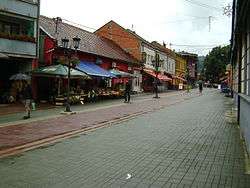
Gračanica is located in the lower valley of the River Spreča along the main road from Tuzla to Doboj, about 50 km west of Tuzla.
Municipality
The Gračanica municipality is currently the home of about 49,000 people. Villages around the town are:
• Babići • Boljanić • Bosansko Petrovo Selo • Doborovci • Donja Lohinja • Džakule • Gornja Lohinja • Gračanica • Kakmuž • Karanovac • Lendići • Lukavica • Malešići • Miričina • Orahovica Donja • Orahovica Gornja • Piskavica • Porječina • Pribava • Prijeko Brdo • Rašljeva • Skipovac Donji • Skipovac Gornji • Sočkovac • Soko • Stjepan Polje • Škahovica • Vranovići
The Gračanica municipality covers 219 square kilometers.
History
First writings about Gračanica were found in Turkish archives from 1528, in which Gračanica was known by its iron mine. Some 4 km (2.5 mi) away from the town was a middle age fortress named Sokol. Gračanica got the status of a town in 1548. It grew bigger during the 17th century, with the help of Ahmed-paša Budimlija, who built the White Mosque, a public bath and a clock tower. Through the time of Austrian Empire, Gračanica experienced huge economic, urban and culture development. From 1929-41, Gračanica was part of the Vrbas Banovina of the Kingdom of Yugoslavia.
Climate
The average temperature during January is 1.8 °C (35.2 °F), and during July 23.3 °C (73.9 °F).
This area is characteristic for small quantity of downfalls, which average year amount is 830mm/m2. Maximum quantity of downfalls is in May (121mm) and June (101mm), and minimum in March (41mm). Snowfalls are most often at January, February and March (Average: 50 days in a year). Gračanica is area with continental climate type.
Demographics
| Ethnic Composition | |||||||||||||
| Year | Serbs | % | Bosniaks | % | Croats | % | Yugoslavs | % | others | % | Total | ||
|---|---|---|---|---|---|---|---|---|---|---|---|---|---|
| 1961 | 8,543 | 28.29% | 20,726 | 68.62% | 171 | 0.57% | 686 | 2.27% | 77 | 0.25% | 30,203 | ||
| 1971 | 13,135 | 27.97% | 33,135 | 70.57% | 199 | 0.42% | 184 | 0.39% | 297 | 0.65% | 46,950 | ||
| 1981 | 13,226 | 24.35% | 38,189 | 70.32% | 135 | 0.25% | 2,359 | 4.34% | 402 | 0.74% | 54,311 | ||
| 1991 | 13,566 | 22.97% | 42,628 | 72.19% | 135 | 0.23% | 1,501 | 2.54% | 1,220 | 2.07% | 59,050 | ||
References
- Official results from the book: Ethnic composition of Bosnia-Herzegovina population, by municipalities and settlements, 1991. census, Zavod za statistiku Bosne i Hercegovine - Bilten no.234, Sarajevo 1991.
Twin towns
Notable people
- Branko Cvetković, basketball player
- Muhamed Konjić, football player
- Nebojša Radmanović, politician
- Mitar Lukić, football player
- Vedin Musić, football player
- Edvin Kanka Ćudić, human rights defender
- Prof. dr Ilija Babić, law professor
External links
Municipalities of the Tuzla Canton | ||
|---|---|---|
Coordinates: 44°41′21″N 18°18′08″E / 44.68917°N 18.30222°E
| Wikimedia Commons has media related to Gračanica, Bosnia and Herzegovina. |
| Authority control |
|---|