Donji Žabar
| Donji Žabar Доњи Жабар | |
|---|---|
| Village and municipality | |
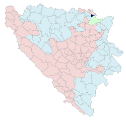 Location of Donji Žabar within Bosnia and Herzegovina | |
| Coordinates: 44°56′29″N 18°38′46″E / 44.9414°N 18.6461°ECoordinates: 44°56′29″N 18°38′46″E / 44.9414°N 18.6461°E | |
| Country | Bosnia and Herzegovina |
| Entity | Republika Srpska |
| Government | |
| • Mayor | Nikola Djokanović (SRS) |
| • Municipality | 46.76 km2 (18.05 sq mi) |
| Population (2013 census) | |
| • Municipality | 3,809 |
| • Municipality density | 81/km2 (210/sq mi) |
| Time zone | UTC+1 (CET) |
| • Summer (DST) | UTC+2 (CEST) |
| Area code(s) | 54 |
Donji Žabar (Serbian Cyrillic: Доњи Жабар) is a village and municipality located in Republika Srpska, an entity of Bosnia and Herzegovina. As of 2013, it has a population of 3,809 inhabitants.
History
Municipality was also known as Srpsko Orašje (Српско Орашје), and was created from part of the pre-war municipality of Orašje (the other part of the pre-war municipality is now in the Federation of Bosnia and Herzegovina).
Demographics
According to the 2013 census results, the municipality has 3,809 inhabitants.
Ethnic groups
- 1991
In 1991, the population of Donji Žabar village numbered 1,407 people of whom 1,388 (99%) were ethnic Serbs.
- 2013
| Municipality | Nationality | Total | |||||
|---|---|---|---|---|---|---|---|
Bosniaks |
% |
Croats |
% |
Serbs |
% | ||
| Donji Žabar | 5 | 0.13 | 1,029 | 27.01 | 2,759 | 72.43 | 3,809 |
Page text.[1]
See also
References
External links
| Wikimedia Commons has media related to Donji Žabar. |
This article is issued from
Wikipedia.
The text is licensed under Creative Commons - Attribution - Sharealike.
Additional terms may apply for the media files.