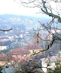
Stanari
| Stanari Станари | |
|---|---|
| Town and municipality | |
 Stanari | |
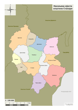 Municipality map | |
 Stanari Municipality map | |
| Coordinates: 44°44′50″N 17°49′46″E / 44.74722°N 17.82944°ECoordinates: 44°44′50″N 17°49′46″E / 44.74722°N 17.82944°E | |
| Country | Bosnia and Herzegovina |
| Entity | Republika Srpska |
| Re-established | 2014 |
| Government | |
| • Mayor | Dušan Panić (SNSD) |
| Area | |
| • Total | 165 km2 (64 sq mi) |
| Population (2013) | |
| • Total | 6,958 |
| • Density | 42/km2 (110/sq mi) |
| Time zone | UTC+1 (CET) |
| • Summer (DST) | UTC+2 (CEST) |
| Website |
www |
Stanari (Serbian Cyrillic: Станари) is a town and municipality located in Republika Srpska, an entity of Bosnia and Herzegovina. It was established in 2014, after it split from Doboj municipality.
Geography
The municipality is located in the basin of the Ukrina river in the northern part of Republika Srpska.
History
The Stanari municipality was dissolved in 1958. The area was administratively part of the Doboj municipality[1] until 2014, when the Stanari municipality was re-created.[2]
Settlements
Aside from the town of Stanari, the following settlements comprise the municipality:
Demographics
According to the preliminary results of the 2013 census, there were 1,123 inhabitants in the settlement of Stanari and 6,958 inhabitants in municipality.
References
- ↑ Official results from the book: Ethnic composition of Bosnia-Herzegovina population, by municipalities and settlements, 1991. census, Zavod za statistiku Bosne i Hercegovine - Bilten no. 234, Sarajevo 1991
- ↑ http://pressrs.ba/sr/vesti/vesti_dana/story/69264/Osnovana+op%C5%A1tina+Stanari.html. Missing or empty
|title=(help)
| Wikimedia Commons has media related to Stanari. |
This article is issued from
Wikipedia.
The text is licensed under Creative Commons - Attribution - Sharealike.
Additional terms may apply for the media files.