Mrkonjić Grad
| Mrkonjić Grad Мркоњић Град | ||
|---|---|---|
| Town and municipality | ||
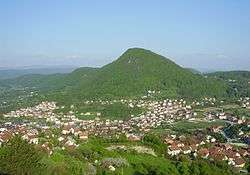 View on Mrkonjić Grad | ||
| ||
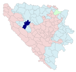 Location of Mrkonjić Grad within Republika Srpska | ||
| Coordinates: 44°25′N 17°05′E / 44.417°N 17.083°ECoordinates: 44°25′N 17°05′E / 44.417°N 17.083°E | ||
| Country | Bosnia and Herzegovina | |
| Entity | Republika Srpska | |
| Government | ||
| • Mayor | Divna Aničić (SNSD) [1] | |
| Area | ||
| • Total | 677.43 km2 (261.56 sq mi) | |
| Population (2013 census) | ||
| • Total | 16,671 | |
| • Density | 25/km2 (64/sq mi) | |
| Time zone | UTC+1 (CET) | |
| • Summer (DST) | UTC+2 (CEST) | |
| Area code(s) | 50 | |
.svg.png)
Mrkonjić Grad (Serbian Cyrillic: Мркоњић Град; pronounced [mr̩koɲit͡ɕ grad]) is a town and municipality located in western Republika Srpska, an entity of Bosnia and Herzegovina. It is located in the region of Bosanska Krajina, between Banja Luka and Jajce. As of 2013, it has a population of 16,671 inhabitants.
Name
The town changed its name several times in history: Gornje Kloke, Novo Jajce, Varcarev Vakuf, Varcar Vakuf, and ultimately the present one. The last renaming took place in 1924 after King Peter I of Serbia, who had taken the nom de guerre "Mrkonjić" while fighting in the uprising (1875–78) against the Ottoman Empire.
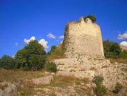
History
.jpg)
From 1929 to 1941, Mrkonjić Grad was part of the Vrbas Banovina of the Kingdom of Yugoslavia.
In World War II, the town became renowned by the first meeting of ZAVNOBiH on 25 November 1943, when Bosnia and Herzegovina was proclaimed as a common republic of Serbs, Croats and Muslims.
During the Bosnian War from 1992 to 1995, the town was within the territory controlled by Bosnian Serbs. The town is also known for the Mrkonjić Grad incident where the USAF lost one F-16 in June 1995.[2] The pilot of the jet, Scott O'Grady, was stranded in the area for six days before being rescued by US Marines. In 8–12 October 1995, Mrkonjić Grad was in the hands of the Croatian Army (HV) and the Croatian Defence Council (HVO).
After the Dayton peace agreement the town was assigned to the entity of Republika Srpska.[3] In 1996, a mass grave containing the bodies of 181 Serbs—mostly civilians—was uncovered in Mrkonjić Grad. Almost all were killed by Bosniak and Croat forces in late 1995.[4]
Demographics
| Historical population | ||
|---|---|---|
| Year | Pop. | ±% p.a. |
| 1948 | 29,178 | — |
| 1953 | 31,127 | +1.30% |
| 1971 | 30,159 | −0.18% |
| 1981 | 29,684 | −0.16% |
| 1991 | 37,379 | +2.33% |
| 2013 | 16,671 | −3.60% |
According to the 2013 census results, the municipality has 16,671 inhabitants.
Ethnic groups
- 1910
According to the 1910 census, the majority in the Varcar Vakuf municipality were Serbian Orthodox Christians.
- 1971
30,159 total
- 22,735 Serbs (75.38%)
- 4,990 Bosniaks (16.55%)
- 2,204 Croats (7.31%)
- 98 Yugoslavs (0.32%)
- 133 others (0.44%)
- 1981
29,684 total
- 23,009 Serbs (77.51%)
- 3,364 Bosniaks (11.33%)
- 2,290 Croats (7.71%)
- 855 Yugoslavs (2.88%)
- 166 others (0.56%)
- 1991
In the 1991 census, the municipality of Mrkonjić Grad had 37,379 residents, including:
- 33,275 Serbs
- 1,159 Bosniaks
- 2,141 Croats
- 584 Yugoslavs
- 220 others
Tourism
The Balkana Lake lies near the town and presents a small, but beautiful tourist resort including the nearby Skakavac Waterfall.
Gallery
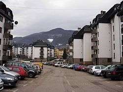 Residential town area
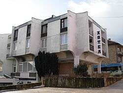 Hotel Krajina
See also
References
- ↑ "2004 Nacelnici" (PDF). Archived from the original (PDF) on December 21, 2006. Retrieved February 8, 2016.
- ↑ "AFSOUTH Fact sheets". AF South Nato. 2011-03-07. Retrieved 2016-08-06.
- ↑ "Dayton Accords - international agreement". Encyclopædia Britannica. Retrieved 2016-08-06.
- ↑ "Another Mass Grave Is Excavated in Bosnia". The New York Times. 6 April 1996. Retrieved 26 September 2014.
External links
| Wikimedia Commons has media related to Mrkonjić Grad. |
- Municipality of Mrkonjić Grad
- Mrkonjić Grad Guide
- Mrkonjić Grad - Internet - Live & Exclusive from MG
- Mrkonjić Grad Portal
- Zelenkovac Art gallery
| Authority control |
|---|