Laktaši
| Laktaši Лакташи | ||
|---|---|---|
| Town and municipality | ||
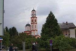 Serbian Orthodox church in Laktaši | ||
| ||
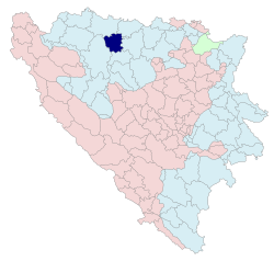 Location of Laktaši (municipality) within Republika Srpska | ||
 Laktaši Location of Laktaši (town) | ||
| Coordinates: 44°54′N 17°18′E / 44.900°N 17.300°E | ||
| Country | Bosnia and Herzegovina | |
| Entity | Republika Srpska | |
| Geographical region | Bosanska Krajina | |
| Government | ||
| • Mayor | Miroslav Kodžoman (SNSD) | |
| • Municipality | 388.37 km2 (149.95 sq mi) | |
| Population (2013 census) | ||
| • Town | 5,879 | |
| • Municipality | 34,966 | |
| • Municipality density | 90/km2 (230/sq mi) | |
| Time zone | UTC+1 (CET) | |
| • Summer (DST) | UTC+2 (CEST) | |
| Area code(s) | 51 | |
| Website |
www | |
.svg.png)
Laktaši (Serbian Cyrillic: Лакташи) is a town and municipality located in Republika Srpska, an entity of Bosnia and Herzegovina. As of 2013, it has a population of 34,966 inhabitants.
Geography
It is located between municipalities of Gradiška and Srbac in the north, Prnjavor in the east, Čelinac in the south, and Banja Luka in the west.
Demographics
| Historical population | ||
|---|---|---|
| Year | Pop. | ±% p.a. |
| 1961 | 26,021 | — |
| 1971 | 25,997 | −0.01% |
| 1981 | 27,676 | +0.63% |
| 1991 | 29,910 | +0.78% |
| 2013 | 34,966 | +0.71% |
According to the 2013 census results, the municipality of Laktaši has a population of 34,966 inhabitants.
Ethnic groups
The ethnic composition of the municipality:
| Ethnic group | Population 1971[1] |
Population 1981[2] |
Population 1991 |
Population 2013[3] |
|---|---|---|---|---|
| Serbs | 21,986 | 21,642 | 24,438 | 33,462 |
| Croats | 2,731 | 2,512 | 2,584 | 521 |
| Bosniaks/Muslims | 341 | 244 | 506 | 112 |
| Yugoslavs | 84 | 2,260 | 1,491 | - |
| Others | 855 | 1,072 | 891 | 871 |
| Total | 25,997 | 27,676 | 29,910 | 34,966 |
Sport
The local football club, FK Laktaši, plays in the Second League of Republika Srpska. It is most prominently known for its successful Basketball team KK Igokea based in Aleksandrovac. They are the most recent Bosnian League champions and are one of the 2 teams from Bosnia and Herzegovina playing in the Adriatic League and are regular competitors in the Euro Cup.
Gallery
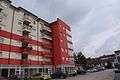 Street in Laktaši
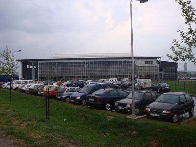 Sports hall in Laktaši
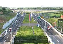 Motorway going through Laktaši
References
- ↑ "Nacionalni Sastav Stanovništva SFR Jugoslavije" (PDF). stat.gov.rs (in Serbian). Republički zavod za statistiku (Srbija). Archived from the original (PDF) on 4 March 2016. Retrieved 24 December 2016.
- ↑ "Nacionalni Sastav Stanovništva SFR Jugoslavije" (PDF). stat.gov.rs (in Serbian). Republički zavod za statistiku (Srbija). Archived from the original (PDF) on 4 March 2016. Retrieved 24 December 2016.
- ↑ "POPIS STANOVNIŠTVA, DOMAĆINSTAVA I STANOVA U BOSNI I HERCEGOVINI, 2013. REZULTATI POPISA" (PDF). popis2013.ba (in Serbian). Retrieved 15 December 2016.
See also
External links
| Wikimedia Commons has media related to Laktaši. |