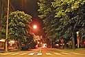
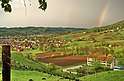
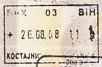
Kostajnica, Bosnia and Herzegovina
| Kostajnica Костајница | ||
|---|---|---|
| Town and municipality | ||
   | ||
| ||
| Nickname(s): The city of chestnut | ||
 | ||
| Coordinates: 45°13′N 16°32′E / 45.217°N 16.533°ECoordinates: 45°13′N 16°32′E / 45.217°N 16.533°E | ||
| Country | Bosnia and Herzegovina | |
| Entity | Republika Srpska | |
| Government | ||
| • Mayor | Drago Bundalo (SDS[1]) | |
| Area | ||
| • Total | 85,12 km2 (3,287 sq mi) | |
| Elevation | 109 m (358 ft) | |
| Population (2013 census)[2] | ||
| • Total | 5,977 | |
| • Density | 70/km2 (200/sq mi) | |
| Time zone | UTC+1 (CET) | |
| • Summer (DST) | UTC+2 (CEST) | |
| Postal code | 79224 | |
| Area code(s) | +387 (052) | |
| Website |
opstina-kostajnica | |

Kostajnica (Serbian Cyrillic: Костајница),[3] is a town and municipality located in northern Republika Srpska, an entity of Bosnia and Herzegovina. It is situated in the part of the Кrajina[4] region. As of 2013, it has a population of 5,977 inhabitants.
The municipality was created from part of the pre-war municipality of Novi Grad. It is located across the Una from Hrvatska Kostajnica, Croatia.
Name
During the Bosnian War, it was renamed to Srpska Kostajnica (Српска Костајница). After that, name of the town was changed to Kostajnica.[5]
Demographics
According to the 2013 census results, the municipality has 5,977 inhabitants.
Ethnic groups
- 1991
In the 1991 census, Kostajnica was part of the Novi Grad municipality, and its population numbered 3,768 people, including:[6]
Note: The vast majority of those who declared as Muslims by nationality in 1991 have considered themselves Bosniaks since the Bosnian War.
- 2013
| Municipality | Nationality | Total | |||||
|---|---|---|---|---|---|---|---|
Bosniaks |
% |
Croats |
% |
Serbs |
% | ||
| KOSTAJNICA | 1,460 | 24.42 | 86 | 1.43 | 4,315 | 72.19 | 5,977 |
Page text.[7]
History
From 1929 to 1941, Bosanska Kostajnica was part of the Vrbas Banovina of the Kingdom of Yugoslavia.
See also
External links
| Wikimedia Commons has media related to Bosanska Kostajnica. |
- Official website (in Serbian)
- Kostajnica (in Serbian)
References
- ↑ Official results of Local elections in Bosnia and Herzegovina. October 2016.
- ↑ Preliminary Results of the 2013 Census of Population, Households and Dwellings in Bosnia and Herzegovina. Sarajevo. 5 November 2013. Retrieved 5 November 2013
- ↑ the official web site of the municipality, Kostajnica/Костајница.
- ↑ official name of region Archived 2015-06-07 at the Wayback Machine.
- ↑ http://www.opstina-kostajnica.com/
- ↑ See bs:Demografija Bosanskog Novog
- ↑ Link text, additional text.