Istočni Drvar
| Istočni Drvar Источни Дрвар | |
|---|---|
| Village and municipality | |
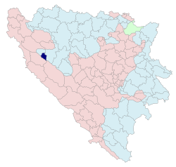 Location of Istočni Drvar within Bosnia and Herzegovina | |
| Coordinates: 44°23′22″N 16°37′25″E / 44.38944°N 16.62361°ECoordinates: 44°23′22″N 16°37′25″E / 44.38944°N 16.62361°E | |
| Country | Bosnia and Herzegovina |
| Entity | Republika Srpska |
| Government | |
| • Mayor | Đuro Josipović (SNSD) |
| Area | |
| • Total | 75.3 km2 (29.1 sq mi) |
| Population (2013 census) | |
| • Total | 79 |
| • Density | 1.0/km2 (2.7/sq mi) |
| Time zone | UTC+1 (CET) |
| • Summer (DST) | UTC+2 (CEST) |
| Area code(s) | 51 |
Istočni Drvar (Serbian Cyrillic: Источни Дрвар) is a village and municipality located in western Republika Srpska, an entity of Bosnia and Herzegovina. It is situated in the central part of the Bosanska Krajina region. It was also known as Srpski Drvar (Српски Дрвар), and was created from part of the pre-war municipality of Drvar (the other part of the pre-war municipality is now in the Federation of Bosnia and Herzegovina).
Geography
It is located in a densely wooded area between municipalities of Drimic in the north-west, Ribnik in the east, and Drvar in the south. The seat of the municipality is in the village of Potoci.
Demographics
According to the 2013 census results, the municipality has 79 inhabitants.
Ethnic groups
The ethnic composition of the municipality:
| Municipality | Nationality | Total | |||||
|---|---|---|---|---|---|---|---|
Bosniaks |
% |
Croats |
% |
Serbs |
% | ||
| Istočni Drvar | 0 | 0.00 | 1 | 1.26 | 78 | 98.73 | 79 |
Page text.[1]
See also
References
External links
| Wikimedia Commons has media related to Istočni Drvar. |