Srebrenik
| Srebrenik Сребреник | |
|---|---|
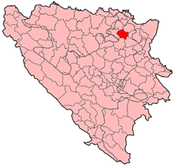 Location of Srebrenik within Bosnia and Herzegovina. | |
 Location of Srebrenik | |
| Coordinates: 44°42′N 18°29′E / 44.700°N 18.483°E | |
| Country |
|
| Government | |
| • Municipality president | Nihad Omerović (SDA) |
| Area | |
| • Total | 248 km2 (96 sq mi) |
| Elevation | 252 m (827 ft) |
| Population (2013 census) | |
| • Total | 39,678 |
| • Density | 159.99/km2 (414.4/sq mi) |
| Time zone | UTC+1 (CET) |
| • Summer (DST) | UTC+2 (CEST) |
| Area code(s) | +387 35 |
| Website |
www |
Srebrenik is a town and municipality located in Tuzla Canton of the Federation of Bosnia and Herzegovina, an entity of Bosnia and Herzegovina. It is located in northeastern Bosnia and Herzegovina, near Tuzla. As of 2013, it has a population of 39,678 inhabitants.
History
Bosnia's best-preserved medieval castle, Srebrenik Fortress, dating from 1333 is located in the outskirts of Srebrenik. The castle was occupied by the Ban of Bosnia Stephen II Kotromanić until his death in 1353.
There are two historical versions related to the Ottoman conquest of Srebrenik. According to one, Srebrenik was taken in 1512, together with Teočak. The other version says that Srebrenik was taken together with Sokol and Tešanj in 1521 by the Bosnian sanjak bey Feriz. Although there is no precise data, it can be assumed that the Srebrenik old town and its fortress were built during the Hungarian rule over Bosnia, while some parts, such as a mosque were built during the Ottoman period.[1]
Demographics
1971
33,620 total
- Bosniaks - 24,628 (73,25%)
- Serbs - 5,489 (16,32%)
- Croats - 3,256 (9,68%)
- Yugoslavs - 34 (0,10%)
- others - 213 (0,65%)
1991
In the 1991 census, the municipality of Srebrenik had 40,882 inhabitants:
2013 Census
| Municipality | Nationality | Total | |||||
|---|---|---|---|---|---|---|---|
Bosniaks |
% |
Croats |
% |
Serbs |
% | ||
| Srebrenik | 35,951 | 90.60 | 1,968 | 4.95 | 394 | 0.99 | 39,678 |
Page text.[2]
List of residential places in Srebrenik municipality
The list from 1991.: Alibasici, Babunovići, Behrami, Brda, Brezik, Brnjičani, Cage, Cerik, Crveno Brdo, Čekanići, Ćehaje, Ćojlučko Polje, Ćojluk, Dedići, Donji Moranjci, Donji Podpeć, Donji Srebrenik, Duboki Potok, Falešići, Gornji Hrgovi, Gornji Moranjci, Novo naselje Polje, Gornji Podpeć, Gornji Srebrenik, Huremi, Jasenica, Ježinac, Kiseljak, Kuge, Like, Lipje, Lisovići, Luka, Ljenobud, Maoča, Podorašje, Previle, Rapatnica, Seona, Sladna, Srebrenik, Straža, Šahmeri, Špionica Centar, Špionica Donja, Špionica Gornja, Špionica Srednja, Tinja Donja, Tinja Gornja, Tutnjevac, Uroža and Zahirovići.
Sport
The local football club, NK Gradina, plays in the First League of the Federation of Bosnia and Herzegovina.
See also
There are numerous famous people in Srebrenik, Which are: Danis Fejzic Singer Mirza Selimovic Singer
External links
References
- ↑ "NERDA - SREBRENIK - investment possibilities". nerda.ba.
- ↑ Link text, additional text.
External links
| Wikimedia Commons has media related to Srebrenik. |
Municipalities of the Tuzla Canton | ||
|---|---|---|