Fraser, Colorado
| Fraser, Colorado | |
|---|---|
| Statutory Town | |
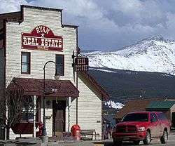
 Cozens Ranch Museum (1874) | |
 Location of Fraser in Grand County, Colorado. | |
| Coordinates: 39°56′39″N 105°48′48″W / 39.94417°N 105.81333°WCoordinates: 39°56′39″N 105°48′48″W / 39.94417°N 105.81333°W | |
| Country | United States |
| State | Colorado |
| County[1] | Grand |
| Established | 1871 |
| Incorporated (town) | June 15, 1953[2] |
| Government | |
| • Type | Statutory Town[1][3] |
| • Mayor | Philip Vandernail[3] |
| Area[4] | |
| • Total | 3.51 sq mi (9.09 km2) |
| • Land | 3.51 sq mi (9.08 km2) |
| • Water | 0.01 sq mi (0.01 km2) |
| Elevation | 8,574 ft (2,613 m) |
| Population (2010) | |
| • Total | 1,224 |
| • Estimate (2016)[5] | 1,252 |
| • Density | 357.10/sq mi (137.86/km2) |
| Time zone | UTC-7 (MST) |
| • Summer (DST) | UTC-6 (MDT) |
| ZIP code[6] | 80442 |
| Area code(s) | 970 |
| FIPS code | 08-28305 |
| GNIS feature ID | 204701[7] |
| Website |
www |
Fraser is a Statutory Town in Grand County, Colorado, United States. The population was 1,224 at the 2010 census.[8] The town is in Middle Park in the valley of the Fraser River along U.S. Highway 40. Its location northwest of Winter Park, the location of a popular ski resort, has provided growth in recent years with new condominium and other real estate developments.
History
Fraser was incorporated in 1953.[2] A post office called Fraser has been in operation since 1876.[9] The town derives its name from Reuben Frazer, a pioneer settler.[10]
Geography
Fraser is located in southeastern Grand County at 39°56′39″N 105°48′48″W / 39.94417°N 105.81333°W (39.944158, -105.813355), at an elevation of 8,574 feet (2,613 m) above sea level.[11] It is bordered to the south by the town of Winter Park and to the north by unincorporated Tabernash. U.S. Route 40 leads south and east across Berthoud Pass 71 miles (114 km) to Denver, and northwest 15 miles (24 km) to Granby, the largest town in Grand County.
According to the United States Census Bureau, the town has a total area of 3.6 square miles (9.2 km2), of which 0.004 square miles (0.01 km2), or 0.14%, is water.[8] The Fraser River passes through the east side of town, flowing north toward the Colorado River.
Climate
Fraser, with an annual mean temperature of 32.5 °F (0.3 °C) (or 34.8 °F (1.6 °C) based on another station in town) is the coldest incorporated town in the lower 48 states. It also has the shortest growing season with an average of only 4 to 7 days (depending on which weather station data is used) and can and does get frost year-round, totaling over 300 nights under 32 °F (0 °C), rivalled only by Barrow, Alaska, among currently inhabited localities in the United States. The total of 79 nights under 0 °F (−17.8 °C) is also among the highest in the contiguous 48 states, but the 72 days with highs not topping freezing is exceeded by substantial areas of North Dakota, Minnesota and the Upper Peninsula of Michigan. Both Fraser and International Falls, Minnesota, have claimed the title "Icebox of the Nation", which has caused conflict between the two towns over the years.[12]
According to the Köppen climate classification system, Fraser has a subalpine climate, abbreviated Dfc on climate maps. The hottest temperature recorded in Fraser is 98 °F (36.7 °C) on August 1, 1969, and the coldest −53 °F (−47.2 °C) on January 10, 1962. The wettest calendar year has been 1957 with 30.33 inches (770.4 mm) and the driest 1944 with 11.04 inches (280.4 mm), whilst the most precipitation in one month has been 7.69 inches (195.3 mm) in September 1961. Snowfall is naturally heavy at 142.5 inches (3.62 m) and has ranged up to 82.4 inches (2.09 m) in February 1936 and 275.5 inches (7.00 m) from July 1926 to June 1927.
| Climate data for Fraser, Colorado | |||||||||||||
|---|---|---|---|---|---|---|---|---|---|---|---|---|---|
| Month | Jan | Feb | Mar | Apr | May | Jun | Jul | Aug | Sep | Oct | Nov | Dec | Year |
| Record high °F (°C) | 50 (10) |
55 (13) |
63 (17) |
72 (22) |
81 (27) |
87 (31) |
94 (34) |
98 (37) |
82 (28) |
75 (24) |
65 (18) |
58 (14) |
98 (37) |
| Average high °F (°C) | 28.5 (−1.9) |
31.8 (−0.1) |
36.8 (2.7) |
46.4 (8) |
57.9 (14.4) |
67.9 (19.9) |
73.4 (23) |
71.6 (22) |
65.3 (18.5) |
54.0 (12.2) |
39.2 (4) |
30.0 (−1.1) |
50.2 (10.1) |
| Daily mean °F (°C) | 11.6 (−11.3) |
14.7 (−9.6) |
20.6 (−6.3) |
31.2 (−0.4) |
41.0 (5) |
48.6 (9.2) |
53.9 (12.2) |
52.1 (11.2) |
45.1 (7.3) |
35.5 (1.9) |
22.6 (−5.2) |
13.2 (−10.4) |
32.5 (0.3) |
| Average low °F (°C) | −5.4 (−20.8) |
−2.4 (−19.1) |
4.1 (−15.5) |
16.0 (−8.9) |
24.1 (−4.4) |
29.4 (−1.4) |
34.4 (1.3) |
31.6 (−0.2) |
24.9 (−3.9) |
16.9 (−8.4) |
5.9 (−14.5) |
−3.5 (−19.7) |
14.7 (−9.6) |
| Record low °F (°C) | −53 (−47) |
−49 (−45) |
−39 (−39) |
−30 (−34) |
−1 (−18) |
12 (−11) |
18 (−8) |
15 (−9) |
−2 (−19) |
−18 (−28) |
−37 (−38) |
−50 (−46) |
−53 (−47) |
| Average precipitation inches (mm) | 1.61 (40.9) |
1.55 (39.4) |
1.67 (42.4) |
1.99 (50.5) |
1.72 (43.7) |
1.49 (37.8) |
1.95 (49.5) |
1.71 (43.4) |
1.50 (38.1) |
1.27 (32.3) |
1.21 (30.7) |
1.46 (37.1) |
19.13 (485.8) |
| Average snowfall inches (cm) | 23.4 (59.4) |
22.9 (58.2) |
21.6 (54.9) |
20.6 (52.3) |
5.6 (14.2) |
0.7 (1.8) |
0 (0) |
0 (0) |
1.5 (3.8) |
9.3 (23.6) |
16.8 (42.7) |
20.0 (50.8) |
142.5 (362) |
| Average precipitation days (≥ 0.01 inch) | 13 | 12 | 13 | 12 | 11 | 9 | 12 | 12 | 9 | 8 | 9 | 12 | 132 |
| Source: http://www.wrcc.dri.edu/cgi-bin/cliMAIN.pl?cofras | |||||||||||||
Icebox of the Nation
Fraser, Colorado has been in a dispute with International Falls, Minnesota since 1956 over use of the trademark "Icebox of the Nation." [13] After several years of legal battles, the United States Patent and Trademark Office officially registered the slogan with International Falls on January 29, 2008.[14]
Demographics
| Historical population | |||
|---|---|---|---|
| Census | Pop. | %± | |
| 1960 | 253 | — | |
| 1970 | 221 | −12.6% | |
| 1980 | 470 | 112.7% | |
| 1990 | 575 | 22.3% | |
| 2000 | 910 | 58.3% | |
| 2010 | 1,224 | 34.5% | |
| Est. 2016 | 1,252 | [5] | 2.3% |
| U.S. Decennial Census[15] | |||
As of the census[16] of 2000, there were 910 people, 410 households, and 191 families residing in the town. The population density was 491.1 people per square mile (189.9/km²). There were 622 housing units at an average density of 335.7 per square mile (129.8/km²). The racial makeup of the town was 94.51% White, 0.88% African American, 0.88% Native American, 0.88% Asian, 0.22% Pacific Islander, 1.10% from other races, and 1.54% from two or more races. Hispanic or Latino of any race were 3.30% of the population.
There were 410 households out of which 25.1% had children under the age of 18 living with them, 33.2% were married couples living together, 9.0% had a female householder with no husband present, and 53.2% were non-families. 27.6% of all households were made up of individuals and 3.2% had someone living alone who was 65 years of age or older. The average household size was 2.21 and the average family size was 2.71.
In the town, the population was spread out with 17.9% under the age of 18, 14.2% from 18 to 24, 46.2% from 25 to 44, 18.0% from 45 to 64, and 3.7% who were 65 years of age or older. The median age was 31 years. For every 100 females, there were 129.8 males. For every 100 females age 18 and over, there were 130.6 males.
The median income for a household in the town was $38,173, and the median income for a family was $39,643. Males had a median income of $29,583 versus $26,346 for females. The per capita income for the town was $20,628. About 11.1% of families and 8.8% of the population were below the poverty line, including 9.8% of those under age 18 and none of those age 65 or over.
Infrastructure
Transportation
Amtrak (the National Passenger Railroad Corporation) provides regular service to Fraser and nearby Winter Park (station code: WIP), operating its California Zephyr daily in each direction between Chicago, Illinois and Emeryville, California in the San Francisco Bay Area. In 2015, Amtrak also resumed seasonal ski train service to the Winter Park Resort.[17] The new Winter Park Express resumed service ski train service that had been provided to resort by Denver and Rio Grande Western Railroad's Ski Train for nearly 70 years.[18]
See also
References
- 1 2 "Active Colorado Municipalities". State of Colorado, Department of Local Affairs. Archived from the original on 2010-11-23. Retrieved 2007-09-01.
- 1 2 "Local Government Filings". dola.colorado.gov. State of Colorado, Department of Local Affairs. Retrieved January 19, 2017.
- 1 2 "GOVERNMENT". Fraser, Colorado. Archived from the original on 2007-08-20. Retrieved 2007-09-22.
- ↑ "2016 U.S. Gazetteer Files". United States Census Bureau. Retrieved Jul 25, 2017.
- 1 2 "Population and Housing Unit Estimates". Retrieved June 9, 2017.
- ↑ "Look Up a ZIP Code™". usps.com. United States Postal Service. Retrieved 19 Jan 2017.
- ↑ U.S. Geological Survey Geographic Names Information System: Fraser, Colorado
- 1 2 "Geographic Identifiers: 2010 Demographic Profile Data (G001): Fraser town, Colorado". American Factfinder. U.S. Census Bureau. Retrieved November 17, 2016.
- ↑ "Post offices". Jim Forte Postal History. Archived from the original on 6 March 2016. Retrieved 25 June 2016.
- ↑ Dawson, John Frank. Place names in Colorado: Why 700 communities were so named, 150 of Spanish or Indian origin. Denver, CO: J. Frank Dawson Publishing Co. p. 23.
- ↑ "US Gazetteer files: 2010, 2000, and 1990". United States Census Bureau. 2011-02-12. Retrieved 2011-04-23.
- ↑ Riccardi, Nicholas. "Dueling for 'Icebox of Nation' Archived 2012-02-07 at the Wayback Machine.." Journal Gazette. March 5, 2007. Retrieved on March 5, 2007.
- ↑ Towns feud over claim to be nation's 'icebox', Associated Press, January 14, 2008. Retrieved on May 1, 2015.
- ↑ Trademark Status & Document Retrieval, United States Patent and Trademark Office, Accessed May 1, 2015.
- ↑ "Census of Population and Housing". Census.gov. Archived from the original on May 12, 2015. Retrieved June 4, 2015.
- ↑ "American FactFinder". United States Census Bureau. Archived from the original on 2013-09-11. Retrieved 2008-01-31.
- ↑ amtrak.com. Amtrak https://web.archive.org/web/20150227115059/http://www.amtrak.com/WinterParkExpress. Archived from the original on 27 February 2015. Retrieved 19 January 2017 – via Internet Archive. Missing or empty
|title=(help) - ↑ Blevins, Jason (24 Aug 2016). "Denver to Winter Park ski train returning for 2016-17: Tickets prices, schedules and details for new boarding platform at ski area will be announced Thursday". The Denver Post. Denver: Digital First Media. Retrieved 19 Dec 2016.
External links
| Wikimedia Commons has media related to Fraser, Colorado. |
Municipalities and communities of Grand County, Colorado, United States | ||
|---|---|---|
| Towns | 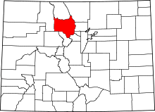 | |
| CDPs | ||
| Unincorporated communities | ||
