Dacono, Colorado
| City of Dacono, Colorado | |
|---|---|
| Home Rule Municipality | |
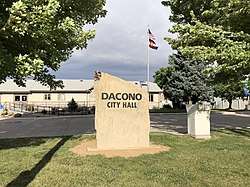 Dacono City Hall. | |
 Location of Dacono in Weld County, Colorado. | |
| Coordinates: 40°03′49″N 104°56′48″W / 40.063521°N 104.946804°WCoordinates: 40°03′49″N 104°56′48″W / 40.063521°N 104.946804°W[1] | |
| Country |
|
| State |
|
| County | Weld County[2] |
| Incorporated | September 23, 1908[3] |
| Government | |
| • Type | Home Rule Municipality[2] |
| Area[4] | |
| • Total | 8.13 sq mi (21.06 km2) |
| • Land | 8.12 sq mi (21.04 km2) |
| • Water | 0.01 sq mi (0.02 km2) |
| Elevation[5] | 5,030 ft (1,533 m) |
| Population (2010) | |
| • Total | 4,152 |
| • Estimate (2016)[6] | 5,090 |
| • Density | 626.54/sq mi (241.91/km2) |
| Time zone | UTC-7 (MST) |
| • Summer (DST) | UTC-6 (MDT) |
| ZIP code[7] | 80514 |
| Area code(s) | 303 |
| FIPS code | 08-19080 |
| GNIS feature ID | 0180837 |
| Website | City of Dacono |
The City of Dacono is a Home Rule Municipality located in Weld County, Colorado, United States. The population was 4,152 at the 2010 census.
History
The city name's is an amalgamation of the names of Daisy Baum, Cora Van Vorhies and Nora Brooks.[8] Dacono was first settled in 1901, and early settlers moved there to work in the coal mines.[9] The city was incorporated in 1908.[10]
Geography
Dacono is located at 40°4′33″N 104°56′43″W / 40.07583°N 104.94528°W (40.075772, -104.945353).[11]
According to the United States Census Bureau, the city has a total area of 2.7 square miles (7.0 km2), of which, 2.7 square miles (7.0 km2) of it is land and 0.37% is water.
Points of Interest
Dacono is home to the Colorado National Speedway.
Demographics
| Historical population | |||
|---|---|---|---|
| Census | Pop. | %± | |
| 1910 | 180 | — | |
| 1920 | 172 | −4.4% | |
| 1930 | 275 | 59.9% | |
| 1940 | 296 | 7.6% | |
| 1950 | 258 | −12.8% | |
| 1960 | 302 | 17.1% | |
| 1970 | 360 | 19.2% | |
| 1980 | 2,321 | 544.7% | |
| 1990 | 2,228 | −4.0% | |
| 2000 | 3,015 | 35.3% | |
| 2010 | 4,152 | 37.7% | |
| Est. 2016 | 5,090 | [6] | 22.6% |
| U.S. Decennial Census[12] | |||
As of the census[13] of 2000, there were 3,015 people, 1,087 households, and 756 families residing in the city. The population density was 1,103.0 people per square mile (426.4/km²). There were 1,136 housing units at an average density of 415.6 per square mile (160.7/km²). The racial makeup of the city was 77.05% White, 0.43% African American, 0.96% Native American, 1.00% Asian, 17.98% from other races, and 2.59% from two or more races. Hispanic or Latino of any race were 32.04% of the population.
There were 1,087 households out of which 34.6% had children under the age of 18 living with them, 55.3% were married couples living together, 9.3% had a female householder with no husband present, and 30.4% were non-families. 23.6% of all households were made up of individuals and 7.6% had someone living alone who was 65 years of age or older. The average household size was 2.77 and the average family size was 3.32.
In the city, the population was spread out with 29.2% under the age of 18, 7.9% from 18 to 24, 32.4% from 25 to 44, 21.2% from 45 to 64, and 9.3% who were 65 years of age or older. The median age was 33 years. For every 100 females, there were 100.2 males. For every 100 females age 18 and over, there were 99.3 males.
The median income for a household in the city was $38,854, and the median income for a family was $42,659. Males had a median income of $29,899 versus $25,000 for females. The per capita income for the city was $15,368. About 3.6% of families and 6.0% of the population were below the poverty line, including 6.5% of those under age 18 and 6.4% of those age 65 or over.
See also
References
- ↑ "2014 U.S. Gazetteer Files: Places". United States Census Bureau. July 1, 2014. Retrieved January 5, 2015.
- 1 2 "Active Colorado Municipalities". State of Colorado, Department of Local Affairs. Archived from the original on 2010-11-23. Retrieved 2007-09-01.
- ↑ "Colorado Municipal Incorporations". State of Colorado, Department of Personnel & Administration, Colorado State Archives. 2004-12-01. Retrieved 2007-09-02.
- ↑ "2016 U.S. Gazetteer Files". United States Census Bureau. Retrieved Jul 25, 2017.
- ↑ "US Board on Geographic Names". United States Geological Survey. 2007-10-25. Retrieved 2008-01-31.
- 1 2 "Population and Housing Unit Estimates". Retrieved June 9, 2017.
- ↑ "ZIP Code Lookup". United States Postal Service. Archived from the original (JavaScript/HTML) on November 23, 2010. Retrieved September 6, 2007.
- ↑ Dawson, John Frank. Place names in Colorado: why 700 communities were so named, 150 of Spanish or Indian origin. Denver, CO: The J. Frank Dawson Publishing Co. p. 16.
- ↑ "Dacono History". City of Dacono Colorado. Retrieved 2012-09-07.
- ↑ "Dacono, Colorado". City-Data.com. Retrieved 2012-09-07.
- ↑ "US Gazetteer files: 2010, 2000, and 1990". United States Census Bureau. 2011-02-12. Retrieved 2011-04-23.
- ↑ "Census of Population and Housing". Census.gov. Archived from the original on May 12, 2015. Retrieved June 4, 2015.
- ↑ "American FactFinder". United States Census Bureau. Archived from the original on 2013-09-11. Retrieved 2008-01-31.
External links
- City of Dacono website
- CDOT map of the City of Dacono
- Carbon Valley Edition of the Longmont Times-Call (Local news, information & advertising)
Municipalities and communities of Weld County, Colorado, United States | ||
|---|---|---|
| Cities | 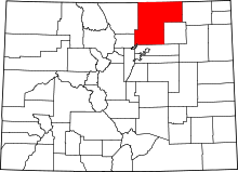 | |
| Towns | ||
| CDP | ||
| Unincorporated communities | ||
| Ghost towns | ||
| Footnotes | ‡This populated place also has portions in an adjacent county or counties | |
