Columbine Valley, Colorado
| Town of Columbine Valley, Colorado | |
|---|---|
| Statutory Town | |
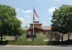 The Columbine Valley Town Hall. | |
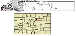 Location of Columbine Valley in Arapahoe County, Colorado. | |
| Coordinates: 39°35′58″N 105°01′51″W / 39.599580°N 105.030771°WCoordinates: 39°35′58″N 105°01′51″W / 39.599580°N 105.030771°W[1] | |
| Country |
|
| State |
|
| County | Arapahoe County[2] |
| Incorporated | July 2, 1959[3] |
| Government | |
| • Type | Statutory Town[2] |
| Area[4] | |
| • Total | 1.04 sq mi (2.69 km2) |
| • Land | 1.02 sq mi (2.65 km2) |
| • Water | 0.01 sq mi (0.04 km2) |
| Elevation[5] | 5,344 ft (1,629 m) |
| Population (2010)[6] | |
| • Total | 1,256 |
| • Estimate (2016)[7] | 1,406 |
| • Density | 1,373.05/sq mi (529.89/km2) |
| Time zone | UTC-7 (MST) |
| • Summer (DST) | UTC-6 (MDT) |
| ZIP Code[8] | 80123 |
| Area code(s) | Both 303 and 720 |
| FIPS code | 08-16385 |
| GNIS feature ID | 0182642 |
| Website | Town of Columbine Valley |
The Town of Columbine Valley is a Statutory Town located in western Arapahoe County, Colorado, United States. The town population was 1256 at the 2010 United States Census. Columbine Valley is a part of the Denver-Aurora-Lakewood, CO Metropolitan Statistical Area.
Geography
Columbine Valley is located at 39°35′58″N 105°2′14″W / 39.59944°N 105.03722°W (39.599665, -105.03736).[9]
According to the United States Census Bureau, the town has a total area of 1.0 square mile (2.6 km2), all of it land.
Demographics
| Historical population | |||
|---|---|---|---|
| Census | Pop. | %± | |
| 1970 | 481 | — | |
| 1980 | 923 | 91.9% | |
| 1990 | 1,071 | 16.0% | |
| 2000 | 1,132 | 5.7% | |
| 2010 | 1,256 | 11.0% | |
| Est. 2016 | 1,406 | [7] | 11.9% |
| U.S. Decennial Census[10] | |||
As of the census of 2010,[6] there were 1,256 people, 491 households, and 421 families residing in the town. There were 530 housing units. The racial makeup of the town was 95.3% White, 0.7% African American, 0.4% Native American, 1.5% Asian, 0% Pacific Islander, and 1.5% from two or more races. Hispanic or Latino of any race were 2.1% of the population.
There were 491 households out of which 26.5% had children under the age of 18 living with them, 80.9% were married couples living together, 3.1% had a female householder with no husband present, and 14.3% were non-families. 13.4% of all households were made up of individuals and 37.7% had an individual 65 years of age or older. The average household size was 2.56 and the average family size was 2.79.
In the town, the population was spread out with 21.1% under the age of 18, 3.4% from 20 to 29, 5.3% from 30 to 39, 11.1% from 40 to 49, 34.6% from 50 to 64, and 22.3% who were 65 years of age or older. The median age was 52.5 years. 49.7% of the population was male and 50.3% was female.
The median income for a household in the town was $130,417, and the median income for a family was $149,375. The per capita income for the town was $71,089. None of the families and 0.5% of the population were living below the poverty line, including no under eighteen and 0.6% of those 65 and older.
See also
References
- ↑ "2014 U.S. Gazetteer Files: Places". United States Census Bureau. July 1, 2014. Retrieved January 5, 2015.
- 1 2 "Active Colorado Municipalities". State of Colorado, Department of Local Affairs. Archived from the original on 2010-11-23. Retrieved 2010-08-12.
- ↑ "Colorado Municipal Incorporations". State of Colorado, Department of Personnel & Administration, Colorado State Archives. 2004-12-01. Retrieved 2007-09-02.
- ↑ "2016 U.S. Gazetteer Files". United States Census Bureau. Retrieved Jul 25, 2017.
- ↑ "US Board on Geographic Names". United States Geological Survey. 2007-10-25. Retrieved 2008-01-31.
- 1 2 "2010 Demographic Profile Data". American FactFinder. United States Census Bureau. Retrieved 23 April 2013.
- 1 2 "Population and Housing Unit Estimates". Retrieved June 9, 2017.
- ↑ "ZIP Code Lookup". United States Postal Service. Archived from the original (JavaScript/HTML) on September 3, 2007. Retrieved September 5, 2007.
- ↑ "US Gazetteer files: 2010, 2000, and 1990". United States Census Bureau. 2011-02-12. Retrieved 2011-04-23.
- ↑ "Census of Population and Housing". Census.gov. Archived from the original on May 12, 2015. Retrieved June 4, 2015.
External links
Municipalities and communities of Arapahoe County, Colorado, United States | ||
|---|---|---|
| Cities |  | |
| Towns | ||
| CDPs | ||
| Footnotes | ‡This populated place also has portions in an adjacent county or counties | |
