Minhe Hui and Tu Autonomous County
| Minhe County | |
|---|---|
| Autonomous County | |
|
民和回族土族自治县 • مٍهْ خُوِذُو تُوذُو ذِجِشِیًا Minhe Hui and Tu Autonomous County | |
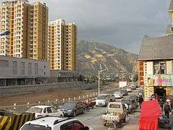 | |
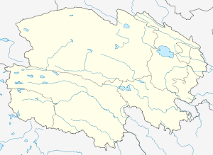 Minhe Location of the seat in Qinghai | |
| Coordinates: 36°20′33″N 102°51′32″E / 36.34250°N 102.85889°ECoordinates: 36°20′33″N 102°51′32″E / 36.34250°N 102.85889°E | |
| Country | People's Republic of China |
| Province | Qinghai |
| Prefecture-level city | Haidong |
| County seat | Chuankou |
| Area | |
| • Total | 1,780 km2 (690 sq mi) |
| Population | |
| • Total | 351,000 |
| • Density | 200/km2 (510/sq mi) |
| Time zone | UTC+8 (China Standard) |
| Postal code | 810800 |
| Area code(s) | 0972 |
Minhe Hui and Tu Autonomous County (simplified Chinese: 民和回族土族自治县; traditional Chinese: 民和回族土族自治縣; pinyin: Mínhé Huízú Tǔzú Zìzhìxiàn; Xiao'erjing: مٍهْ خُوِذُو تُوذُو ذِجِشِیًا) is the easternmost county in Qinghai Province, China. It is under the administration of Haidong (lit. Eastern Qinghai) Region. "Hui" refers to the Chinese Muslims, whereas "Tu" refers to the ethnic group known as “Monguor” in the West and as "Tu Zu" in China. It borders the Honggu District of Gansu on the east, demarcated by the Datong River, a tributary to the Huangshui River, which eventually flows into the Yellow River.
The County is multi-ethnic and significant to not only holding the most densely populated Tu Zu settlement in Sanchuan/Guanting in its southeastern portion, but also as the homeland of the legendary Emperor Yü the Great, who established the Xia Dynasty (2070–1600 BC), the first ever recorded dynasty in the ancient Chinese history[1][2][3][4] based on recent archaeological discoveries.[5]
Climate
| Climate data for Minhe Hui And Tu Autonomous County | |||||||||||||
|---|---|---|---|---|---|---|---|---|---|---|---|---|---|
| Month | Jan | Feb | Mar | Apr | May | Jun | Jul | Aug | Sep | Oct | Nov | Dec | Year |
| Average high °C (°F) | 1.6 (34.9) |
4.9 (40.8) |
11.0 (51.8) |
17.3 (63.1) |
21.8 (71.2) |
25.0 (77) |
26.7 (80.1) |
25.7 (78.3) |
20.5 (68.9) |
15.3 (59.5) |
8.3 (46.9) |
2.6 (36.7) |
15.1 (59.1) |
| Daily mean °C (°F) | −6.4 (20.5) |
−2.9 (26.8) |
3.8 (38.8) |
9.9 (49.8) |
14.6 (58.3) |
17.9 (64.2) |
20.1 (68.2) |
19.6 (67.3) |
14.6 (58.3) |
8.8 (47.8) |
1.4 (34.5) |
−5.0 (23) |
8 (46.5) |
| Average low °C (°F) | −14.4 (6.1) |
−10.7 (12.7) |
−3.3 (26.1) |
2.6 (36.7) |
7.5 (45.5) |
10.9 (51.6) |
13.5 (56.3) |
13.5 (56.3) |
8.7 (47.7) |
2.3 (36.1) |
−5.5 (22.1) |
−12.6 (9.3) |
1 (33.9) |
| Average precipitation mm (inches) | 2 (0.08) |
3 (0.12) |
10 (0.39) |
22 (0.87) |
41 (1.61) |
44 (1.73) |
69 (2.72) |
84 (3.31) |
59 (2.32) |
24 (0.94) |
5 (0.2) |
2 (0.08) |
365 (14.37) |
| Source: Climate-Data.org [6] | |||||||||||||
See also
References
- ↑ Bao Yizhi (鲍义志) (15 September 2006). 喇家遗址与大禹治水 [The Lajia Site and flood management by Yü the Great]. Qinghai Daily (青海日报). Xining.
- ↑ Bao Yizhi (鲍义志) (2007). 再说大禹故里 [More discussions on the homeland of Yü the Great]. China's Tu Nationality (中国土族). 34 (2): 13.
- ↑ Xie Zuo (谢佐) (2006). 略论河湟文化的史前文明 [On the prehistorical civilization of the Hehuang Culture]. China's Tu Nationality (中国土族). 32 (4): 4–6.
- ↑ Zhang Zhongxiao (张忠孝) (2007). 民和官亭是大禹故里 [Guanting of Minhe is the homeland of Yü the Great]. China's Tu Nationality (中国土族). 34 (2): 14–16.
- ↑ Lu, Houyuan, Xiaoyan Yang, Maolin Ye, Kam-Biu Liu, Zhengkai Xia, Xiaoyan Ren, Linhai Cai, Naiqin Wu and Tung-Sheng Liu (2005). "Culinary archaeology: Millet noodles in Late Neolithic China." Nature 437(7061): 967-968.
- ↑ "Climate: Minhe Hui And Tu Autonomous County". Retrieved March 22, 2018.