The Village at Castle Pines, Colorado
| The Village at Castle Pines, Colorado | |
|---|---|
| Census-designated place | |
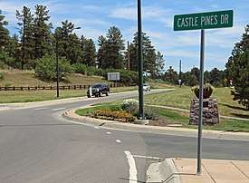 Looking uphill from the intersection of Happy Canyon Road and Castle Pines Drive. | |
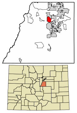 Location of The Village at Castle Pines in Douglas County, Colorado. | |
 The Village at Castle Pines Location in Colorado | |
| Coordinates: 39°28′18″N 104°53′41″W / 39.47167°N 104.89472°WCoordinates: 39°28′18″N 104°53′41″W / 39.47167°N 104.89472°W | |
| Country |
|
| State |
|
| County | Douglas |
| Founded | 1981 |
| Government | |
| • Type | Homeowner association |
| Population (ACS 2011-2013) | |
| • Total | 3,973 |
| Time zone | UTC-7 (MST) |
| • Summer (DST) | UTC-6 (MDT) |
| ZIP code | 80108[1] |
| Area code(s) | 303, 720 |
| FIPS code | 08-12393 |
The Village at Castle Pines (formerly Castle Pines Village) is a gated, unincorporated community and census-designated place in Douglas County, Colorado, United States.[2] The Village at Castle Pines is situated 25 miles (40 km) south-southeast of the Colorado State Capitol in Denver. The community surrounds the Castle Pines Golf Club and the Country Club at Castle Pines.
History
The Village at Castle Pines was founded as a gated residential community by Jack A. Vickers, and lies at an elevation of 6,000 to 6,500 feet (1,800 to 2,000 m) along the Front Range of the Rocky Mountains. It is the northernmost incidence of tablelands along the Front Range with views of Pikes Peak, Mount Evans and the Rocky Mountains.[3]
Castle Pines Golf Club, founded by Jack A. Vickers[4] and designed by Jack Nicklaus, opened in 1981. The International professional golf tournament was an annual PGA Tour event held at Castle Pines Golf Club from 1986 through 2006.[5]
Geography
The Village at Castle Pines is located at 39°26′27″N 104°53′55″W / 39.440709°N 104.898695°W (39.440709, -104.898695).[6] It is bordered to the north by the city of Castle Pines and to the south by the town of Castle Rock, the Douglas County seat. The community surrounds the Castle Pines Golf Club and the Country Club at Castle Pines.
Demographics
| Historical population | |||
|---|---|---|---|
| Census | Pop. | %± | |
| U.S. Decennial Census[7] | |||
As of the ACS of 2011-2013, there were 3,973 people, 1,330 households, and 1,164 families residing in the community. There were 1,453 housing units. The racial makeup of the community was 93.9% White, 5.8% Asian, and 0.3% African American. Hispanics and Latinos of any race were 0.6% of the population.[8]
The ACS estimated that there were 1,330 households out of which 37.6% had children under the age of 18 living with them, 86.8% were married couples living together, 0.0% had a male householder with no wife present, 0.7% had a female householder with no husband present, and 12.5% were non-families. 11.1% of all households were made up of individuals, and 1.4% had someone living alone who was 65 years of age or older. The average household size was 2.65, and the average family size was 2.86.[8]
In the community, the population's estimated distribution of age was spread out with 23.3% under the age of 18, 3.8% from 18 to 24, 16.1% from 25 to 44, 42.5% from 45 to 64, and 14.3% who were 65 years of age or older. The median age was 49.6 years. The gender makeup of the community was 47.1% male and 52.9% female.[8]
The estimated median annual income for a household in the community over the period 2007-2011 was $208,008, and the median income for a family was $209,915. Males had a median income of $208,654 versus $109,118 for females. The per capita income for the town was $118,043. No families and 0.5% of the population were below the poverty line, including none of those under age 18 and 1.8% of those age 65 or over.[9]
Economy
For the period 2007-2011, the American Community Survey estimated that 59.0% of the population over the age of 16 was in the labor force. 0.0% was in the armed forces, and 59.0% was in the civilian labor force with 56.8% employed and 2.2% unemployed. The composition, by occupation, of the employed civilian labor force was: 61.1% in management, business, science, and arts; 32.0% in sales and office occupations; 4.1% in service occupations; 1.9% in production, transportation, and material moving; 0.9% in natural resources, construction, and maintenance. The three industries employing the largest percentages of the working civilian labor force were: professional, scientific, and management, and administrative and waste management services (19.2%); finance and insurance, and real estate and rental and leasing (18.7%); and educational services, health care, and social assistance (15.3).[9]
The estimated median home value in the community between 2007 and 2011 was $935,100, the median selected monthly owner cost was $4,000+ for housing units with a mortgage and $1,000+ for those without, and the median gross rent was $2,000+.[10]
Government
The Village at Castle Pines is an unincorporated area of Douglas County, Colorado, officially represented by a county commissioner.
The Castle Pines Homes Association ("CPHA") manages the community through a five-member board of directors. CPHA is funded through dues and assessments from residents.[11] Police and fire services are provided by the in-house Emergency Services department of The Village at Castle Pines, which supplements the services provided by Douglas County and the South Metro Fire Rescue Authority.[12]
Infrastructure
Transportation
The Village at Castle Pines is located west of Interstate 25. The city is served by Denver International Airport and nearby Centennial Airport.
Utilities
The Castle Pines Metropolitan District ("CP MET"), established in 1973, provides water, wastewater treatment, operation and maintenance of street improvements and storm drainage services to The Village at Castle Pines. CP MET is also governed by an elected five-member board of directors.[13]
Notable residents
- Dale Douglass (1936- ), professional golfer
- Charlie Ergen (1953- ), founder of Dish Network
See also
References
- ↑ "ZIP Code Lookup". United States Postal Service. 2007-11-09. Archived from the original (JavaScript/HTML) on 2007-09-03. Retrieved 2007-11-09.
- ↑ "Castle Pines Homes Association (CPHA) - About Us". Castle Pines Homes Association. Archived from the original on 2009-02-06. Retrieved 2013-11-03.
- ↑ "Archived copy". Archived from the original on 2009-04-14. Retrieved 2009-04-06.
- ↑ http://www.coloradobusinesshalloffame.org/jack-vickers.html
- ↑ http://www.pgatour.com/tournaments/r056/
- ↑ "US Gazetteer files: 2010, 2000, and 1990". United States Census Bureau. 2011-02-12. Retrieved 2011-04-23.
- ↑ "Census of Population and Housing". Census.gov. Retrieved June 4, 2016.
- 1 2 3 "ACS Demographic and Housing Estimates: 2007-2011 American Community Survey 5-Year Estimates (DP05): Parker town, Colorado". U.S. Census Bureau, American Factfinder. Retrieved October 16, 2015.
- 1 2 "Selected Economic Characteristics: 2007-2011 American Community Survey 5-Year Estimates (DP03): Parker town, Colorado". U.S. Census Bureau, American Factfinder. Retrieved October 16, 2015.
- ↑ "Selected Housing Characteristics: 2007-2011 American Community Survey 5-Year Estimates (DP05): Parker town, Colorado". U.S. Census Bureau, American Factfinder. Retrieved October 16, 2015.
- ↑ "Archived copy". Archived from the original on 2009-04-17. Retrieved 2009-04-06.
- ↑ "Archived copy". Archived from the original on 2009-04-14. Retrieved 2009-04-06.
- ↑ http://www.castlepinesmetro.com/
External links
| Wikimedia Commons has media related to The Village at Castle Pines, Colorado. |
- Castle Pines Metropolitan District
- Castle Pines Village Homes Association
- Castle Pines Golf Club
- Country Club at Castle Pines
Municipalities and communities of Douglas County, Colorado, United States | ||
|---|---|---|
| Cities |  | |
| Towns | ||
| CDPs | ||
| Unincorporated communities | ||
| Footnotes | ‡This populated place also has portions in an adjacent county or counties | |
