Cassville, Missouri
| Cassville, Missouri | |
|---|---|
| City | |
.jpg) Locomotive for the old Cassville and Exeter Railroad | |
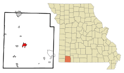 Location of Cassville, Missouri | |
| Coordinates: 36°40′48″N 93°52′10″W / 36.68000°N 93.86944°WCoordinates: 36°40′48″N 93°52′10″W / 36.68000°N 93.86944°W | |
| Country | United States |
| State | Missouri |
| County | Barry |
| Township | Flat Creek |
| Area[1] | |
| • Total | 3.22 sq mi (8.34 km2) |
| • Land | 3.22 sq mi (8.34 km2) |
| • Water | 0 sq mi (0 km2) |
| Elevation | 1,309 ft (399 m) |
| Population (2010)[2] | |
| • Total | 3,266 |
| • Estimate (2016)[3] | 3,340 |
| • Density | 1,000/sq mi (390/km2) |
| Time zone | UTC-6 (Central (CST)) |
| • Summer (DST) | UTC-5 (CDT) |
| ZIP codes | 65623, 65625 |
| Area code(s) | 417 |
| FIPS code | 29-11890[4] |
| GNIS feature ID | 0749248[5] |
| Website | cityofcassville.com |
Cassville is a city in Flat Creek Township, Barry County, Missouri, United States. According to 2010 census the population of Cassville was 3,266, and is estimated to have been 3,340 in 2016. It is the county seat of Barry County.[6]
History
Cassville was platted in 1845.[7] The community was named after Lewis Cass.[8] A post office has been in operation at Cassville since 1845.[9]

The city was connected by rail via the Cassville & Exeter Railroad from July 4, 1896 to September 11, 1956.[10]
The Cassville Ranger Station Historic District, Natural Bridge Archeological Site, and six sites in Roaring River State Park are listed on the National Register of Historic Places.[11]
Geography
According to the United States Census Bureau, the city has a total area of 3.22 square miles (8.34 km2), all land.[1]
Demographics
| Historical population | |||
|---|---|---|---|
| Census | Pop. | %± | |
| 1870 | 287 | — | |
| 1890 | 626 | — | |
| 1900 | 702 | 12.1% | |
| 1910 | 781 | 11.3% | |
| 1920 | 1,002 | 28.3% | |
| 1930 | 1,016 | 1.4% | |
| 1940 | 1,214 | 19.5% | |
| 1950 | 1,441 | 18.7% | |
| 1960 | 1,451 | 0.7% | |
| 1970 | 1,910 | 31.6% | |
| 1980 | 2,091 | 9.5% | |
| 1990 | 2,371 | 13.4% | |
| 2000 | 2,890 | 21.9% | |
| 2010 | 3,266 | 13.0% | |
| Est. 2016 | 3,340 | [3] | 2.3% |
| U.S. Decennial Census | |||
2010 census
As of the census[2] of 2010, there were 3,266 people, 1,275 households, and 848 families residing in the city. The population density was 1,014.3 inhabitants per square mile (391.6/km2). There were 1,402 housing units at an average density of 435.4 per square mile (168.1/km2). The racial makeup of the city was 93.8% White, 0.4% African American, 1.7% Native American, 0.3% Asian, 2.1% from other races, and 1.8% from two or more races. Hispanic or Latino of any race were 4.6% of the population.
There were 1,275 households of which 34.2% had children under the age of 18 living with them, 48.9% were married couples living together, 13.1% had a female householder with no husband present, 4.5% had a male householder with no wife present, and 33.5% were non-families. 30.0% of all households were made up of individuals and 16% had someone living alone who was 65 years of age or older. The average household size was 2.43 and the average family size was 2.99.
The median age in the city was 40.5 years. 23.8% of residents were under the age of 18; 8.4% were between the ages of 18 and 24; 23% were from 25 to 44; 25.3% were from 45 to 64; and 19.3% were 65 years of age or older. The gender makeup of the city was 46.8% male and 53.2% female.
2000 census
As of the census[4] of 2000, there were 2,890 people, 1,194 households, and 770 families residing in the city. The population density was 1,046.0 people per square mile (404.3/km²). There were 1,307 housing units at an average density of 473.0 per square mile (182.8/km²). The racial makeup of the city was 96.30% White, 0.03% African American, 0.73% Native American, 0.69% Asian, 1.11% from other races, and 1.14% from two or more races. Hispanic or Latino of any race were 2.63% of the population.
There were 1,194 households out of which 30.2% had children under the age of 18 living with them, 50.1% were married couples living together, 10.9% had a female householder with no husband present, and 35.5% were non-families. 31.7% of all households were made up of individuals and 15.7% had someone living alone who was 65 years of age or older. The average household size was 2.35 and the average family size was 2.95.
In the city, the population was spread out with 25.5% under the age of 18, 8.2% from 18 to 24, 26.4% from 25 to 44, 21.7% from 45 to 64, and 18.2% who were 65 years of age or older. The median age was 38 years. For every 100 females, there were 90.3 males. For every 100 females age 18 and over, there were 85.8 males.
The median income for a household in the city was $27,351, and the median income for a family was $34,074. Males had a median income of $22,952 versus $19,120 for females. The per capita income for the city was $16,660. About 12.3% of families and 15.4% of the population were below the poverty line, including 21.4% of those under age 18 and 12.4% of those age 65 or over.
Government
The City of Cassville is managed by four-member Board of Aldermen (City Council) with Bill Shiveley serving as the Mayor.
Education
Cassville R-IV School District operates one elementary school, one middle school, one intermediate school, and Cassville High School.[12]
Cassville has a public library, a branch of the Barry-Lawrence Regional Library.[13]
Crowder College offers two-year degree programs in Cassville.
Climate
Climate in this area is characterized by relatively high temperatures and evenly distributed precipitation throughout the year. The Köppen Climate Classification subtype for this climate is "Cfa" (Humid Subtropical Climate).[14]
| Climate data for Cassville, Missouri | |||||||||||||
|---|---|---|---|---|---|---|---|---|---|---|---|---|---|
| Month | Jan | Feb | Mar | Apr | May | Jun | Jul | Aug | Sep | Oct | Nov | Dec | Year |
| Average high °C (°F) | 7 (44) |
9 (48) |
14 (58) |
20 (68) |
24 (76) |
29 (84) |
32 (89) |
31 (88) |
27 (81) |
21 (70) |
15 (59) |
8 (47) |
20 (68) |
| Average low °C (°F) | −7 (20) |
−4 (24) |
1 (34) |
6 (43) |
11 (52) |
16 (60) |
18 (64) |
17 (63) |
13 (56) |
6 (43) |
1 (34) |
−4 (24) |
6 (43) |
| Average precipitation mm (inches) | 48 (1.9) |
58 (2.3) |
97 (3.8) |
112 (4.4) |
130 (5) |
109 (4.3) |
91 (3.6) |
89 (3.5) |
109 (4.3) |
86 (3.4) |
81 (3.2) |
71 (2.8) |
1,087 (42.8) |
| Source: Weatherbase [15] | |||||||||||||
References
- 1 2 "US Gazetteer files 2010". United States Census Bureau. Archived from the original on 2012-07-14. Retrieved 2012-07-08.
- 1 2 "American FactFinder". United States Census Bureau. Retrieved 2012-07-08.
- 1 2 "Population and Housing Unit Estimates". Retrieved June 9, 2017.
- 1 2 "American FactFinder". United States Census Bureau. Archived from the original on 2013-09-11. Retrieved 2008-01-31.
- ↑ "US Board on Geographic Names". United States Geological Survey. 2007-10-25. Retrieved 2008-01-31.
- ↑ "Find a County". National Association of Counties. Archived from the original on 2011-05-31. Retrieved 2011-06-07.
- ↑ Eaton, David Wolfe (1916). How Missouri Counties, Towns and Streams Were Named. The State Historical Society of Missouri. p. 206.
- ↑ "Barry County Place Names, 1928-1945 (archived)". The State Historical Society of Missouri. Archived from the original on 24 June 2016. Retrieved 30 August 2016.
- ↑ "Post Offices". Jim Forte Postal History. Archived from the original on 6 March 2016. Retrieved 30 August 2016.
- ↑
- ↑ National Park Service (2010-07-09). "National Register Information System". National Register of Historic Places. National Park Service.
- ↑ "Cassville R-IV School District". Great Schools. Retrieved 17 March 2018.
- ↑ "Locations". Barry-Lawrence Regional Library. Retrieved 17 March 2018.
- ↑ Climate Summary for Cassville, Missouri
- ↑ "Weatherbase.com". Weatherbase. 2013. Retrieved on August 16, 2013.
External links
- City of Cassville
- Chamber of Commerce
- Historic maps of Cassville in the Sanborn Maps of Missouri Collection at the University of Missouri
Municipalities and communities of Barry County, Missouri, United States | ||
|---|---|---|
| Cities |  | |
| Villages | ||
| Townships | ||
| CDPs | ||
| Unincorporated communities | ||
| Ghost towns | ||
| Footnotes | ‡This populated place also has portions in an adjacent county or counties | |
